Fernweh: Home
    ExploreTravel GuidesPlan a tripMy tripLast visited
    de|en
    All Places & RegionsAll highlightsAbout FernwehFAQPrivacy PolicyImprint
    ExploreTravel GuidesPlan a tripMy tripLast visited
    Gletscherregion (Franz Josef & Fox Glacier)

    New Zealand

    Gletscherregion (Franz Josef & Fox Glacier)

    Area

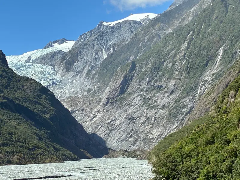
    In Westland Tai Poutini National Park, two glaciers extend from the Southern Alps deep into the rainforest: Franz Josef and Fox Glacier.

    by Felix Gillen

    1. Home
    2. Destinations
    3. New Zealand
    4. West Coast
    5. Gletscherregion (Franz Josef & Fox Glacier)
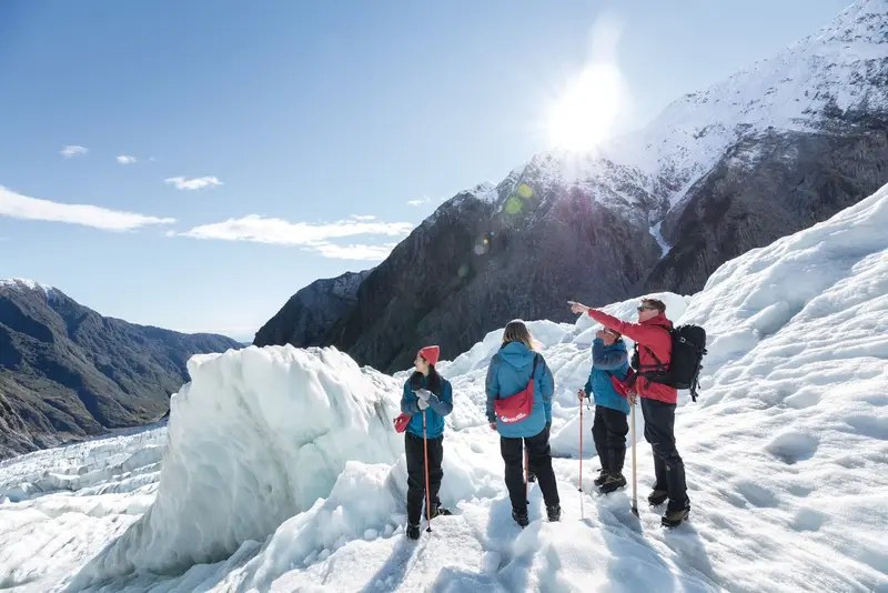
    In Westland Tai Poutini National Park, two glaciers extend from the Southern Alps deep into the rainforest: Franz Josef and Fox Glacier. The two namesake villages are located about 25 kilometers apart on State Highway 6 and serve as the base for glacier hikes, helicopter flights, and valley walks.Both glaciers have retreated significantly in recent decades. Today, you can only access the ice with guided Heli-Hikes; the valley paths end at viewpoints at a distance from the glacier terminus.

    Sehenswürdigkeiten

    Discover the most important sights and attractions

    Westland Tai Poutini National Park

    1Westland Tai Poutini National Park

    The National Park extends from the Southern Alps' peaks to the Tasman Sea. Here, Franz Josef and Fox Glacier descend from over 2,500 metres in elevation to just hundreds of metres above sea level, surrounded by temperate rainforest. Both glaciers have significantly retreated for years.
    Open in Google Maps
    Glacier Country Helicopters

    2Glacier Country Helicopters

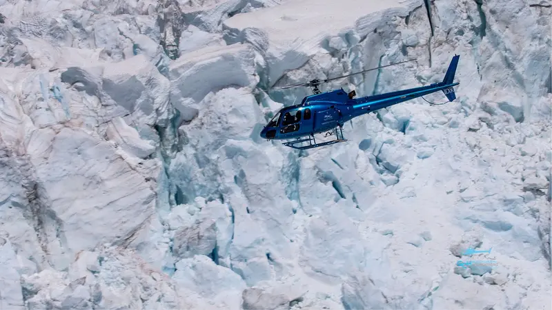
    Helicopter flights from Franz Josef with snow landing on the glacier. As the glacier tongues can no longer be accessed on foot, flights are the only way onto the ice. In bad weather, they are often cancelled, so plan a buffer day.
    Open in Google Maps
    Franz Josef Glacier Guides

    3Franz Josef Glacier Guides

    The local operator offers guided Heli-Hike tours, featuring helicopter transport to the ice and mountain guides navigating crevasses and ice caves. Equipment provided.
    Open in Google Maps
    Fox Glacier Valley Walk
    Attraction

    4Fox Glacier Valley Walk

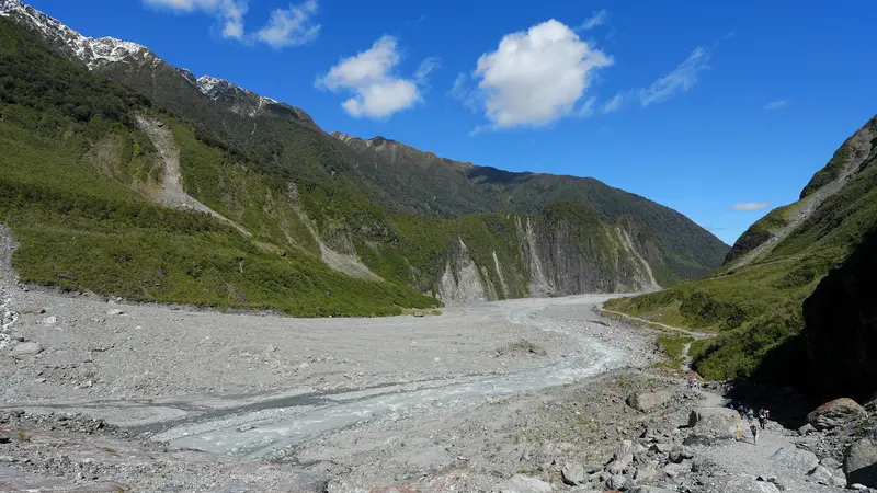
    The path leads through the glacier-carved valley with steep rock faces and waterfalls to a viewpoint in front of the glacier tongue. Access may be closed after storms; check the DOC advisories beforehand.
    Open in Google Maps
    Lake Matheson
    Attraction

    5Lake Matheson

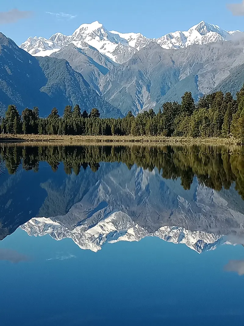
    The dark forest lake by Fox Glacier reflects Aoraki/Mount Cook and Mount Tasman on calm mornings. A 90-minute path leads through rainforest to viewpoints; a café is at the car park.
    Open in Google Maps
    Terrace Walk Franz Josef
    Attraction

    6Terrace Walk Franz Josef

    Short loop walk on the outskirts of Franz Josef, through rainforest and river terrace, with remnants of old gold miner channels. Good for an hour's walk.
    Open in Google Maps

    Essen & Trinken

    1

    Betsey Jane Eatery & Bar

    Restaurant and bar in Fox Glacier for breakfast, lunch, and dinner.
    Show on Google Maps
    2

    Matheson Cafe

    Cafe at the Lake Matheson car park, with views of the Southern Alps on a clear day. Convenient for breakfast after the morning walk around the lake.
    Show on Google Maps

    Alice May Restaurant, Franz Josef

    Alice May Parkinson gewidmetes, neuseeländisches Restaurant mit urigem Ambiente und Innenhof mit Blick auf die Berge.
    Show on Google Maps
    3

    Blue Ice Restaurant & Bar

    Restaurant and bar on the main street of Franz Josef with Asian-inspired cuisine.
    Show on Google Maps

    Glaciers and World Heritage

    The National Park is part of the UNESCO World Heritage site Te Wāhipounamu in the southwest of the South Island. The Māori names of the glaciers are Kā Roimata o Hine Hukatere for Franz Josef and Te Moeka o Tuawe for Fox Glacier.WeatherThe west side of the Southern Alps is one of New Zealand's rainiest regions. Helicopter flights are often cancelled due to low clouds, so plan a buffer day if a flight is important to you.

    Arrival and On-site

    The region lies on State Highway 6; from Hokitika, it's a good two-hour drive south. To continue towards Wanaka, you go via Haast Pass. Intercity buses stop in both villages, but for Lake Matheson and the valley trails, your own car is much more convenient. Petrol stations and supermarkets are small; fill up before longer journeys.

    Accommodations in Gletscherregion (Franz Josef & Fox Glacier)

    Find perfect stay in Gletscherregion (Franz Josef & Fox Glacier)

    Booking.com* (Affiliate link)
    Search Hotels
    Agoda* (Affiliate link)
    Search Hotels
    Airbnb
    Vacation Rentals

    * Affiliate link: if you book through it, we earn a small commission. The price stays the same for you.

    Nearby

    Aoraki/Mount Cook National Park

    The Aoraki/Mount Cook National Park encompasses the highest peaks of the Southern Alps, notably Aoraki/Mount Cook at 3,724 meters. Approximately 40 percent of its area is covered by glaciers, including the Tasman Glacier, the country's longest. The park has existed since 1953 and is part of the UNESCO World Heritage Site Te Wāhipounamu.The starting point is the small Mount Cook Village at the end of State Highway 80. From here, short hikes like the Hooker Valley Track, mountaineering tours, and scenic flights depart. At night, the park is part of the Aoraki Mackenzie International Dark Sky Reserve.

    Lake Tekapo

    Lake Tekapo, in Māori Takapō, is a small town on the southern shore of the eponymous lake in the Mackenzie Basin. Fine rock flour from the glaciers colors the water milky turquoise, with the Southern Alps standing in the background.By day, the view from Mount John and the stone church on the shore beckon; by night, the starry sky: The region belongs to the Aoraki Mackenzie International Dark Sky Reserve. In early summer, lupins bloom along the shores, an introduced plant that attracts many photographers.
    Hokitika

    Hokitika

    Hokitika is a small town on the South Island's West Coast, founded during the 1860s gold rush. Today, it's known for Pounamu workshops, its driftwood beach, and as a gateway to the turquoise Hokitika Gorge.
    West Coast

    West Coast

    The West Coast stretches as a narrow strip for about 600 kilometers along the South Island, between the Tasman Sea and the Southern Alps. Rainforest, wild beaches, and rivers characterize the landscape; the towns are small and spread far apart.In the north await the limestone landscapes of Paparoa and Kahurangi, in the center the old gold mining towns of Greymouth and Hokitika, and in the south the Franz Josef and Fox Glaciers. Most travelers drive the entire coast.
    Greymouth

    Greymouth

    Greymouth, Māwhera in Māori, is at the mouth of the Grey River and the largest town on the West Coast. Gold and coal made it thrive in the 19th century; today it's mainly a service hub and the TranzAlpine's terminus from Christchurch.The centre is small and quick to explore. For a day, highlights include the brewery, a walk along the river, and trips into the surrounding area, to Shantytown or the Brunner Mine.

    Sources & method

    • Photos: Pexels, Google Maps. Each photo carries its credit.
    • Place data such as addresses and ratings comes from Google Maps.
    • The content is based on web research from public, traceable sources. How the content is made · The role of AI