Fernweh: Home
    ExploreTravel GuidesPlan a tripMy tripLast visited
    de|en
    All Places & RegionsAll highlightsAbout FernwehFAQPrivacy PolicyImprint
    ExploreTravel GuidesPlan a tripMy tripLast visited
    • Overview
    • Places in the region
    • Culture
    • Getting around
    • Nearby
    Gisborne

    New Zealand

    Gisborne

    Region

    Gisborne, in Māori Tairāwhiti, is located on the far east of the North Island and is one of the first places to see the sun rise each morning.

    by Felix Gillen

    1. Home
    2. Destinations
    3. New Zealand
    4. Gisborne
    Gisborne, in Māori Tairāwhiti, is located on the far east of the North Island and is one of the first places to see the sun rise each morning. You can expect long surf beaches, vineyards with abundant Chardonnay, Māori communities with a rich history, and a coastline away from the main tourist routes.
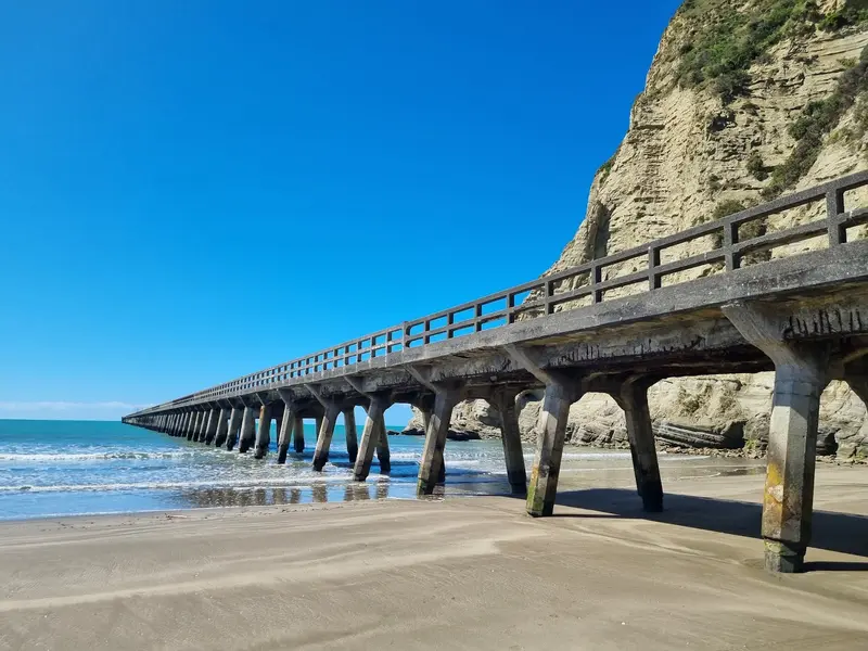
    The Tairāwhiti Gisborne region is sparsely populated and defined by its main town, Gisborne, situated on Poverty Bay. Tradition holds that the Waka Horouta and Te Ikaroa-a-Rauru landed in Tūranganui-a-Kiwa Bay, and it was here on October 8, 1769, that James Cook and his crew first set foot in New Zealand. Vineyards surround the city, with Chardonnay being the most prominent grape variety grown. Inland, the Rere Falls and Rere Rockslides make for a worthwhile detour. North of the city, State Highway 35 hugs the coast towards East Cape, featuring the 660-meter-long Tolaga Bay Wharf as its most famous stop. For details on the city, beaches, and wineries, you’ll find dedicated pages for Inner City Gisborne, Wainui Beach, and the Wine Region.
    Gisborne Wine Region
    Ulrich Lange, Bochum, Germany / Wikimedia Commons / CC BY-SA 3.0

    Place 1 of 3

    Gisborne Wine Region

    The Gisborne wine region is on the fertile Poverty Bay Flats, west and south of the city. Few NZ wine regions have such sun and warmth; harvest often starts here first.

    Discover
    Inner City Gisborne

    Place 2 of 3

    Inner City Gisborne

    The center of Gisborne lies where the Taruheru and Waimata rivers meet to form the Tūranganui, flowing into Poverty Bay. The museum, riverside paths, harbor, and Waikanae Beach are just a short walk away.

    Discover
    Wainui Beach
    russellstreet / Wikimedia Commons / CC BY-SA 2.0

    Place 3 of 3

    Wainui Beach

    Wainui Beach is a coastal suburb about six kilometres east of Gisborne's city centre, directly on State Highway 35.

    Discover

    Sights in Gisborne

    Discover the most important sights and attractions

    Rere Falls
    Park

    Rere Falls

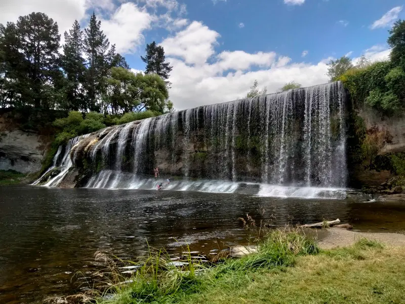
    A wide waterfall on the Wharekopae River in the hinterland west of Gisborne, directly on Wharekopae Road. Adjacent is a picnic area; a few kilometres upstream are the Rere Rockslides.
    Open in Google Maps
    Tolaga Bay Wharf
    Historic Landmark

    Tolaga Bay Wharf

    The approx. 660-meter long pier, dating from 1929, in Tolaga Bay north of Gisborne on State Highway 35. It is one of New Zealand's longest piers and is perfect for a stroll above the sea.
    Open in Google Maps
    Rere Rockslides
    Attraction

    Rere Rockslides

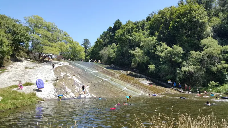
    An approximately 60-meter-long, smoothly polished rock slab in the Wharekōpae River, just under two kilometers upstream from the Rere Falls. Many slide down belly-first on bodyboards, air mattresses, or swim rings. Check water level and current yourself beforehand; general advice can be found in the travel and safety advisories of the Federal Foreign Office.
    Open in Google Maps

    Māori Heritage and Encounter of 1769

    Tairāwhiti is the homeland of several iwi, including Ngāti Porou on the East Coast, and Rongowhakaata, Ngāi Tāmanuhiri, and Te Aitanga-a-Māhaki around Poverty Bay. The Māori population share here is much higher than the national average, and Te Reo Māori is heard more often in daily life than elsewhere.The 1769 landing site at Titirangi's base is now the Cook Landing Site National Historic Reserve, under Department of Conservation care. It commemorates both the Waka's arrival and the initial, often violent, encounters with the Endeavour crew. A great introduction to the region's history is the Tairāwhiti Museum in Gisborne.

    On the road in Tairāwhiti

    Gisborne has a small regional airport with domestic flights. By road, you can reach the region via State Highway 2 from Napier in the south or from Ōpōtiki in the Bay of Plenty. State Highway 35 runs around the East Cape. Buses are infrequent; for trips to beaches, waterfalls, and wineries, you practically need a car.In February 2023, Cyclone Gabrielle caused severe damage to roads and bridges in Tairāwhiti and Hawke's Bay, leading New Zealand to declare a national state of emergency. Road closures and roadworks are constantly changing: check current traffic updates from the NZ Transport Agency (NZTA Waka Kotahi) before you travel.

    Nearby

    Inner City Gisborne

    Inner City Gisborne

    The center of Gisborne lies where the Taruheru and Waimata rivers meet to form the Tūranganui, flowing into Poverty Bay. The museum, riverside paths, harbor, and Waikanae Beach are just a short walk away.
    Wainui Beach

    Wainui Beach

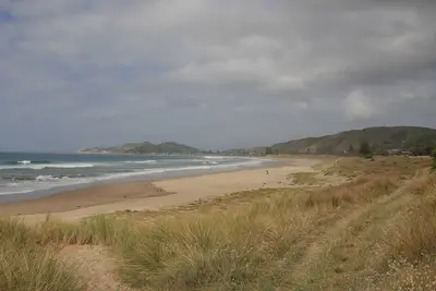
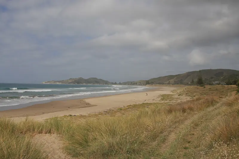
    Wainui Beach is a coastal suburb about six kilometres east of Gisborne's city centre, directly on State Highway 35. Together with the adjoining Makorori Beach to the north, this stretch offers about six kilometres of sandy beach along the east coast, featuring dunes, rock reefs, and waves that attract surfers all year round. Locals call the northern curve of the beach Okitu, and the southern curve Wainui.You come here for surfing, long beach walks, or as a first stop on your journey towards East Cape. During summer, the Wainui Beach Surf Life Saving Club patrols a section of the beach near the mouth of the Hamanatua Stream. Swim there if possible and observe the lifeguards' instructions; general advice can be found in the travel and safety advisories of the German Federal Foreign Office.
    Gisborne Wine Region

    Gisborne Wine Region

    The Gisborne wine region is on the fertile Poverty Bay Flats, west and south of the city. Few NZ wine regions have such sun and warmth; harvest often starts here first. Chardonnay is dominant, alongside Gewürztraminer, Pinot Gris, Sauvignon Blanc, and Merlot.According to New Zealand Winegrowers, all wineries are within 15 minutes of the city or airport. Three sub-regions define the area: Ormond (north, with the Golden Slope), Patutahi (west, known for Gewürztraminer), and Manutuke (south, near the coast). Plan tastings; cellar doors often have limited hours, confirm your driver.
    Napier

    Napier

    Napier is located on Hawke Bay on the east coast of the North Island and is primarily known for its Art Deco centre. The earthquake of February 3, 1931, destroyed large parts of the city, after which the centre was rebuilt in the style of the era. Today, you can stroll among pastel-coloured facades, walk along the Marine Parade by the sea, and view the harbour from Bluff Hill. The Hawke's Bay wineries are just a short drive away.
    Hawke's Bay

    Hawke's Bay

    Hawke's Bay on the East Coast of the North Island is both orchard and wine country. Around Napier, Hastings and Havelock North, apple orchards, vineyards, and gravel soils alternate; the coast features long beaches and the gannet colony at Cape Kidnappers. The 1931 earthquake still shapes the cityscape: Napier and Hastings were rebuilt in Art Deco and Spanish Mission styles afterwards.

    Sources & method

    • Photos: Pexels, Google Maps. Each photo carries its credit.
    • Place data such as addresses and ratings comes from Google Maps.
    • The content is based on web research from public, traceable sources. How the content is made · The role of AI