Fernweh: Home
    ExploreTravel GuidesPlan a tripMy tripLast visited
    de|en
    All Places & RegionsAll highlightsAbout FernwehFAQPrivacy PolicyImprint
    ExploreTravel GuidesPlan a tripMy tripLast visited
    • Neighborhoods & highlights
    • Eat & drink
    • Culture
    • Getting around
    • Accommodation
    • Plan trip
    • Nearby
    Wainui Beach
    russellstreet / Wikimedia Commons / CC BY-SA 2.0

    New Zealand

    Wainui Beach

    City

    Wainui Beach is a coastal suburb about six kilometres east of Gisborne's city centre, directly on State Highway 35.

    by Felix Gillen

    1. Home
    2. Destinations
    3. New Zealand
    4. Gisborne
    5. Wainui Beach
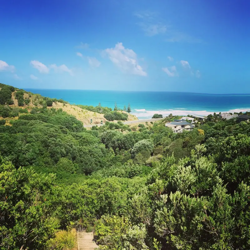
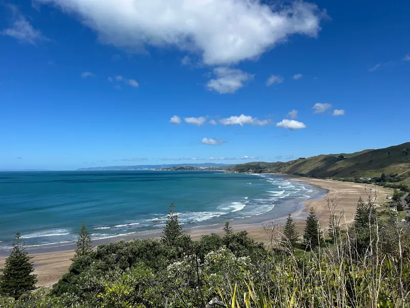
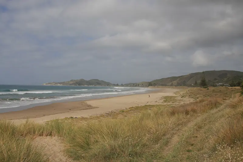
    Wainui Beach is a coastal suburb about six kilometres east of Gisborne's city centre, directly on State Highway 35. Together with the adjoining Makorori Beach to the north, this stretch offers about six kilometres of sandy beach along the east coast, featuring dunes, rock reefs, and waves that attract surfers all year round. Locals call the northern curve of the beach Okitu, and the southern curve Wainui.You come here for surfing, long beach walks, or as a first stop on your journey towards East Cape. During summer, the Wainui Beach Surf Life Saving Club patrols a section of the beach near the mouth of the Hamanatua Stream. Swim there if possible and observe the lifeguards' instructions; general advice can be found in the travel and safety advisories of the German Federal Foreign Office.

    Sights in Wainui Beach

    Discover the most important sights and attractions

    Dive Tatapouri
    Attraction

    1Dive Tatapouri

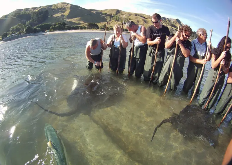
    Operator on Whangara Road in Tatapouri, about 15 minutes north of Gisborne on SH35. On the Reef Ecology Tour, you go onto the reef at low tide with guides and encounter wild stingrays and eagle rays. Tours are only available around low tide and require booking.
    Open in Google Maps
    Okitu Scenic Reserve

    2Okitu Scenic Reserve

    Small coastal forest reserve of the Department of Conservation at the north end of Wainui Beach, right on SH35. An easy 20-30 minute loop track crosses three boardwalks through Kohekohe and Pūriri stands to a platform overlooking the beach. You often see Kererū and Fantails. Caution when parking and exiting onto the road.
    Open in Google Maps
    Makorori Lookout
    Attraction

    3Makorori Lookout

    Viewpoint on Whangara Road (SH35) above Makorori Beach, Wainui's northern neighboring beach. From here you overlook the bay with its sandy sections and rock reefs, a good stop on the way to the East Cape.
    Open in Google Maps

    Essen & Trinken

    1

    Zephyr Wainui

    Café with small shop on Oneroa Road, at the south end of Wainui Beach.
    Show on Google Maps

    Coast with a Long History

    The coast around Wainui and Makorori has long been connected with the communities of Ngāti Rakai and Ngāti Konohi. At the northern end of the W.D. Lysnar Reserve, the so-called Whales Grave commemorates 1970, when 59 sperm whales stranded here and were buried on the beach.Today, surf culture primarily defines the area, with boards on car roofs and a Surf Life Saving Club that patrols the beach in summer. The dunes with Pingao and Spinifex protect the coast from erosion, therefore, stay on the marked access paths.

    Out and About in Wainui

    Wainui is located on State Highway 35, the coastal road towards East Cape. From Gisborne city centre, it's about a ten-minute drive by car, and easily cyclable by bike. According to Gisborne District Council, GizzyBus line 1 also serves Wainui; check the current timetable beforehand, as buses do not run very frequently.At the beach itself, you can get around on foot. For Makorori, the Lookout, and Tatapouri further north, you'll need a car or bike. Be careful when parking on the Highway, traffic is fast.

    Accommodations in Wainui Beach

    Find perfect stay in Wainui Beach

    Booking.com* (Affiliate link)
    Search Hotels
    Agoda* (Affiliate link)
    Search Hotels
    Airbnb
    Vacation Rentals

    * Affiliate link: if you book through it, we earn a small commission. The price stays the same for you.

    Plan your trip to Wainui Beach

    Save places, build a route and plan your city trip, all in one place.

    1. 1
      Sunrise over alpine peaks and a sea of clouds
      1234

      Round trip

      12 days · 4 stops

      Saved

      Pick a route

      Pick a ready-made one or save places and plan your own.

      Open bookmarks
    2. 2

      Trip to Wainui Beach

      Live
      • 1Dive Tatapouri3 days
      • 2Okitu Scenic Reserve4 days
      • 3Makorori Lookout5 days
      Budget

      Plan your trip

      The planner sorts stops, days and budget. Plan together in real time.

      Start trip planning
    3. 3
      9:41 No signal
      Wainui Beach
      Available offline

      Use it on the road

      Download the guide to your phone and use it on site, even offline.

    Nearby

    Gisborne

    Gisborne

    Gisborne, in Māori Tairāwhiti, is located on the far east of the North Island and is one of the first places to see the sun rise each morning. You can expect long surf beaches, vineyards with abundant Chardonnay, Māori communities with a rich history, and a coastline away from the main tourist routes.
    Inner City Gisborne

    Inner City Gisborne

    The center of Gisborne lies where the Taruheru and Waimata rivers meet to form the Tūranganui, flowing into Poverty Bay. The museum, riverside paths, harbor, and Waikanae Beach are just a short walk away.
    Gisborne Wine Region

    Gisborne Wine Region

    The Gisborne wine region is on the fertile Poverty Bay Flats, west and south of the city. Few NZ wine regions have such sun and warmth; harvest often starts here first. Chardonnay is dominant, alongside Gewürztraminer, Pinot Gris, Sauvignon Blanc, and Merlot.According to New Zealand Winegrowers, all wineries are within 15 minutes of the city or airport. Three sub-regions define the area: Ormond (north, with the Golden Slope), Patutahi (west, known for Gewürztraminer), and Manutuke (south, near the coast). Plan tastings; cellar doors often have limited hours, confirm your driver.
    Napier

    Napier

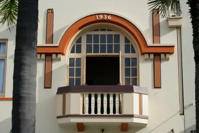
    Napier is located on Hawke Bay on the east coast of the North Island and is primarily known for its Art Deco centre. The earthquake of February 3, 1931, destroyed large parts of the city, after which the centre was rebuilt in the style of the era. Today, you can stroll among pastel-coloured facades, walk along the Marine Parade by the sea, and view the harbour from Bluff Hill. The Hawke's Bay wineries are just a short drive away.
    Hawke's Bay

    Hawke's Bay

    Hawke's Bay on the East Coast of the North Island is both orchard and wine country. Around Napier, Hastings and Havelock North, apple orchards, vineyards, and gravel soils alternate; the coast features long beaches and the gannet colony at Cape Kidnappers. The 1931 earthquake still shapes the cityscape: Napier and Hastings were rebuilt in Art Deco and Spanish Mission styles afterwards.

    Sources & method

    • Photos: Wikimedia Commons, Google Maps. Each photo carries its credit.
    • Place data such as addresses and ratings comes from Google Maps.
    • The content is based on web research from public, traceable sources. How the content is made · The role of AI