Fernweh: Home
    ExploreTravel GuidesPlan a tripMy tripLast visited
    de|en
    All Places & RegionsAll highlightsAbout FernwehFAQPrivacy PolicyImprint
    ExploreTravel GuidesPlan a tripMy tripLast visited
    • Places in the region
    • Eat & drink
    • Nearby
    Spanish Pyrenees

    Spain

    Spanish Pyrenees

    Region

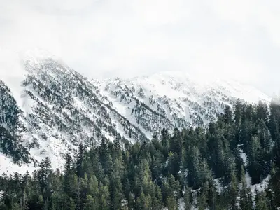
    The Spanish Pyrenees stretch along the border with France and Andorra, with rugged peaks, deep valleys, and national parks like Ordesa y Monte Perdido and Aigüestortes.

    by Felix Gillen

    1. Home
    2. Destinations
    3. Spain
    4. Spanish Pyrenees
    The Spanish Pyrenees stretch along the border with France and Andorra, with rugged peaks, deep valleys, and national parks like Ordesa y Monte Perdido and Aigüestortes. The region is suitable for challenging hikes and climbing tours as well as strolls through medieval villages. Here you'll discover a mix of nature, history, and local culture.
    Jaca

    Place 1 of 4

    Jaca

    Jaca, the first capital of the Kingdom of Aragón until 1096, is nestled in the Pyrenees, blending history with mountain charm. Its striking landmark is the five-sided *Citadel*, built in the late 16th century under Philip II.

    Discover
    National Park Aigüestortes i Estany de Sant Maurici

    Place 2 of 4

    National Park Aigüestortes i Estany de Sant Maurici

    Catalonia's only National Park is known for its almost 200 mountain lakes ("estanys"), waterfalls, and a high-mountain landscape of granite and slate, shaped by glaciers.

    Discover
    Ordesa y Monte Perdido National Park

    Place 3 of 4

    Ordesa y Monte Perdido National Park

    The National Park is a UNESCO World Heritage site and is known for its glacier-formed U-shaped valleys, deep gorges, steep rock faces, and Monte Perdido, ideal for hikers and nature lovers.

    Discover
    Sierra and Canyons of Guara

    Place 4 of 4

    Sierra and Canyons of Guara

    The Natural Park in the Huesca province is Aragon's largest protected area and known for its limestone canyons, which attract thousands of canyoning enthusiasts every year.

    Discover

    More places in Spanish Pyrenees

    Valle de Arán

    Valle de Arán

    A Pyrenean valley on the north side of the main ridge with its own language (Aranese, a variant of Occitan), known for its villages with Romanesque churches, the Baqueira Beret ski resort, and diverse hiking opportunities.
    Valle de Benasque

    Valle de Benasque

    The valley is often referred to as the "Heart of the Pyrenees" and is surrounded by the highest peaks of the mountain range, including Aneto. It is an important destination for mountaineers and hikers.

    Sights in Spanish Pyrenees

    Discover the most important sights and attractions

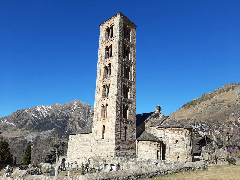
    Sant Climent de Taüll

    Sant Climent de Taüll

    The Romanesque Basilica in Vall de Boí, consecrated in 1123, is, with its slender, freestanding bell tower, the most famous example of the valley's Romanesque churches, which have been a UNESCO World Heritage site since 2000. In the apse, you'll see a faithful replica of the Pantocrator fresco; the original hangs in the MNAC in Barcelona.
    Open in Google Maps
    Congost de Mont-rebei
    Park

    Congost de Mont-rebei

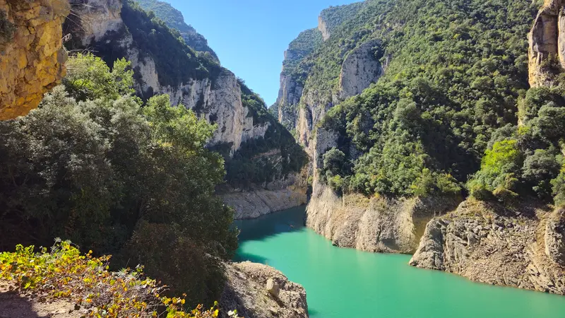
    The Noguera Ribagorçana river has carved a gorge between Catalonia and Aragon, with rock walls almost 500m high and only about 20m wide at its narrowest points. A rock-hewn path with railings leads through it. The protected area on the Catalan side covers nearly 600 hectares.
    Open in Google Maps
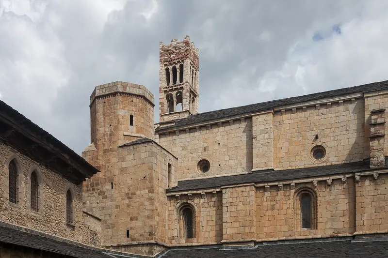
    Cathedral of Saint Mary of Urgell
    Church

    Cathedral of Saint Mary of Urgell

    The Cathedral of La Seu d'Urgell was built from 1090 and completed in the late 12th century, making it Catalonia's only surviving Romanesque cathedral. Its cloister features over 50 capitals with plant, human, and animal motifs, and the Diocesan Museum houses a valuable copy of the Beatus of Liébana.
    Open in Google Maps

    Essen & Trinken

    1

    El Cau

    Restaurant in Carrer dels graieres.
    Show on Google Maps
    2

    ROIA Barruera

    Restaurant in Passeig Sant Feliu.
    Show on Google Maps
    3

    Restaurant La Granja

    Restaurant in Carrer de Santa Eulàlia.
    Show on Google Maps
    4

    El Ventador

    Restaurant in Passeig Sant Feliu.
    Show on Google Maps
    5

    Ca La Pepa

    Restaurant in Carretera de Taüll.
    Show on Google Maps

    Nearby

    National Park Aigüestortes i Estany de Sant Maurici

    National Park Aigüestortes i Estany de Sant Maurici

    Catalonia's only National Park is known for its almost 200 mountain lakes ("estanys"), waterfalls, and a high-mountain landscape of granite and slate, shaped by glaciers.
    Valle de Benasque

    Valle de Benasque

    The valley is often referred to as the "Heart of the Pyrenees" and is surrounded by the highest peaks of the mountain range, including Aneto. It is an important destination for mountaineers and hikers.
    Valle de Arán

    Valle de Arán

    A Pyrenean valley on the north side of the main ridge with its own language (Aranese, a variant of Occitan), known for its villages with Romanesque churches, the Baqueira Beret ski resort, and diverse hiking opportunities.
    Aínsa

    Aínsa

    Discover Aínsa, a breathtaking medieval fortress majestically perched on a hill in the heart of the Spanish Pyrenees. This historic-artistic gem transports you on an unforgettable journey through time with its cobblestone streets, the imposing castle, and the charming Plaza Mayor. Here, where history meets spectacular nature, you'll feel the spirit of bygone eras and the warm hospitality of the Aragon region.
    Ordesa y Monte Perdido National Park

    Ordesa y Monte Perdido National Park

    The National Park is a UNESCO World Heritage site and is known for its glacier-formed U-shaped valleys, deep gorges, steep rock faces, and Monte Perdido, ideal for hikers and nature lovers.

    Sources & method

    • Photos: Wikimedia Commons, Pexels, Google Maps. Each photo carries its credit.
    • Place data such as addresses and ratings comes from Google Maps.
    • The content is based on web research from public, traceable sources. How the content is made · The role of AI