Fernweh: Home
    ExploreTravel GuidesPlan a tripMy tripLast visited
    de|en
    All Places & RegionsAll highlightsAbout FernwehFAQPrivacy PolicyImprint
    ExploreTravel GuidesPlan a tripMy tripLast visited
    • Neighborhoods & highlights
    • Eat & drink
    • Food culture
    • Culture
    • Getting around
    • Accommodation
    • Plan trip
    • Nearby
    Sukhumvit

    Thailand

    Sukhumvit

    City

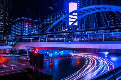
    Sukhumvit is less a district than an axis: The street stretches for kilometers east from the center, spanned by the BTS-Sukhumvit Line.

    by Felix Gillen

    1. Home
    2. Destinations
    3. Thailand
    4. Bangkok
    5. Sukhumvit
    Sukhumvit is less a district than an axis: The street stretches for kilometers east from the center, spanned by the BTS-Sukhumvit Line. Numbered side streets, the Sois, branch off from it, with odd numbers to the north and even to the south. Here you find daily life: residential buildings, street food stalls, massage parlors, small bars.The major shopping centers are located at the BTS stations: Terminal 21 at the Asok intersection, where the MRT also stops, Emporium and EmQuartier at Phrom Phong. Further east, Thonglor and Ekkamai are home to cafés, wine bars, and restaurants that appeal primarily to a younger, affluent clientele.Sukhumvit is also a residential area for many newcomers, which is reflected in its cuisine: around Phrom Phong, Japanese restaurants and supermarkets; on Soi 12, Korean eateries; near Nana, Arabic cuisine. The Benjasiri Park and the larger Benjakitti Park serve as green spaces. Because traffic on the street often jams, Skytrain and U-Bahn are usually faster than a taxi.

    Sights in Sukhumvit

    Discover the most important sights and attractions

    1Holy Redeemer Church Bangkok

    Catholic church near BTS Ploen Chit station, built in 1954 for the Redemptorist parish established in 1949. From the outside, the building resembles a Thai temple; inside, it follows the usual church layout. Daily masses in Thai and English.
    Open in Google Maps

    2Masjid Baan Doon

    East Sukhumvit's neighborhood mosque, a hub for a Muslim community, surrounded by Halal shops and small kitchens. Not for visits, but an active place of worship. To enter, inquire first and come outside prayer times.
    Open in Google Maps

    3Benjakitti Park

    On the western edge of Sukhumvit, on the former grounds of the state tobacco authority: a lake with a walking and cycling path, plus a forest park, fully opened in 2022, with elevated walkways over wetlands. Connected to Lumphini Park via the 1.3-kilometer Green Bridge. Used by runners in the mornings and evenings, but lacking shade during the day. The MRT Station Queen Sirikit National Convention Centre is located by the park.
    Open in Google Maps

    4Benjasiri Park

    Small city park right by the BTS Phrom Phong Station, created in 1992 for Queen Sirikit's 60th birthday. Twelve sculptures by Thai artists stand between lawns and a pond, along with paths and shaded seating areas. Open daily from 5 AM to 9 PM. A good escape when the shopping malls get too much.
    Open in Google Maps

    5Kamthieng House (Siam Society)

    A mid-19th century teak house, originally on the east bank of the Ping in Chiang Mai, was dismantled, brought to Bangkok, and opened in 1966 as a folk museum on Lanna daily life. Operated by the Siam Society, which also maintains a library on the same grounds. A few minutes from BTS Asok Station. Important: Closed for restoration since late 2023; reopening date unknown. Confirm with Siam Society beforehand.
    Open in Google Maps

    Essen & Trinken

    1

    Usman Thai Muslim Food (Halal)

    Restaurant in 259/9 Sukhumvit Soi 22.
    Show on Google Maps
    2

    Pasta 54

    Restaurant in 29 Soi Saeng Ngoen.
    Show on Google Maps

    Arabian Kitchens of Soi 3/1

    A short alley near Nana, where Egyptian, Lebanese, and Syrian eateries are side-by-side: grilled meats, mezze, flatbread, shisha at tables on the sidewalk. Opens late and stays open late. A few steps from BTS-Station Nana.
    Show on Google Maps

    Foodcourt Terminal 21

    Food court on the upper floor of the shopping mall at Asok intersection, featuring stalls for Thai and Asian everyday dishes. Air-conditioned, affordable, and a quick meal when you're at the Asok interchange.
    Show on Google Maps

    Food and Drink in Sukhumvit

    No Bangkok neighborhood offers such international dining. Between Nana and Ekkamai, you'll discover Japanese, Korean, Arabic, Indian, Italian, and American cuisines — in a density unrivaled elsewhere in the country. Alongside this, the Thai culinary scene thrives: street food stalls at Soi entrances, food courts in shopping malls, and restaurants lining the residential streets of Thonglor and Ekkamai.

    Japanese Bangkok around Phrom Phong

    Phrom Phong is home to many Japanese restaurants – Izakaya, Ramen, Sushi – plus Japanese supermarkets. Prices vary from affordable to high-end.

    Arabic Cuisine in Soi 3/1

    Near Nana, a short alley branches off, home to Egyptian, Lebanese, and Syrian eateries serving grilled meats, mezze, and hookahs. They open late and stay open long.

    Halal-style Thai Cuisine

    Thai-Muslim establishments cook Massaman, Roti, beef broth, and Khao Mok Kai, the Thai Biryani. A distinct branch of the national cuisine.

    Food courts in the shopping malls

    Terminal 21 at Asok, and Emporium and EmQuartier at Phrom Phong, have food courts with Thai and Asian stalls. Air-conditioned and cheaper than the restaurants one floor up.

    Food stalls at the Soi entrances

    At the Sois junctions, stalls for commuters are set up mornings and evenings: fried noodles, grilled skewers, rice soup, fruit. The cheapest way to eat here.

    A quarter that consists of numbers

    Sukhumvit is not a historic quarter, but a road that has evolved into a district. Sukhumvit Road stretches from the city center to the Cambodian border; the first few kilometers are what travelers call Sukhumvit. From this main artery, the Sois branch off, with even numbers to the south and odd numbers to the north. These numbers serve as both address and orientation.The Logic of Soi NumbersGenerally speaking: The further east, the more residential. Around Nana lies the loudest and most traveler-focused part, with bars, massage parlors, and the red-light scene around Nana and Soi Cowboy. From Asok and Phrom Phong, the character shifts to shopping malls, offices, and residential towers; around Thonglor and Ekkamai, you'll find residential streets with cafés and restaurants.International CommunitiesMany expatriates reside in Sukhumvit, which is evident street by street. Around Phrom Phong is Japanese Bangkok, with supermarkets and numerous Japanese restaurants. Soi 3/1 near Nana is distinctly Arabic, featuring Egyptian and Levantine cuisines. Soi 12 is home to Korean eateries.What You Should KnowAround Nana and Soi Cowboy, the red-light scene is openly visible. Prostitution is illegal in Thailand but tolerated. Sexual acts with minors are punishable by law in Thailand, as in Germany, even if committed abroad. For current safety advice, consult the Auswärtiges Amt.The sidewalks of Sukhumvit Road are bustling with crowds, trade, and construction. If you're seeking peace and quiet, step into a Soi.The district has little historic architecture. Temples and museums are primarily found in Rattanakosin.

    Exploring on site

    You can access Sukhumvit via the BTS Sukhumvit Line. The elevated train runs directly above the main road, and many addresses are described using the nearest station plus Soi number.BTS Sukhumvit Line: From west to east: Ploen Chit, Nana, Asok, Phrom Phong, Thong Lo (Soi 55), Ekkamai (Soi 63), Phra Khanong, On Nut.MRT: The Blue Line crosses at Sukhumvit Station, underneath Asok BTS Station, a major interchange. Further west is the Queen Sirikit National Convention Centre by Benjakitti Park.Airport Rail Link: Makkasan Station is connected to Phetchaburi MRT Station, one stop north of Sukhumvit. From there, the train goes to Suvarnabhumi Airport.Skywalk: Between Asok and Phrom Phong and around the shopping centers, elevated walkways lead over the street. A better choice in rain and heat.Walking in the Sois: Some Sois are very long and don't have continuous sidewalks. For an address deep inside a Soi, a motorcycle taxi from the Soi entrance is worthwhile; drivers wear numbered vests.Taxi: During rush hour, traffic on Sukhumvit Road grinds to a halt. The BTS is usually faster then. Insist on the meter or use an app.


    Accommodations in Sukhumvit

    Find perfect stay in Sukhumvit

    Booking.com* (Affiliate link)
    Search Hotels
    Agoda* (Affiliate link)
    Search Hotels
    Airbnb
    Vacation Rentals

    * Affiliate link: if you book through it, we earn a small commission. The price stays the same for you.

    Plan your trip to Sukhumvit

    Save places, build a route and plan your city trip, all in one place.

    1. 1
      Sunrise over alpine peaks and a sea of clouds
      1234

      Round trip

      12 days · 4 stops

      Saved

      Pick a route

      Pick a ready-made one or save places and plan your own.

      Open bookmarks
    2. 2

      Trip to Sukhumvit

      Live
      • 1Holy Redeemer Church Bangkok3 days
      • 2Masjid Baan Doon4 days
      • 3Benjakitti Park5 days
      Budget

      Plan your trip

      The planner sorts stops, days and budget. Plan together in real time.

      Start trip planning
    3. 3
      9:41 No signal
      Sukhumvit
      Available offline

      Use it on the road

      Download the guide to your phone and use it on site, even offline.

    Nearby

    Siam Square / Ratchaprasong

    Siam Square / Ratchaprasong

    Siam Square and neighbouring Ratchaprasong form Bangkok's shopping hub. Around BTS Siam station, the interchange between the Sukhumvit and Silom lines, you'll find Siam Paragon, Siam Center, and Siam Discovery. Skywalks connect them, so you hardly need to step onto the streets.Siam Square itself comprises low-rise blocks with small shops, tutoring centres, and eateries, frequented by students from the nearby Chulalongkorn University and more affordable than the malls. Near National Stadium is the MBK Center, offering hundreds of small stalls for clothing and electronics.At the Ratchaprasong intersection stands the Erawan Shrine, where devotees daily lay flower garlands and dance groups perform for donations; next to it is CentralWorld. A short walk from National Stadium is the Jim Thompson House, a complex of old teak houses belonging to the American silk merchant. It's a convenient spot in heat or rain, as almost everything is air-conditioned and covered.
    Silom / Sathorn

    Silom / Sathorn

    Silom and Sathorn form Bangkok's business district: two parallel main streets between Lumphini Park and the Chao Phraya, lined with office towers, banks, and embassies. During the day, rush hour traffic and street food stalls in the side streets define the scene.At the eastern end lies Lumphini Park, where Tai Chi groups and joggers are out in the mornings and monitor lizards live by the ponds. On Silom Road stands the Hindu Sri Maha Mariamman Temple with its colorful Gopuram, founded by the Tamil community.In the evenings, life shifts to the Sois: The night market of Patpong, the bars of Soi 4, and restaurants on Convent Road are just a few minutes apart, plus there are rooftop bars in the skyscrapers. Connectivity is good: BTS Sala Daeng and Chong Nonsi, MRT Si Lom and Lumphini. At the river end, the BTS Saphan Taksin station takes you directly to the express boat pier.
    Yaowarat (Chinatown)

    Yaowarat (Chinatown)

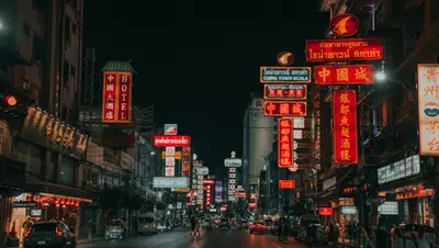
    Yaowarat is Bangkok's Chinatown, formed when the Chinese community relocated here from Rattanakosin during the construction of the Grand Palace. Along Yaowarat Road, gold shops, Chinese medicine pharmacies, shrines, and street food stalls jostle for space; their neon signs are inscribed in both Chinese and Thai.Key attractions include Wat Traimit, home to a 5.5-ton golden Buddha long hidden beneath a layer of stucco, and Wat Mangkon Kamalawat, Bangkok's most important Chinese-Buddhist temple on Charoen Krung Road. In Sampheng Alley and its side streets, wholesale trade predominates.In the evenings, the main street transforms into a food paradise: grilled seafood, noodle soups, roasted chestnuts, and desserts, available in permanent restaurants and from folding stalls on the pavement. The Wat Mangkon MRT station is located in the heart of the district. During Chinese New Year, Yaowarat gets notably crowded. Southwest of here is Talat Noi, a quieter alley district with workshops, old residential buildings, and cafés stretching down to the river.
    Riverside (Chao Phraya)

    Riverside (Chao Phraya)

    The Chao Phraya is Bangkok's most important waterway and one of the most revealing perspectives on the city. Along its banks, temples, old trading houses, cargo piers, and modern high-rises line up. In the Riverside district, historic hotels stand next to large shopping centers on the Thonburi side.The Chao Phraya Express Boats operate between numerous piers and are often the most practical means of transport for visitors: Sathorn Pier connects to the BTS Skytrain, and further north are the piers for Wat Arun, Wat Pho, and the Grand Palace. Small cross-river ferries connect the two sides of the river.In the evening, dinner boats cruise up and down the river, and waterside night markets and restaurant terraces open. For those who prefer peace, stroll through the alleys of Talat Noi and Chinatown, which reach right to the riverbank.
    Bangkok

    Bangkok

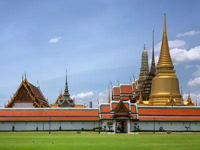
    Bangkok is Thailand's capital and by far its largest city, where Buddhist temples, street food, and high-rise districts lie closely side by side. Along the Chao Phraya River stand the Grand Palace with the Emerald Buddha, Wat Pho with its 46-meter-long Reclining Buddha, and opposite, Wat Arun. Markets like the Chatuchak Weekend Market and the street food of Yaowarat showcase daily city life, while Sukhumvit and Siam are known for shopping malls and nightlife. The most pleasant time to visit is from November to February. You can avoid traffic jams with the Skytrain (BTS), Metro (MRT), and river boats.

    Sources & method

    • Photos: Unsplash. Each photo carries its credit.
    • Place data such as addresses and ratings comes from Google Maps.
    • The content is based on web research from public, traceable sources. How the content is made · The role of AI