Fernweh: Home
    ExploreTravel GuidesPlan a tripMy tripLast visited
    de|en
    All Places & RegionsAll highlightsAbout FernwehFAQPrivacy PolicyImprint
    ExploreTravel GuidesPlan a tripMy tripLast visited
    • Neighborhoods & highlights
    • Recommendations
    • Walking tours
    • Eat & drink
    • Culture
    • Nightlife
    • Getting around
    • Accommodation
    • Plan trip
    • Nearby
    Gqeberha (Port Elizabeth)

    South Africa

    Gqeberha (Port Elizabeth)

    City

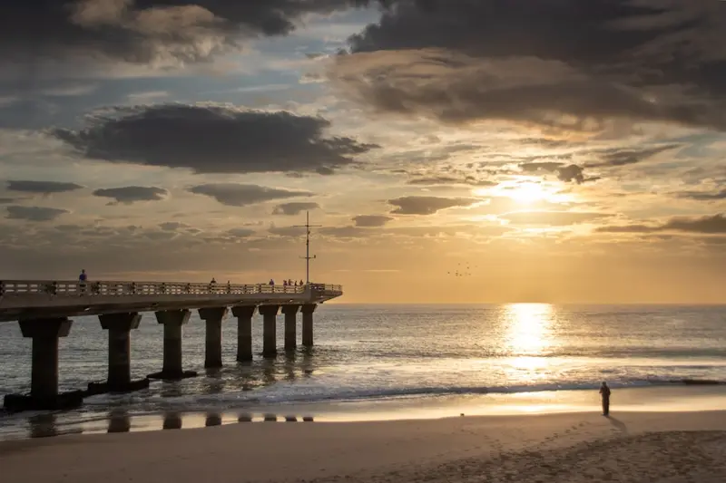
    Gqeberha, until 2021 Port Elizabeth, is the largest city of the Eastern Cape and lies on Algoa Bay. For most, it is the starting point for the Addo Elephant National Park, plus beaches and an interesting city center.

    by Felix Gillen

    1. Home
    2. Destinations
    3. South Africa
    4. Ostkap
    5. Gqeberha (Port Elizabeth)
    Gqeberha, until 2021 Port Elizabeth, is the largest city of the Eastern Cape and lies on Algoa Bay. For most, it is the starting point for the Addo Elephant National Park, plus beaches and an interesting city center.

    Sights in Gqeberha (Port Elizabeth)

    Discover the most important sights and attractions

    1Donkin Reserve & Route 67

    At Donkin Reserve, overlooking the city center, stand a lighthouse and a stone pyramid, which Governor Rufane Donkin had erected for his deceased wife Elizabeth. Route 67 starts here, an art trail with 67 works, one for each year Nelson Mandela dedicated to public service.

    Open in Google Maps

    2Bayworld

    Museum complex on the promenade with exhibitions on the natural and cultural history of the East Cape. Check current openings.
    Open in Google Maps

    3The Boardwalk

    Seaside entertainment complex with casino, restaurants, shops and cinema. At night, one of the city's liveliest spots.
    Open in Google Maps

    4St George's Park

    The city's oldest park, featuring gardens, a greenhouse, and the cricket stadium that hosted South Africa's first Test Match in 1889.
    Open in Google Maps

    City walks in Gqeberha (Port Elizabeth)

    Curated walking tours through the city's highlights, handpicked by experienced travel journalists.

    Gqeberha's Heartbeat: A Walk Through History and Art

    Explore Gqeberha (formerly Port Elizabeth) on a relaxed city walk that takes you to the most important historic sites and through the lively art scene. From the iconic Donkin Reserve and the colourful Route 67 to magnificent colonial buildings, immerse yourself in the soul of this South African port city.

    ~2 Std. 15 Min.
    Open in Google Maps
    Stops (6)

    Restaurants & Cafés

    Something Good Roadhouse

    Roadhouse on the beach promenade with burgers, milkshakes, and fish and chips.
    Show on Google Maps

    The Coachman on the Bay

    Wenn du Lust auf klassische Steaks oder frische Meeresfrüchte hast, ist The Coachman on the Bay eine ausgezeichnete Wahl. Dieses etablierte Restaurant bietet eine gemütliche Atmosphäre und ist bekannt für seine hochwertigen Gerichte und seinen freundlichen Service – ein verlässlicher Favorit bei Einheimischen und Besuchern gleichermaßen.
    Show on Google Maps
    1

    De Kelder Restaurant Port Elizabeth

    Wenn du Lust auf ein exzellentes Steak hast, bist du bei De Kelder genau richtig. Dieses beliebte Restaurant bietet eine breite Auswahl an Fleischgerichten und Weinen.
    Show on Google Maps

    Culture & History

    In 1820, British settlers landed here; Governor Rufane Donkin named the city after his deceased wife Elizabeth. In 2021, it was officially renamed Gqeberha, after the Xhosa name of the Baakens River. The city's townships, including New Brighton, were important centers of resistance against Apartheid.

    Nightlife

    1

    PEazy Times Cannabis Café

    Bar in 32 Bain Street.
    Show on Google Maps
    2

    James Tavern

    36 Connaught Ave, Kensington, Gqeberha, 6001, Südafrika
    Show on Google Maps
    3

    Cafe Loxion

    24 Parliament St, Gqeberha Central, Gqeberha, 6006, Südafrika
    Show on Google Maps
    4

    Roof Garden Bar

    Bar in 33 Winston Ntshona St.
    Show on Google Maps
    5

    Rattle and Hum

    Bar in 32 Stanley St.
    Show on Google Maps
    6

    The OG Lounge

    263 Kempston Rd, Ferguson, Gqeberha, 6001, Südafrika
    Show on Google Maps
    7

    LA KOUZINA

    Bar in Shop No. 5.
    Show on Google Maps
    8

    Freedom On Parliament

    10 Parliament St, Central, Gqeberha, 6001, Südafrika
    Show on Google Maps

    Traveling

    The airport is near the city center. Within the city, Uber or Bolt are easiest; explore the beachfront promenade on foot. For Addo and Jeffreys Bay, you'll need a car or a tour.

    Accommodations in Gqeberha (Port Elizabeth)

    Find perfect stay in Gqeberha (Port Elizabeth)

    Booking.com* (Affiliate link)
    Search Hotels
    Agoda* (Affiliate link)
    Search Hotels
    Airbnb
    Vacation Rentals

    * Affiliate link: if you book through it, we earn a small commission. The price stays the same for you.

    Plan your trip to Gqeberha (Port Elizabeth)

    Save places, build a route and plan your city trip, all in one place.

    1. 1
      Sunrise over alpine peaks and a sea of clouds
      1234

      Round trip

      12 days · 4 stops

      Saved

      Pick a route

      Pick a ready-made one or save places and plan your own.

      Open bookmarks
    2. 2

      Trip to Gqeberha (Port Elizabeth)

      Live
      • 1Donkin Reserve & Route 673 days
      • 2Bayworld4 days
      • 3The Boardwalk5 days
      Budget

      Plan your trip

      The planner sorts stops, days and budget. Plan together in real time.

      Start trip planning
    3. 3
      9:41 No signal
      Gqeberha (Port Elizabeth)
      Available offline

      Use it on the road

      Download the guide to your phone and use it on site, even offline.

    Nearby

    Sundays River Valley

    Sundays River Valley

    The Sundays River Valley, stretching between Kirkwood, Addo, and its mouth near Colchester, is one of South Africa's largest citrus-growing regions. For travelers, it primarily serves as a base for the Addo Elephant National Park, offering many guesthouses and farm accommodations nestled among the orange groves.
    Schotia Private Game Reserve

    Schotia Private Game Reserve

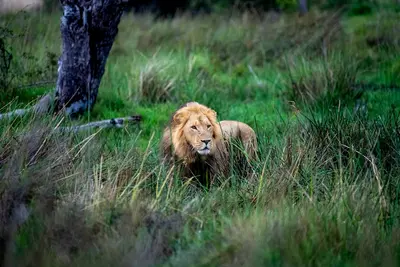
    Schotia is a small private game reserve on the edge of Addo Elephant National Park and one of the oldest in the Eastern Cape. Lions, rhinos, giraffes, hippos, and many antelopes live in a compact space. Schotia is known for game drives that extend into the darkness.
    Addo Elephants National Park

    Addo Elephants National Park

    The Addo Elephant National Park is located approximately 70 kilometres north of Gqeberha (Port Elizabeth). It was established in 1931 to protect the last eleven elephants in the region; today, over 600 live here. Besides them, there are lions, buffalo, rhinos, leopards, and zebras. The park is malaria-free and easily explored by private car.
    Addo and Sundays River Valley

    Addo and Sundays River Valley

    The region around the Addo Elephant National Park north of Gqeberha (Port Elizabeth) is the most important safari area in the Eastern Cape and is malaria-free. Besides the national park, private game reserves like Shamwari and Schotia are located here, plus the citrus valley of the Sundays River.
    Jeffreys Bay

    Jeffreys Bay

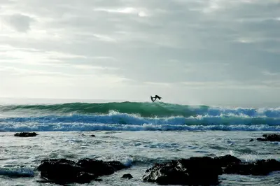
    Jeffreys Bay, some 75 kilometers west of Gqeberha, is internationally famous for its 'Supertubes' wave – one of the world's most renowned right-hand breaks and a frequent host of World Surf League events. Beyond surfing, the area boasts long beaches, surf shops, and a laid-back vibe.

    Sources & method

    • Photos: Unsplash. Each photo carries its credit.
    • Place data such as addresses and ratings comes from Google Maps.
    • The content is based on web research from public, traceable sources. How the content is made · The role of AI