Eighteen days from Lima via Paracas, Huacachina, and Nazca to Arequipa and the Colca Canyon, then on to Lake Titicaca, and finally to Cusco, the Sacred Valley, and Machu Picchu. You travel to Cusco comfortably by long-distance bus; return to Lima by plane.
17 Days / 16 Nights
May–October
11 stops
Why This Route?
The route follows the classic path through southern Peru, slowly ascending from the coast to the highlands. This way, your body gradually acclimatizes to the altitude, from sea level, via Arequipa at a good 2,300 meters, to Puno at around 3,800 meters, before you reach Cusco and Machu Picchu. Along the way, you'll see desert, volcanoes, canyons, the world's highest navigable lake, and the great Inca sites.
Hidden Gems
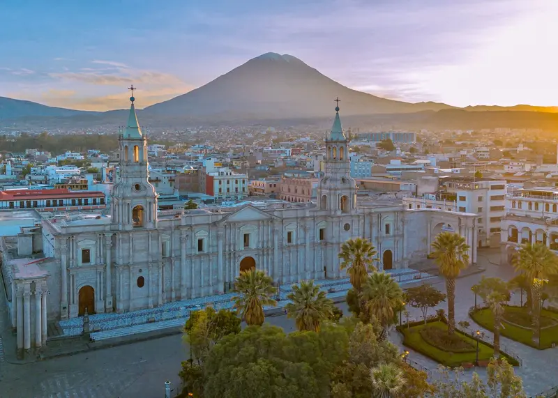
Arequipa: Head to Mirador de Yanahuara late afternoon, Misti glowing in evening light
Sillustani: Visit late afternoon, burial towers glowing gold
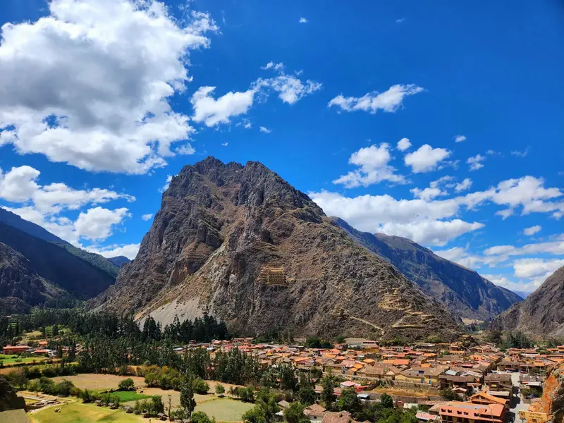
Ollantaytambo: Climb to Pinkuylluna granaries
path's free, view's the best in town.
Getting there and back
Round trip, returning to where you started
Arrival
Flight · Lima (LIM)From Jorge Chávez Airport in Callao, expect to take just under an hour to over 90 minutes to Miraflores, depending on traffic. Take an official airport taxi or a pre-booked transfer.
Departure
Flight · Lima (LIM)From Cusco, you'll fly back to Lima in about an hour, connecting there to your home flight. Allow several hours buffer between flights.
Itinerary
Stop 1 • 2 Nights
Lima
City
Route highlight
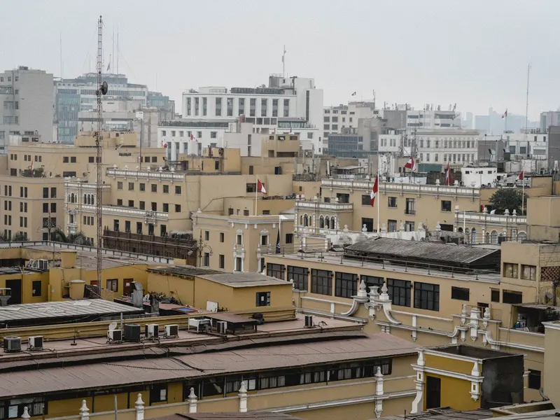
Peru's capital lies on the Pacific coast and is the first stop for most travelers. Francisco Pizarro founded it in 1535; as the seat of the Viceroyalty, it became Spanish South America's most important city. Its historic center, with its cathedral, monasteries, and wooden balconies, has been a UNESCO World Heritage site since 1988.For travelers, three districts are particularly important: the Centro Histórico with Plaza Mayor and the San Francisco Monastery, Miraflores with the Malecón along the cliffs and the adobe pyramid Huaca Pucllana, and Barranco, the bohemian district with galleries, murals, and the Puente de los Suspiros. In the Pueblo Libre district, the Museo Larco displays one of the country's great collections of pre-Columbian art.
Old Town, Miraflores and Barranco, evenings Ceviche and Pisco Sour.
1 Sight
Culture
Culinary CapitalIn Lima, Spanish, indigenous, African, Chinese, and Japanese influences converge, and nowhere is this more evident than on your plate. Here, you eat ceviche for lunch; Chifa is Peruvian-Chinese cuisine, Nikkei the Peruvian-Japanese.Colonial HeritageThe Spanish founded Lima in 1535 as the capital of their Viceroyalty. The old town, with its wooden balconies, monasteries, and churches, is now a UNESCO World Heritage site.Museums and ArtThe Museo Larco displays pre-Columbian ceramics spanning millennia; in Barranco, galleries and murals shape the streetscape. Those who want to hear Peruvian music go to a Peña in the evening.
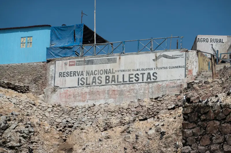
The coastal resort of Paracas on the Pacific coast is the starting point for two of the most famous natural experiences on the Peruvian coast. From Muelle El Chaco, boats depart in the mornings for the Islas Ballestas, passing the El Candelabro geoglyph, which can be seen from the sea on a sand dune. Sea lions, Humboldt penguins, pelicans, and colonies of guano birds live on the rocky islands.South of the town begins the Reserva Nacional de Paracas, founded in 1975 and, at around 335,000 hectares, the largest protected area on Peru's coast, two-thirds of which is ocean. Viewpoints such as Playa Roja, with its reddish beach, and the rock formation La Catedral, whose arch collapsed in the 2007 earthquake, are accessible by car or tour.
Mornings by boat to the Islas Ballestas, afternoons to the Reserva Nacional.
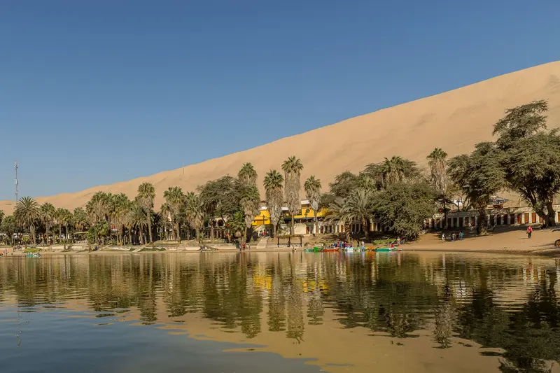
Huacachina is a small oasis with a lagoon and palm trees, surrounded by towering sand dunes, just a few kilometers from the center of the city of Ica. Most visitors come for exhilarating dune buggy tours and sandboarding, often in the late afternoon to experience the sunset over the desert. The lagoon's water level has dropped, and water is now being supplied.From Lima, take a bus to Ica, then a ten-minute taxi ride to Huacachina.Around Ica, you'll find bodegas producing Pisco and wine, offering tours with tastings.Buggies have been involved in accidents, so choose a reputable provider.
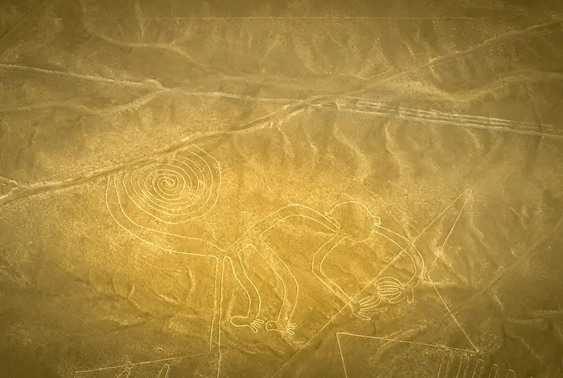
The Nazca Lines are immense geoglyphs etched into the desert on Peru's southern coast, primarily created by the Nazca culture, which lived here roughly between 100 BC and 800 AD. Alongside straight lines and geometric forms, there are animal figures like the hummingbird, monkey, spider, and condor. In 1994, UNESCO designated the Lines and Geoglyphs of Nazca and Palpa as a World Heritage site.The figures are barely discernible from the ground. From the observation tower on the Pan-American Highway, you can see two figures: the Hands and the Tree. Only scenic flights from María Reiche Airport in Nazca, lasting about half an hour, offer a complete overview. The German Foreign Office advises that there have been several accidents on these flights in the past; please research your provider beforehand.
Arequipa is located in southern Peru at around 2,400 meters, at the foot of Misti volcano. The Spanish founded the city on August 15, 1540. Its center is almost entirely built from Sillar, a white to pink volcanic rock that earned it the nickname "White City." Since 2000, its historic center has been a UNESCO World Heritage site.The most important sight is the Santa Catalina Monastery, founded in 1579 and, covering around 20,000 square meters, is like a small city itself with alleys, courtyards, and colorful walls. The Museo Santuarios Andinos displays the mummy Juanita, an Inca girl found in 1995 on the summit of Ampato volcano. Enjoy views of Misti and Chachani from the Mirador de Yanahuara, with its Sillar arches.
Santa Catalina, Museo Santuarios Andinos and Picanterías, good for acclimatizing.
4 Sights
3 Restaurants
Culture
The White CityArequipa's churches and mansions are built from Sillar, a light volcanic rock that gave the city its nickname. The Misti volcano looms over everything. Since 2000, the old town has been a UNESCO World Heritage site.Pride and Self-willThe Arequipeños are considered proud and independent; some jokingly speak of their own republic. A souvenir passport is part of the fun.PicanteríasIn traditional Picanterías, Rocoto Relleno, Chupe de Camarones and Adobo are served, along with Chicha de Jora. They are busiest at lunchtime, as this is when people traditionally eat here.
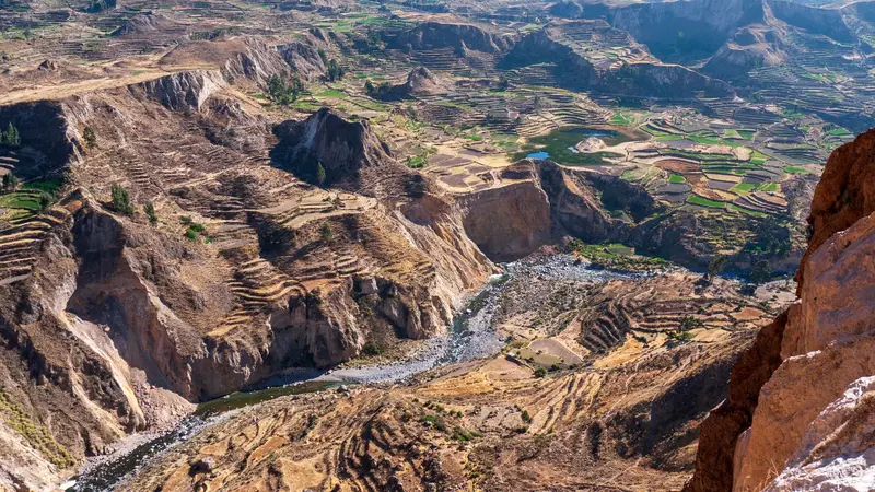
The Colca Canyon is located approximately 160 kilometers northwest of Arequipa and is one of the deepest canyons in the world. Along the valley, villages still cultivate ancient agricultural terraces, some of which date back to pre-Incan times. At the Cruz del Cóndor viewpoint, where the canyon floor lies approximately 1,200 meters deeper, Andean condors circle, best observed in the morning.The starting point is the town of Chivay, about a four-hour drive from Arequipa, with thermal baths in the surrounding area.To visit the viewpoints, you need the Colca Tourist Ticket, which you can purchase in Chivay or at the checkpoints.The road leads over high altitudes; plan for acclimatization.
Overnight in Chivay, next morning condors at Cruz del Cóndor.
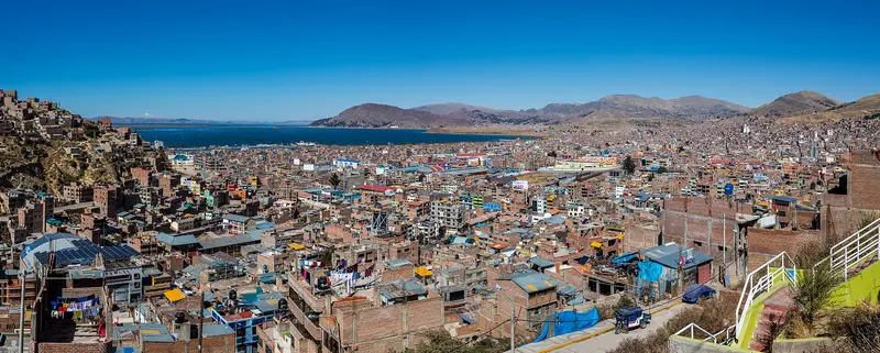
Puno is located at about 3,800 meters on the western shore of Lake Titicaca and is the starting point for boat trips on the lake. The city calls itself the “Folklore Capital of Peru”: Every February, it celebrates the Fiesta de la Virgen de la Candelaria with thousands of dancers and musicians, an intangible UNESCO cultural heritage since 2014.On the Plaza de Armas stands the baroque cathedral, completed in 1757. From the hill with the monument to Manco Cápac, the legendary first Inca, you overlook the city and the lake. About 30 kilometers outside, on Lago Umayo, are the funerary towers of Sillustani, built by the Colla before Inca rule.The nearest airport is Inca Manco Cápac Airport in Juliaca. You can also reach Puno by bus or with the PeruRail Titicaca train from Cusco.After arrival, allow yourself time to acclimatize before going on excursions.
A boat tour to Uros and Taquile, a side trip to Sillustani.
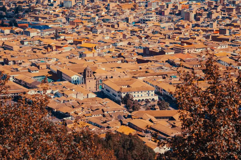
Cusco was the capital of the Inca Empire and is now the starting point for almost every trip to Machu Picchu. Under Pachacútec, a planned city with religious and administrative areas emerged. The Spanish retained the layout and built their churches and palaces on the Inca walls. Since 1983, the city has been a UNESCO World Heritage site.The heart of the city is the Plaza de Armas with its Cathedral and arcades. The Santo Domingo Monastery stands on Qorikancha, the Inca Sun Temple, whose walls are still visible. On Calle Hatun Rumiyoc is the famous twelve-angled stone, above it the artisan quarter San Blas. The Mercado San Pedro is the city's main market. Above the city lies the Inca site of Sacsayhuamán with its mighty stone walls, the venue for Inti Raymi on June 24.Cusco is located at around 3,500 meters: Take it easy for the first few days.For Sacsayhuamán and the Inca sites in the Sacred Valley, you'll need the Boleto Turístico, available as a ten-day general ticket or as partial tickets. Qorikancha and the Cathedral are not included.
Inca Walls, San Blas, Qorikancha and Sacsayhuamán.
5 Sights
3 Restaurants
Culture
Navel of the WorldQosqo means roughly Navel in Quechua, and that is exactly what the city was for the Inca: the center of their empire. The Spanish built their churches and palaces directly on the seamless Inca walls, which you can still see on many street corners today. The old town is a UNESCO World Heritage site.Living TraditionsYou hear Quechua everywhere in Cusco, in the markets as well as in the surrounding villages. Every year on June 24th, the city celebrates Inti Raymi, the Inca Festival of the Sun, with a grand staging in Sacsayhuamán.Art and CraftThe Cusqueña School of Painting shaped the colonial art of the Andes; many churches in the city are filled with their paintings. In San Blas, artisans still work in small workshops today.
Ollantaytambo is situated at approximately 2,800 meters at the western end of the Sacred Valley. The town is often referred to as a living Inca village: Its old town still follows the rectilinear street grid of the Inca, water flows through the alleys in stone channels, and many houses stand on Inca walls.Above the town rise the Inca terraces and temple complexes, which were expanded under Pachacútec. During the Spanish conquest, Ollantaytambo served as a fortress for Manco Inca. On the opposite slope lie ancient storage structures.From the station, PeruRail and Inca Rail run several times daily to Aguas Calientes; the journey takes about two hours.The Inca site is included in Cusco's Boleto Turístico.
En route Pisac, Moray and Maras, evening the fortress.
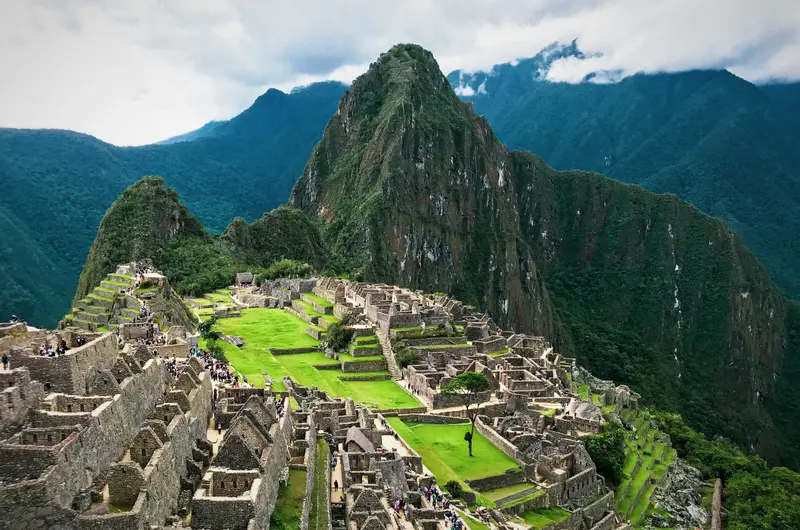
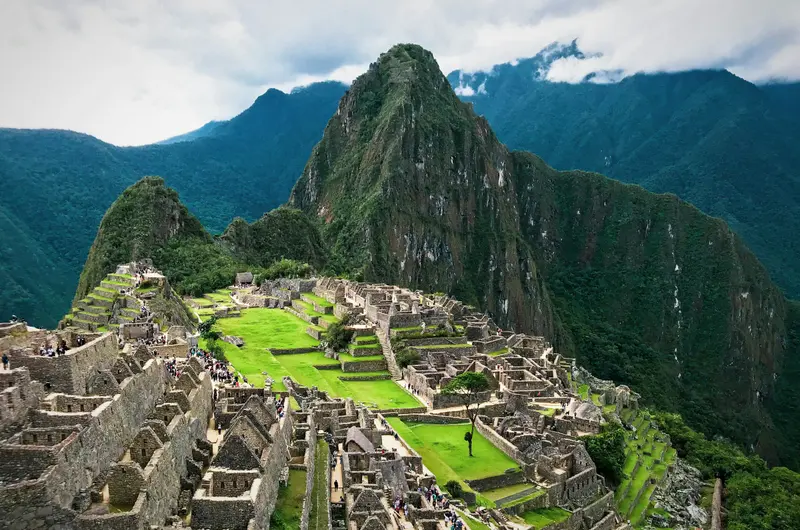
Machu Picchu is the most famous Inca site and the reason most travelers come to Peru. The complex lies at around 2,430 meters on a mountain ridge between the peaks of Machu Picchu and Huayna Picchu high above the Urubamba River, approximately 80 kilometers northwest of Cusco. Most archaeologists consider it an estate of the Inca ruler Pachacútec, built around 1450. It remained hidden from the Spanish, becoming internationally known in 1911 through Hiram Bingham. It has been a UNESCO World Heritage site since 1983.Tickets: Entry is organized into three circuits with a total of ten routes and fixed entry times. The daily capacity is 4,500 visitors, increasing to 5,600 on designated high-season days. Tickets are sold online by the Ministry of Culture; a small contingent for the next day is available locally in Aguas Calientes. For June to October, book well in advance.Getting there: By train from Cusco or Ollantaytambo to Aguas Calientes, then by Consettur bus or on foot via stairs up to the entrance.Inca Trail: The classic trail requires a permit and is closed every February.
Overnight in Aguas Calientes, early morning, up to the citadel.
Cusco was the capital of the Inca Empire and is now the starting point for almost every trip to Machu Picchu. Under Pachacútec, a planned city with religious and administrative areas emerged. The Spanish retained the layout and built their churches and palaces on the Inca walls. Since 1983, the city has been a UNESCO World Heritage site.The heart of the city is the Plaza de Armas with its Cathedral and arcades. The Santo Domingo Monastery stands on Qorikancha, the Inca Sun Temple, whose walls are still visible. On Calle Hatun Rumiyoc is the famous twelve-angled stone, above it the artisan quarter San Blas. The Mercado San Pedro is the city's main market. Above the city lies the Inca site of Sacsayhuamán with its mighty stone walls, the venue for Inti Raymi on June 24.Cusco is located at around 3,500 meters: Take it easy for the first few days.For Sacsayhuamán and the Inca sites in the Sacred Valley, you'll need the Boleto Turístico, available as a ten-day general ticket or as partial tickets. Qorikancha and the Cathedral are not included.
By train back to Cusco, last evening in the Old Town.
5 Sights
3 Restaurants
Culture
Navel of the WorldQosqo means roughly Navel in Quechua, and that is exactly what the city was for the Inca: the center of their empire. The Spanish built their churches and palaces directly on the seamless Inca walls, which you can still see on many street corners today. The old town is a UNESCO World Heritage site.Living TraditionsYou hear Quechua everywhere in Cusco, in the markets as well as in the surrounding villages. Every year on June 24th, the city celebrates Inti Raymi, the Inca Festival of the Sun, with a grand staging in Sacsayhuamán.Art and CraftThe Cusqueña School of Painting shaped the colonial art of the Andes; many churches in the city are filled with their paintings. In San Blas, artisans still work in small workshops today.