Fernweh: Home
ExploreGuideDestinationsMy tripsMy trip
de|en
All Places & RegionsRound tripsNight trains in EuropeAll highlightsAbout FernwehFAQPrivacy PolicyImprint
Download on the App StoreGet it on Google Play
ExploreGuideDestinationsMy tripsMy trip
    • Neighborhoods & highlights
    • Eat & drink
    • Culture
    • Getting around
    • Accommodation
    • Plan trip
    • Nearby
    Narvik

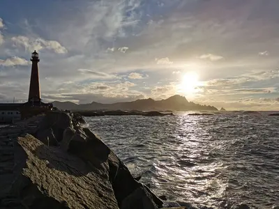
    Photo by Kristian Nordvik on Pexels

    Norway

    Narvik

    City

    Narvik is the port city in the north of Nordland province, at the ice-free end of the Iron Ore Line from Sweden.

    by Felix Gillen

    1. Home
    2. Destinations
    3. Norway
    4. Nordland
    5. Narvik
    Narvik is the port city in the north of Nordland province, at the ice-free end of the Iron Ore Line from Sweden. You come here for the history of the Battle of Narvik in the Second World War, the train journey on the Ofotbanen, and the local mountain Narvikfjellet with views over the Ofotfjord.The Ofotbanen brings iron ore from the Swedish mines around Kiruna to the port, its Norwegian section to the border is 43 kilometers long. The War Museum tells of the Battle of Narvik, the naval battles and occupation; the Narvik Museum, of its rise to an industrial city.Narvikfjellet's ski resort is expanding for the 2029 Alpine World Ski Championships, with a new gondola set to open in January 2027. Within walking distance of the center are a roughly 5,000-year-old rock carving at Brennholtet and the Arctic Sauna in the harbor.
    Norway travel guideRound trips in NorwayPlan a trip with Narvik

    Contents

    • Neighborhoods & highlights
    • Eat & drink
    • Culture
    • Getting around
    • Accommodation
    • Nearby

    Sights in Narvik

    Discover the most important sights and attractions

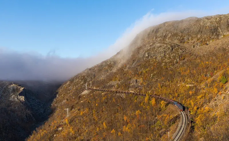
    Ofotbanen

    Kabelleger / David Gubler / Wikimedia Commons / CC BY-SA 4.0, mod.

    Point of Interest

    1Ofotbanen

    The Iron Ore Line was built to transport iron ore from Kiruna in Northern Sweden to the ice-free port of Narvik. The Norwegian section, starting from Narvik station, is 43 kilometres long and ascends over bridges, through tunnels, and along steep valley slopes into the high mountains near Bjørnfjell.
    Open in Google Maps
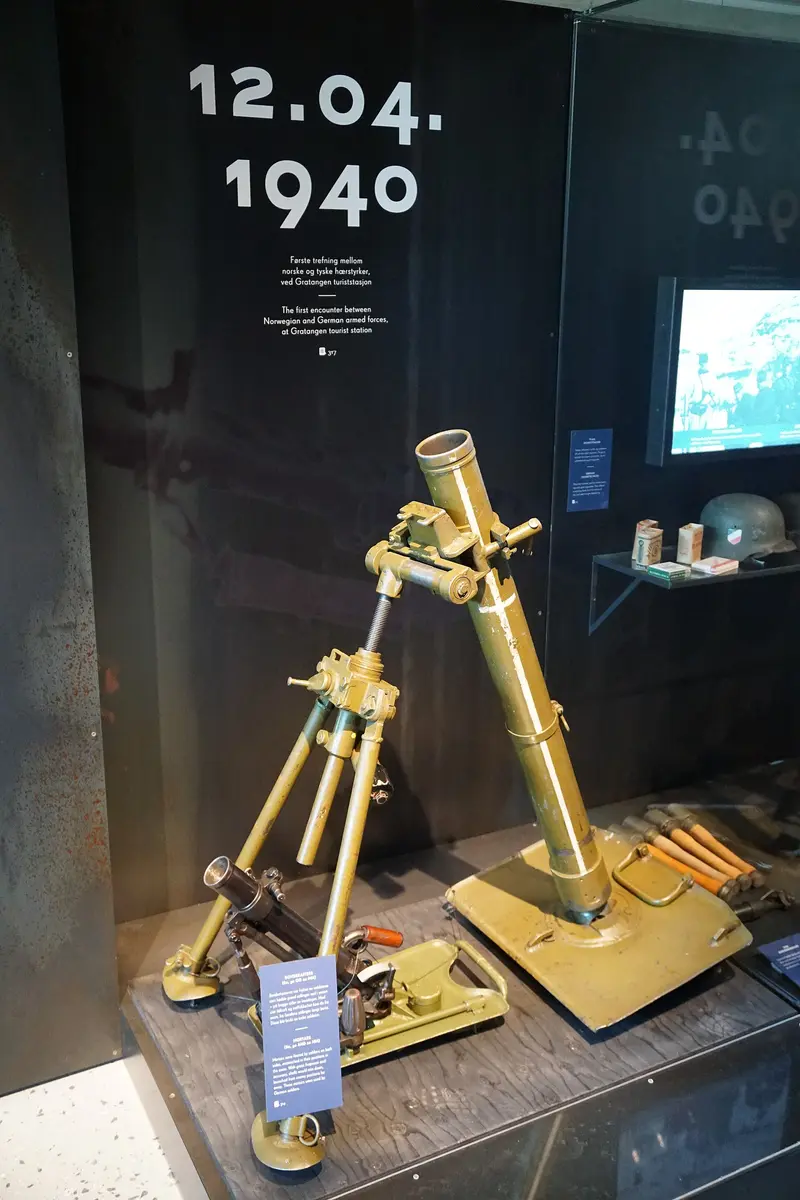
    Narvik Museum of War

    “Narvik War Museum - 48469187321” by Olivier Bruchez / Wikimedia Commons / CC BY-SA 2.0, mod.

    Museum

    2Narvik Museum of War

    The War Museum in the center covers the Battle of Narvik in World War II, the naval battles in the fjord, mountain warfare, and the subsequent occupation. Nearby, you'll find war relics such as bunkers, memorials, and shipwrecks. Check museum opening hours beforehand.
    Open in Google Maps
    Attraction

    3Narvikfjellet

    The local mountain sits directly above the town center, offering views over the Ofotfjord. The area is being developed for the Alpine Ski World Championships 2029; a new gondola, according to Norway's Best, is set to open in January 2027. During construction, the cable car, lifts, and mountain restaurant may have limited operations; please check opening hours in advance.
    Open in Google Maps
    Museum

    4Narvik Museum

    The City Museum chronicles the building of the Ofotbanen, rail ore transport, the ice-free harbor, and how Narvik became an industrial city over a century.
    Open in Google Maps

    Restaurants in Narvik

    History and Culture

    Ore and RailwayThe Ofotbanen was built to transport ore from Kiruna in northern Sweden to the ice-free port of Narvik. The Narvik Museum shows how the railway and port transformed the city into an industrial hub over a hundred years.War and OccupationDuring World War II, Narvik was a battleground on land and sea. The War Museum tells of the Battle of Narvik, the mountain warfare, and the occupation. In the surrounding area, you can find bunkers, memorials, and shipwrecks.Traces from the Stone AgeThe rock carving at Brennholtet is around 5,000 years old and is just a short walk from the town centre. Please show consideration for rock art and other cultural monuments.

    Arrival and exploring

    By TrainThe Ofotbanen connects Narvik with Kiruna, Sweden. From Narvik station, the Arctic Train ascends into the high mountains near Bjørnfjell.In the CityCentre, harbour, War Museum and station are close together. From city centre, paths lead to viewpoints like The Water Column. Local mountain Narvikfjellet is directly above centre.

    Accommodations in Narvik

    Find perfect stay in Narvik

    Booking.com* (Affiliate link)
    Search Hotels
    Agoda* (Affiliate link)
    Search Hotels
    Airbnb
    Vacation Rentals

    * Affiliate link: if you book through it, we earn a small commission. The price stays the same for you.

    Campgrounds in Narvik

    Find perfect campground in Narvik

    Search via Google Maps
    Campgrounds nearby (15km)
    Camping.info
    Find Campgrounds
    Park4Night
    RV Parks & Camping

    Plan your trip to Narvik

    Save places, build a route and plan your city trip, all in one place.

    1. 1
      Sunrise over alpine peaks and a sea of clouds
      1234

      Round trip

      12 days · 4 stops

      Saved

      Pick a route

      Pick a ready-made one or save places and plan your own.

      Open bookmarks
    2. 2

      Trip to Narvik

      Live
      • 1Ofotbanen3 days
      • 2Narvik Museum of War4 days
      • 3Narvikfjellet5 days
      Budget

      Plan your trip

      The planner sorts stops, days and budget. Plan together in real time.

      Start trip planning
    3. 3
      9:41 No signal
      Narvik
      Available offline

      Photo by Kristian Nordvik on Pexels

      Use it on the road

      Download the guide to your phone and use it on site, even offline.

    Nearby

    Abisko

    Abisko

    Abisko is located on the southern shore of Torneträsk, about 195 kilometres north of the Arctic Circle, and is one of Sweden's most famous places for observing the Northern Lights. This small village is the starting point for Abisko National Park, the Aurora Sky Station on Mount Nuolja, and the long-distance hiking trail Kungsleden. In summer, the sun doesn't set for weeks, while in winter, long nights and snow characterize the landscape.

    Unsplash

    Abisko National Park

    Abisko National Park

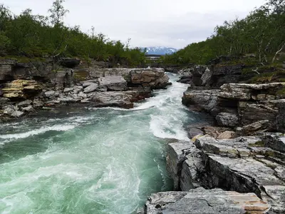
    The Abisko National Park in Swedish Lapland was founded in 1909 and covers approximately 77 square kilometers between the shore of Lake Torneträsk and the fells to the southwest. It lies about 195 kilometers north of the Arctic Circle and is considered one of the best places for observing the Northern Lights thanks to its often cloudless skies, especially from the Aurora Sky Station on Mount Nuolja. During the day, the Kungsleden invites you to hike, or you can follow the canyon of the Abiskojåkka. The Naturum Abisko provides information about the region's flora, fauna, and history. You can see the Northern Lights during the dark season from approximately September to March, and the Midnight Sun from late May to mid-July.

    Timmy Siik·Pexels

    Torneträsk

    Torneträsk

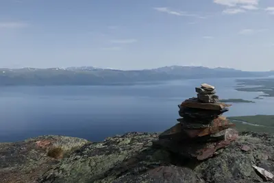
    At approximately 330 square kilometers, Lake Torneträsk (Sami Duortnosjávri) is Sweden's sixth-largest lake and is considered Scandinavia's largest fell lake. The lake, approximately 69 kilometers long, reaches depths of up to 168 meters and lies nestled among the mountains north of Kiruna. Along its southern shore lie Abisko, Björkliden, and views of the Lapporten. In winter, observe the Northern Lights here; in summer, hike under the Midnight Sun.

    Unsplash

    Vesterålen

    Vesterålen

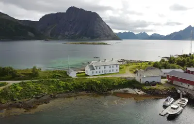
    The Vesterålen are the island group north of the Lofoten, featuring the island Andøya and the town Andenes at its northern tip. You come here for whale safaris from Andenes, the National Tourist Route Andøya, and a quieter landscape than the Lofoten.The tourist route runs 58 kilometers along the outer coast between Andenes and Bjørnskinn, passing Bleik beach. In summer, a ferry connects Andenes with Gryllefjord on Senja. The Vesterålen is also home to Kvitnes Gård, the only restaurant in Northern Norway with a Michelin Star.

    Gjermund Gustavsen·Unsplash

    Andenes

    Andenes

    Andenes is located at the northern tip of Andøya island in Vesterålen and is the starting point of the National Tourist Route Andøya. You primarily come here for whale safaris to the sperm whales off the coast and for the drive along the open outer coast.The main whale safari season runs from late May to mid-September, with fewer boats operating in winter. Sightings are not guaranteed. South of Andenes lies Bleik with its long sandy beach and the bird cliff Bleiksøya. Space operations have been conducted on Andøya since 1962; during launches from Andøya Spaceport, the road near Børvågen can be closed for up to 8 hours.The whale center The Whale is under construction, with its opening planned for June 2027. In summer, a ferry operates from Andenes to Gryllefjord on Senja.

    Wolfgang Hägele·CC BY-SA 4.0

    Your next steps

    Narvik is in Norway. Ways to carry on from here.

    • More in Norway

      Highlights, areas, routes and the best time to travel for all of Norway.

      Norway travel guide
    • Round trips in Norway

      Ready-made routes through Norway, with stops, nights and a map.

      See the routes

    Sources & method

    • Photos: Wikimedia Commons, Pexels. Each photo carries its credit.
    • Place data such as addresses and ratings comes from Google Maps.
    • The content is based on web research from public, traceable sources. How the content is made · The role of AI