Fernweh: Home
ExploreGuideDestinationsMy tripsMy trip
de|en
All Places & RegionsRound tripsNight trains in EuropeAll highlightsAbout FernwehFAQPrivacy PolicyImprint
Download on the App StoreGet it on Google Play
ExploreGuideDestinationsMy tripsMy trip
    • Places in the region
    • Culture
    • Getting around
    • Nearby
    Fish River Canyon and Ai-Ais

    Photo by Reto Wiezel on Pexels

    Namibia

    Fish River Canyon and Ai-Ais

    Region

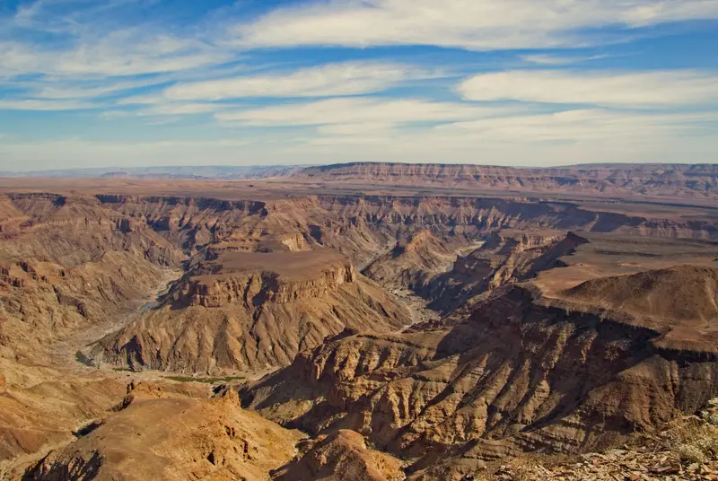
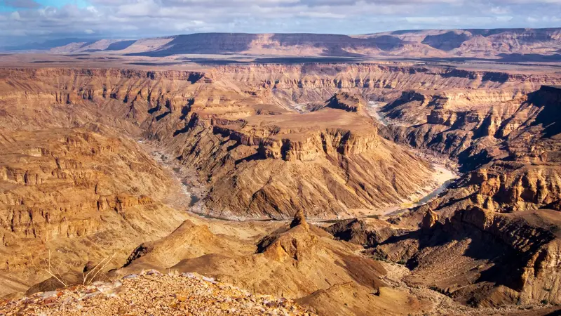
    The Fish River Canyon in the south is considered the second largest canyon in the world by the Ministry of Environment.

    by Felix Gillen

    1. Home
    2. Destinations
    3. Namibia
    4. Fish River Canyon and Ai-Ais
    The Fish River Canyon in the south is considered the second largest canyon in the world by the Ministry of Environment. From the main viewpoint near Hobas, you look down on the Hell's Bend river loop deep below, and at the southern end are the hot springs of Ai-Ais. The canyon belongs to the transboundary Ai-Ais/Richtersveld Park; from May to mid-September, the multi-day canyon hike is possible with a permit.
    Namibia travel guideRound trips in NamibiaPlan a trip with Fish River Canyon and Ai-Ais

    Contents

    • Places in the region
    • Culture
    • Getting around
    • Nearby

    Sights in Fish River Canyon and Ai-Ais

    Discover the most important sights and attractions

    Spa

    Hot Springs of Ai-Ais

    At the southern end of the canyon, thermal water of about 60 °C emerges. At the Ai-Ais rest camp, you can bathe in it. This is also where the multi-day canyon hike ends.
    Open in Google Maps
    Main Viewpoint Fish River Canyon

    Photo by Frank Odenthal on Pexels

    Point of Interest

    Main Viewpoint Fish River Canyon

    The viewpoint near the Hobas Rest Camp offers the classic view into the Canyon, of the Hell's Bend river loop. The Hobas office is open daily from 8 AM to 4:30 PM; a second viewpoint is located approximately 2 km north, at the start of the hike.
    Open in Google Maps

    Nature and Hiking

    The CanyonThe Fish River has cut deep into the southern plateau. From the main viewpoint at Hobas, you overlook Hell's Bend, while the viewpoint at the hike's starting point is about 2 km north.Fish River HikeThe approximately 86 to 90 km long hike through the canyon takes 4 to 5 days. You need a permit, a medical fitness certificate, and a group of at least 3 people; the minimum age is over 12 years. The season ends on September 15th; its start is given as mid-April or May 1st, depending on the source.Ai-AisAt the southern end of the canyon, thermal water emerges. The Ai-Ais camp is the hike's destination and a place to relax after visiting the canyon.

    Directions & Info

    DirectionsThe drive from Windhoek to Keetmanshoop takes about 5 to 6 hours (475 to 497 km). From there, it's approximately 150 km to Hobas. Continuing to Lüderitz is about 350 km, roughly 4 hours.FeesAi-Ais/Fish River falls into the highest fee category: as of April 2026, N$ 280 per adult per day, plus a vehicle fee.TipNear Keetmanshoop, on Farm Gariganus, you'll find the Quiver Tree Forest with about 250 trees, 13 to 14 km northeast of the town—a worthwhile stop on your journey south.

    Nearby

    Port Nolloth

    Port Nolloth

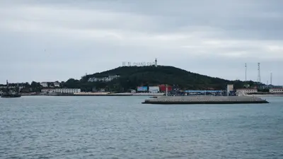
    Port Nolloth is a small harbour town on Namaqualand's cold Atlantic coast, about two hours west of Springbok. Copper was shipped here in the past, and later offshore diamond prospecting defined the town. Today, it's primarily a base for the Richtersveld in the north.

    Unsplash

    Namaqualand

    Namaqualand

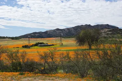
    Namaqualand is a barren semi-desert in northwestern South Africa between the Atlantic Ocean and the border to Namibia, about five hours' drive north of Cape Town. Following sufficient winter rains, the landscape transforms in spring, usually from mid-August to mid-September, into a sea of orange, yellow, and white wildflowers.

    Unsplash

    Springbok

    Springbok

    Springbok is the main town of Namaqualand on the N7, approximately 550 kilometres north of Cape Town and a good 100 kilometres before the border with Namibia. During the wildflower season, the small town is the most important base for excursions; the rest of the year, it's a practical stopover.

    Unsplash

    Lüderitz and Kolmanskop

    Lüderitz and Kolmanskop

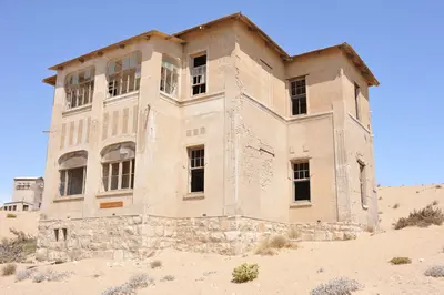
    Lüderitz lies on a rocky bay of the southern Atlantic coast. Felsenkirche and Goerke-Haus recall the colonial era, while Spectacled Penguins breed on Halifax Island off the coast. Just a few kilometers inland lies the abandoned diamond town Kolmanskop, which Marco Polo counts among the country's top highlights.

    Elina Emeleeva·Pexels

    Augrabies Falls National Park

    Augrabies Falls National Park

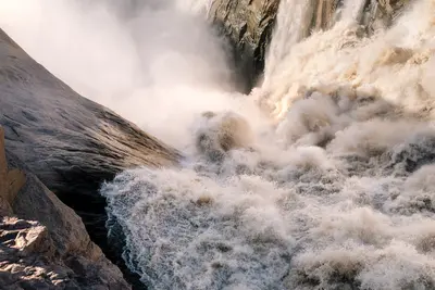
    In Augrabies Falls National Park in the Northern Cape, about 120 kilometers west of Upington, the Orange River plunges approximately 56 meters into an 18-kilometer-long granite gorge. Surrounding it is a barren semi-desert with smooth, polished rock domes, quiver trees, and rock hyraxes.

    Unsplash

    Your next steps

    Fish River Canyon and Ai-Ais is in Namibia. Ways to carry on from here.

    • More in Namibia

      Highlights, areas, routes and the best time to travel for all of Namibia.

      Namibia travel guide
    • Round trips in Namibia

      Ready-made routes through Namibia, with stops, nights and a map.

      See the routes
    • Plan a trip with Fish River Canyon and Ai-Ais

      The Guide asks about season, length and who is coming, and suggests a trip with Fish River Canyon and Ai-Ais.

      Plan the trip
    Sources & method

    • Photos: Pexels. Each photo carries its credit.
    • Place data such as addresses and ratings comes from Google Maps.
    • The content is based on web research from public, traceable sources. How the content is made · The role of AI