Fernweh: Home
ExploreGuideDestinationsMy tripsMy trip
de|en
All Places & RegionsRound tripsNight trains in EuropeAll highlightsAbout FernwehFAQPrivacy PolicyImprint
Download on the App StoreGet it on Google Play
ExploreGuideDestinationsMy tripsMy trip
    • Neighborhoods & highlights
    • Tours
    • Eat & drink
    • Culture
    • Getting around
    • Accommodation
    • Plan trip
    • Nearby
    Lüderitz and Kolmanskop

    Photo by Elina Emeleeva on Pexels

    Namibia

    Lüderitz and Kolmanskop

    City

    Lüderitz lies on a rocky bay of the southern Atlantic coast. Felsenkirche and Goerke-Haus recall the colonial era, while Spectacled Penguins breed on Halifax Island off the coast.

    by Felix Gillen

    1. Home
    2. Destinations
    3. Namibia
    4. Lüderitz and Kolmanskop
    Lüderitz lies on a rocky bay of the southern Atlantic coast. Felsenkirche and Goerke-Haus recall the colonial era, while Spectacled Penguins breed on Halifax Island off the coast. Just a few kilometers inland lies the abandoned diamond town Kolmanskop, which Marco Polo counts among the country's top highlights.
    Namibia travel guideRound trips in NamibiaPlan a trip with Lüderitz and Kolmanskop

    Contents

    • Neighborhoods & highlights
    • Tours
    • Eat & drink
    • Culture
    • Getting around
    • Accommodation
    • Nearby

    Sights in Lüderitz and Kolmanskop

    Discover the most important sights and attractions

    Historic Landmark

    1Diaz Point

    On the peninsula southwest of the city, a cross marks the 1487 landing of Portuguese Bartolomeu Dias. Next to the lighthouse, there's a café; Halifax Island lies offshore.
    Open in Google Maps
    Church

    2Rock Church

    The Protestant church on a rock above the city dates from 1911/12, designed by Albert Bause. Kaiser Wilhelm II donated the altar window.
    Open in Google Maps
    Kolmanskop

    Photo by Francesco Ungaro on Pexels

    Museum

    3Kolmanskop

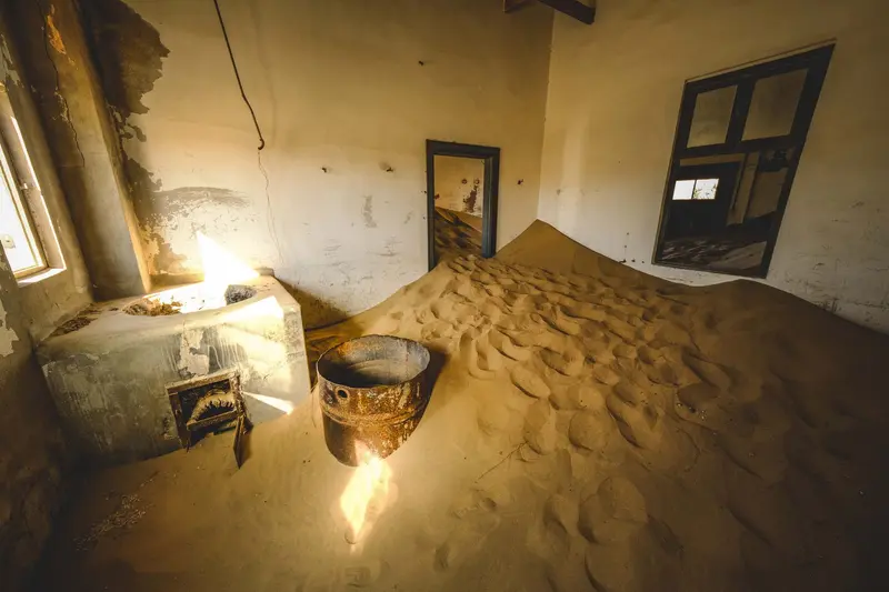
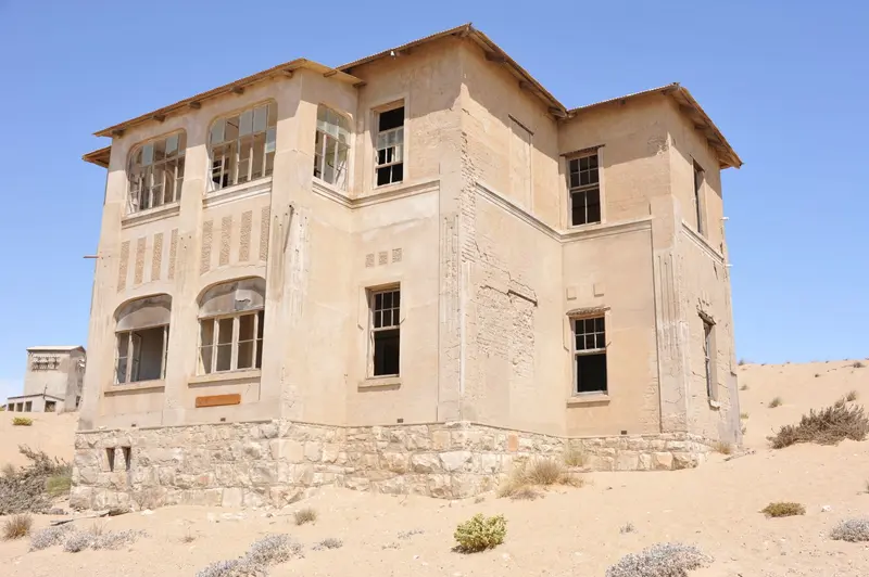
    The diamond town originated after Zacharias Lewala's 1908 diamond find, abandoned in the 1950s; sources cite 1954 or 1956-1960. Buy permits at the entrance. Tours: Mon-Sat 9:30 & 11 AM, Sun 10 AM. Kolmanskop lies 10-15 km inland from Lüderitz.
    Open in Google Maps
    Natural Feature

    4Halifax Island

    The small island off Diaz Point is one of the breeding islands of the African penguins. According to the city administration, Halifax, Mercury, Ichaboe and the Possession Islands together host 96 percent of Namibia's breeding African penguins.
    Open in Google Maps

    Tours & experiences in Lüderitz and Kolmanskop

    Search tours for Lüderitz and Kolmanskop on GetYourGuide* (Affiliate link)On GetYourGuide, with reviews from other travellers

    * Affiliate link: if you book through it, we earn a small commission. The price stays the same for you.

    Restaurants in Lüderitz and Kolmanskop

    Heritage

    Merchant LüderitzIn 1883, merchant Adolf Lüderitz acquired land here from the Nama, marking the start of the German colony. As early as 1487, the Portuguese Bartolomeu Dias had landed at the bay, commemorated by the cross at Diaz Point.DiamondsIn 1908, Zacharias Lewala found diamonds near Kolmanskop, after which the town grew rapidly. From this period date the Goerke-House (1910, architect Otto Ertl), today a museum and national monument, and the Felsenkirche (1911/12).Crayfish FestivalIn late April or early May, Lüderitz celebrates the Crayfish Festival, centered around the spiny lobster. In 2025, it took place for the 18th time.

    Location & Details

    Getting ThereFrom Fish River Canyon (Hobas), it's about 350 km, approx. 4 hours. On the way, near Garub, about 20 km from Aus on the B4, you can see the wild horses of the Namib at a waterhole shelter. FlyNamibia flies to Lüderitz from Windhoek-Eros.KolmanskopPermits are purchased at the entrance; tours run Monday to Saturday at 9:30 AM and 11 AM, and Sundays at 10 AM.To SossusvleiFrom Lüderitz to Sesriem, expect a long drive, with many sections on gravel roads.

    Accommodations in Lüderitz and Kolmanskop

    Find perfect stay in Lüderitz and Kolmanskop

    Booking.com* (Affiliate link)
    Search Hotels
    Agoda* (Affiliate link)
    Search Hotels
    Airbnb
    Vacation Rentals

    * Affiliate link: if you book through it, we earn a small commission. The price stays the same for you.

    Plan your trip to Lüderitz and Kolmanskop

    Save places, build a route and plan your city trip, all in one place.

    1. 1
      Sunrise over alpine peaks and a sea of clouds
      1234

      Round trip

      12 days · 4 stops

      Saved

      Pick a route

      Pick a ready-made one or save places and plan your own.

      Open bookmarks
    2. 2

      Trip to Lüderitz and Kolmanskop

      Live
      • 1Diaz Point3 days
      • 2Rock Church4 days
      • 3Kolmanskop5 days
      Budget

      Plan your trip

      The planner sorts stops, days and budget. Plan together in real time.

      Start trip planning
    3. 3
      9:41 No signal
      Lüderitz and Kolmanskop
      Available offline

      Photo by Elina Emeleeva on Pexels

      Use it on the road

      Download the guide to your phone and use it on site, even offline.

    Nearby

    Sossusvlei and Namib-Naukluft Park

    Sossusvlei and Namib-Naukluft Park

    The red dunes around the salt and clay pans of Sossusvlei and Deadvlei are Namibia's most famous motif. Located in the Namib-Naukluft Park, the country's largest protected area (49,768 km²), they form part of the Namib Sand Sea, a UNESCO World Heritage site since 2013. The starting point is Sesriem, about 5 hours southwest of Windhoek, from there, an asphalt road leads through the dune valley.

    Felipe Labate·Unsplash

    Fish River Canyon and Ai-Ais

    Fish River Canyon and Ai-Ais

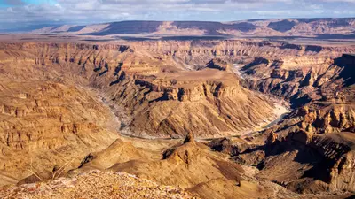
    The Fish River Canyon in the south is considered the second largest canyon in the world by the Ministry of Environment. From the main viewpoint near Hobas, you look down on the Hell's Bend river loop deep below, and at the southern end are the hot springs of Ai-Ais. The canyon belongs to the transboundary Ai-Ais/Richtersveld Park; from May to mid-September, the multi-day canyon hike is possible with a permit.

    Reto Wiezel·Pexels

    Port Nolloth

    Port Nolloth

    Port Nolloth is a small harbour town on Namaqualand's cold Atlantic coast, about two hours west of Springbok. Copper was shipped here in the past, and later offshore diamond prospecting defined the town. Today, it's primarily a base for the Richtersveld in the north.

    Unsplash

    Walvis Bay

    Walvis Bay

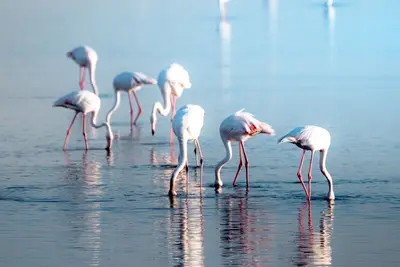
    The port city of Walvis Bay, south of Swakopmund, lies on a lagoon protected since 1995 as a Ramsar wetland, attracting tens of thousands of waterfowl, including large flamingo flocks. South of the city, the Namib begins; about 55 km away is Sandwich Harbour, where dunes drop directly into the sea.

    Nicola Toscan·Pexels

    Namaqualand

    Namaqualand

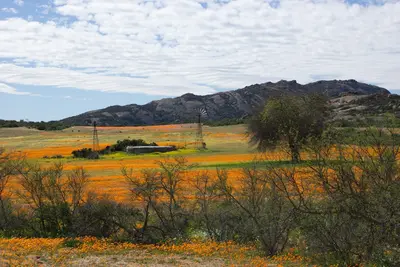
    Namaqualand is a barren semi-desert in northwestern South Africa between the Atlantic Ocean and the border to Namibia, about five hours' drive north of Cape Town. Following sufficient winter rains, the landscape transforms in spring, usually from mid-August to mid-September, into a sea of orange, yellow, and white wildflowers.

    Unsplash

    Your next steps

    Lüderitz and Kolmanskop is in Namibia. Ways to carry on from here.

    • More in Namibia

      Highlights, areas, routes and the best time to travel for all of Namibia.

      Namibia travel guide
    • Round trips in Namibia

      Ready-made routes through Namibia, with stops, nights and a map.

      See the routes


    Sources & method

    • Photos: Pexels. Each photo carries its credit.
    • Place data such as addresses and ratings comes from Google Maps.
    • The content is based on web research from public, traceable sources. How the content is made · The role of AI