Fernweh: Home
    ExploreTravel GuidesPlan a tripMy tripLast visited
    de|en
    All Places & RegionsAll highlightsAbout FernwehFAQPrivacy PolicyImprint
    ExploreTravel GuidesPlan a tripMy tripLast visited
    Pieniny and the Dunajec Gorge

    Poland

    Pieniny and the Dunajec Gorge

    Point of Interest

    The Pieniny Mountains are a small limestone range on the border with Slovakia, east of the Tatra Mountains. The Polish Pieniny National Park was established in 1932 as Poland's first national park and covers just over 23 square kilometres.

    by Felix Gillen

    1. Home
    2. Destinations
    3. Poland
    4. Małopolska
    5. Pieniny and the Dunajec Gorge
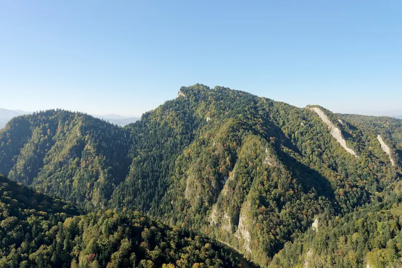
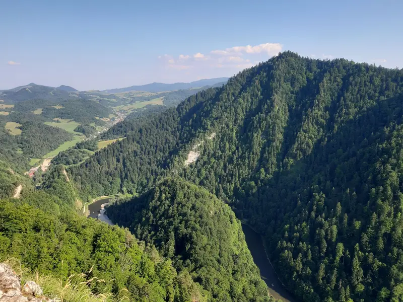
    The Pieniny Mountains are a small limestone range on the border with Slovakia, east of the Tatra Mountains. The Polish Pieniny National Park was established in 1932 as Poland's first national park and covers just over 23 square kilometres. The highest peak of the central massif is Trzy Korony (Three Crowns) at 982 metres, from whose viewing platform on Okrąglica you look deep into the valley.The Pieniny Mountains are primarily known for the Dunajec Gorge: The river has carved its way in loops between steep limestone cliffs. On wooden rafts, the region's rafters take visitors from Sromowce through the gorge to Szczawnica or Krościenko. West of this, the castles of Niedzica and Czorsztyn face each other across the Czorsztyn Reservoir.

    Sights in Pieniny and the Dunajec Gorge

    Discover the most important sights and attractions

    Viewpoint on the Trzy Korony
    Attraction

    1Viewpoint on the Trzy Korony

    View from the 982-meter-high Okrąglica peak, the highest point of the Trzy Korony Massif, over the Dunajec. At the top is a small viewing platform with a railing for about 30 people; during the season, the summit area is subject to a fee; the ticket is also valid for Sokolica.
    Open in Google Maps
    Sokolica
    Point of Interest

    2Sokolica

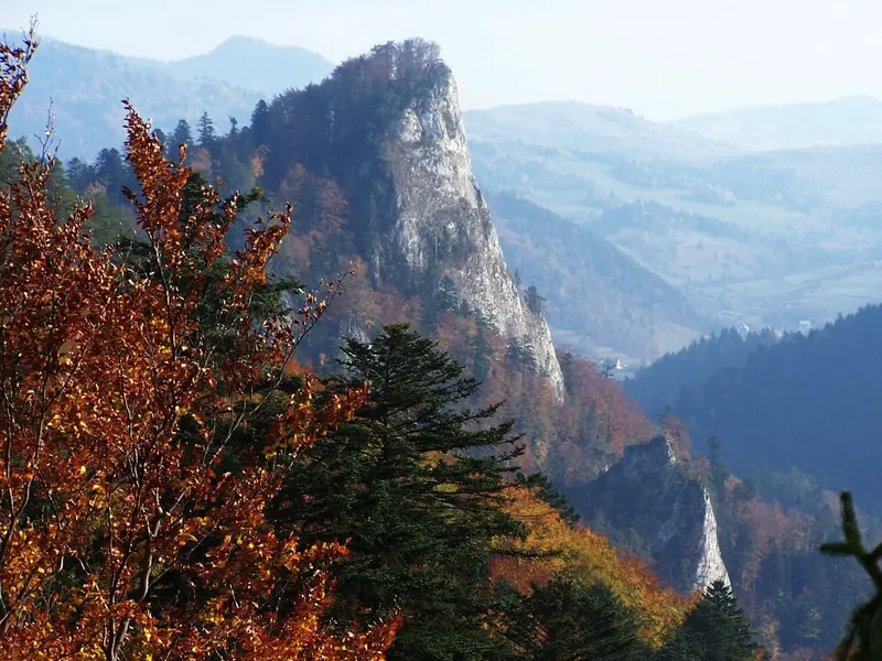
    Rocky peak above the Dunajec Gorge with a viewing platform, accessible via the blue hiking trail from Szczawnica, which continues towards Trzy Korony.
    Open in Google Maps
    Czorsztyn Castle Ruin
    Attraction

    3Czorsztyn Castle Ruin

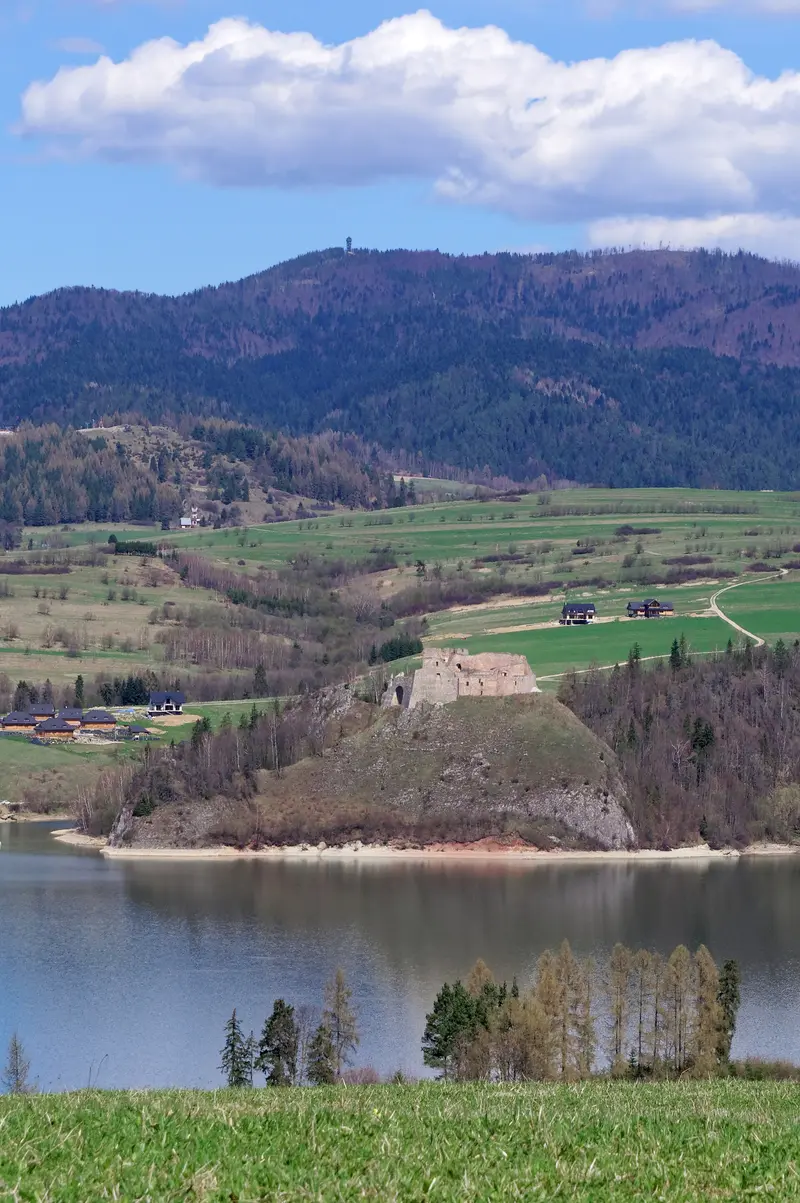
    The ruin lies above Czorsztyn Lake, opposite Niedzica Castle, built in the 14th century. From Czorsztyn, you look across the lake at Niedzica.
    Open in Google Maps

    Videos & Travel Reports

    Wunderschön! Polens Süden: Von der Hohen Tatra nach Krakau

    Ramon Babazadeh fährt mit einem Goralen-Floß durch den Dunajec-Durchbruch im Pieniny-Nationalpark, läuft in der Hohen Tatra, trifft in Zakopane Skispringer Kamil Stoch und erkundet anschließend…

    Restaurants in Pieniny and the Dunajec Gorge

    1

    Cafe Helenka

    Café at Plac Dietla 1 in Szczawnica, next to the rebuilt Drinking Hall. The menu features pasta, salads, quiches, and Polish classics, plus cakes, coffee, and ice cream.
    Show on Google Maps
    2

    Restaurant Pod Siekierkami

    Family-run restaurant on ul. Zdrojowa 12 in Szczawnica, in a historic house, with regional cuisine.
    Show on Google Maps

    Nature and History

    Castles on the DunajecThe Niedzica and Czorsztyn castles emerged on both sides of the ancient routes along the Dunajec. Gothic Niedzica Castle, built in the 14th century, now stands about 35 meters above the water level of the Czorsztyn Reservoir, created by a dam on the Dunajec. A legend of Inca treasure surrounds the castle.Rafters and Mountain TrailsRafting on the Dunajec has a tradition in the Pieniny; today, rafters operate their boats from their own landing stages. Hiking trails lead from Krościenko, Szczawnica, and Sromowce Niżne to Trzy Korony; the blue trail from Szczawnica leads over Sokolica.

    Raft Trip and Arrival

    Rafting on the DunajecThe season runs from April 1st to October 31st; trips operate daily except on Easter Sunday and Corpus Christi. Starting points are the Sromowce Wyżne-Kąty pier (ul. Kąty 12) or Sromowce Niżne. The trip to Szczawnica is approximately 18 kilometers long and takes about 2:15 hours; to Krościenko, it's 23 kilometers, taking about 2:45 hours. In 2026, the trip to Szczawnica cost 111 to 117 Złoty, and to Krościenko 134 to 140 Złoty, depending on the season. A raft departs once eleven people are assembled; for fewer, the base price must be paid. The national park path fee is included in the ticket price. Buses return to the starting point parking lot for an additional fee; tickets are available at the ticket office; prices on flisacy.pl.Trzy KoronyDuring the season, access to the summit area is subject to a fee; the ticket is also valid for Sokolica. The platform is temporarily closed due to works; check the Pieniny National Park notices before your tour.

    Accommodations in Pieniny and the Dunajec Gorge

    Find perfect stay in Pieniny and the Dunajec Gorge
    Booking.com* (Affiliate link)
    Search Hotels
    Agoda* (Affiliate link)
    Search Hotels
    Airbnb
    Vacation Rentals

    * Affiliate link: if you book through it, we earn a small commission. The price stays the same for you.

    Campgrounds in Pieniny and the Dunajec Gorge
    Find perfect campground in Pieniny and the Dunajec Gorge
    Search via Google Maps
    Campgrounds nearby (15km)
    Camping.info
    Find Campgrounds
    Park4Night
    RV Parks & Camping

    Nearby

    Tatra National Park and Morskie Oko

    Tatra National Park and Morskie Oko

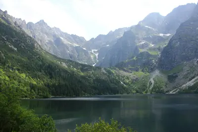
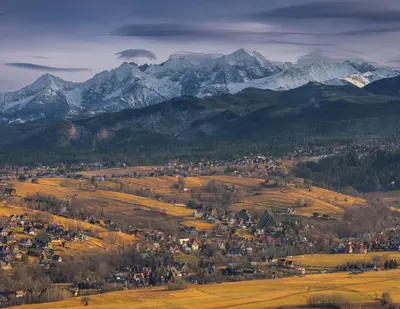
    The Tatra National Park (Tatrzański Park Narodowy, TPN) has protected the Polish part of the Tatra Mountains since 1955, covering over 211 square kilometers. Together with the Slovak National Park, it has formed a cross-border UNESCO Biosphere Reserve since 1993. Here, Rysy (2,499 meters on the Polish side) is Poland's highest peak; chamois, marmots, brown bears, and lynxes live in the forests and cirques.The most famous destination is Morskie Oko, a glacial lake at an altitude of 1,395 meters in the Rybi Potok Valley at the foot of the Mięguszowieckie Szczyty. Covering almost 35 hectares, it is the second-largest lake in the Tatra after Wielki Staw and up to approximately 51 meters deep. From the Palenica Białczańska car park, an approximately 8.5-kilometer-long asphalt road leads up, which is closed to private cars.
    Zakopane

    Zakopane

    Zakopane is located at the foot of the High Tatras, at an altitude of around 840 meters, and has a population of over 25,000. The town is considered Poland's winter capital; the railway line from Chabówka, via which you arrive today from Krakow (Kraków), was built starting in 1899; in summer, it is a starting point for hikes in the Tatra National Park, and in winter for skiers and the World Cup ski jumping at Wielka Krokiew.The pedestrian zone Krupówki, with its shops and eateries, forms the town center. From ul. Na Gubałówkę, a funicular railway leads up to the scenic ridge Gubałówka. To the south lies Kuźnice, the valley station for the cable car to Kasprowy Wierch and the starting point for many hiking trails.
    Małopolska

    Małopolska

    Lesser Poland (Małopolska) stretches from the Vistula around Krakow (Kraków) to the peaks of the High Tatras on the Slovakian border. Krakow, capital of the Kingdom of Poland until 1596, serves as the administrative and cultural heart of the Voivodeship; its Old Town, the Wieliczka Salt Mine, and the Auschwitz-Birkenau Memorial together form several UNESCO World Heritage Sites located close by.To the south, the land rises through hills to the Carpathians. Around Zakopane and in the Pieniny, the Goral people define the landscape with their wooden architecture, sheep's cheese, and folk music, and in the villages of Southern Lesser Poland stand Gothic wooden churches that have been World Heritage Sites since 2003.
    Wieliczka

    Wieliczka

    Wieliczka is located about 13 kilometers southeast of Krakow (Kraków) and has lived from salt since the Middle Ages. The first shafts were dug in the 13th century, and the town was granted city rights in 1290. Salt mining ended in 1996; the mine has been on the UNESCO World Heritage list since 1978, joined by the Bochnia mine in 2008, and the Saltworks Castle in 2013. Together, they form the World Heritage site Royal Salt Mines Wieliczka and Bochnia.Most visitors come for the underground tourist route, but the town itself is also worth a tour. At Rynek Górny, the buildings follow the medieval layout, while Rynek Dolny was once a trading place for salt and is located by the Regis Shaft. The town also features the Saltworks Castle, the wooden St. Sebastian's Church, and a brine graduation tower.
    Krakow (Kraków)

    Krakow (Kraków)

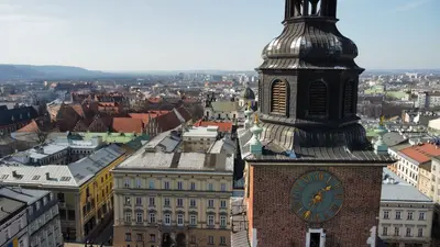
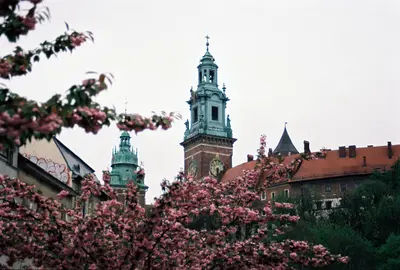
    Krakow (Kraków) lies on the Vistula in southern Poland and, with around 800,000 inhabitants, is the country's second-largest city. Until 1596, it was the capital of the Kingdom of Poland; on Wawel Hill, kings were crowned until 1734 and most of them were interred. Since 1978, its historic center—the Old Town, Wawel, Stradom, and Kazimierz—has been a UNESCO World Heritage site.The Old Town (Stare Miasto) surrounds the Rynek Główny, whose layout dates back to 1257. A green belt, the Planty, occupies the site of the former city fortifications; the historic Royal Route begins at St. Florian's Gate and led coronation processions up to Wawel. South of it lies Kazimierz, founded as a separate city in 1335 and for centuries a center of Jewish life. Today, synagogues, cafés, and bars mingle there.Beyond the Vistula lies Podgórze, where German occupiers established the ghetto in 1941; in the Zabłocie district stands Oskar Schindler's former enamel factory. To the east, Nowa Huta is an industrial city of the socialist era, incorporated in 1951.

    Sources & method

    • Photos: Wikimedia Commons, Pexels, Google Maps. Each photo carries its credit.
    • Place data such as addresses and ratings comes from Google Maps.
    • Video reportages: Wunderschön! Polens Süden: Von der Hohen Tatra nach Krakau
    • The content is based on web research from public, traceable sources. How the content is made · The role of AI