Fernweh: Home
    ExploreTravel GuidesPlan a tripMy tripLast visited
    de|en
    All Places & RegionsAll highlightsAbout FernwehFAQPrivacy PolicyImprint
    ExploreTravel GuidesPlan a tripMy tripLast visited
    • Neighborhoods & highlights
    • Eat & drink
    • Food culture
    • Culture
    • Getting around
    • Accommodation
    • Plan trip
    • Nearby
    Wieliczka
    Magistratwieliczka / Wikimedia Commons / CC BY-SA 4.0

    Poland

    Wieliczka

    City

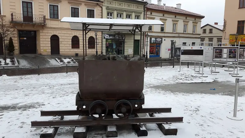
    Wieliczka is located about 13 kilometers southeast of Krakow (Kraków) and has lived from salt since the Middle Ages. The first shafts were dug in the 13th century, and the town was granted city rights in 1290.

    by Felix Gillen

    1. Home
    2. Destinations
    3. Poland
    4. Małopolska
    5. Wieliczka
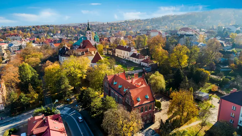
    Wieliczka is located about 13 kilometers southeast of Krakow (Kraków) and has lived from salt since the Middle Ages. The first shafts were dug in the 13th century, and the town was granted city rights in 1290. Salt mining ended in 1996; the mine has been on the UNESCO World Heritage list since 1978, joined by the Bochnia mine in 2008, and the Saltworks Castle in 2013. Together, they form the World Heritage site Royal Salt Mines Wieliczka and Bochnia.Most visitors come for the underground tourist route, but the town itself is also worth a tour. At Rynek Górny, the buildings follow the medieval layout, while Rynek Dolny was once a trading place for salt and is located by the Regis Shaft. The town also features the Saltworks Castle, the wooden St. Sebastian's Church, and a brine graduation tower.

    Sights in Wieliczka

    Discover the most important sights and attractions
    Rynek Górny

    1Rynek Górny

    The Upper Market Square is surrounded by houses with medieval layouts. On the square lies the three-dimensional floor painting Solne Miasto, the Salt City.
    Open in Google Maps
    Wieliczka Salt Mine: Tourist Route
    Museum

    2Wieliczka Salt Mine: Tourist Route

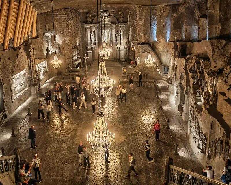
    Tourist Route: The guided tour starts at Daniłowicz Shaft, extending approx. 3.5 km to a depth of 135 meters. The highlight is Kinga Chapel, 101 meters deep, with its fittings crafted from salt by miners. The mine has been a UNESCO World Heritage Site since 1978; tickets are best booked online in advance.
    Open in Google Maps
    Salt Mine Castle (Zamek Żupny)
    Museum

    3Salt Mine Castle (Zamek Żupny)

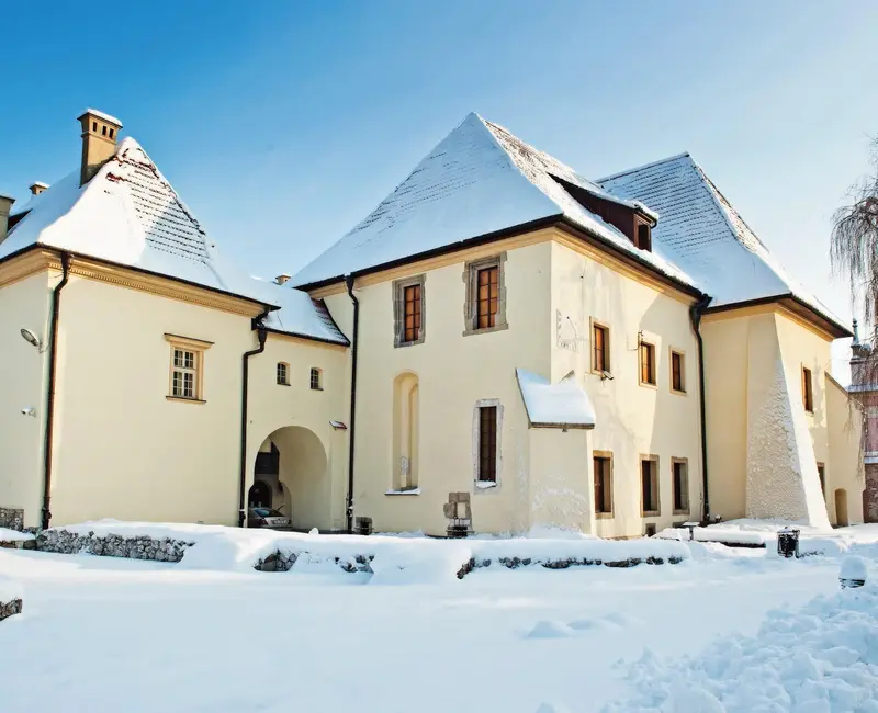
    The castle, built around the turn of the 13th to the 14th century, served as the seat of administration for the Kraków Salt Mines until 1945 and has been part of the UNESCO World Heritage Site since 2013. Today, it houses the Kraków Salt Mines Museum.
    Open in Google Maps

    Restaurants in Wieliczka

    1

    Bistro Posolone

    The mine's surface bistro, near the Daniłowicz Shaft, where the tourist route begins. The menu offers salads, pizza, burgers, and pasta, ideal before or after your tour.
    Show on Google Maps
    2

    Miners' Karczma

    The mine's restaurant at a depth of 125 meters on the tourist route, offering Polish cuisine and hot and cold drinks.
    Show on Google Maps
    3

    Mine of Taste

    Town center restaurant near the salt mine, with Polish cuisine and pizza. It has four halls, the largest seating up to 100 guests.
    Show on Google Maps

    Food & Beverage

    Wielickie Solone

    Salted ice cream that a café in the town center offers as a local specialty.

    Polish Cuisine Underground

    During the tour at Karczma Górnicza, 125 meters deep, you can enjoy Polish dishes and warm drinks.

    Obwarzanek krakowski

    The boiled and baked yeast ring, as a Protected Geographical Indication, may only be produced in Krakow and the districts of Krakow and Wieliczka.

    Culture and History

    City of SaltInitially, brine was evaporated here; underground rock salt mining began in the 13th century. From the late 13th century until 1945, the Salt-Count's Castle (Zamek Żupny) was the seat of Żupy Krakowskie, which managed the Kraków Salt Mines. Today, it is home to the Museum of the Kraków Salt Mines.Art Above and Below GroundMiners carved chapels and sculptures from salt in the chambers. The most famous is the Kinga Chapel, 101 meters deep. Above ground stands the larch wood St. Sebastian's Church, built in 1582, with stained-glass windows by Stanisław Matejko and murals by Włodzimierz Tetmajer from 1906.

    Arrival and Visit

    Getting There from KrakowSuburban trains run from Kraków Główny to Wieliczka Rynek Kopalnia station; from there, it’s just a few minutes' walk to the mine. Alternatively, bus line 304 departs from the Dworzec Główny Zachód stop at Galeria Krakowska; for the Tourist Route, alight at Wieliczka Kopalnia Soli. A ticket for zones I and II is required. By car, you can reach Wieliczka via the Kraków Wieliczka junction of the A4 motorway. Mine parking is available at the Graduation Tower (entrance ul. Dembowskiego 22) and at the Daniłowicz Shaft (entrance ul. Daniłowicza 10).Tickets and Tourist RouteThe Tourist Route starts at the Daniłowicz Shaft and is only possible with a guided tour, available in Polish and several foreign languages, including German. It covers approximately 3.5 kilometers and about 800 steps, 380 of them right at the beginning, leading down to a depth of 135 meters and lasting two to three hours. Underground temperatures are 17 to 18 degrees Celsius. Tickets are best purchased in advance from the mine's online shop; on-site, there is a ticket office and a machine at the Daniłowicz Shaft. Prices, tour times, and closing days can be found at wieliczka-saltmine.com.

    Accommodations in Wieliczka

    Find perfect stay in Wieliczka

    Booking.com* (Affiliate link)
    Search Hotels
    Agoda* (Affiliate link)
    Search Hotels
    Airbnb
    Vacation Rentals

    * Affiliate link: if you book through it, we earn a small commission. The price stays the same for you.

    Campgrounds in Wieliczka

    Find perfect campground in Wieliczka

    Search via Google Maps
    Campgrounds nearby (15km)
    Camping.info
    Find Campgrounds
    Park4Night
    RV Parks & Camping

    Plan your trip to Wieliczka

    Save places, build a route and plan your city trip, all in one place.

    1. 1
      Sunrise over alpine peaks and a sea of clouds
      1234

      Round trip

      12 days · 4 stops

      Saved

      Pick a route

      Pick a ready-made one or save places and plan your own.

      Open bookmarks
    2. 2

      Trip to Wieliczka

      Live
      • 1Rynek Górny3 days
      • 2Wieliczka Salt Mine: Tourist Route4 days
      • 3Salt Mine Castle (Zamek Żupny)5 days
      Budget

      Plan your trip

      The planner sorts stops, days and budget. Plan together in real time.

      Start trip planning
    3. 3
      9:41 No signal
      Wieliczka
      Available offline

      Use it on the road

      Download the guide to your phone and use it on site, even offline.

    Nearby

    Krakow (Kraków)

    Krakow (Kraków)

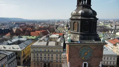
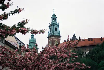
    Krakow (Kraków) lies on the Vistula in southern Poland and, with around 800,000 inhabitants, is the country's second-largest city. Until 1596, it was the capital of the Kingdom of Poland; on Wawel Hill, kings were crowned until 1734 and most of them were interred. Since 1978, its historic center—the Old Town, Wawel, Stradom, and Kazimierz—has been a UNESCO World Heritage site.The Old Town (Stare Miasto) surrounds the Rynek Główny, whose layout dates back to 1257. A green belt, the Planty, occupies the site of the former city fortifications; the historic Royal Route begins at St. Florian's Gate and led coronation processions up to Wawel. South of it lies Kazimierz, founded as a separate city in 1335 and for centuries a center of Jewish life. Today, synagogues, cafés, and bars mingle there.Beyond the Vistula lies Podgórze, where German occupiers established the ghetto in 1941; in the Zabłocie district stands Oskar Schindler's former enamel factory. To the east, Nowa Huta is an industrial city of the socialist era, incorporated in 1951.
    Małopolska

    Małopolska

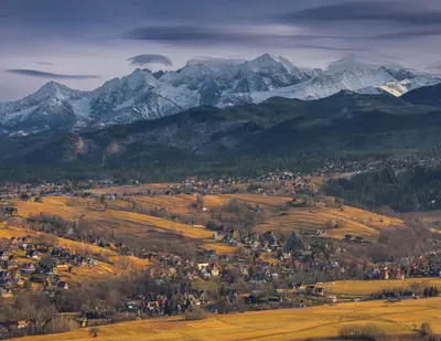
    Lesser Poland (Małopolska) stretches from the Vistula around Krakow (Kraków) to the peaks of the High Tatras on the Slovakian border. Krakow, capital of the Kingdom of Poland until 1596, serves as the administrative and cultural heart of the Voivodeship; its Old Town, the Wieliczka Salt Mine, and the Auschwitz-Birkenau Memorial together form several UNESCO World Heritage Sites located close by.To the south, the land rises through hills to the Carpathians. Around Zakopane and in the Pieniny, the Goral people define the landscape with their wooden architecture, sheep's cheese, and folk music, and in the villages of Southern Lesser Poland stand Gothic wooden churches that have been World Heritage Sites since 2003.
    Auschwitz-Birkenau Memorial Site

    Auschwitz-Birkenau Memorial Site

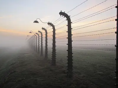
    The Auschwitz-Birkenau Memorial and State Museum is located on the outskirts of Oświęcim, west of Krakow (Kraków). German occupiers established the camp in 1940, and Auschwitz II-Birkenau was built from October 1941. According to estimates by the Memorial, approximately 1.1 million people were murdered in Auschwitz, about 1 million of them Jews. The victims also included approximately 70,000 Poles, 21,000 Sinti and Roma, 15,000 Soviet prisoners of war, and about 12,000 prisoners of other nationalities.On January 27, 1945, Soviet troops liberated the camp; since 2005, this day has been the International Holocaust Remembrance Day. The Polish Parliament founded the museum on July 2, 1947, and since 1979, the site has been on the UNESCO World Heritage List. The site covers approximately 191 hectares: the former main camp Auschwitz I and the much larger Birkenau, about three kilometers away; a free shuttle bus provided by the Memorial connects both parts. For a visit, you should allow at least half a day.
    Pieniny and the Dunajec Gorge

    Pieniny and the Dunajec Gorge

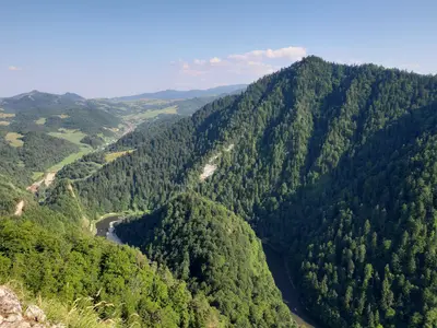
    The Pieniny Mountains are a small limestone range on the border with Slovakia, east of the Tatra Mountains. The Polish Pieniny National Park was established in 1932 as Poland's first national park and covers just over 23 square kilometres. The highest peak of the central massif is Trzy Korony (Three Crowns) at 982 metres, from whose viewing platform on Okrąglica you look deep into the valley.The Pieniny Mountains are primarily known for the Dunajec Gorge: The river has carved its way in loops between steep limestone cliffs. On wooden rafts, the region's rafters take visitors from Sromowce through the gorge to Szczawnica or Krościenko. West of this, the castles of Niedzica and Czorsztyn face each other across the Czorsztyn Reservoir.
    Zakopane

    Zakopane

    Zakopane is located at the foot of the High Tatras, at an altitude of around 840 meters, and has a population of over 25,000. The town is considered Poland's winter capital; the railway line from Chabówka, via which you arrive today from Krakow (Kraków), was built starting in 1899; in summer, it is a starting point for hikes in the Tatra National Park, and in winter for skiers and the World Cup ski jumping at Wielka Krokiew.The pedestrian zone Krupówki, with its shops and eateries, forms the town center. From ul. Na Gubałówkę, a funicular railway leads up to the scenic ridge Gubałówka. To the south lies Kuźnice, the valley station for the cable car to Kasprowy Wierch and the starting point for many hiking trails.

    Sources & method

    • Photos: Wikimedia Commons, Google Maps. Each photo carries its credit.
    • Place data such as addresses and ratings comes from Google Maps.
    • The content is based on web research from public, traceable sources. How the content is made · The role of AI