Fernweh: Home
    ExploreTravel GuidesPlan a tripMy tripLast visited
    de|en
    All Places & RegionsAll highlightsAbout FernwehFAQPrivacy PolicyImprint
    ExploreTravel GuidesPlan a tripMy tripLast visited
    • Neighborhoods & highlights
    • Recommendations
    • Walking tours
    • Eat & drink
    • Food culture
    • Culture
    • Getting around
    • Accommodation
    • Plan trip
    • Nearby
    Sonilortiz / Wikimedia Commons / CC BY-SA 3.0

    Colombia

    City

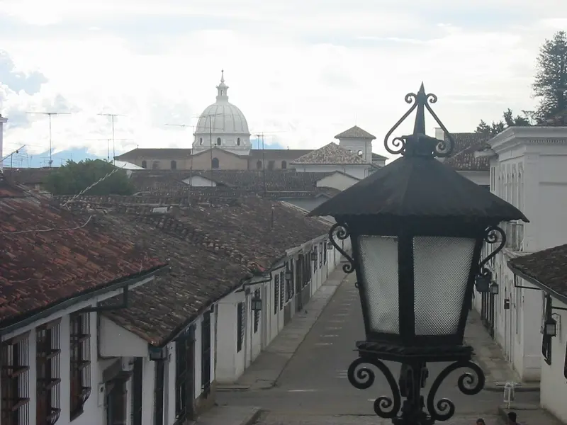
    Popayán is the capital of Departamento Cauca and is called Ciudad Blanca due to its whitewashed colonial buildings.

    by Felix Gillen

    1. Home
    2. Destinations
    3. Colombia
    4. Cali & Popayán
    Popayán is the capital of Departamento Cauca and is called Ciudad Blanca due to its whitewashed colonial buildings. You travel here for the old town, which is among Latin America's best-preserved, for the Holy Week processions, and for Cauca's cuisine. The city is located approximately 140 road kilometers south of Cali. Check the current UK FCDO travel advice before your trip. Before traveling, check the current travel and security advisories.

    Sights in

    Discover the most important sights and attractions
    Parque Caldas
    Park

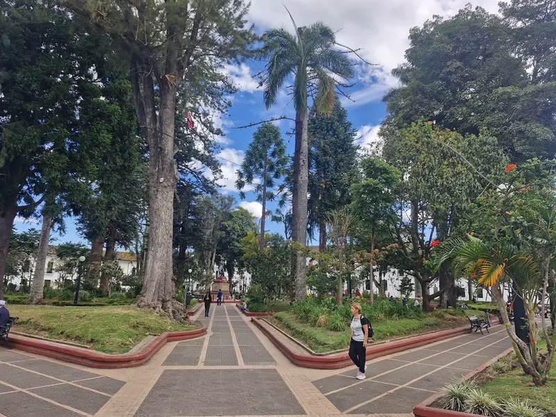
    1Parque Caldas

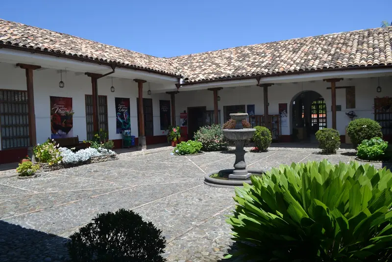
    The main square is the centre of the Old Town and a good start for a tour. The Clock Tower and Cathedral are on the square.
    Open in Google Maps
    Torre del Reloj
    Historic Landmark

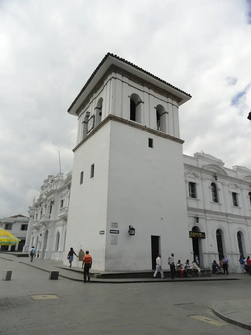
    2Torre del Reloj

    The Clock Tower was built between 1673 and 1682; the clock was added in 1737. It is one of the city's landmarks.
    Open in Google Maps
    Museo Casa Mosquera
    Museum

    3Museo Casa Mosquera

    The Museum of the Universidad del Cauca displays colonial art and Mosquera family memorabilia.
    Open in Google Maps
    Puente del Humilladero
    Historic Landmark

    4Puente del Humilladero

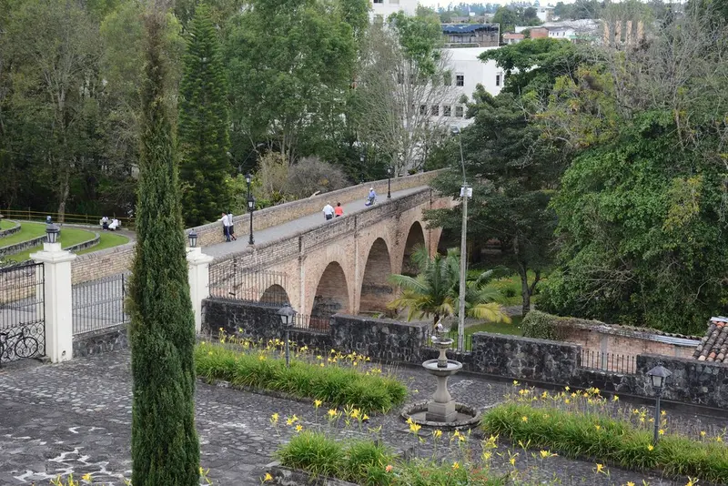
    The bridge on brick arches was built in 1873 and leads north from the Old Town. Its name recalls a steep slope that people formerly had to overcome almost on their knees.
    Open in Google Maps
    El Morro de Tulcán
    Historic Landmark

    5El Morro de Tulcán

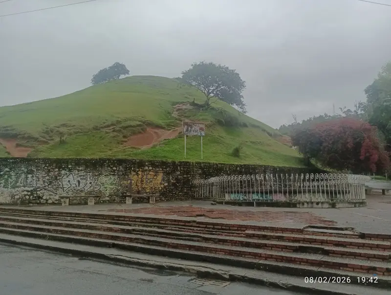
    The hill bordering the Old Town is a pre-Hispanic pyramid, now topped by an equestrian statue of city founder Sebastián de Belalcázar. From its summit, you overlook the white roofs.
    Open in Google Maps

    City walks in

    Curated walking tours through the city's highlights, handpicked by experienced travel journalists.

    Rundgang Centro Histórico

    Der Rundgang beginnt an La Ermita am Ostrand der Altstadt, führt über Santo Domingo zum Parque Caldas mit Kathedrale und Uhrturm, weiter zu San Francisco und zur Casa Mosquera. Über den Puente del Humilladero endet er auf dem Morro de Tulcán. Die Strecke ist gut 2,5 km lang, rechne mit zwei bis drei Stunden.
    Open in Google Maps
    Stops (8)

    Restaurants in

    1

    Mora Castilla

    Small, simple eatery on the first floor of an old town house on Calle 2. Many consider it the best place for traditional dishes from Popayán, such as Empanadas de pipián.
    Show on Google Maps
    2

    Parador La Fresa

    Unassuming corner eatery on Calle 5, primarily selling Empanadas de pipián. The empanadas are very small and very affordable; usually at least half a dozen are ordered.
    Show on Google Maps
    3

    Qaray Signature Cuisine

    Restaurant in a historic building by Parque Caldas. The cuisine combines regional ingredients with international techniques.
    Show on Google Maps

    Food & Drinks in Popayán

    Popayán has been a UNESCO Creative City of Gastronomy since 2005, cherishing recipes passed down over centuries. Corn, potatoes, and peanuts are central.
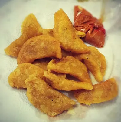
    Empanadas de pipián

    Empanadas de pipián

    Tiny dumplings with Pipián, a creamy potato and peanut ragout seasoned with Achiote. Served with a spicy peanut sauce.

    Tamal de pipián

    Tamal with the same Pipián filling of potatoes and peanuts. It is eaten at various times of the day.
    Carantanta

    Carantanta

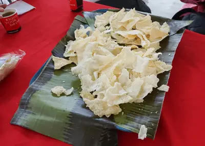
    Crispy snack made from the baked-on corn dough that remains stuck to the pan when preparing tortillas. It is often served with Hogao, a sauce of tomatoes, onions, and garlic.
    Salpicón payanés

    Salpicón payanés

    A refreshment made from finely chopped fruits like Lulo, blackberry, and Guanabana. It is mixed with water and sugar and served over ice.

    Holy Week and Fare

    The Semana Santa processions have been on the UNESCO Intangible Cultural Heritage List since 2009. On March 31, 1983, Maundy Thursday, an earthquake destroyed large parts of the old town, which was subsequently rebuilt.Popayán is part of the UNESCO Creative Cities Network in the field of Gastronomy.Try: Empanadas de pipián, small pastries with potato and peanut filling and spicy peanut sauce, as well as Tamal de pipián.On Sundays: Many restaurants in the old town are closed.

    Getting There and On the Road

    Flight: Guillermo León Valencia Airport has daily connections to Bogotá. Due to ash clouds from the Puracé volcano, operations were suspended multiple times in 2026, most recently in August.Road: The Panamericana connects Popayán with Cali (approx. 140 km). Check the current UK FCDO travel advice before your trip.Locally: You explore the old town around Parque Caldas on foot.

    Accommodations in

    Find perfect stay in

    Booking.com* (Affiliate link)
    Search Hotels
    Agoda* (Affiliate link)
    Search Hotels
    Airbnb
    Vacation Rentals

    * Affiliate link: if you book through it, we earn a small commission. The price stays the same for you.

    Plan your trip to

    Save places, build a route and plan your city trip, all in one place.

    1. 1
      Sunrise over alpine peaks and a sea of clouds
      1234

      Round trip

      12 days · 4 stops

      Saved

      Pick a route

      Pick a ready-made one or save places and plan your own.

      Open bookmarks
    2. 2

      Trip to

      Live
      • 1Parque Caldas3 days
      • 2Torre del Reloj4 days
      • 3Museo Casa Mosquera5 days
      Budget

      Plan your trip

      The planner sorts stops, days and budget. Plan together in real time.

      Start trip planning
    3. 3
      9:41 No signal
      Available offline

      Use it on the road

      Download the guide to your phone and use it on site, even offline.

    Nearby

    Cali & Popayán

    Cali & Popayán

    Colombia's southwest connects two very different cities: Cali in Valle del Cauca is considered the capital of Salsa, Popayán in Departamento Cauca the country's white colonial city. You travel here for dance nights in Salsotecas, for whitewashed old town alleys and for the cuisine of Cauca. Both cities are located approximately 140 road kilometers apart.
    San Agustín

    San Agustín

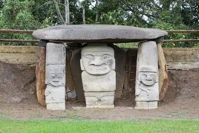
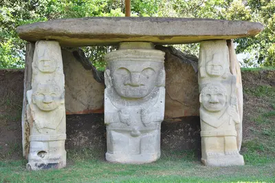
    San Agustín is a small town in the south of the Huila Department, near the source of the Río Magdalena. You travel here for the Archaeological Park with its stone statues, a UNESCO World Heritage site since 1995, and for the Estrecho del Magdalena canyon. The park lies approximately 2 km from the town at an elevation of about 1,730 m. Check the current UK FCDO travel advice before your trip.
    Huila

    Huila

    The Huila Department is located in the upper valley of the Magdalena River in southern Colombia. You travel here for two destinations: the stone figures of San Agustín, a UNESCO World Heritage site since 1995, and the dry landscape of Tatacoa near Neiva.
    Cali

    Cali

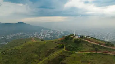
    Cali, with around 2.3 million inhabitants, is the largest city in southwestern Colombia and is known as the capital of Salsa. You come here for dancing, for the Valle del Cauca cuisine, and for the view from Cristo Rey. Worth seeing are the colonial quarter San Antonio, the Granada restaurant district, and the Bulevar del Río in the center.
    Desierto de la Tatacoa

    Desierto de la Tatacoa

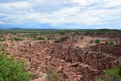
    The Tatacoa Desert is a dry landscape in the north of the Departamento Huila near Villavieja, about 38 km from the capital Neiva. You come here for red and gray erosion labyrinths, for fossils, and for the starry sky that observatories explain at night. Technically, it is a tropical dry forest spanning about 330 km², making it Colombia's second-largest dry zone after La Guajira. Check the current UK FCDO travel advice before your trip. Before traveling, check the current travel and security advisories.

    Sources & method

    • Photos: Wikimedia Commons, Google Maps. Each photo carries its credit.
    • Place data such as addresses and ratings comes from Google Maps.
    • The content is based on web research from public, traceable sources. How the content is made · The role of AI