ExploreTravel GuidesPlan a trip
    de|en
    All Places & RegionsAbout FernwehFAQPrivacy PolicyImprint
    ExploreTravel GuidesPlan a trip
    • Places in the region
    • Nearby
    Bremen

    Germany

    Bremen

    RegionUNESCO

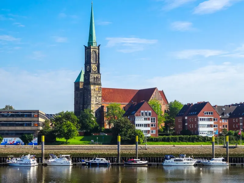
    Bremen is located on both sides of the Weser, about 60 river kilometers before its mouth into the North Sea near Bremerhaven.

    1. Home
    2. Destinations
    3. Germany
    4. Bremen
    Bremen is located on both sides of the Weser, about 60 river kilometers before its mouth into the North Sea near Bremerhaven. The city is the capital of the Free Hanseatic City of Bremen, which also includes Bremerhaven, and joined the Hanseatic League as early as 1260.On your journey, you'll discover the Town Hall and Roland, jointly a UNESCO World Heritage site since 2004, along with the bronze statue of the Bremen Town Musicians, the medieval Schnoor quarter, and the Schlachte riverside promenade. In the former port area, Überseestadt has been developing as a new city district since 2000.

    More places in Bremen
    Bremen

    Bremen

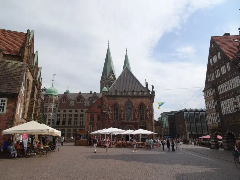
    The Hanseatic City of Bremen, with around 580,000 inhabitants, spans both sides of the Weser and is the capital of the Free Hanseatic City of Bremen, which also includes Bremerhaven. Its heart is the Market Square, with the Gothic Town Hall, whose façade has shone in the Weser Renaissance style since 1608, and the stone Roland from 1404.From here, you can reach St. Peter's Cathedral on foot, the mere 108-meter-long Böttcherstraße with its porcelain carillon, and the winding Schnoor Quarter. In the evenings, the Schlachte on the Weser beckons with its gastronomy.
    Nearby

    Bremen

    Bremen

    The Hanseatic City of Bremen, with around 580,000 inhabitants, spans both sides of the Weser and is the capital of the Free Hanseatic City of Bremen, which also includes Bremerhaven. Its heart is the Market Square, with the Gothic Town Hall, whose façade has shone in the Weser Renaissance style since 1608, and the stone Roland from 1404.From here, you can reach St. Peter's Cathedral on foot, the mere 108-meter-long Böttcherstraße with its porcelain carillon, and the winding Schnoor Quarter. In the evenings, the Schlachte on the Weser beckons with its gastronomy.
    Wilsede & Totengrund

    Wilsede & Totengrund

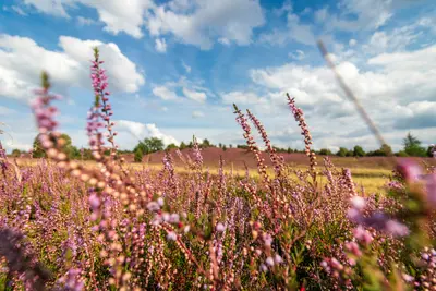
    The heath village of Wilsede, a district of Bispingen with 29 inhabitants (as of 2020), is located in the heart of the Lüneburg Heath Nature Reserve and is largely closed to motor vehicles. You can reach it on foot, by bike, or by horse-drawn carriage from the hiking car parks of the surrounding villages. In the Dat ole Huus Heath Museum, you can see how a heath farm lived around 1850.About one kilometer to the southeast lies the Totengrund, a 30-hectare basin with heathland and numerous juniper bushes. Pastor Wilhelm Bode purchased it in 1906 with donations to protect it from development. Nearby rises the Wilseder Berg, at 169.2 meters, the highest elevation in the Lüneburg Heath.
    Lüneburg Heath

    Lüneburg Heath

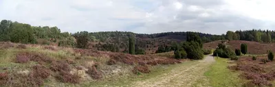
    The Lüneburg Heath is located in the northeast of Lower Saxony between the Elbe and Aller rivers, within easy reach of Hamburg, Bremen, and Hanover. Heidschnucken sheep graze the open areas, preventing trees from overgrowing the heath. The heath is in full bloom, especially in August and September.At its heart is the Lüneburg Heath Nature Reserve, founded in 1921, surrounding the Wilseder Berg, which at 169.2 metres is the highest elevation in the heath. On the edge of the heath lies the Hanseatic city of Lüneburg, which grew rich from its salt and today boasts around 1300 listed brick houses.

    Blankenese & Övelgönne

    Blankenese was a fishing village, first documented in 1301. Later, captains and pilots lived here; today, it is one of Hamburg's most affluent districts. In 1938, it became part of Hamburg along with Altona. The old village center is formed by the Treppenviertel on the steep Elbe slope with winding stairs and alleys, above which rises the 74.7-meter-high Süllberg. Upriver, in Othmarschen, lies Övelgönne with its kilometer-long Elbe beach and the museum harbor at Neumühlen pier.You descend the 170 steps of the Strandtreppe to the Strandweg, stroll through parks like the Römischer Garten, and watch the ships on the Elbe from the Elbe beach. You reach Blankenese with the S1; the small bus 488, the "Bergziege," runs through the steep streets. To Övelgönne, the HADAG Ferry 62 takes you from the Landungsbrücken to Neumühlen.
    Altona & Ottensen

    Altona & Ottensen

    Altona originated around 1535 as a fishing settlement. On August 23, 1664, it received city rights from Danish King Frederick III and grew into the second-largest city in the Danish realm. It only became part of Hamburg in 1938. Neighboring Ottensen, first mentioned in 1310 as the village of Ottenhusen, developed into an industrial hub after 1866 and became part of Altona in 1889. Today, Ottensen, with some 35,000 residents across 2.9 square kilometers, is a popular district for shopping and going out.From Altona Balcony, you can see across the Elbe to the Köhlbrand Bridge; along the Palmaille stand grand bourgeois buildings from the early 19th century. In Ottensen, you'll find the Fabrik cultural center with its crane and the Zeise Kinos featuring a ship's propeller from the former propeller factory. The S-Bahn lines S1, S2, and S3 stop at Altona Station.