ExploreTravel GuidesPlan a trip
    de|en
    All Places & RegionsAbout FernwehFAQPrivacy PolicyImprint
    ExploreTravel GuidesPlan a trip
    • Neighborhoods & highlights
    • Eat & drink
    • Culture
    • Nightlife
    • Getting around
    • Accommodation
    • Plan trip
    • Nearby
    Bremen

    Germany

    Bremen

    CityUNESCO

    The Hanseatic City of Bremen, with around 580,000 inhabitants, spans both sides of the Weser and is the capital of the Free Hanseatic City of Bremen, which also includes Bremerhaven.

    1. Home
    2. Destinations
    3. Germany
    4. Bremen
    5. Bremen
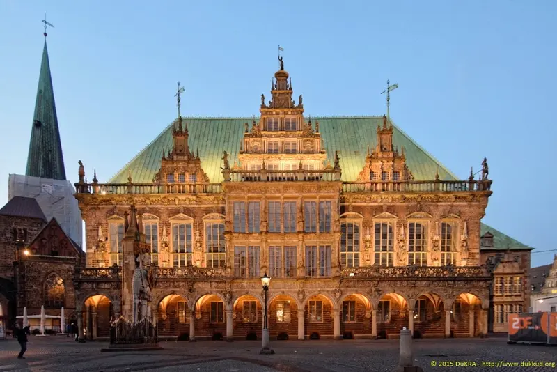
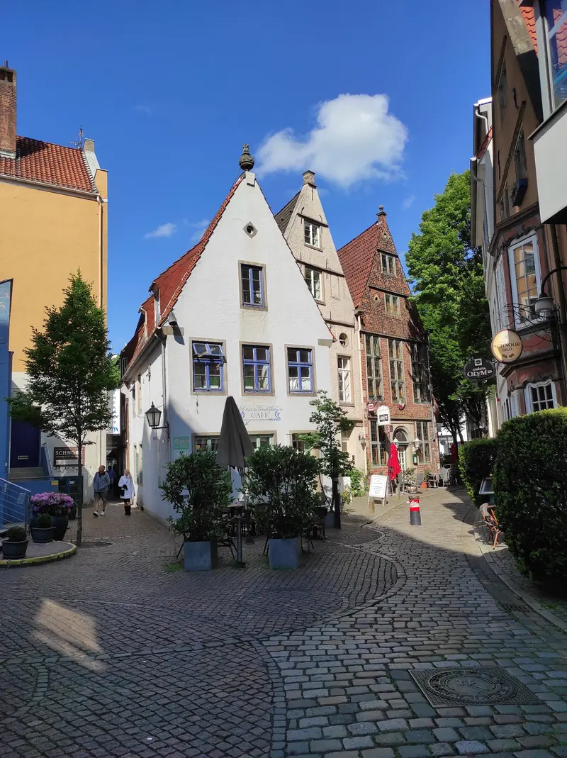
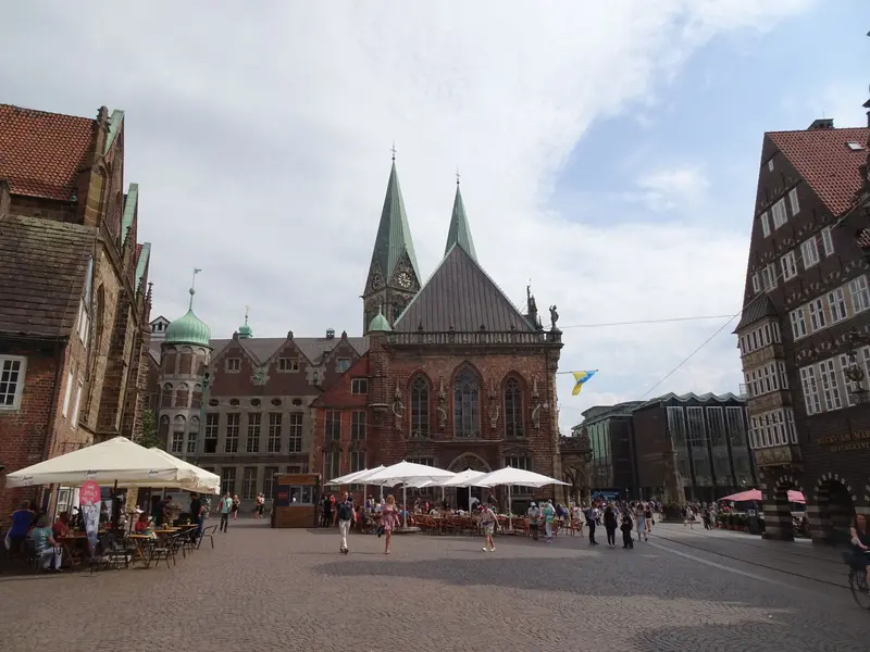
    The Hanseatic City of Bremen, with around 580,000 inhabitants, spans both sides of the Weser and is the capital of the Free Hanseatic City of Bremen, which also includes Bremerhaven. Its heart is the Market Square, with the Gothic Town Hall, whose façade has shone in the Weser Renaissance style since 1608, and the stone Roland from 1404.From here, you can reach St. Peter's Cathedral on foot, the mere 108-meter-long Böttcherstraße with its porcelain carillon, and the winding Schnoor Quarter. In the evenings, the Schlachte on the Weser beckons with its gastronomy.
    Bremen, with 580,000 residents, lies 60 river kilometers before the Weser's North Sea mouth. The Old Town is compact; Marktplatz, Rathaus, Dom, Böttcherstraße and Schnoor are minutes apart. Highlights: UNESCO World Heritage Rathaus and Roland, plus the Grimm fairy tale's Town Musicians. The Weser's Schlachte promenade features dining; Überseestadt has developed in the former port since 2000. For longer distances, use BSAG trams and buses.

    Sights in Bremen

    Discover the most important sights and attractions

    Bremen Rathaus
    Attraction

    1Bremen Rathaus

    The Gothic Town Hall, built 1405-1410, saw its market facade gain a Weser Renaissance look from 1608, designed by Lüder von Bentheim. A UNESCO World Heritage Site since 2004, its Ratskeller has stored and sold wine since 1405.
    Open in Google Maps
    Bremen Town Musicians
    Attraction

    2Bremen Town Musicians

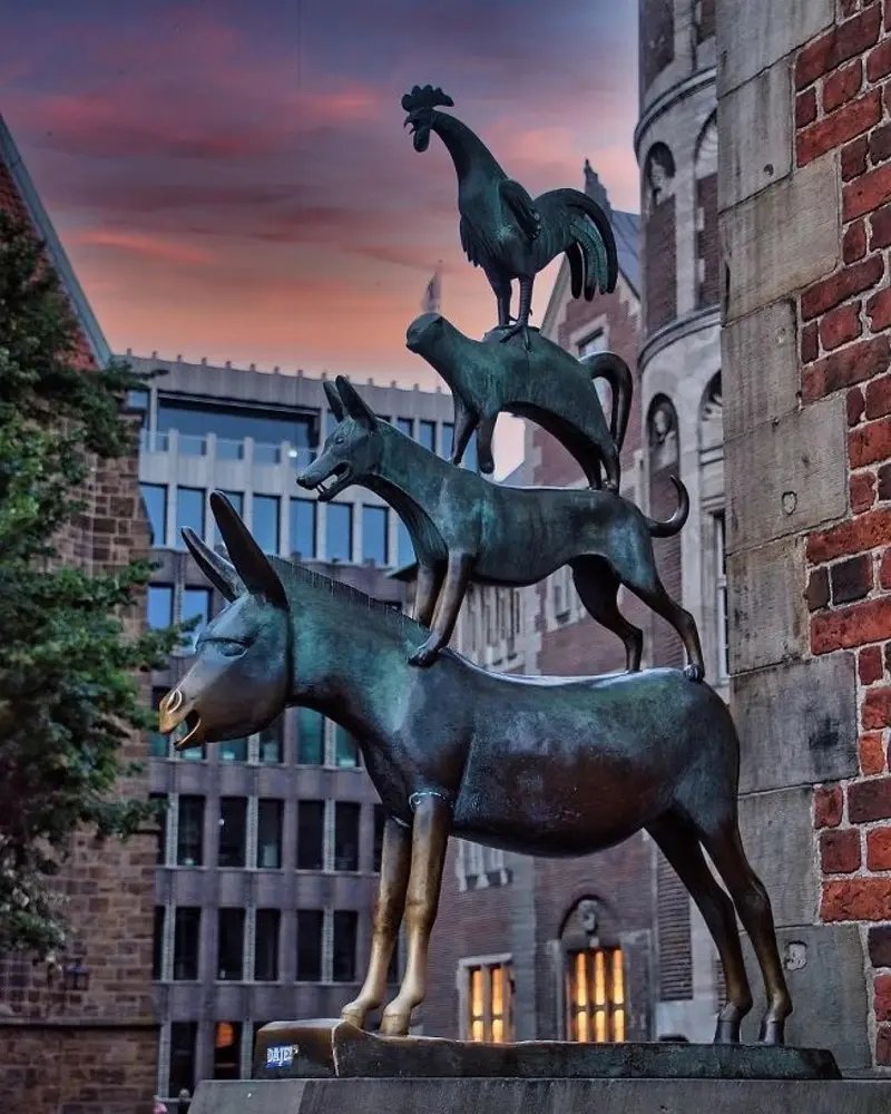
    The two-meter-high bronze group by Gerhard Marcks has stood at the front of the City Hall since 1953, depicting the donkey, dog, cat, and rooster from the Grimm fairy tale. Legend has it that whoever touches the donkey's front legs will be granted a wish.
    Open in Google Maps
    Bremen Roland
    Historic Landmark

    3Bremen Roland

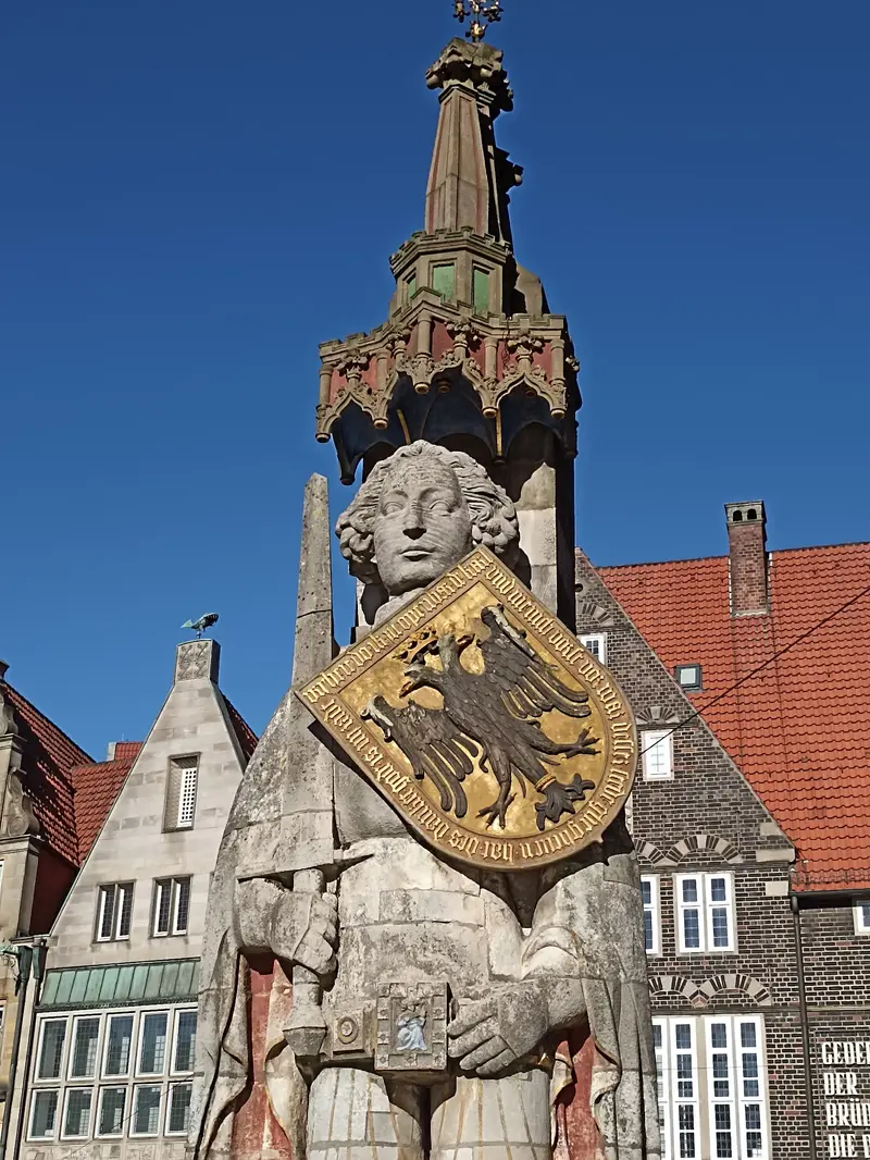
    The 1404 Roland on the Market Square is the oldest preserved stone figure, 10.21 meters tall with pillar and canopy. It stands for market rights and city freedom and, with the City Hall, became a UNESCO World Heritage Site in 2004.
    Open in Google Maps
    Böttcherstraße
    Museum

    4Böttcherstraße

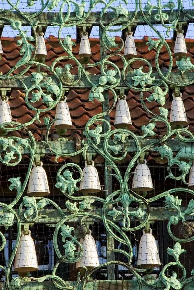
    The coffee merchant Ludwig Roselius had the alley, only 108 meters long, redesigned starting in 1922. Bernhard Hoetger created, among other things, the building for the Paula Modersohn-Becker Museum. The porcelain carillon chimes from April to December between 12 PM and 6 PM on the hour.
    Open in Google Maps
    Schnoor
    Historic Landmark

    5Schnoor

    Bremen's oldest quarter is an alleyway district with around 120 houses from the 15th to 19th centuries; the oldest residential building, Schnoor 15, dates back to 1402. The name comes from the Low German word for 'string' because ropes and cables were once made here.
    Open in Google Maps
    St. Petri Dom
    Church

    6St. Petri Dom

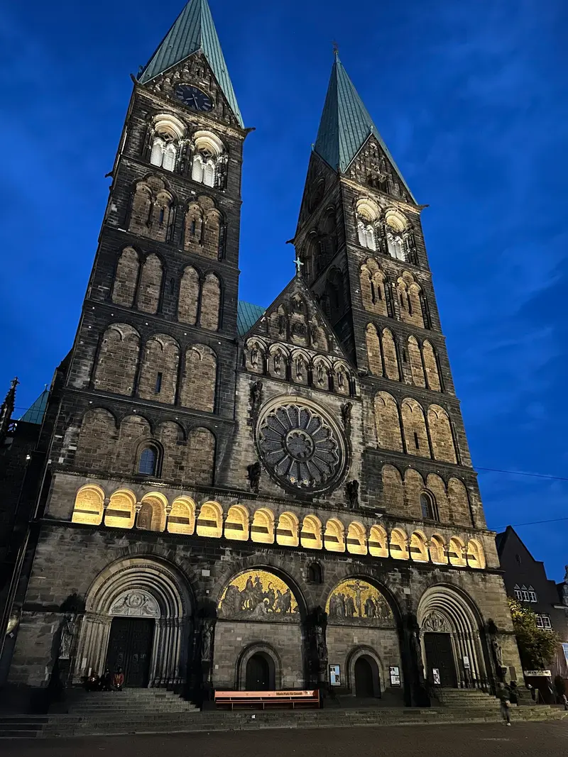
    The cathedral, Romanesque from the 11th century and later Gothic-transformed, features two approx. 93-meter-high west towers. You climb over 265 steps in the south tower to the viewing platform at about 57 meters height; in the cathedral museum, you'll see, among other things, the Last Supper relief.
    Open in Google Maps

    Restaurants in Bremen

    1

    Little Ratskeller

    Quaint inn with wood paneling near the market square, the menu offers Schnitzel and rustic traditional dishes, accompanied by German beer.
    Show on Google Maps
    2

    Two Brothers

    Italian restaurant with wine bar right on the Bremer Marktplatz (Am Markt 13); steaks are also on the menu.
    Show on Google Maps
    3

    Muchos Más

    Lively Spanish restaurant with Montaditos, Tapas, and desserts, plus Sangria, beer, and cocktails.
    Show on Google Maps

    Hanse, Fairy Tales and Brick Gothic

    Bremen joined the Hanseatic League in 1260. The self-confidence of this civic city is evident in the Roland statue, symbolizing market rights and urban freedom. In 1819, the Brothers Grimm published the fairy tale of the Bremen Town Musicians; since 1953, the bronze sculpture by Gerhard Marcks at the Town Hall has commemorated it.From 1922, coffee merchant Ludwig Roselius created a brick total work of art in Böttcherstraße, which today houses the Paula Modersohn-Becker Museum. The Kunsthalle (Art Gallery) was built in 1849, and the Universum Science Center is located on the university campus.

    Nightlife

    1

    Meisenfrei

    Small, sociable smoking club with an outdoor area, where well-known and new Blues and Rock bands play live.
    Show on Google Maps
    2

    Litfass

    A long, narrow bar on Ostertorsteinweg with a stage and outdoor seating, featuring Jazz, Funk and Soul, and occasionally performances from Theater Bremen.
    Show on Google Maps
    3

    Union Brewery Bremen

    Brewery with a bar, restaurant, and beer garden on Theodorstraße.
    Show on Google Maps

    On Foot, and with the Tramway

    The Old Town's attractions are easily reachable on foot; from the Marketplace, it's just a few minutes to the Schlachte and the Schnoor. For longer distances, the Bremer Straßenbahn AG operates a network of tram and bus lines totaling around 620 kilometers.You can buy tickets, for example, digitally via the FahrPlaner-App of the Verkehrsverbund Bremen/Niedersachsen.

    Accommodations in Bremen

    Find perfect stay in Bremen

    Booking.com* (Affiliate link)
    Search Hotels
    Agoda* (Affiliate link)
    Search Hotels
    Airbnb
    Vacation Rentals

    * Affiliate link: if you book through it, we earn a small commission. The price stays the same for you.

    Campgrounds in Bremen

    Find perfect campground in Bremen

    Search via Google Maps
    Campgrounds nearby (15km)
    Camping.info
    Find Campgrounds
    Park4Night
    RV Parks & Camping

    Plan your trip to Bremen

    Save places, build a route and plan your city trip, all in one place.

    1. 1
      1234

      Round trip

      12 days · 4 stops

      Saved

      Pick a route

      Pick a ready-made one or save places and plan your own.

      Open bookmarks
    2. 2

      Trip to Bremen

      Live
      • 1Bremen Rathaus3 days
      • 2Bremen Town Musicians4 days
      • 3Bremen Roland5 days
      Budget

      Plan your trip

      The planner sorts stops, days and budget. Plan together in real time.

      Start trip planning
    3. 3
      9:41 No signal
      Available offline

      Use it on the road

      Download the guide to your phone and use it on site, even offline.

    Nearby

    Bremen

    Bremen

    Bremen is located on both sides of the Weser, about 60 river kilometers before its mouth into the North Sea near Bremerhaven. The city is the capital of the Free Hanseatic City of Bremen, which also includes Bremerhaven, and joined the Hanseatic League as early as 1260.On your journey, you'll discover the Town Hall and Roland, jointly a UNESCO World Heritage site since 2004, along with the bronze statue of the Bremen Town Musicians, the medieval Schnoor quarter, and the Schlachte riverside promenade. In the former port area, Überseestadt has been developing as a new city district since 2000.
    Wilsede & Totengrund

    Wilsede & Totengrund

    The heath village of Wilsede, a district of Bispingen with 29 inhabitants (as of 2020), is located in the heart of the Lüneburg Heath Nature Reserve and is largely closed to motor vehicles. You can reach it on foot, by bike, or by horse-drawn carriage from the hiking car parks of the surrounding villages. In the Dat ole Huus Heath Museum, you can see how a heath farm lived around 1850.About one kilometer to the southeast lies the Totengrund, a 30-hectare basin with heathland and numerous juniper bushes. Pastor Wilhelm Bode purchased it in 1906 with donations to protect it from development. Nearby rises the Wilseder Berg, at 169.2 meters, the highest elevation in the Lüneburg Heath.
    Lüneburg Heath

    Lüneburg Heath

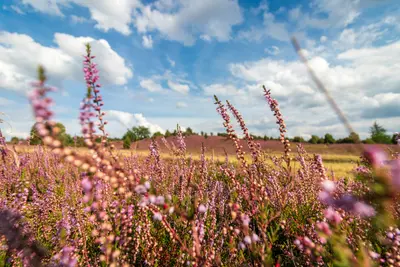
    The Lüneburg Heath is located in the northeast of Lower Saxony between the Elbe and Aller rivers, within easy reach of Hamburg, Bremen, and Hanover. Heidschnucken sheep graze the open areas, preventing trees from overgrowing the heath. The heath is in full bloom, especially in August and September.At its heart is the Lüneburg Heath Nature Reserve, founded in 1921, surrounding the Wilseder Berg, which at 169.2 metres is the highest elevation in the heath. On the edge of the heath lies the Hanseatic city of Lüneburg, which grew rich from its salt and today boasts around 1300 listed brick houses.

    Blankenese & Övelgönne

    Blankenese was a fishing village, first documented in 1301. Later, captains and pilots lived here; today, it is one of Hamburg's most affluent districts. In 1938, it became part of Hamburg along with Altona. The old village center is formed by the Treppenviertel on the steep Elbe slope with winding stairs and alleys, above which rises the 74.7-meter-high Süllberg. Upriver, in Othmarschen, lies Övelgönne with its kilometer-long Elbe beach and the museum harbor at Neumühlen pier.You descend the 170 steps of the Strandtreppe to the Strandweg, stroll through parks like the Römischer Garten, and watch the ships on the Elbe from the Elbe beach. You reach Blankenese with the S1; the small bus 488, the "Bergziege," runs through the steep streets. To Övelgönne, the HADAG Ferry 62 takes you from the Landungsbrücken to Neumühlen.
    Altona & Ottensen

    Altona & Ottensen

    Altona originated around 1535 as a fishing settlement. On August 23, 1664, it received city rights from Danish King Frederick III and grew into the second-largest city in the Danish realm. It only became part of Hamburg in 1938. Neighboring Ottensen, first mentioned in 1310 as the village of Ottenhusen, developed into an industrial hub after 1866 and became part of Altona in 1889. Today, Ottensen, with some 35,000 residents across 2.9 square kilometers, is a popular district for shopping and going out.From Altona Balcony, you can see across the Elbe to the Köhlbrand Bridge; along the Palmaille stand grand bourgeois buildings from the early 19th century. In Ottensen, you'll find the Fabrik cultural center with its crane and the Zeise Kinos featuring a ship's propeller from the former propeller factory. The S-Bahn lines S1, S2, and S3 stop at Altona Station.