Fernweh: Home
    ExploreTravel GuidesPlan a tripMy tripLast visited
    de|en
    All Places & RegionsAll highlightsAbout FernwehFAQPrivacy PolicyImprint
    ExploreTravel GuidesPlan a tripMy tripLast visited
    • Overview
    • Places in the region
    • Best travel time
    • Round trips
    • Nearby
    Oases & Sahara
    LBM1948 / Wikimedia Commons / CC BY-SA 4.0

    Tunisia

    Oases & Sahara

    Region

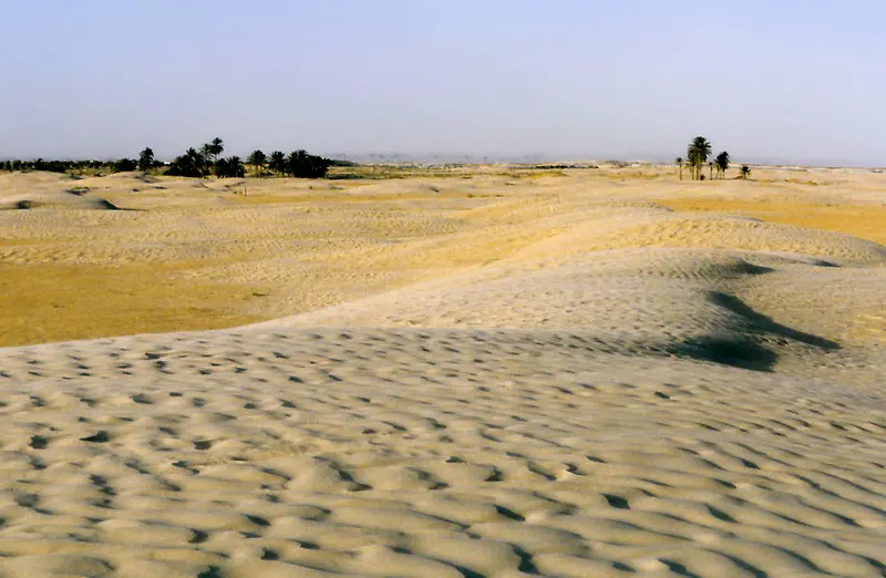
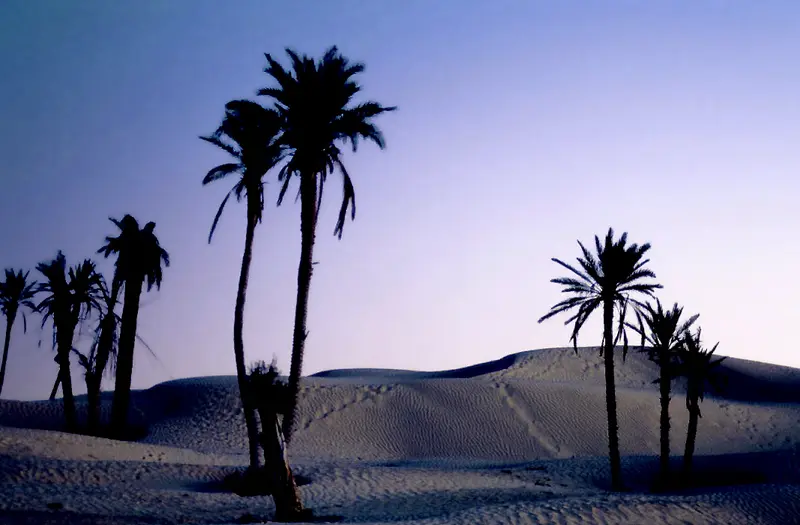
    In southwestern Tunisia, steppe and mountains give way to the Sahara: palm oases such as Tozeur and Nefta, the Chott el Djerid salt lake and the dunes of the Grand Erg Oriental near Douz define the region.

    by Felix Gillen

    1. Home
    2. Destinations
    3. Tunisia
    4. Oases & Sahara
    In southwestern Tunisia, steppe and mountains give way to the Sahara: palm oases such as Tozeur and Nefta, the Chott el Djerid salt lake and the dunes of the Grand Erg Oriental near Douz define the region. You travel here for brick-built old towns, date palms, the salt lake and the first sand dunes of the Sahara.The region borders Algeria and areas covered by official travel warnings. Check the current travel advice, such as the UK FCDO Travel Advice for Tunisia, before making any plans.
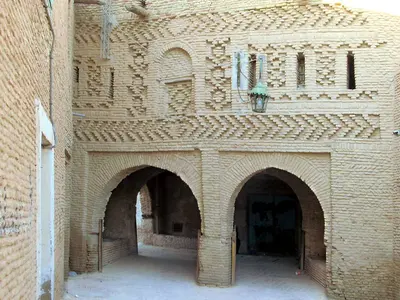
    Djerid and DouzThe Djerid region around Tozeur and Nefta is a chain of oases on the northern edge of the Chott el Djerid. Its old towns are built from light mud bricks with ornamental patterns, a building style unique to this part of Tunisia. East of the salt lake, Douz lies on the edge of the Grand Erg Oriental.Tozeur: Old Town Ouled el Hadef, Palmeraie, Dar Cheraït MuseumNefta: Corbeille palm basin and center of SufismDouz: Dunes, Musée du Sahara and International Sahara Festival in DecemberChott el Djerid: Salt lake, traversed by a causewayMountain Oases: Chebika, Tamerza and Midès in the border area with Algeria, which official travel advice warns againstClimate and Travel TimeTozeur receives only about 100 millimeters of rain annually. In spring and autumn, average daily temperatures range between 17 and 24 °C, while in July and August, average daily highs reach almost 40 °C.Getting There and SafetyTozeur-Nefta Airport is served by flights from Tunis, and long-distance buses from Tunis to Tozeur take about 7 hours. The German Federal Foreign Office advises against travel south of the line from the Algerian border via Tozeur/Nefta, Douz, Ksar Ghilane and Tataouine to Zarzis, against the immediate border area with Algeria and against individual, unorganised desert tours. Check the current official travel advice, such as the UK FCDO Travel Advice, before you go.
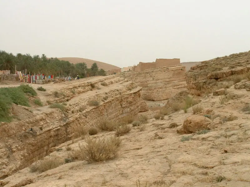
    Mountain Oases Chebika, Tamerza & Midès
    Asram at French Wikipedia / Wikimedia Commons / CC BY-SA 3.0

    Place 1 of 4

    Mountain Oases Chebika, Tamerza & Midès

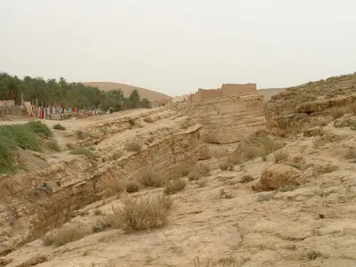
    Chebika, Tamerza and Midès are three mountain oases about 50 to 75 kilometres northwest of Tozeur on the Algerian border. Springs feed waterfalls and palm gardens between bare rock walls, above them stand the ruins of mud-brick villages abandoned in 1969.

    Discover
    Tozeur
    David Stanley from Nanaimo, Canada / Wikimedia Commons / CC BY 2.0

    Place 2 of 4

    Tozeur

    Tozeur is the main town of the Djerid in southwestern Tunisia, about 450 kilometres southwest of Tunis on the northern edge of the Chott el Djerid salt lake.

    Discover
    Nefta
    Rawen Ab / Wikimedia Commons / CC BY-SA 4.0

    Place 3 of 4

    Nefta

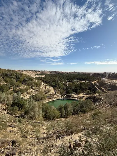
    Nefta is the second major oasis of the Djerid, about 25 kilometres west of Tozeur between the Chott el Djerid and the first sand dunes. The town is known for the Corbeille, a palm-filled rocky basin, and as the centre of Sufism in Tunisia.

    Discover
    Chott el Djerid
    Francesco Piraneo G. / Wikimedia Commons / CC BY 3.0

    Place 4 of 4

    Chott el Djerid

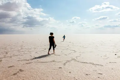
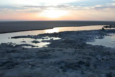
    The Chott el Djerid is a vast salt lake between Tozeur and Kebili in southwestern Tunisia, the largest salt flat in the Maghreb. You experience it on the causeway road from Tozeur to Douz, which runs across the white salt crust.

    Discover

    More places in Oases & Sahara

    Douz

    Douz

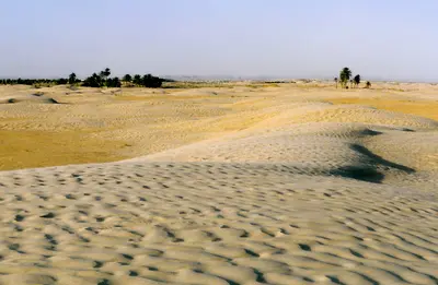
    Douz is known as the gateway to the Sahara: the oasis town in Kebili governorate lies about two hours' drive southeast of Tozeur on the edge of the Grand Erg Oriental. You come for the first big sand dunes, organised camel rides and the Festival international du Sahara in December.The town has around 30,000 inhabitants, most of them from the Mrazig tribe. Douz lies on the edge of areas covered by official travel warnings, and independent desert trips are advised against: check the current travel advice, such as the UK FCDO Travel Advice, before you go.
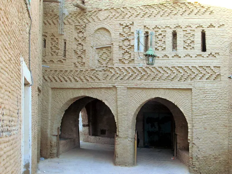
    Best Time to Visit

    When is the best time for your trip?

    March
    April
    October
    November
    17–24°C·10–13 mm(little rain)
    In spring and autumn, daily averages range from 17 to 24 °C. From June to August, daily highs average 37 to 40 °C, and in winter, nights drop to 7 to 8 °C.
    The climate data for Tozeur serves as a regional reference.Tozeur has a hot desert climate with approximately 97 millimeters of precipitation per year and over 3,100 hours of sunshine. Data sources: Institut National de la Météorologie, normal values according to Wikipedia.

    Seasons

    Jan
    Feb
    Mar
    Apr
    May
    Jun
    Jul
    Aug
    Sep
    Oct
    Nov
    Dec
    Nice and warm
    Mild, cool nights
    Very hot
    Best Time to Visit
    ▶Show detailed monthly data
    MonthTemp (°C)Rain (mm)Sun (h)
    January11.9146.7
    February13.678.0
    March17.4117.9
    April21.3138.6
    May25.949.1
    June30.4410.5
    July33.3111.2
    August33.2210.5
    September29.2108.4
    October24.2107.7
    November17.5117.1
    December12.996.5

    Round trips through this region

    The South: Djerba, Matmata and the Oases

    The South: Djerba, Matmata and the Oases

    Ten days in southern Tunisia: from the island of Djerba to the cave dwellings of Matmata, to Douz on the edge of the Grand Erg Oriental, and across the Chott el Djerid salt lake to Tozeur and Nefta. Parts of the route lie in areas covered by specific warnings in the UK FCDO Travel Advice. Check the current advice before you travel and only go into the desert on organised tours with local operators.

    10 Days
    7 stops

    Nearby

    Chott el Djerid

    Chott el Djerid

    The Chott el Djerid is a vast salt lake between Tozeur and Kebili in southwestern Tunisia, the largest salt flat in the Maghreb. You experience it on the causeway road from Tozeur to Douz, which runs across the white salt crust.Depending on the source and the water level, the lake covers 5,000 to over 7,000 square kilometres. It lies on the edge of areas covered by official travel warnings: check the current travel advice, such as the UK FCDO Travel Advice, before you go.
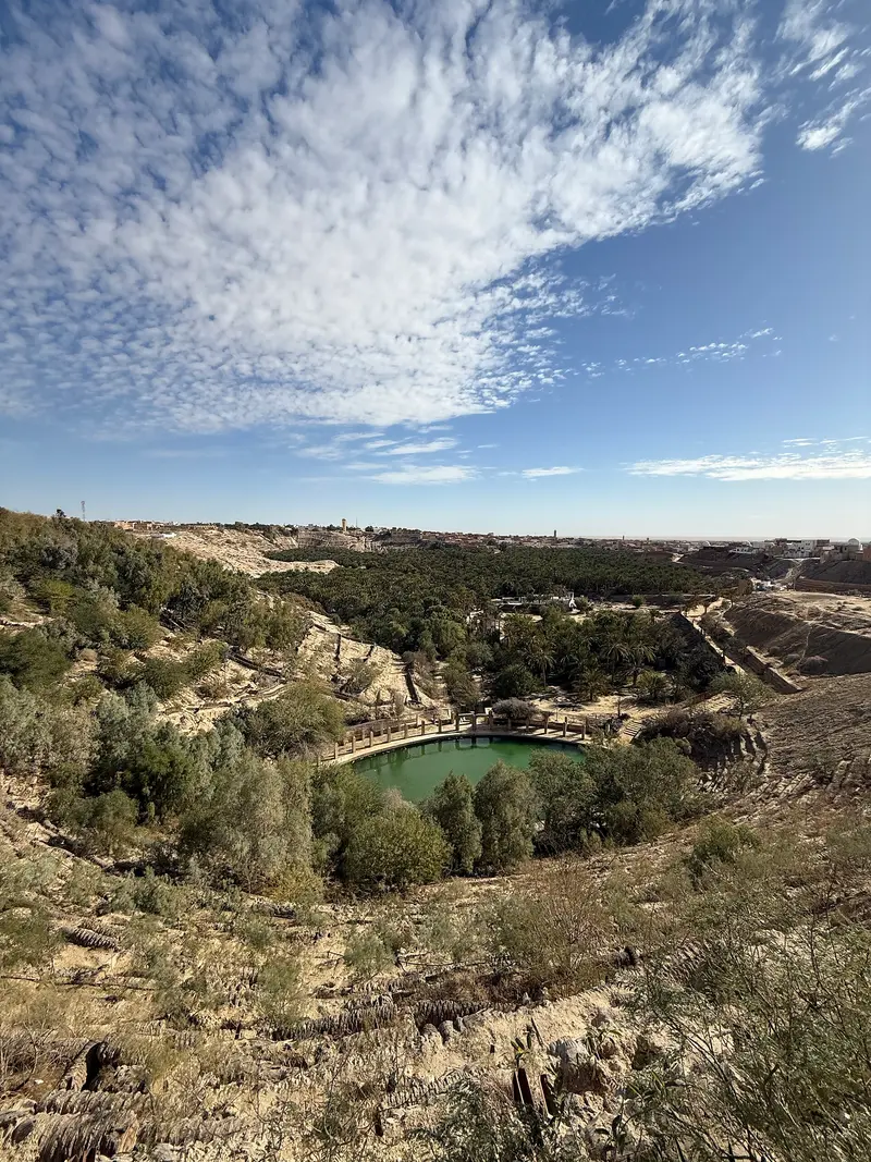
    Tozeur

    Tozeur

    Tozeur is the main town of the Djerid in southwestern Tunisia, about 450 kilometres southwest of Tunis on the northern edge of the Chott el Djerid salt lake. You come for the Ouled el Hadef old town with its patterned brickwork and for the palm grove with around 400,000 date palms.The town has just under 40,000 inhabitants and is easy to explore on foot, by bicycle or by horse-drawn carriage. Tozeur lies on the edge of areas covered by official travel warnings: check the current travel advice, such as the UK FCDO Travel Advice, before you go.
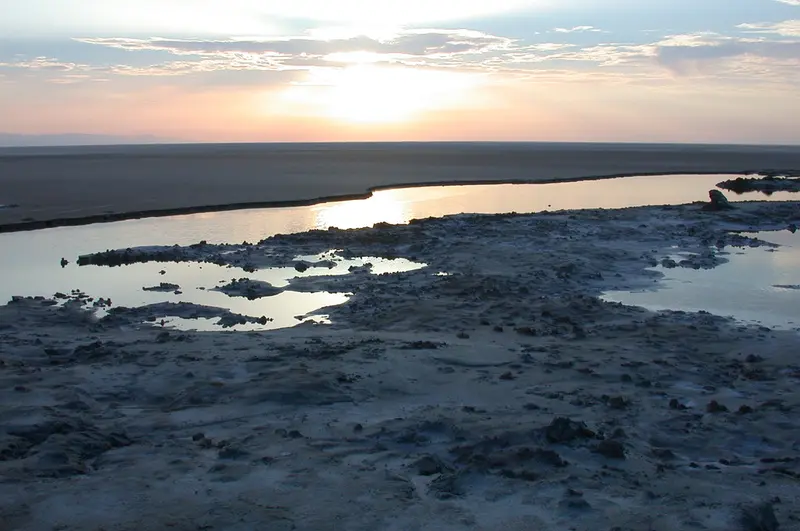
    Nefta

    Nefta

    Nefta is the second major oasis of the Djerid, about 25 kilometres west of Tozeur between the Chott el Djerid and the first sand dunes. The town is known for the Corbeille, a palm-filled rocky basin, and as the centre of Sufism in Tunisia.Nefta has just over 20,000 inhabitants and an old town of patterned mud brick. It lies close to the Algerian border on the edge of areas covered by official travel warnings: check the current travel advice, such as the UK FCDO Travel Advice, before you go.
    Douz

    Douz

    Douz is known as the gateway to the Sahara: the oasis town in Kebili governorate lies about two hours' drive southeast of Tozeur on the edge of the Grand Erg Oriental. You come for the first big sand dunes, organised camel rides and the Festival international du Sahara in December.The town has around 30,000 inhabitants, most of them from the Mrazig tribe. Douz lies on the edge of areas covered by official travel warnings, and independent desert trips are advised against: check the current travel advice, such as the UK FCDO Travel Advice, before you go.
    Mountain Oases Chebika, Tamerza & Midès

    Mountain Oases Chebika, Tamerza & Midès

    Chebika, Tamerza and Midès are three mountain oases about 50 to 75 kilometres northwest of Tozeur on the Algerian border. Springs feed waterfalls and palm gardens between bare rock walls, above them stand the ruins of mud-brick villages abandoned in 1969.The oases lie in the border area with Algeria, Midès directly on the border, an area official travel advice warns against: check the current travel advice, such as the UK FCDO Travel Advice, before making any plans.

    Sources & method

    • Photos: Wikimedia Commons. Each photo carries its credit.
    • The content is based on web research from public, traceable sources. How the content is made · The role of AI