Fernweh: Home
    ExploreTravel GuidesPlan a tripMy tripLast visited
    de|en
    All Places & RegionsAll highlightsAbout FernwehFAQPrivacy PolicyImprint
    ExploreTravel GuidesPlan a tripMy tripLast visited
    • Overview
    • Places in the region
    • Culture
    • Getting around
    • Round trips
    • Nearby
    Arlberg
    Florian Lindner / Wikimedia Commons / CC BY 2.5

    Austria

    Arlberg

    RegionMountains

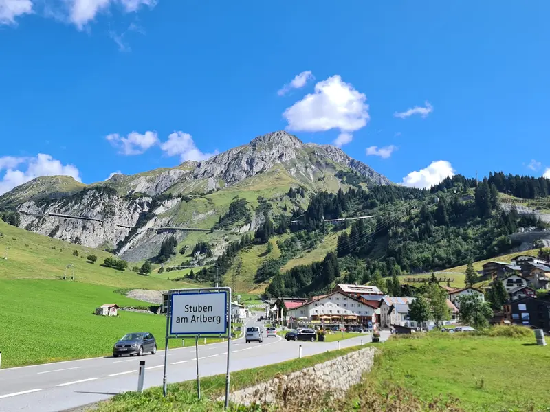
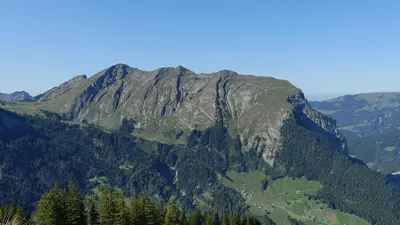
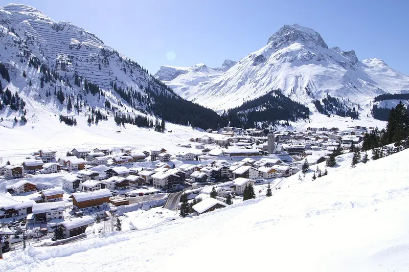
    The Arlberg Pass, at 1,793 meters, separates Vorarlberg and Tyrol. On the Tyrolean side lies St. Anton; on the Vorarlberg side, the road leads over the Flexen Pass to Zürs and Lech.

    by Felix Gillen

    1. Home
    2. Destinations
    3. Austria
    4. Arlberg
    The Arlberg Pass, at 1,793 meters, separates Vorarlberg and Tyrol. On the Tyrolean side lies St. Anton; on the Vorarlberg side, the road leads over the Flexen Pass to Zürs and Lech. Known as the cradle of alpine skiing, the region is a summer hiking area with mountain lakes, cable cars and the Skyspace by James Turrell.
    A Pass Between Two StatesThe Arlberg Pass links the Klostertal valley in Vorarlberg with the Stanzertal valley in Tyrol. Since 1978 the 14-kilometer Arlberg road tunnel, which charges a toll, has run beneath the pass between Langen and St. Anton; the old pass road is toll-free. At Alpe Rauz the Flexen road branches off and leads through the Flexen Gallery over the 1,773-meter Flexen Pass to Zürs and Lech.St. Anton and LechSt. Anton, on the Tyrolean side, is considered the cradle of alpine skiing: the Ski Club Arlberg was founded here in 1901, and in 1921 Hannes Schneider opened the region's first ski school. Lech and Zürs form the second hub on the Vorarlberg side, with Oberlech set on a sunny terrace above the village.Tips for Your VisitIn summer the Galzig cable car takes you from St. Anton up to 2,086 meters, where the Valluga cable car continues to the Valluga summit.There are almost 400 kilometers of marked hiking trails around St. Anton, including gentle paths into the Verwall valley to Lake Verwall.A hiking bus takes you from Lech up a toll road to Lake Formarin below the Rote Wand.

    Sights in Arlberg

    Discover the most important sights and attractions

    Museum St. Anton am Arlberg
    Museum

    Museum St. Anton am Arlberg

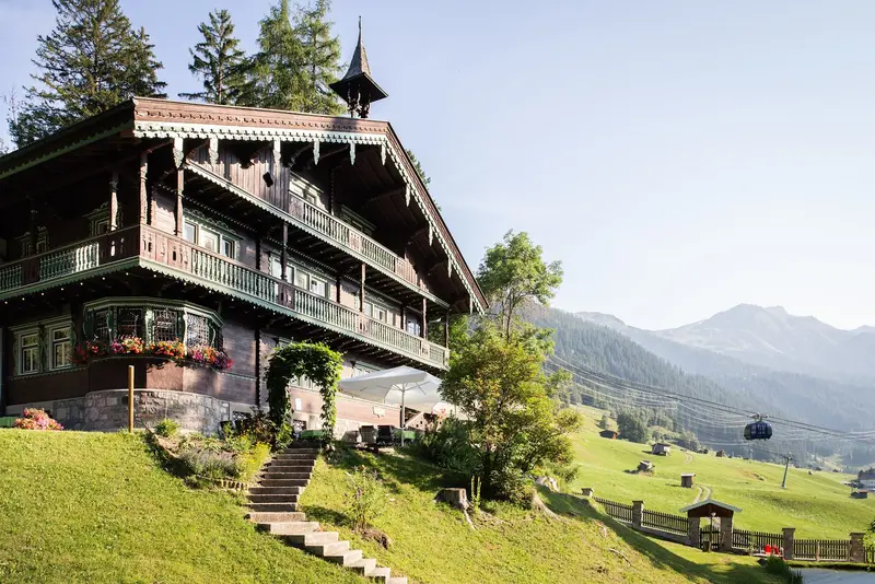
    The Ski and Local Heritage Museum is housed in Villa Trier, an Art Nouveau villa built around 1910, situated in a park above the Galzigbahn. The upstairs exhibition details St. Anton's rise as a winter sports resort, rail and tunnel construction, and local culture. A restaurant is on the ground floor.
    Open in Google Maps
    Skyspace Lech
    Point of Interest

    Skyspace Lech

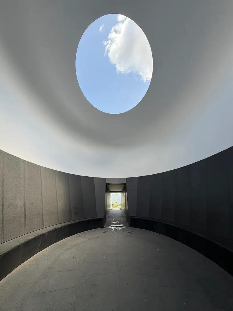
    US light artist James Turrell designed the space on Alpe Tannegg near Oberlech, at 1,780 meters. It opened in September 2018 and is reachable on foot above the Schlosskopfbahn mountain station. The light sequences begin 50 minutes before sunrise or at sunset and must be booked in advance.
    Open in Google Maps
    Flexen Pass
    Natural Feature

    Flexen Pass

    The Flexenstraße (B198) branches off the Arlbergstraße near Alpe Rauz and leads through the Flexen Gallery over the 1,773-meter-high pass to Zürs and Lech. From the Trittkopfbahn in Zürs, an easy walking path of around 2.5 kilometers leads to the Flexenpass and back.
    Open in Google Maps
    Formarinsee
    Natural Feature

    Formarinsee

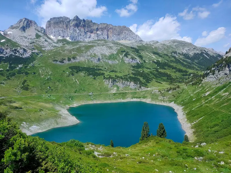
    The mountain lake lies at 1,793 meters below the Rote Wand in the Lechquellengebirge and fills annually with meltwater. In summer, a hiking bus takes you from Lech up a toll road, from there, hikes start, for example, to the Freiburger Hütte or around the Rote Wand.
    Open in Google Maps

    Culture and History

    Ski History at Villa TrierThe Museum St. Anton am Arlberg is located in the Art Nouveau Villa Trier, which Bernhard Trier had built around 1910 above today's Galzigbahn. It tells of the village's rise to a winter sports center, of railway and tunnel construction, and the local culture of the Stanzertal.Light and Sky in OberlechAt Alpe Tannegg near Oberlech, at 1,780 meters, stands the Skyspace Lech by US light artist James Turrell, opened in September 2018. You can access the booked light sequences at sunrise and sunset.One Region, Two StatesThe name Vorarlberg means 'before the Arlberg'. St. Anton and St. Christoph belong to Tyrol, Stuben, Zürs, Lech and Warth to Vorarlberg.

    Exploring locally

    By TrainSt. Anton and Langen am Arlberg are on the Arlberg railway line, with hourly direct trains from Vienna. From Langen, Bus 750 takes about 20 minutes to Lech and Zürs, while from St. Anton, Bus 760 takes about 30 minutes.By CarFrom the Bregenzerwald, you arrive via the Hochtannberg Pass at Warth and then proceed to Lech. The short stretch between Warth and Lech is closed during winter.From Lech, the Flexenstrasse leads via Zürs to Alpe Rauz, from there the route continues over the Arlberg Pass or through the toll tunnel to St. Anton.On-siteIn summer, a local bus connects Lech and Zürs; it is included in the Lech Card.

    Round trips through this region

    Western Austria: Lake Constance, Arlberg and Zillertal

    Western Austria: Lake Constance, Arlberg and Zillertal

    The trip starts in Bregenz on Lake Constance and leads through the Bregenz Forest, with its cheese-making alpine dairies, over the Hochtannberg Pass to the Arlberg and the villages of Lech and St. Anton. From there you continue into the Ötztal Valley with the Stuibenfall waterfall and the summit lifts of Sölden, then on to Innsbruck, and finally into the Zillertal Valley with the Schlegeis Reservoir and a side trip over the Gerlos Alpine Road to the Krimml Waterfalls. A car gives you the most flexibility, and most legs take 45 minutes to an hour. Bregenz, St. Anton, Ötztal station, Innsbruck and Jenbach are on the rail network, and buses serve the valleys, often free with local guest cards. This is a summer route: the road between Warth and Lech is closed in winter, and many cable cars and hiking buses only run during the summer season.

    13 Days
    6 stops
    Open jaw

    Nearby

    Lower Engadine

    Lower Engadine

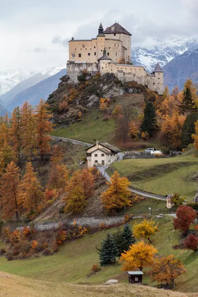
    The Lower Engadine is the lower part of the Engadine valley in Graubünden, between Zernez and the Austrian border. Its main town is Scuol, at about 1,290 meters. Since 2015, Scuol, Guarda, Ardez, Ftan, Sent and Tarasp have formed a single municipality whose official language is Romansh.Scuol has been a spa town since the 19th century. More than twenty mineral springs rise within the municipality, you can taste the water straight from five village fountains, and the Bogn Engiadina has carried on the bathing tradition since 1993. Across the valley, Tarasp Castle stands on a hill and can only be visited on a guided tour.Guarda sits at 1,653 meters on a sunny terrace high above the Inn. The village, with its painted 17th-century Engadine houses, received the Wakker Prize in 1975 and inspired Selina Chönz and Alois Carigiet to create the story of Schellen-Ursli (A Bell for Ursli). From Scuol, the Rhaetian Railway takes you to Zernez and the Swiss National Park in just over half an hour.
    Bregenzerwald

    Bregenzerwald

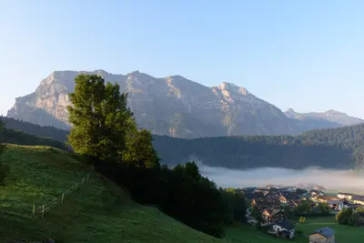
    Beyond Bregenz, the land ascends along the Bregenzer Ach through green hills, mountain villages, and alpine pastures, up to the Hochtannberg Pass. The Bregenzerwald is known for its mountain cheese, its three-tier farming system (Tal, Vorsäß, Alpe), and a wooden architecture that combines old Wälder houses with contemporary design.
    Swiss National Park

    Swiss National Park

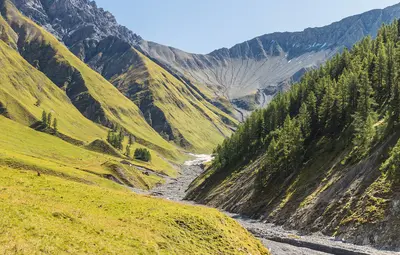
    Founded on August 1, 1914, the Swiss National Park in eastern Graubünden is the oldest national park in the Alps. On 170 square kilometers, between 1400 and 3174 meters altitude, nature is allowed to develop without human intervention; the park is classified as a wilderness area of the strictest IUCN Category Ia. Roughly half the area is rock and scree, and just under a third is forest.The starting point for most visits is Zernez in Engadin, home to the National Park Centre. Twenty-one hiking routes, totaling around 100 kilometers, lead through the park. The Ofenpass road from Zernez towards Val Müstair crosses it, and PostBus stops at the trailheads. With luck, you could see red deer, chamois, ibex, marmots, and bearded vultures.Since 2017, the park has formed the core zone of the UNESCO Biosfera Engiadina Val Müstair. The rules are strict: Stay on marked trails, dogs are forbidden even on a leash, and in winter, the park is closed to protect animals.
    Ötztal

    Ötztal

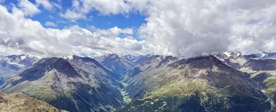
    Spanning approximately 65 kilometers, the Ötztal extends from the Inntal, west of Innsbruck, south into the glacier world of the Ötztal Alps. Along the route are Tyrol's highest waterfall near Umhausen, the thermal spa in Längenfeld, Sölden with its summit lifts, and at its far end, Vent and Obergurgl. The glacier mummy Ötzi was discovered at the Tisenjoch in 1991.
    Val Müstair

    Val Müstair

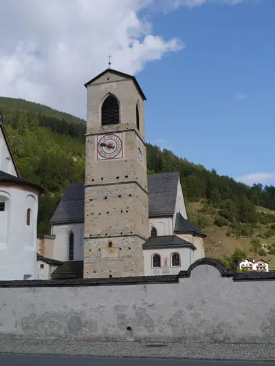
    Val Müstair is located in the far southeast of Graubünden, beyond the Ofenpass. The PostBus route through the valley continues to Mals in Italy's Vinschgau. In the village of Müstair stands the Benedictine Convent of St. John, which has been a UNESCO World Heritage site since 1983.According to tradition, Charlemagne founded the monastery around 775 after surviving a snowstorm on the Umbrailpass. The convent church preserves the largest and best-preserved fresco cycle from the Early Middle Ages: Carolingian murals from around 800, rediscovered in 1894 beneath later layers of paint, and Romanesque frescoes from the 12th century. Benedictine nuns still live here today.The convent museum, housed in a residential and defensive tower over a thousand years old, recounts the monastery's more than 1200-year history. From Zernez, you can reach Müstair by PostBus, traveling over the Ofenpass and through the Swiss National Park, in about 50 minutes to just over an hour. The valley, together with the National Park and Scuol, forms the UNESCO Biosfera Engiadina Val Müstair.

    Sources & method

    • Photos: Wikimedia Commons, Google Maps. Each photo carries its credit.
    • Place data such as addresses and ratings comes from Google Maps.
    • The content is based on web research from public, traceable sources. How the content is made · The role of AI