Fernweh: Home
ExploreGuideDestinationsMy tripsMy trip
de|en
All Places & RegionsRound tripsNight trains in EuropeAll highlightsAbout FernwehFAQPrivacy PolicyImprint
Download on the App StoreGet it on Google Play
ExploreGuideDestinationsMy tripsMy trip
    • Neighborhoods & highlights
    • Eat & drink
    • Culture
    • Getting around
    • Accommodation
    • Plan trip
    • Round trips
    • Nearby
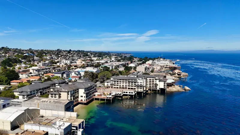
    Monterey and Carmel

    Photo by Rodrigo Kammer on Unsplash

    United States

    Monterey and Carmel

    CityCulture

    Monterey, on its namesake bay, was the sardine capital of the world during World War II; Cannery Row, made famous by John Steinbeck's novel, is now home to the Monterey Bay Aquarium.

    by Felix Gillen

    1. Home
    2. Destinations
    3. United States
    4. California
    5. Monterey and Carmel
    Monterey, on its namesake bay, was the sardine capital of the world during World War II; Cannery Row, made famous by John Steinbeck's novel, is now home to the Monterey Bay Aquarium. From Old Fisherman's Wharf, boats depart for whale watching.A few kilometers south, beyond the 17-Mile Drive through Pebble Beach, lies the town of Carmel-by-the-Sea, featuring the Carmel Mission and several Michelin-starred restaurants. Just beyond that, Point Lobos and coastal Highway 1 to Big Sur begin.
    United States travel guideSee the round tripPlan a trip with Monterey and Carmel

    Contents

    • Neighborhoods & highlights
    • Eat & drink
    • Culture
    • Getting around
    • Accommodation
    • Round trips
    • Nearby

    Sights in Monterey and Carmel

    Discover the most important sights and attractions

    Aquarium

    1Monterey Bay Aquarium

    The aquarium at the end of Cannery Row showcases the marine life of Monterey Bay. Admission is $65 for adults, $50 for ages 5-17 and 70+, children under 4 are free; tickets are best purchased online in advance. The aquarium's Seafood Watch program, a guide for sustainable seafood choices, has existed since 1999.
    Open in Google Maps
    Attraction

    2Cannery Row

    From 1902, fish canneries were built here; by World War II, Monterey was the world's sardine capital. John Steinbeck immortalized the street in 1945 with his novel 'Cannery Row', whose character Doc was modeled after marine biologist Ed Ricketts. Since 1958, the former Ocean View Avenue has officially carried the novel's name.
    Open in Google Maps
    Attraction

    317-Mile Drive and Lone Cypress

    The private road through Pebble Beach leads past 21 stops along the coast, the most famous being the Lone Cypress, which has stood on its rock for more than 250 years. Day visitors pay $12.50 per vehicle, reimbursed with a meal of $35 or more at a resort restaurant. Open from sunrise to sunset, motorcycles are not permitted.
    Open in Google Maps
    Museum

    4Carmel Mission

    The Spanish Mission Church on the southern edge of Carmel-by-the-Sea features a museum, a shop, and a garden. Open Wednesdays and Thursdays 10 AM to 4 PM, Fridays and Saturdays 10 AM to 5 PM, Sundays 11:30 AM to 5 PM. Closed Mondays and Tuesdays. Access is restricted during services and weddings.
    Open in Google Maps
    Park

    5Point Lobos State Natural Reserve

    The coastal preserve south of Carmel is open daily from 8 AM to 5 PM, with last entry at 4:30 PM. Parking within the preserve costs $10 per passenger vehicle. There are only 150 parking spaces; your best chance is before 9:30 AM or after 3 PM. Vehicles over 6.4 meters in length and dogs, even inside vehicles, are not permitted.
    Open in Google Maps
    Historic Landmark

    6Old Fisherman's Wharf

    Thomas Larkin built the first pier in 1845 for passengers and freight. After sardine fishing ended, it was repurposed for tourism; today, whale watching tours depart here.
    Open in Google Maps

    Restaurants in Monterey and Carmel

    1

    Aubergine

    The restaurant at Hotel L'Auberge Carmel boasts two stars in the Guide Michelin USA 2026, with Chef Justin Cogley.
    Show on Google Maps
    2

    Chez Noir

    Contemporary cuisine with fish and seafood in Carmel-by-the-Sea, awarded one star in the Guide Michelin USA 2026.
    Show on Google Maps
    3

    Yafa

    Mediterranean cuisine in Carmel-by-the-Sea, awarded a Bib Gourmand by the Guide Michelin for good value for money.
    Show on Google Maps

    Culture and Taste

    Steinbeck and the SardinesFrom 1902, fish canneries were established on what was then Ocean View Avenue. In 1945, John Steinbeck published his novel "Cannery Row," and in 1958, the street officially received this name.Wine and FestivalsThe region is home to around 349 vineyards, from Arroyo Seco to the Santa Lucia Highlands. In August, the ten-day Monterey Car Week fills the peninsula, and in spring, Pebble Beach Food & Wine takes place. Carmel-by-the-Sea boasts two Guide Michelin 2026 addresses with Aubergine (two stars) and Chez Noir (one star).

    Traveling

    Peninsula and Coast17-Mile Drive: $12.50 per vehicle, reimbursed with a meal of $35 or more at a resort restaurant; open from sunrise to sunset, no motorcycles.Point Lobos: Only 150 parking spots for $10; arrive before 9:30 AM or after 3 PM. Parallel parking only on Highway 1.Highway 1 to Big Sur: The road has been fully passable again since 2026, but there are recurring closures for slope stabilization, such as daytime closures on November 18 and 19, 2026, near the Torre Canyon Bridge. Check Caltrans QuickMap for daily status.Monterey Bay AquariumTickets for a specific day are best bought online in advance; it gets crowded on weekends and holidays.

    Accommodations in Monterey and Carmel

    Find perfect stay in Monterey and Carmel

    Booking.com* (Affiliate link)
    Search Hotels
    Agoda* (Affiliate link)
    Search Hotels
    Airbnb
    Vacation Rentals

    * Affiliate link: if you book through it, we earn a small commission. The price stays the same for you.

    Campgrounds in Monterey and Carmel

    Find perfect campground in Monterey and Carmel

    Search via Google Maps
    Campgrounds nearby (15km)
    Camping.info
    Find Campgrounds
    Park4Night
    RV Parks & Camping

    Plan your trip to Monterey and Carmel

    Save places, build a route and plan your city trip, all in one place.

    1. 1
      Sunrise over alpine peaks and a sea of clouds
      1234

      Round trip

      12 days · 4 stops

      Saved

      Pick a route

      Pick a ready-made one or save places and plan your own.

      Open bookmarks
    2. 2

      Trip to Monterey and Carmel

      Live
      • 1Monterey Bay Aquarium3 days
      • 2Cannery Row4 days
      • 317-Mile Drive and Lone Cypress5 days
      Budget

      Plan your trip

      The planner sorts stops, days and budget. Plan together in real time.

      Start trip planning
    3. 3
      9:41 No signal
      Monterey and Carmel
      Available offline

      Photo by Rodrigo Kammer on Unsplash

      Use it on the road

      Download the guide to your phone and use it on site, even offline.

    Round trips with Monterey and Carmel

    Pacific Coast Highway: From San Francisco to San Diego

    Pacific Coast Highway: From San Francisco to San Diego

    The classic coastal route runs from San Francisco via Monterey and Carmel through Big Sur, along the Central Coast to Santa Barbara and past Los Angeles to San Diego. Drive from north to south: The ocean will be on your side, and viewpoints are reached without left turns. Highway 1 through Big Sur is often closed by landslides and wildfires, sometimes for extended periods, and traffic lights regulate single-lane passage at construction sites; therefore, check the Caltrans QuickMap (quickmap.dot.ca.gov) before your leg. After fires, hiking trails east of Highway 1 also often remain closed for long periods. In Big Sur, gas stations are rare and expensive, and cell reception is often unavailable, so fill up in Carmel and save maps offline.

    15 Days
    6 stops
    Open jaw

    Furqan Mohammed·Pexels

    Nearby

    Big Sur & Highway 1

    Big Sur & Highway 1

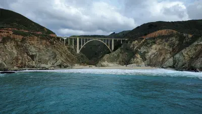
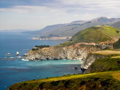
    Big Sur is the roughly 70-mile stretch of California coast between Carmel and San Simeon where the Santa Lucia Mountains drop straight into the Pacific. You come for Highway 1, which winds along sheer cliffs, over concrete arch bridges and past redwood canyons.There are no towns here. About 2,000 people live on the coast year-round, plus a few small clusters of lodges, restaurants, gas stations and campgrounds. The biggest is Big Sur Village in the Big Sur River valley, about 26 miles south of Carmel. There are no supermarkets or chains, so stock up in Carmel or Monterey.Don't treat Big Sur as a two-hour drive-through. Bixby Creek Bridge, Pfeiffer Beach, McWay Falls and a short hike fill a whole day, and a night in the valley makes the trip far more relaxed. It's busiest on summer weekends and holiday weekends like Memorial Day and Labor Day, quietest on spring and fall weekdays. In summer, thick fog often sits on the coast until around midday.After the 2026 firesIn August 2026 two large wildfires burned in the mountains above the coast in the Los Padres National Forest: the Timber Fire (from August 8) in the north around the Big Sur valley, and the Plaskett Fire (from August 26) in the south. About 40 miles of Highway 1 closed on August 27; the northern section reopened September 3, and the full road has been open again since mid-September. Pfeiffer Big Sur State Park reopened October 16. Many trails in the mountains east of Highway 1 remain closed until further notice.

    Calilover·public domain

    Mission District & the Castro

    Mission District & the Castro

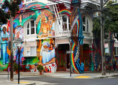
    The Mission District and the Castro sit next to each other south of downtown San Francisco, with Dolores Park in between. The weather here is often sunnier than on the waterfront, and the days revolve around murals, taquerias and the park, the nights around bars that stay busy late.The Mission is the city's oldest neighborhood, named for Mission Dolores (1776), and for decades the heart of San Francisco's Latino community. Valencia Street has cafés, bookstores and restaurants; Mission Street and 24th Street are louder and cheaper, lined with taquerias and panaderías. The Castro, just west, has been the country's best-known gay neighborhood since the 1970s, marked by the rainbow crosswalks at Castro and 18th and the Castro Theatre's neon sign.Plan your day: Mission Dolores and Dolores Park in the morning, a burrito for lunch, the Balmy Alley murals off 24th Street in the afternoon, then the Castro in the evening.Weather: Sheltered by Twin Peaks, the Mission is often warmer and less foggy than Fisherman's Wharf, which is why Dolores Park gets packed on sunny weekends.

    Solenn Thircuir·Pexels

    San Francisco

    San Francisco

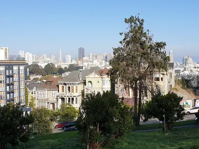
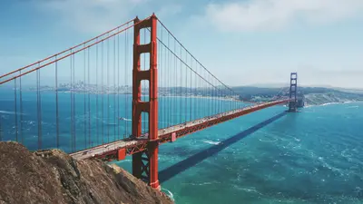
    San Francisco sits on the hilly northern tip of a peninsula in Northern California, between the Pacific and the Bay, with about 874,000 people. You come for the Golden Gate Bridge, the old prison on Alcatraz, cable cars clanking up steep hills and walkable neighborhoods like Chinatown and the Mission.Give it at least three full days: one for the waterfront from Fisherman's Wharf to the Ferry Building, one for Alcatraz and the Golden Gate Bridge, and one for Chinatown, North Beach, the Mission and Haight-Ashbury.The neighborhoods at a glanceFisherman's Wharf, North Beach & Chinatown: Piers and sea lions, the old Italian quarter and the oldest Chinatown in North America, all linked on foot.Union Square, SoMa & the Embarcadero: Downtown, with hotels, department stores, SFMOMA and the Ferry Building on the water.Nob Hill, Russian Hill & the Fillmore: Cable cars, Grace Cathedral and Lombard Street up on the hills, plus Japantown and the old Fillmore Street jazz corridor.Mission District & the Castro: Murals, taquerias, Dolores Park and the country's best-known gay neighborhood, often sunnier than the rest of town.Haight-Ashbury & Golden Gate Park: Hippie history, Victorian houses and the big park with its museums and Japanese Tea Garden.Presidio, Marina & Lands End: Beach, bayfront path and coastal trail around the Golden Gate Bridge.Book ahead: Alcatraz tickets are sold only through Alcatraz City Cruises, up to 90 days out. For summer, weekends and holiday weekends like Memorial Day or Labor Day, book early; walk-up spots are rare.Weather: Summer fog pours through the Golden Gate, and the waterfront gets cold and windy. Dress in layers and pack a jacket, even in July.Driving: You don't need a car downtown, and parking is expensive. Never leave anything visible in a parked car.

    Maarten van den Heuvel·Unsplash

    Haight-Ashbury & Golden Gate Park

    Haight-Ashbury & Golden Gate Park

    Haight-Ashbury and Golden Gate Park sit on San Francisco's west side, where the old hippie neighborhood around Haight and Ashbury runs right into the park's eastern entrance. Come for Victorian houses, vintage clothing and record stores, then spend a full day in the park with its museums, gardens and lakes.Haight Street was ground zero for the 1967 Summer of Love and still trades on it: thrift stores, smoke shops, murals and street musicians. The side streets are lined with brightly painted Victorians. Golden Gate Park stretches about three miles from here to the Pacific. The de Young Museum, the California Academy of Sciences and the Japanese Tea Garden are clustered together on the east side; farther west it gets quieter, with lakes, meadows and the windmills at Ocean Beach.Time: A morning is enough for the Haight. Give the park a full day if you want to do two museums.Car-free: The eastern stretch of JFK Drive is closed to cars, so it's easy to explore on foot or by bike.

    Misaochan2·CC BY-SA 4.0

    Union Square, SoMa & the Embarcadero

    Union Square, SoMa & the Embarcadero

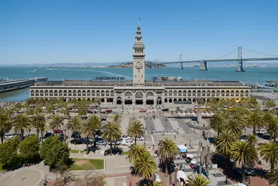
    Union Square, SoMa and the Embarcadero make up downtown San Francisco along Market Street, from the shopping district around Union Square to the Ferry Building on the bay. This is where many visitors stay, where BART and the cable cars stop, and where you'll find the big art museums and the waterfront farmers market.Union Square is the hotel and shopping district, with department stores and the cable car turnaround at Powell and Market. South of Market Street, SoMa has SFMOMA, Yerba Buena Gardens and Moscone Center by day and bars and clubs in old warehouses by night. The Embarcadero is the bayfront boulevard that replaced the elevated freeway torn down after 1989, now lined with palms, a bike path and the F-line's vintage streetcars. Its centerpiece is the 1898 Ferry Building.Plan your day: Hit the Saturday farmers market at the Ferry Building in the morning, walk along the water, then head up Market Street to SFMOMA.Heads-up: Between Union Square, Civic Center and the Tenderloin, the street scene can change within a few blocks. For current safety information, see the UK FCDO Travel Advice.

    Daniel Lu·CC BY-SA 4.0

    Your next steps

    Monterey and Carmel is in United States. Ways to carry on from here.

    • More in United States

      Highlights, areas, routes and the best time to travel for all of United States.

      United States travel guide
    • Round trips with Monterey and Carmel

      One route passes through Monterey and Carmel, with stops, nights and a map.

      See the round trip

    Sources & method

    • Photos: Unsplash. Each photo carries its credit.
    • Place data such as addresses and ratings comes from Google Maps.
    • The content is based on web research from public, traceable sources. How the content is made · The role of AI