Fernweh: Home
    ExploreTravel GuidesPlan a tripMy tripLast visited
    de|en
    All Places & RegionsAll highlightsAbout FernwehFAQPrivacy PolicyImprint
    ExploreTravel GuidesPlan a tripMy tripLast visited
    • Overview
    • Places in the region
    • Eat & drink
    • Best travel time
    • Culture
    • Getting around
    • Nearby
    Kimberley

    Australia

    Kimberley

    Region

    At roughly 420,000 km², the Kimberley in northern Western Australia is larger than Germany, yet home to only about 40,000 inhabitants.

    by Felix Gillen

    1. Home
    2. Destinations
    3. Australia
    4. Kimberley
    At roughly 420,000 km², the Kimberley in northern Western Australia is larger than Germany, yet home to only about 40,000 inhabitants. Gorges, waterfalls, the Bungle Bungles' beehive domes, and a rugged coast with extreme tides define the region.Most travellers start in Broome in the west or Kununurra in the east. Between these, the Gibb River Road leads through the outback.
    The Kimberley, one of the last great wildernesses in northern Western Australia, captivates with its unparalleled nature and ancient landscapes. Here, you'll experience an impressive diversity of red rock formations, deep gorges, and a dramatic coastline. Among the most famous attractions are the unique Bungle Bungle Range in Purnululu National Park and the spectacular Horizontal Falls. The region is also rich in Indigenous culture, visible in millennia-old rock art and the spiritual significance of many sites. For a comprehensive exploration, traversing the Gibb River Road is recommended. The ideal travel time is the dry season from May to October, as many roads become impassable during the wet season. A 4WD vehicle is essential for the more remote areas to fully experience the Kimberley's grandeur.
    Broome

    Place 1 of 3

    Broome

    Broome on Roebuck Bay, with 14,000 residents, is the Kimberley's largest town and western gateway. The town grew from pearl fishing; Chinatown, with tin buildings, pearl shops, and the Sun Pictures open-air cinema, tells the story.

    Discover
    Kununurra

    Place 2 of 3

    Kununurra

    Kununurra, in the east of the Kimberley, was established in the 1960s as the heart of the Ord River Irrigation Scheme.

    Discover
    Purnululu National Park

    Place 3 of 3

    Purnululu National Park

    Purnululu National Park, located in the east of the Kimberley, protects the Bungle Bungle Range, a field of striped sandstone domes that only became known outside the region in 1983. Since 2003, the park has been a UNESCO World Heritage site.

    Discover

    Sights in Kimberley

    Discover the most important sights and attractions

    Windjana Gorge

    Windjana Gorge

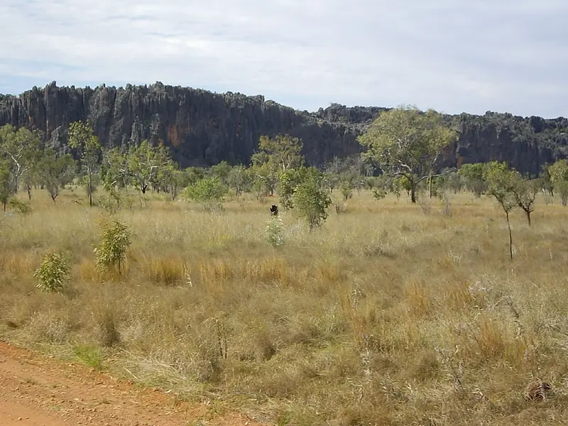
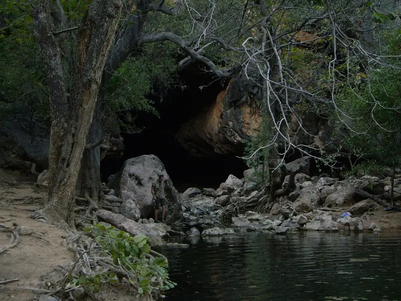
    Gorge in the limestone of an ancient reef on the Gibb River Road, about 145 km east of Derby. Along the Lennard River, dozens of freshwater crocodiles often bask in the sun. The access road is unpaved and only advisable during the dry season.
    Open in Google Maps
    Tunnel Creek

    Tunnel Creek

    Here, a creek has carved a tunnel approximately 750 m long through the Napier Range. You wade with a flashlight through the knee-deep water to the other end. The place is closely linked with the history of the Bunuba resistance fighter Jandamarra.
    Open in Google Maps
    Gibb River Road

    Gibb River Road

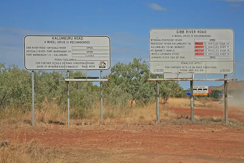
    This approximately 660 km long, mostly unpaved track between Derby and Kununurra traverses the Kimberley. Along the way are gorges like Bell Gorge, Manning Gorge, and El Questro. Only passable in the dry season and with a 4WD, plan at least one week.
    Open in Google Maps
    Horizontal Falls

    Horizontal Falls

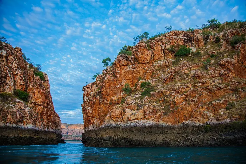
    In Talbot Bay, the enormous tidal range forces the sea through two narrow rock crevices, creating horizontal waterfalls. They are only accessible by seaplane, helicopter or boat, mostly on day trips from Broome or Derby.
    Open in Google Maps
    Mitchell Falls (Punamii-unpuu)

    Mitchell Falls (Punamii-unpuu)

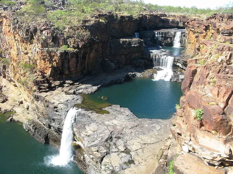
    Four-tiered waterfall on the remote Mitchell Plateau in the north of the Kimberley. A return hiking trail of about 8.6 km leads past rock art to the falls; alternatively, by helicopter. Access via unpaved tracks requires a well-equipped 4WD vehicle.
    Open in Google Maps

    Restaurants in Kimberley

    Matso's Broome Brewery

    Brewery with restaurant in a historic building in Broome, known for its mango beer and a menu featuring curries, fish, and pub dishes.
    Show on Google Maps

    Best Time to Visit

    When is the best time for your trip?

    May
    June
    July
    August
    September
    21–26°C·1–25 mm(little rain)
    The dry season from May to September is the only time when the Gibb River Road and most parks are reliably open. In May, the waterfalls still carry a lot of water; by September, it's already very hot.
    Data for Broome. Inland around Kununurra, it's hotter by day and more humid in the wet season.

    Seasons

    Jan
    Feb
    Mar
    Apr
    May
    Jun
    Jul
    Aug
    Sep
    Oct
    Nov
    Dec
    Dry season, Peak season
    Passage, very hot
    Rainy season, many tracks closed
    Best Time to Visit
    ▶Show detailed monthly data
    MonthTemp (°C)Rain (mm)
    January30.0180
    February30.0180
    March30.0100
    April28.025
    May25.025
    June22.020
    July21.07
    August23.02
    September26.01
    October28.01
    November30.010
    December30.060

    Culture & History

    Aboriginal Cultures of the KimberleyThe Kimberley is home to numerous Aboriginal groups, including Bunuba, Gija, Wunambal Gaambera, and Yawuru. Two renowned art styles can be found in the rocks: the intricate Gwion-Gwion figures and the large Wandjina spirits with their mouthless faces. Many communities run their own art centres, such as Warmun for Gija art.Pearls and ResistanceFrom the 1880s, Broome became the centre of pearling, with divers from Japan, Malaysia, and Indonesia, whose traces are still visible in the townscape today. In the interior, Windjana Gorge and Tunnel Creek commemorate Jandamarra, who led the Bunuba resistance against the colonists in the 1890s.

    Traveling in the Kimberley

    Broome and Kununurra have airports with connections to Perth and Darwin. The sealed Great Northern Highway, approximately 1,000 km long, runs between them.Gibb River Road: Approximately 660 km of mostly unsealed track, accessible only by 4WD during the dry season. Spare tyres, water, and several days' supplies are essential.Wet Season: From December to March, many tracks are closed and rivers swell. Some accommodations and parks close entirely.Scenic Flights: For Horizontal Falls, Mitchell Falls, and the Bungle Bungles, flight tours are often the easiest option.Crocodiles: Saltwater crocodiles inhabit rivers and coastal areas. Only swim in designated locations.

    Nearby

    Purnululu National Park

    Purnululu National Park

    Purnululu National Park, located in the east of the Kimberley, protects the Bungle Bungle Range, a field of striped sandstone domes that only became known outside the region in 1983. Since 2003, the park has been a UNESCO World Heritage site.Access is via a 53 km long 4WD track; the park is only open during the dry season. Many visitors therefore arrive by scenic flight from Kununurra.
    Kununurra

    Kununurra

    Kununurra, in the east of the Kimberley, was established in the 1960s as the heart of the Ord River Irrigation Scheme. Today, approximately 5,000 people reside here, surrounded by irrigated fields of mangos, melons, and sandalwood, Lake Kununurra, and the red rocks of Mirima National Park.The town is a starting point for Lake Argyle, the Bungle Bungles, and the eastern end of the Gibb River Road.
    Broome

    Broome

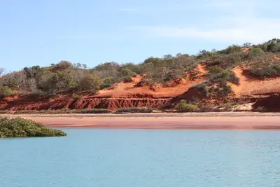
    Broome on Roebuck Bay, with 14,000 residents, is the Kimberley's largest town and western gateway. The town grew from pearl fishing; Chinatown, with tin buildings, pearl shops, and the Sun Pictures open-air cinema, tells the story.Cable Beach, red cliffs at Gantheaume Point, and a tidal range of up to 10 m characterize the surroundings. The dry season, May to October, is high season.
    Darwin

    Darwin

    Darwin is the tropical capital of the Northern Territory and the gateway to Kakadu and Litchfield. A relaxed coastal town with night markets, sunsets, and rich war history.
    Kakadu National Park

    Kakadu National Park

    Kakadu National Park in the north of the Northern Territory is Australia's largest national park, spanning nearly 20,000 km². It stretches from tidal rivers on the coast across vast wetlands to the Arnhem Plateau escarpment with its waterfalls.The park is listed as a natural and cultural heritage site on the UNESCO World Heritage List. The Bininj/Mungguy have lived here for at least 65,000 years, and their rock art at Ubirr and Burrunggui is among the most significant in the world.

    Sources & method

    • Photos: Wikimedia Commons, Unsplash. Each photo carries its credit.
    • The content is based on web research from public, traceable sources. How the content is made · The role of AI