Fernweh: Home
    ExploreTravel GuidesPlan a tripMy tripLast visited
    de|en
    All Places & RegionsAll highlightsAbout FernwehFAQPrivacy PolicyImprint
    ExploreTravel GuidesPlan a tripMy tripLast visited
    Uluru-Kata Tjuta National Park

    Australia

    Uluru-Kata Tjuta National Park

    National Park AreaNatureCulture

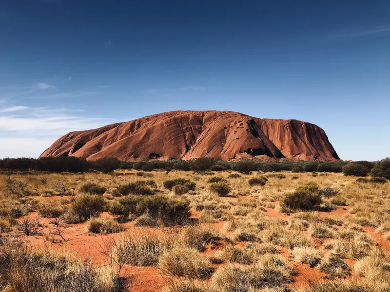
    The Uluru-Kata Tjuta National Park in the southwest of the Northern Territory protects Australia's two most famous rock formations: the monolith Uluru and the 36 domes of Kata Tjuta.

    by Felix Gillen

    1. Home
    2. Destinations
    3. Australia
    4. Red Centre
    5. Uluru-Kata Tjuta National Park
    The Uluru-Kata Tjuta National Park in the southwest of the Northern Territory protects Australia's two most famous rock formations: the monolith Uluru and the 36 domes of Kata Tjuta. The park is a UNESCO World Heritage site for both its natural and cultural heritage and is managed by the Anangu together with Parks Australia.The only accommodation nearby is the Ayers Rock Resort in the town of Yulara, about 20 km from Uluru.

    Sehenswürdigkeiten

    Discover the most important sights and attractions

    Caves at Uluṟu

    1Caves at Uluṟu

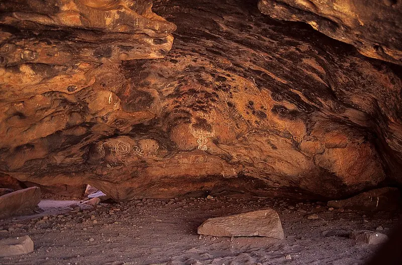
    Along the Base Walk, there are several shallow caves and rock shelters with Anangu rock paintings. They served as shelters, campsites, and places of instruction. Some sections are sacred and may not be photographed; on-site signs indicate where this applies.
    Open in Google Maps
    Uluṟu Car Sunset Viewing Area

    2Uluṟu Car Sunset Viewing Area

    The car park for passenger vehicles on Uluru's west side is the classic spot for sunset. Arrive at least 30 minutes beforehand; in peak season, the car park fills up fast.
    Open in Google Maps

    3Talinguṟu Nyakunytjaku - Uluṟu Sunrise Viewing Area

    Talinguṟu Nyakunytjaku is the sunrise viewpoint. From elevated platforms, you can see Uluru and Kata Tjuta in the distance simultaneously. Informative panels explain the plants and animals of the dune landscape. Arrive early; access opens before sunrise.
    Open in Google Maps
    Mutitjulu Waterhole

    4Mutitjulu Waterhole

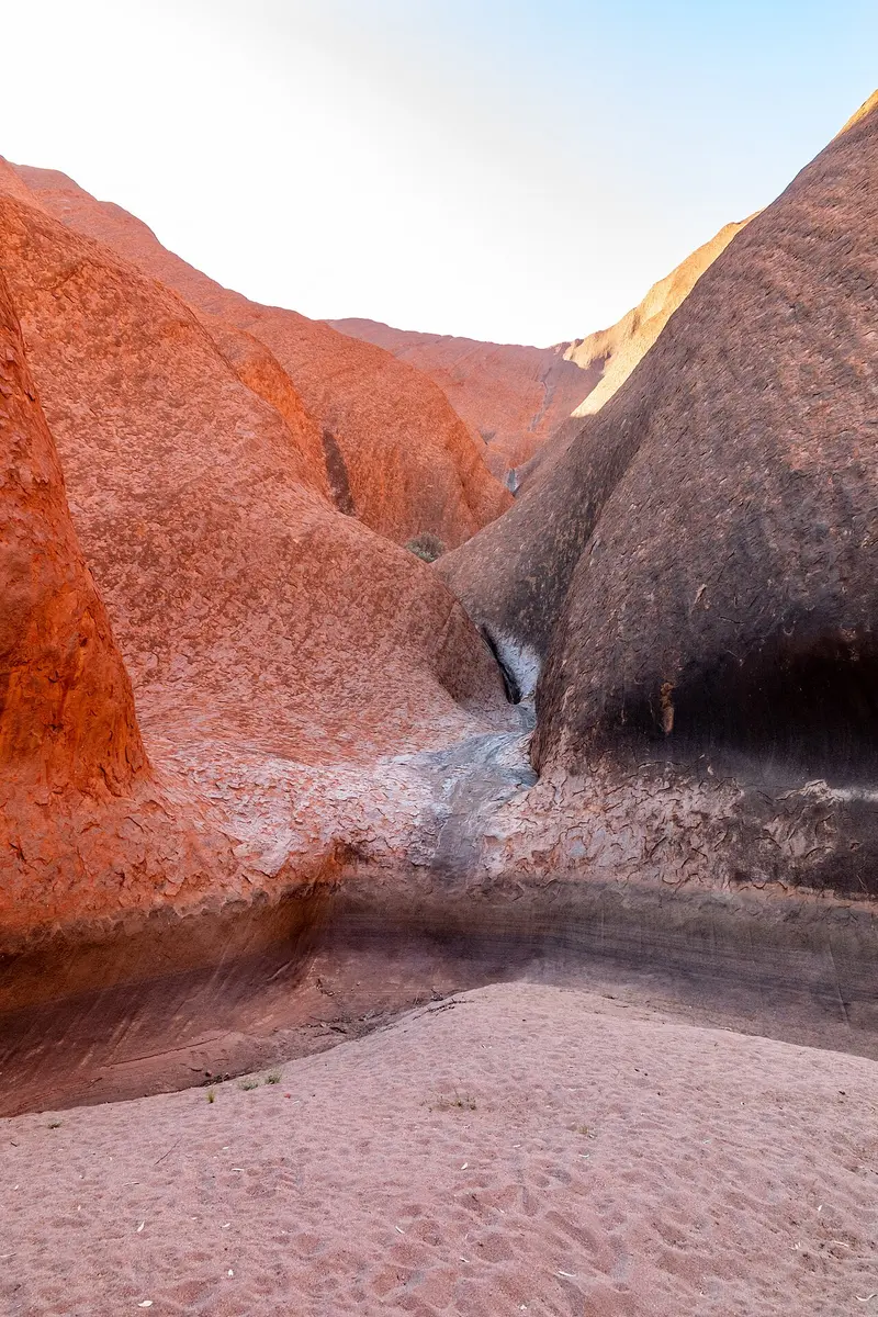
    Waterhole and sacred Aboriginal site located beneath Uluru, accessed by a path lined with trees and grasses.
    Open in Google Maps
    Uluru

    5Uluru

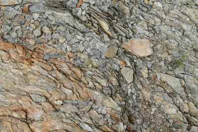
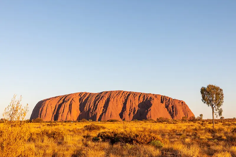
    The Uluru is a monolith of arkose sandstone, rising about 348 m above the plain and having a circumference of nearly 10 km. For the Anangu, it is a central place of the Tjukurpa. Since 2019, climbing has been forbidden. You can explore it on the Base Walk around the rock or on shorter sections like the Mala Walk and the Kuniya Walk to the Mutitjulu waterhole.
    Open in Google Maps

    6Walkatjara Art

    Walkatjara Art is an Anangu-led art centre within the park's cultural centre. Here, predominantly female artists from the Mutitjulu community work and sell their art, with provenance provided for each piece.
    Open in Google Maps

    Essen & Trinken

    1

    Kulata Academy Cafe

    Café on Yulara's Town Square, operated by trainees from the National Indigenous Training Academy. Coffee, sandwiches, and light meals.
    Show on Google Maps
    2

    Ilkari Restaurant

    Buffet restaurant at the Hotel Sails in the Desert with changing dishes made from Australian and local ingredients.
    Show on Google Maps
    3

    Bough House Restaurant

    Buffet restaurant at the Outback Hotel of Ayers Rock Resort, one of the more affordable options for a hot dinner in Yulara.
    Show on Google Maps
    4

    Outback BBQ & Bar

    Pub with a BBQ area in the resort's Outback Pioneer section. Choose your meat or fish at the counter and grill it yourself, often with live music in the evenings.
    Show on Google Maps
    5

    Mangata Bistro & Bar

    Bistro at Hotel Desert Gardens with breakfast, light lunches and dinner menu.
    Show on Google Maps
    6

    Geckos Cafe

    Casual restaurant at Yulara's Town Square with pizza, pasta, and Mediterranean dishes, inside and on the terrace.
    Show on Google Maps

    Culture & Tjukurpa

    Sacred Land of the AnanguFor the Anangu, every rock crevice and waterhole at Uluru is linked to Tjukurpa stories, sharing rules for community life, land, and nature. Some places are reserved for women or men and may not be photographed. Signs along the paths mark these areas.In 1985, the land was returned to the Traditional Owners and immediately leased back to the state. On October 26, 2019, climbing Uluru was permanently closed. The free Ranger tours on the Mala Walk are the best introduction to the park's culture.

    Exploring Locally

    From Yulara, paved roads lead to Uluru (approx. 20 km) and Kata Tjuta (approx. 50 km). A private car is most flexible; alternatively, shuttle buses and guided tours are available from the resort.Getting there: Ayers Rock Airport is located a few kilometers north of Yulara; from Alice Springs, it's approx. 450 km on the highway.Park Pass: 38 AUD per adult for three days, under 18s free. Available online or at the entrance.Heat: In summer, some paths are closed from 11 AM if 36 °C or more is forecast. Plan one liter of water per person per hour of hiking.Flies: From October to March, head fly nets are very helpful.

    Accommodations in Uluru-Kata Tjuta National Park

    Find perfect stay in Uluru-Kata Tjuta National Park

    Booking.com* (Affiliate link)
    Search Hotels
    Agoda* (Affiliate link)
    Search Hotels
    Airbnb
    Vacation Rentals

    * Affiliate link: if you book through it, we earn a small commission. The price stays the same for you.

    Nearby

    Watarrka National Park (Kings Canyon)

    Watarrka National Park (Kings Canyon)

    Watarrka National Park is located at the western end of the George Gill Range, approximately 300 km northeast of Uluru. Its most famous destination is Kings Canyon, a sandstone gorge with walls up to 100 m high and a spring-fed waterhole inside.The land is home to the Luritja people. Nearby are the Kings Canyon Resort and several farm-stay accommodations.
    West MacDonnell Ranges

    West MacDonnell Ranges

    The West MacDonnell Ranges, known as Tjoritja in Arrernte, stretch approximately 160 km west of Alice Springs. Between the parallel mountain ranges are gorges with permanent waterholes, including Simpsons Gap, Standley Chasm, Ellery Creek Big Hole, and Ormiston Gorge.The Namatjira Drive provides access to most destinations via a sealed road, while the Larapinta Trail leads on foot over the ridgeline.
    Alice Springs

    Alice Springs

    Alice Springs, Arrernte Mparntwe, is located almost exactly in the center of Australia, nestled between the MacDonnell Ranges. With around 25,000 residents, it is the largest town in the Outback and the starting point for tours to Uluru, Kings Canyon, and the West MacDonnell Ranges.The town itself is compact. Aboriginal art galleries, 1920s pioneer buildings, and the mostly dry riverbed of the Todd River define its center.
    Red Centre

    Red Centre

    The Red Centre, a desert region in the south of the Northern Territory, encompasses Alice Springs, Uluru, Kata Tjuta, and Kings Canyon. Red sand plains, rocky gorges, and waterholes in the MacDonnell Ranges define its landscape.For tens of thousands of years, the region has been home to the Arrernte, Anangu, and Luritja. Their culture is evident daily, in art centres, guided walks, and the rules at sacred sites.
    Purnululu National Park

    Purnululu National Park

    Purnululu National Park, located in the east of the Kimberley, protects the Bungle Bungle Range, a field of striped sandstone domes that only became known outside the region in 1983. Since 2003, the park has been a UNESCO World Heritage site.Access is via a 53 km long 4WD track; the park is only open during the dry season. Many visitors therefore arrive by scenic flight from Kununurra.

    Sources & method

    • Photos: Wikimedia Commons, Unsplash, Pexels. Each photo carries its credit.
    • Place data such as addresses and ratings comes from Google Maps.
    • The content is based on web research from public, traceable sources. How the content is made · The role of AI