Fernweh: Home
    ExploreTravel GuidesPlan a tripMy tripLast visited
    de|en
    All Places & RegionsAll highlightsAbout FernwehFAQPrivacy PolicyImprint
    ExploreTravel GuidesPlan a tripMy tripLast visited
    Watarrka National Park (Kings Canyon)

    Australia

    Watarrka National Park (Kings Canyon)

    National Park AreaNature

    Watarrka National Park is located at the western end of the George Gill Range, approximately 300 km northeast of Uluru.

    by Felix Gillen

    1. Home
    2. Destinations
    3. Australia
    4. Red Centre
    5. Watarrka National Park (Kings Canyon)
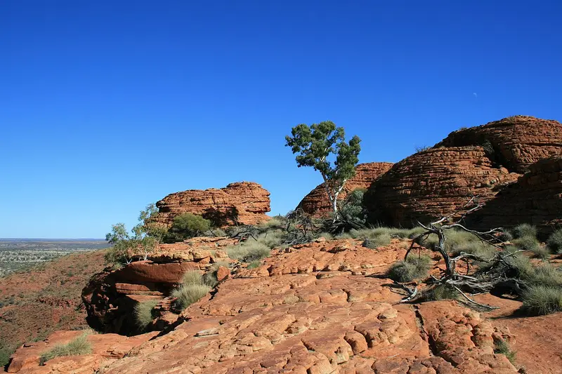
    Watarrka National Park is located at the western end of the George Gill Range, approximately 300 km northeast of Uluru. Its most famous destination is Kings Canyon, a sandstone gorge with walls up to 100 m high and a spring-fed waterhole inside.The land is home to the Luritja people. Nearby are the Kings Canyon Resort and several farm-stay accommodations.

    Sehenswürdigkeiten

    Discover the most important sights and attractions

    Kings Canyon Rim Walk

    1Kings Canyon Rim Walk

    The Rim Walk is a circular trail of around 6 km over the canyon rim. After a steep initial climb, you'll see the domes of the Lost City, views into vertical walls, and descend to the Garden of Eden, a waterhole with cycads. Allow three to four hours. The trail closes from 9 AM if temperatures are forecast at 36 °C or more.
    Open in Google Maps
    Kings Canyon

    2Kings Canyon

    Kings Canyon is a gorge in the sandstone of the George Gill Range, with walls dropping vertically for up to 100 m. In its protected base, plants grow that are otherwise not found in the surrounding desert. For the Luritja, the Traditional Owners, this area has been a habitat for millennia.
    Open in Google Maps

    3Kings Canyon Creek Walk

    The Kings Creek Walk covers about 2.6 km return, leading through the creek bed at the bottom of the canyon to a viewing platform. Flat, achievable in about an hour, and a good alternative if the Rim Walk is closed due to heat.
    Open in Google Maps

    Essen & Trinken

    1

    Kings Canyon Bar & Grill

    Restaurant with grilled dishes at Kings Canyon Resort, one of the only places to eat for over 100 km around.
    Show on Google Maps

    Culture & Nature

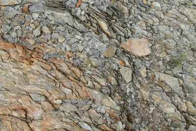
    The Luritja have used the area for at least 20,000 years. Springs and waterholes like Kathleen Springs were vital in the arid environment and are still connected with stories and obligations today. Some Luritja families continue to live in the park.The geological structure is clearly visible: On the Rim Walk, you walk over fossilized ripple marks of a prehistoric seabed, the domes of the Lost City were formed by erosion.

    Arrival & Tips

    The park can be reached via sealed roads from Yulara (approx. 300 km) and Alice Springs (approx. 470 km). There is no regular bus service; multi-day tours are the alternative to a rental car.Start early: The Rim Walk is only accessible until 9 AM in high heat; in winter, early morning is most pleasant.Refuel: At the resort and roadhouses along the way; distances are considerable.Mereenie Loop: The unpaved track to Hermannsburg and the West MacDonnell Ranges requires a 4WD vehicle and a permit.

    Accommodations in Watarrka National Park (Kings Canyon)

    Find perfect stay in Watarrka National Park (Kings Canyon)

    Booking.com* (Affiliate link)
    Search Hotels
    Agoda* (Affiliate link)
    Search Hotels
    Airbnb
    Vacation Rentals

    * Affiliate link: if you book through it, we earn a small commission. The price stays the same for you.

    Nearby

    Uluru-Kata Tjuta National Park

    Uluru-Kata Tjuta National Park

    The Uluru-Kata Tjuta National Park in the southwest of the Northern Territory protects Australia's two most famous rock formations: the monolith Uluru and the 36 domes of Kata Tjuta. The park is a UNESCO World Heritage site for both its natural and cultural heritage and is managed by the Anangu together with Parks Australia.The only accommodation nearby is the Ayers Rock Resort in the town of Yulara, about 20 km from Uluru.
    West MacDonnell Ranges

    West MacDonnell Ranges

    The West MacDonnell Ranges, known as Tjoritja in Arrernte, stretch approximately 160 km west of Alice Springs. Between the parallel mountain ranges are gorges with permanent waterholes, including Simpsons Gap, Standley Chasm, Ellery Creek Big Hole, and Ormiston Gorge.The Namatjira Drive provides access to most destinations via a sealed road, while the Larapinta Trail leads on foot over the ridgeline.
    Alice Springs

    Alice Springs

    Alice Springs, Arrernte Mparntwe, is located almost exactly in the center of Australia, nestled between the MacDonnell Ranges. With around 25,000 residents, it is the largest town in the Outback and the starting point for tours to Uluru, Kings Canyon, and the West MacDonnell Ranges.The town itself is compact. Aboriginal art galleries, 1920s pioneer buildings, and the mostly dry riverbed of the Todd River define its center.
    Red Centre

    Red Centre

    The Red Centre, a desert region in the south of the Northern Territory, encompasses Alice Springs, Uluru, Kata Tjuta, and Kings Canyon. Red sand plains, rocky gorges, and waterholes in the MacDonnell Ranges define its landscape.For tens of thousands of years, the region has been home to the Arrernte, Anangu, and Luritja. Their culture is evident daily, in art centres, guided walks, and the rules at sacred sites.
    Purnululu National Park

    Purnululu National Park

    Purnululu National Park, located in the east of the Kimberley, protects the Bungle Bungle Range, a field of striped sandstone domes that only became known outside the region in 1983. Since 2003, the park has been a UNESCO World Heritage site.Access is via a 53 km long 4WD track; the park is only open during the dry season. Many visitors therefore arrive by scenic flight from Kununurra.

    Sources & method

    • Photos: Wikimedia Commons, Pexels. Each photo carries its credit.
    • Place data such as addresses and ratings comes from Google Maps.
    • The content is based on web research from public, traceable sources. How the content is made · The role of AI