Fernweh: Home
    ExploreTravel GuidesPlan a tripMy tripLast visited
    de|en
    All Places & RegionsAll highlightsAbout FernwehFAQPrivacy PolicyImprint
    ExploreTravel GuidesPlan a tripMy tripLast visited
    • Overview
    • Places in the region
    • Eat & drink
    • Food culture
    • Best travel time
    • Culture
    • Getting around
    • Round trips
    • Nearby
    Whitsunday Islands

    Australia

    Whitsunday Islands

    Region

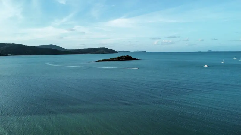
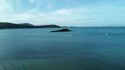
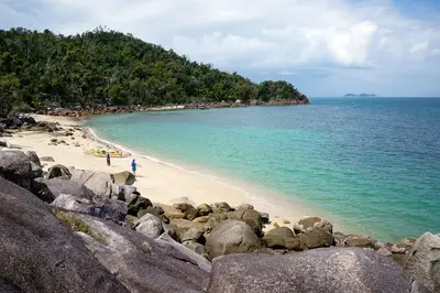
    74 islands in the heart of the Great Barrier Reef, most uninhabited and national park. Explore them by sailboat, ferry, or day trip from Airlie Beach.

    by Felix Gillen

    1. Home
    2. Destinations
    3. Australia
    4. Whitsunday Islands
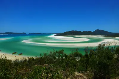
    74 islands in the heart of the Great Barrier Reef, most uninhabited and national park. Explore them by sailboat, ferry, or day trip from Airlie Beach. Whitehaven Beach is famous for its almost pure white quartz sand.
    Airlie Beach is the mainland base; from there, ferries and sailing tours depart for the islands. Hamilton Island has its own airport and the widest range of resorts. Whitsunday Island and Hook Island are almost uninhabited and only accessible by boat, kayak, or seaplane. Many visitors book a two- to three-day sailing trip and sleep on board. The most pleasant time is from May to October.
    Airlie Beach

    Place 1 of 4

    Airlie Beach

    Small coastal town and hub for almost all Whitsunday Islands tours. Days are all about boats; evenings about the bars on Shute Harbour Road.

    Discover
    Hamilton Island

    Place 2 of 4

    Hamilton Island

    The most famous resort island in the Whitsundays, with its own airport and no cars. You get around by golf buggy or island shuttle between the harbour, hotels, and Catseye Beach.

    Discover
    Hook Island

    Place 3 of 4

    Hook Island

    The second-largest island of the Whitsundays is almost entirely National Park and uninhabited. Steep, forested slopes drop into deep bays.

    Discover
    Whitsunday Island

    Place 4 of 4

    Whitsunday Island

    The largest island of the Whitsundays is uninhabited and almost entirely a national park. On its east coast lies Whitehaven Beach, and in the north, the lookout over Hill Inlet.

    Discover

    Sights in Whitsunday Islands

    Discover the most important sights and attractions

    Whitsunday Islands National Park

    The national park covers most of the islands, including Whitsunday, Hook and the Molle Islands. Bushwalking trails, basic campsites and bays for anchoring. For camping, you need a permit from Queensland Parks.
    Open in Google Maps
    Whitehaven Beach

    Whitehaven Beach

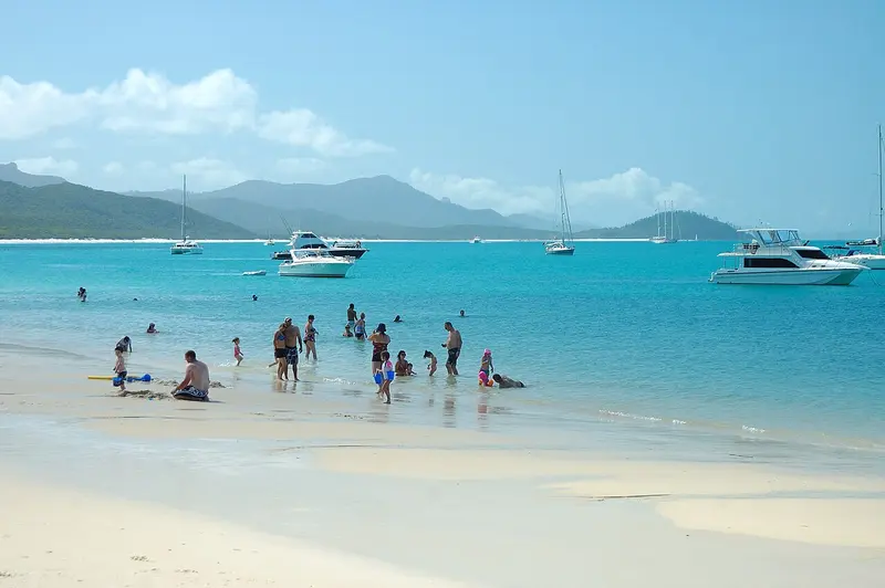
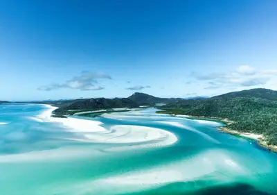
    Seven kilometers of almost pure quartz sand beach on Whitsunday Island's east coast. The sand remains cool even in the sun. Only accessible by boat, seaplane, or helicopter.
    Open in Google Maps
    Hill Inlet Lookout

    Hill Inlet Lookout

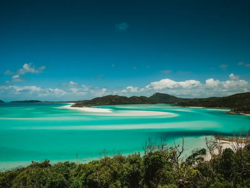
    Lookout point at the north end of Whitehaven Beach. At low tide, white sand and turquoise water blend into patterns that look different every hour. Short climb from Tongue Point.
    Open in Google Maps
    Heart Reef

    Heart Reef

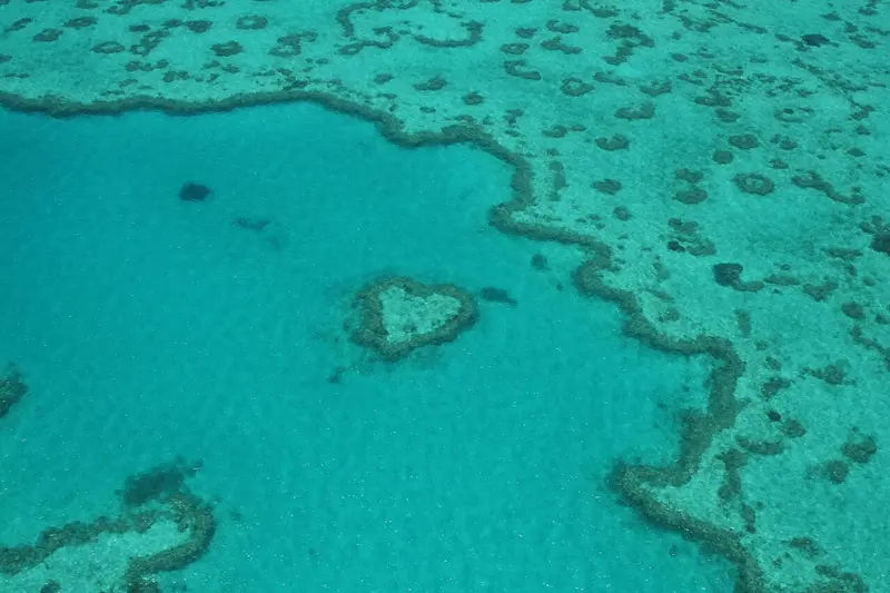
    Small heart-shaped reef on the outer Great Barrier Reef, about an hour's flight from the islands. Visible only from air, scenic flights depart from Hamilton Island and Airlie Beach.
    Open in Google Maps

    Nara Inlet

    A deep-cut, sheltered bay on the south side of Hook Island. Popular anchorage for sailboats. A short path leads to a cave with Ngaro rock paintings.
    Open in Google Maps

    Essen & Trinken

    Coral Sea Resort

    Cozy rooms in an exclusive beach hotel with pools, cafés, and restaurants.
    Show on Google Maps

    Food and Drink

    You'll find most places in Airlie Beach and on Hamilton Island. On sailing trips, the crew cooks on board.

    Oceanic Food

    Prawns, barramundi, and coral trout are on almost every menu. In Airlie Beach, you can also get them freshly caught for takeaway.

    Sundowner

    A sunset drink is a must here, whether at the lagoon in Airlie Beach or on deck at anchor.

    Best Time to Visit

    When is the best time for your trip?

    May
    June
    July
    August
    September
    October
    20–25°C·15–80 mm(little rain)
    May to October is dry and warm, with calm seas and good underwater visibility. Humpback whales pass through the passage from July to September.
    November to May is jellyfish season; swim only in a Stinger Suit. Cyclones can cancel tours between December and March.

    Seasons

    Jan
    Feb
    Mar
    Apr
    May
    Jun
    Jul
    Aug
    Sep
    Oct
    Nov
    Dec
    Dry season
    Rainy season and cyclone season
    Bridging time
    Best Time to Visit
    ▶Show detailed monthly data
    MonthTemp (°C)Rain (mm)Sun (h)
    January28.03007.0
    February28.03307.0
    March27.02507.0
    April25.01207.0
    May23.0807.0
    June21.0507.0
    July20.0358.0
    August21.0259.0
    September23.0159.0
    October25.0259.0
    November26.0559.0
    December27.01508.0

    Culture & History

    Land of the NgaroThe Ngaro lived on the islands for millennia, travelling between them in bark canoes. On Hook Island, rock paintings are preserved in Nara Inlet. The Ngaro Sea Trail connects hiking trails on several islands.Pentecost and SailingJames Cook sailed through the passage in 1770, naming it after Pentecost Sunday, which he believed was the day. Today, the islands are one of Australia's most important sailing regions. Every August, a major regatta takes place off Hamilton Island.

    Getting Here & Around

    Airports are located on Hamilton Island and in Proserpine, half an hour from Airlie Beach. From Airlie Beach, ferries depart several times daily to Hamilton Island and the resort islands.Sailing Trip: The classic way to see several islands. Choices range from backpacker boats to small luxury yachts.Bareboat: With sailing experience, you can charter a boat without a skipper.Day Trips: Speedboats travel to Whitehaven Beach and Hill Inlet in one day.From November to May is jellyfish season. When swimming, you'll wear a Stinger Suit, provided by the operators.

    Round trips through this region

    Relaxed Australia East Coast

    Relaxed Australia East Coast

    The route takes a good three weeks for the East Coast: Byron Bay, Noosa, the sand island K'gari, the Whitsundays from Airlie Beach, and tranquil Mission Beach between rainforest and reef. At each location, you stay three to four nights. Long travel days are between Sydney and Byron Bay (approx. 770 kilometers) and between K'gari and Airlie Beach (approx. 1,000 kilometers); you break them up with a stopover or shorten them with a domestic flight.

    23 Days
    6 stops

    Nearby

    Whitsunday Island

    Whitsunday Island

    The largest island of the Whitsundays is uninhabited and almost entirely a national park. On its east coast lies Whitehaven Beach, and in the north, the lookout over Hill Inlet. To the west, Cid Harbour offers protected anchorages and a hiking trail to the highest peak.
    Hamilton Island

    Hamilton Island

    The most famous resort island in the Whitsundays, with its own airport and no cars. You get around by golf buggy or island shuttle between the harbour, hotels, and Catseye Beach. From here, boats depart for Whitehaven Beach and the outer reef.
    Hook Island

    Hook Island

    The second-largest island of the Whitsundays is almost entirely National Park and uninhabited. Steep, forested slopes drop into deep bays. Along the north coast are some of the region's best snorkeling spots.

    Airlie Beach

    Small coastal town and hub for almost all Whitsunday Islands tours. Days are all about boats; evenings about the bars on Shute Harbour Road. Instead of swimming in the sea, you swim in the large lagoon on the shore.
    Mission Beach

    Mission Beach

    Four small towns on a roughly 14-kilometer long beach between Cairns and Townsville. The rainforest almost reaches the water, and Dunk Island lies off the coast. It's quieter here than in Cairns or Port Douglas, and with a bit of luck, you'll spot cassowaries by the roadside.

    Sources & method

    • Photos: Wikimedia Commons, Unsplash. Each photo carries its credit.
    • Place data such as addresses and ratings comes from Google Maps.
    • The content is based on web research from public, traceable sources. How the content is made · The role of AI