Fernweh: Home
    ExploreTravel GuidesPlan a tripMy tripLast visited
    de|en
    All Places & RegionsAll highlightsAbout FernwehFAQPrivacy PolicyImprint
    ExploreTravel GuidesPlan a tripMy tripLast visited
    • Overview
    • Places in the region
    • Food culture
    • Culture
    • Getting around
    • Nearby
    Norte Grande (Altiplano)
    Pablo Montecinos / Wikimedia Commons / CC BY-SA 4.0

    Chile

    Norte Grande (Altiplano)

    Region

    Chile's far north connects the coastal cities of Arica and Iquique with the Altiplano in Arica y Parinacota and Tarapacá.

    by Felix Gillen

    1. Home
    2. Destinations
    3. Chile
    4. Norte Grande (Altiplano)
    Chile's far north connects the coastal cities of Arica and Iquique with the Altiplano in Arica y Parinacota and Tarapacá. Between the Pacific and the Bolivian border, the land rises from the desert to over 4,500 meters, with volcanoes, highland lagoons, Aymara villages, and the traces of the Saltpeter Era.
    The Norte Grande encompasses Chile's two northernmost regions: Arica y Parinacota and Tarapacá. The coastal cities of Arica and Iquique, with their airports, beaches, and good infrastructure, are the gateways for journeys inland. Inland, the Pampa del Tamarugal stretches out, with abandoned saltpeter works, oases like Pica, and pre-Columbian geoglyphs. Via Ruta 11, you ascend from Arica through the Lluta Valley to Putre, a crucial stop for acclimatization before visiting Parque Nacional Lauca, home to Lago Chungará and Salar de Surire. The Altiplano is home to Aymara communities, whose adobe and stone churches dot nearly every village. As many destinations are over 4,000 meters high, plan your ascent in stages.
    Arica
    Luciajimena1990 / Wikimedia Commons / CC BY-SA 4.0

    Place 1 of 4

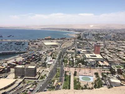
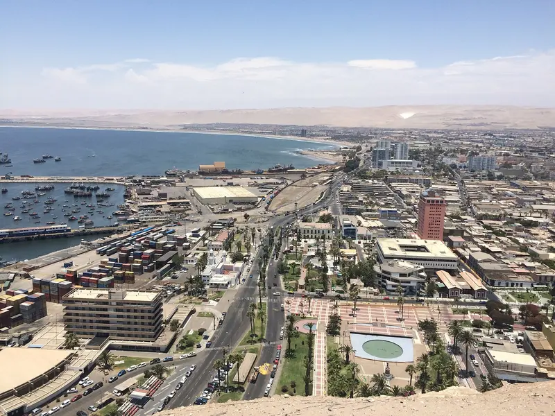
    Arica

    Arica is Chile's northernmost major city, just 20 kilometers from the Peruvian border.

    Discover
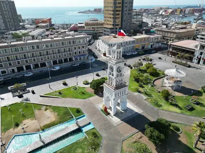
    Iquique

    Place 2 of 4

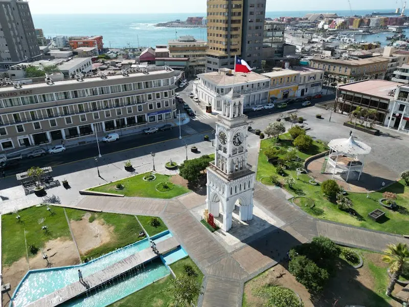
    Iquique

    Iquique is the capital of the Tarapacá Region and lies on a narrow coastal strip beneath a steep desert escarpment.

    Discover
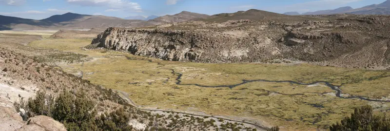
    Parque Nacional Lauca
    PeladínSinOlfato / Wikimedia Commons / CC BY-SA 3.0

    Place 3 of 4

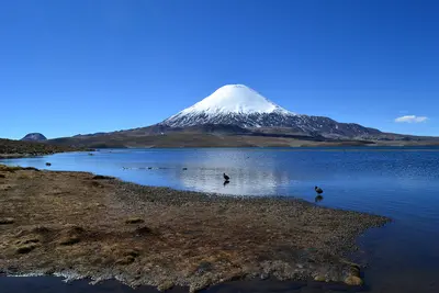
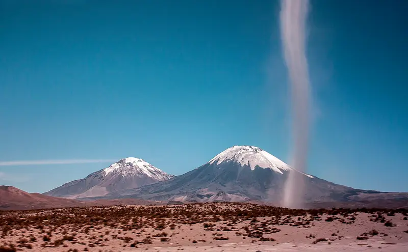
    Parque Nacional Lauca

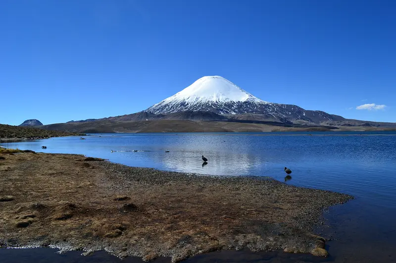
    The National Park protects approximately 1,379 square kilometers of Altiplano between Putre and the Bolivian border. Established in 1965 as a forest reserve, it became a National Park in 1970 and has been part of the UNESCO Lauca Biosphere Reserve since 1981.

    Discover
    Putre
    WeHaKa / Wikimedia Commons / CC BY-SA 4.0

    Place 4 of 4

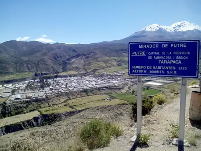
    Putre

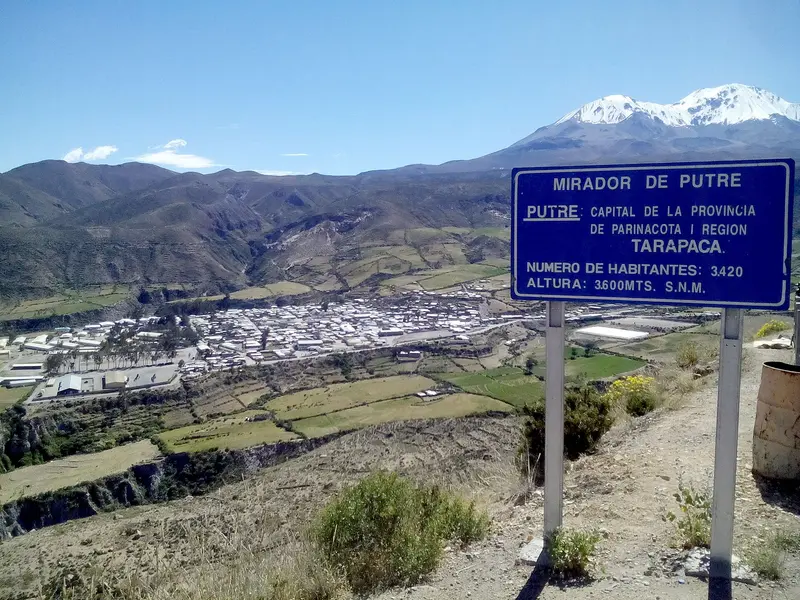
    Putre is located at around 3,500 meters altitude on Ruta 11 and is the main town of Parinacota Province. This Aymara village, with its colonial church and old cultivation terraces, is the usual stop for acclimatization before Lauca National Park.

    Discover

    More places in Norte Grande (Altiplano)

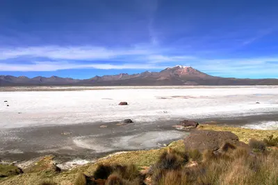
    Salar de Surire

    Salar de Surire

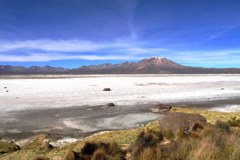
    The Salar de Surire lies at around 4,200 meters, south of Lauca National Park. The white salt flat with its shallow lagoons is a breeding ground for three flamingo species and has been protected as a Ramsar wetland since 1996.

    Sights in Norte Grande (Altiplano)

    Discover the most important sights and attractions

    Humberstone and Santa Laura

    Humberstone and Santa Laura

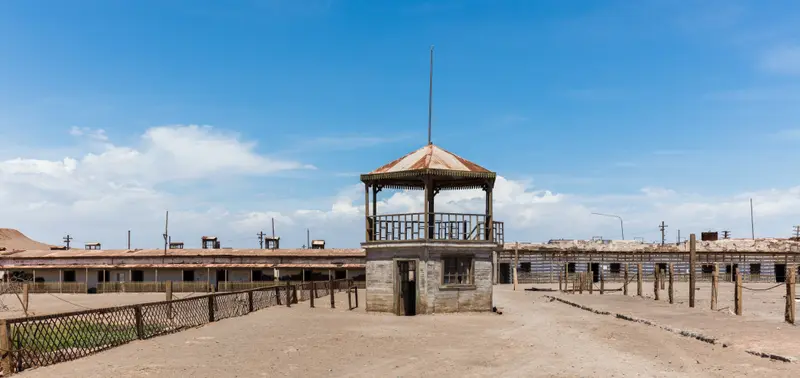
    The two abandoned saltpeter works in the Pampa east of Iquique have been a UNESCO World Heritage site since 2005. In Humberstone, you walk through workers' houses, a theatre, a swimming pool, and a market hall of an entire company town; in Santa Laura, the processing plant still stands.
    Open in Google Maps
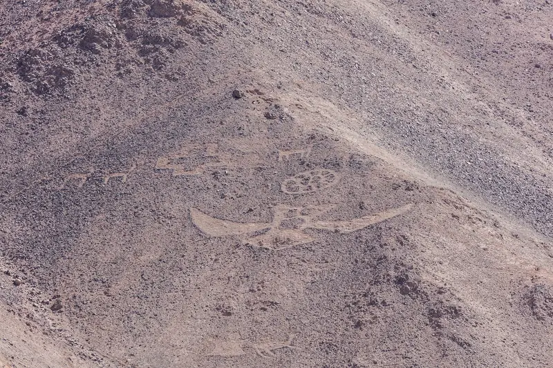
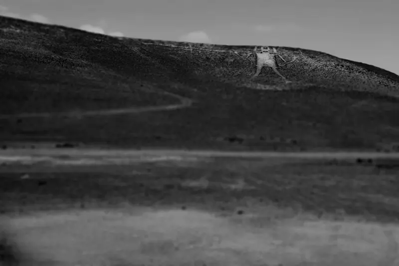
    Gigante de Atacama (Cerro Unita)

    Gigante de Atacama (Cerro Unita)

    The human-like figure on Cerro Unita's northwest slope, some 15km from Huara, measures between 86 and 119 meters (source-dependent) and is considered one of the largest known geoglyphs. Around 20 other figures lie on the hill, attributed to cultures between approximately 1000 and 1400 AD. You view the geoglyphs from the foot of the hill; entry is forbidden.
    Open in Google Maps
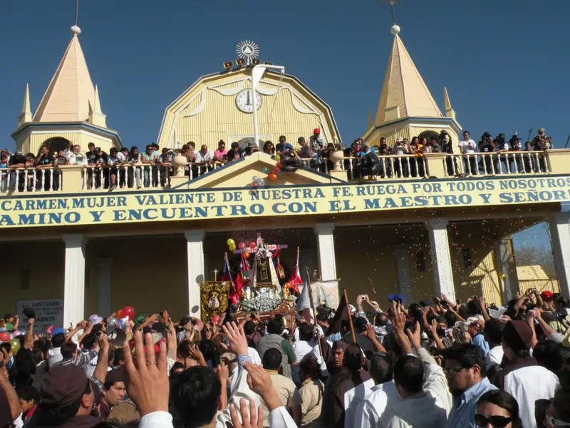
    Sanctuary of La Tirana

    Sanctuary of La Tirana

    The small Pampadorf, with its pilgrimage church of the Virgen del Carmen, is quiet for most of the year. Around July 16th, the day of the Virgen del Carmen, it becomes the stage for the Fiesta de La Tirana: For about ten days, around 200 religious dance groups in masked costumes dance before the sanctuary, and several hundred thousand visitors come each year. In 2026, the festival lasted from July 10th to 20th.
    Open in Google Maps
    Volcán Isluga National Park

    Volcán Isluga National Park

    The National Park in the Altiplano of the Colchane municipality encompasses the Isluga Volcano, highland lagoons like Laguna de Arabilla, and Aymara villages. The Church of Isluga is a Monumento Histórico; the village and church continue to serve as a ceremonial center for festivals blending Andean and Christian traditions. The park is home to vicuñas, guanacos, and the three flamingo species of the Altiplano. The CONAF station is in Enquelga; from Iquique, it's about a four-hour drive.
    Open in Google Maps
    Geoglyphs of Cerro Pintados

    Geoglyphs of Cerro Pintados

    On the eastern slope of the Sierra de Pintados in the Pampa del Tamarugal National Reserve are some 500 geoglyphs in about 60 groups, dating from approx. 900-1500 AD. You'll see geometric patterns, llama caravans, people, and animals, believed to mark caravan routes between the highlands and the coast. Chile nominated the site in 2025 for the UNESCO World Heritage List.
    Open in Google Maps
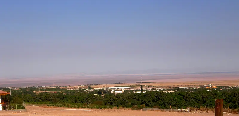
    Pica (Oasis)

    Pica (Oasis)

    The oasis town, at around 1100 meters altitude, is known for its orchards and the small, sour Limón de Pica with protected designation of origin. A popular stop is the thermal spring Cocha Resbaladero, where you can bathe at about 40 degrees in the middle of the desert.
    Open in Google Maps

    Food & Drink in Norte Grande

    The cuisine of the North combines fish and seafood from the coast with ingredients from the oasis valleys and the highlands.

    Aceitunas de Azapa

    The olives from the Azapa Valley near Arica bear a Protected Geographical Indication and are offered in markets, as a side dish, and as olive oil.

    Limón de Pica

    The small limes from Pica Oasis hold a Protected Geographical Indication, used in cooking, baking, and drinks.

    Orégano de Putre and Maíz lluteño

    Also, the oregano from Putre's Pre-Cordillera and the corn from the Lluta Valley are protected as geographical indications.

    Charqui, Chuño and Quinoa

    Dried meat, freeze-dried potatoes, and quinoa are staples of Andean cuisine in Aymara villages, for example, in the festive stew Calapurca.

    Culture and Heritage of the Altiplano

    The history of the Norte Grande dates back a long way. On the coast near Arica and Camarones lived the Chinchorro culture, whose artificially mummified dead are among the oldest in the world and have been a UNESCO World Heritage site since 2021. In the Pampa del Tamarugal, later societies created large geoglyphs between approximately 900 and 1500 AD, for example in Pintados, which presumably marked caravan routes between the highlands and the coast.In the Altiplano today, mainly Aymara communities live, raising llamas and alpacas and cultivating potatoes, quinoa, and oregano on ancient terraces. With the Spanish, 17th and 18th century adobe and stone churches appeared in almost every village, like Putre, Socoroma, Parinacota, and Isluga. Catholic festivals here merge with Andean customs, such as offerings for Pachamama, Mother Earth.In the 19th and early 20th centuries, nitrate mining shaped the Pampa. The company towns of Humberstone and Santa Laura, a UNESCO World Heritage site since 2005, and Iquique's wooden architecture stand as testament to this. The region's largest festival is the Fiesta de La Tirana in July, honoring the Virgen del Carmen, where masked dance groups perform for days before the sanctuary.

    Traveling in Norte Grande

    Getting There and Main RoutesArica and Iquique have their own airports with connections to Santiago. The Panamericana (Ruta 5) runs along the coast and through the Pampa, with long-distance buses connecting the cities. From Arica, Ruta 11 leads for about 190 kilometers through the Lluta Valley to Putre, through Parque Nacional Lauca and up to the Chungará–Tambo Quemado border crossing to Bolivia.In the AltiplanoPublic transport to the highlands is rare. Small buses go to Putre, but beyond that, you'll need a rental car or a guided tour.Rental Car: For Salar de Surire and the side roads in the Altiplano, a vehicle with high ground clearance is recommended, as tracks are often unpaved.Traffic: Ruta 11 sees many trucks heading to Bolivia, so plan your overtaking maneuvers carefully on curves.Fuel Stations: Beyond Arica, Iquique, and Pozo Almonte, supplies are scarce, so fill up your tank and water supplies before ascending.Altitude: Stay at least one night in Putre before continuing towards Chungará.

    Nearby

    Salar de Surire

    Salar de Surire

    The Salar de Surire lies at around 4,200 meters, south of Lauca National Park. The white salt flat with its shallow lagoons is a breeding ground for three flamingo species and has been protected as a Ramsar wetland since 1996.
    Iquique

    Iquique

    Iquique is the capital of the Tarapacá Region and lies on a narrow coastal strip beneath a steep desert escarpment. Wooden houses from the saltpeter era, long beaches, and the Zofri Free Trade Zone characterize the city, which is also the starting point for Humberstone and the oases of the Pampa.
    Arica

    Arica

    Arica is Chile's northernmost major city, just 20 kilometers from the Peruvian border. The port city at the foot of the Morro is known for its mild climate, its beaches, and the Chinchorro mummies, and serves as a starting point for ascending into the Altiplano.
    Parque Nacional Lauca

    Parque Nacional Lauca

    The National Park protects approximately 1,379 square kilometers of Altiplano between Putre and the Bolivian border. Established in 1965 as a forest reserve, it became a National Park in 1970 and has been part of the UNESCO Lauca Biosphere Reserve since 1981. Volcanoes, Lago Chungará, wet highland meadows, and Aymara villages like Parinacota shape the landscape at elevations between about 3,200 and 6,342 meters.
    Putre

    Putre

    Putre is located at around 3,500 meters altitude on Ruta 11 and is the main town of Parinacota Province. This Aymara village, with its colonial church and old cultivation terraces, is the usual stop for acclimatization before Lauca National Park.

    Sources & method

    • Photos: Wikimedia Commons. Each photo carries its credit.
    • The content is based on web research from public, traceable sources. How the content is made · The role of AI