Fernweh: Home
    ExploreTravel GuidesPlan a tripMy tripLast visited
    de|en
    All Places & RegionsAll highlightsAbout FernwehFAQPrivacy PolicyImprint
    ExploreTravel GuidesPlan a tripMy tripLast visited
    • Neighborhoods & highlights
    • Walking tours
    • Eat & drink
    • Food culture
    • Culture
    • Getting around
    • Accommodation
    • Plan trip
    • Nearby
    Leros

    Greece

    Leros

    City

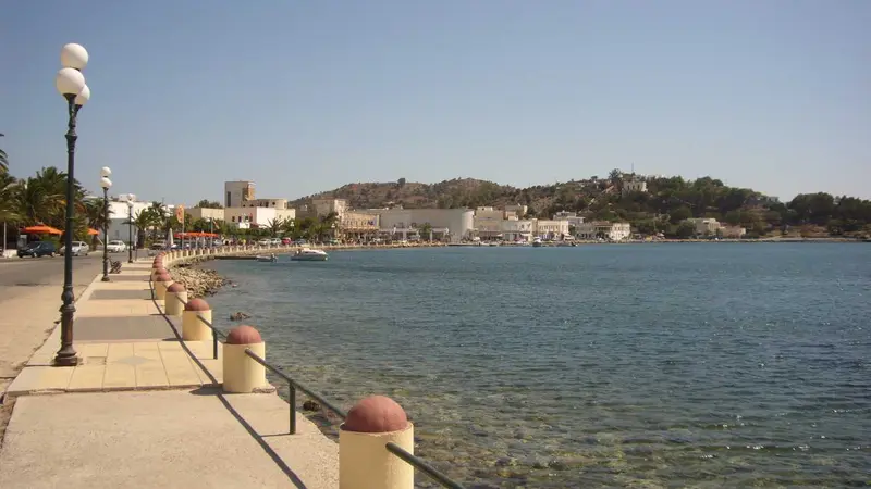
    Leros is an island whose main ferry port is shaped by Italian Rationalism: Lakki, then Portolago, was built in the 1930s as a planned town for the naval base, with round arches, arcades, and wide avenues.

    by Felix Gillen

    1. Home
    2. Destinations
    3. Greece
    4. Dodecanese
    5. Leros
    Leros is an island whose main ferry port is shaped by Italian Rationalism: Lakki, then Portolago, was built in the 1930s as a planned town for the naval base, with round arches, arcades, and wide avenues. Additionally, there are bunkers, tunnels, and a war museum dedicated to the Battle of Leros of 1943.There are also swimming coves, but the island is particularly worthwhile for people who want to read history in the streetscape and are looking for an island without large hotel complexes.

    Sights in Leros

    Discover the most important sights and attractions

    1Italian ammunition tunnels

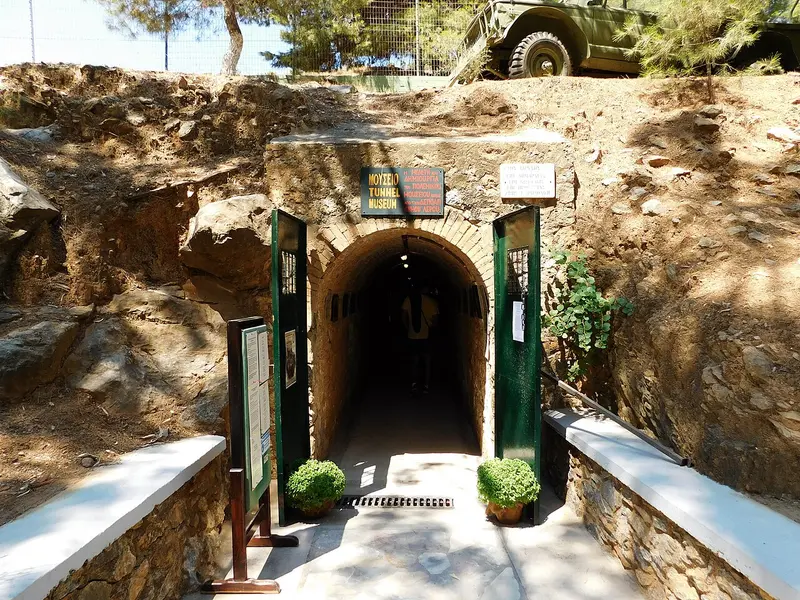
    The Italian Navy dug many tunnels into the slopes around Lakki port to protect ammunition, fuel, and equipment from air raids. Some still bear the carved inscription Deposito di Guerra. Part of the facilities is accessible; others are locked or collapsed. Today, one of the tunnels houses the War Museum in Merikia.
    Open in Google Maps

    2Velanidia Bay

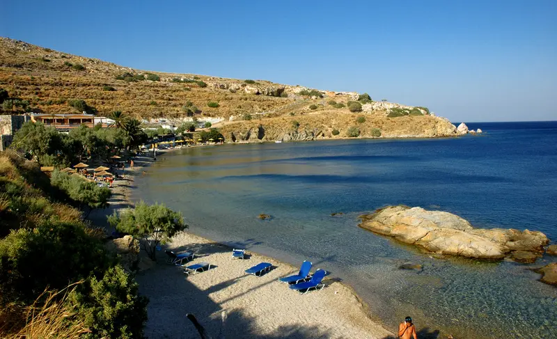
    Velanidia is a small bathing bay on the east coast of Leros, south of Panteli and Vromolithos. The beach features sand and fine shingle, with pebbles and rocks in the water. Trees along the shore provide natural shade. The beach is unorganized, meaning no sunbeds or amenities are available. It can be reached via the coastal road south of Panteli.
    Open in Google Maps
    Dyo Liskaria

    3Dyo Liskaria

    North of Alinda are two small pebble coves side by side, separated by a rocky ridge. The water deepens fast and is clear; the bottom is gravel and smooth slabs. A beach bar serves the front cove; the rear usually stays empty. Access is via a side road off Alinda's coastal road.
    Open in Google Maps
    The War Museum in Merikia

    4The War Museum in Merikia

    The museum is located in a tunnel hewn into the rock, which the Italian Navy constructed. On display are weapons, uniforms, radios, and wreckage from the Battle of Leros in November 1943, when German paratroopers and landing forces captured the island from British and Italian units. It's cool inside the tunnel even in summer. It's on the road between Lakki and Agia Marina.
    Open in Google Maps
    Panteli

    5Panteli

    The fishing village below Kastro comprises a row of houses on a small bay; Kaikis lie directly before the tavernas. The narrow beach is partly shingle and sheltered. A stepped path ascends from here to Platanos and on to the castle. Evenings find the quay the island's liveliest spot.
    Open in Google Maps
    Lakki

    6Lakki

    The place was re-planned in the 1930s under Italian administration as Portolago, for the crews of the naval base at the deep natural harbour. Architects Rodolfo Petracco and Armando Bernabiti designed the market hall, cinema, school, and officers' club in the Rationalist style of the era, with curves, arcades, and long axes. Many buildings stand empty, but the complex is largely preserved. A tour takes about one hour.
    Open in Google Maps

    City walks in Leros

    Curated walking tours through the city's highlights, handpicked by experienced travel journalists.

    Discovering Leros: From Harbour Charm to Panoramic Views

    This walk leads you through the heart of Leros, starting at the picturesque harbour of Agia Marina. Explore charming lanes, climb up to the traditional capital Platanos and crown your tour with a visit to the historic Kastro of Panagia, which offers breathtaking views.

    ~2 Std.
    Open in Google Maps
    Stops (5)

    Dining & Drinks

    1

    Fish Taverna Gourna

    Fish tavern on Gourna Bay on the island's west coast. Serving fish by weight, seafood, and appetizers, with tables set right by the water.
    Show on Google Maps
    2

    Koulouki Pizza (Lakki)

    Pizzeria in Lakki, the port town known for its 1930s Italian architecture. The menu features pizzas and simple dishes, convenient for an easy meal before or after the ferry.
    Show on Google Maps
    3

    Unbekannter Ort

    Beach bar with kitchen on the bay west of Lakki. Drinks and small dishes served directly on the beach during the day; evening drinks by the water.
    Show on Google Maps

    Eating and Drinking on Leros

    Leros doesn't thrive on seasonal business, so its tavernas cook more for locals than for guests. Fish, legumes, and pickled vegetables dominate the menu.

    Mermizeli

    The sponge diver's salad is served on softened rusk, along with tomato, onion, capers, olive oil, and the local fresh cheese Myzithra. It used to be shipboard food because rusk keeps for a long time. Today, it's found on almost every menu for lunch on Leros and Kalymnos.

    Fish from the Gulf of Lakki

    The deep natural harbor and sheltered bays remain fishing grounds; tavernas buy directly from the boats. Sales are by weight. Sardines, Gavros, and grilled octopus are cheaper than Dorade.

    Capers and pickled vegetables

    On the island's barren slopes, caper bushes grow wild; their buds and young shoots are harvested. Both are preserved in salt or vinegar and served with salads. You can find them in jars in the small shops of Platanos.

    Pougkia and pastries

    Pougkia are small filled dough pockets with nut or cream cheese, baked for celebrations and sprinkled with powdered sugar. These are accompanied by Rizogalo, the Greek rice pudding with cinnamon. Both are available fresh in the bakeries of Agia Marina.

    Ouzo and Tsipouro at the Quay

    In Panteli and Agia Marina, ouzeries line the waterfront, where small plates accompany your drink. Evenings begin late, usually after 9 PM. Unlike on the tourist islands, these establishments remain open even in winter.

    History and Architecture on Leros

    Byzantines, Knights, OttomansThe castle above Platanos likely originated as a Byzantine fortress; in 1309, the Knights Hospitaller took over the island and expanded it. Later, Leros, like the rest of the Dodecanese, belonged to the Ottoman Empire. Traditional Aegean houses and 19th-century buildings dominate the townscapes of Platanos and Agia Marina.Italian Era and WarIn 1912, Italy occupied the island, developing Lakki Bay into a naval base. The planned city of Portolago, an example of Italian Rationalism, was built there in the 1930s. In November 1943, German troops captured Leros in battle, occupying it until the war's end. Tunnels, gun emplacements, and the War Museum in Merikia commemorate this.Island LifeLeros relies less on tourism than many neighbouring islands. Fishing, administration, and the hospital shape daily life, while the annual patron saint festivals are the most important dates of the year.

    On the Go Locally

    ArrivalLarge ferries from Piraeus dock in Lakki and take around nine hours. Catamarans connecting the Dodecanese between Patmos, Kalymnos, Kos and Rhodes stop in Agia Marina. From the airport near Partheni in the north, there are flights to Athens.On the IslandAn island bus connects the main towns like Lakki, Platanos, Agia Marina, and Alinda, but it only runs a few times a day. For the secluded bays in the north and south, rental cars or scooters are more practical, both available in Lakki and Alinda. You should order taxis by phone in advance.On FootPlatanos, Panteli, and Agia Marina are close to each other and connected by stepped paths. The island is hilly, so bicycles are only partially suitable for longer distances.

    Accommodations in Leros

    Find perfect stay in Leros

    Booking.com* (Affiliate link)
    Search Hotels
    Agoda* (Affiliate link)
    Search Hotels
    Airbnb
    Vacation Rentals

    * Affiliate link: if you book through it, we earn a small commission. The price stays the same for you.

    Campgrounds in Leros

    Find perfect campground in Leros

    Search via Google Maps
    Campgrounds nearby (15km)
    Camping.info
    Find Campgrounds
    Park4Night
    RV Parks & Camping

    Plan your trip to Leros

    Save places, build a route and plan your city trip, all in one place.

    1. 1
      Sunrise over alpine peaks and a sea of clouds
      1234

      Round trip

      12 days · 4 stops

      Saved

      Pick a route

      Pick a ready-made one or save places and plan your own.

      Open bookmarks
    2. 2

      Trip to Leros

      Live
      • 1Italian ammunition tunnels3 days
      • 2Velanidia Bay4 days
      • 3Dyo Liskaria5 days
      Budget

      Plan your trip

      The planner sorts stops, days and budget. Plan together in real time.

      Start trip planning
    3. 3
      9:41 No signal
      Leros
      Available offline

      Use it on the road

      Download the guide to your phone and use it on site, even offline.

    Nearby

    Patmos

    Patmos

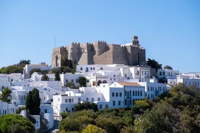
    Patmos, in the northern Dodecanese, has been a monastic island for nearly a thousand years: Byzantine Emperor Alexios I Komnenos granted it to the monk Christodoulos in 1088, and the monastery still shapes its architecture, land ownership, and daily rhythm.The Monastery, Cave of the Apocalypse, and the Chora have been collectively on the UNESCO World Heritage List since 1999. Large hotels and noisy nightlife are rare; the island appeals more to those seeking tranquility, hiking trails, and church history.
    Kos

    Kos

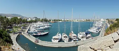
    Kos, the third-largest Dodecanese island, lies just a few kilometers off the Turkish coast near Bodrum. In the island capital, ancient ruins, a Knights Hospitaller castle, and 1930s Italian buildings stand side by side. Inland, the Dikeos Ridge rises, its slopes home to mountain villages like Zia and Pyli.
    Bodrum

    Bodrum

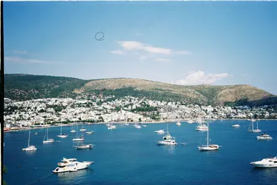
    Bodrum is located at the southern tip of the Turkish Aegean on the peninsula of the same name, at the site of ancient Halikarnassos. You come for the Castle of St. Peter with its Museum of Underwater Archaeology, the remains of the Mausoleum, and the evenings in the harbor and bar street. The Old Town with its castle, harbor, and bazaar is the focal point; on the peninsula are towns like Bitez, Gümüşlük, and Yalıkavak.
    Samos

    Samos

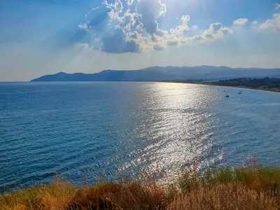
    Samos is located at its narrowest point, less than two kilometers from the Turkish coast, and is considered one of the greenest islands in the Aegean. Spread across nearly 480 square kilometers are the UNESCO World Heritage sites of Pythagoreion and Heraion, the 1,434-meter-high Kerkis mountain, and the wine terraces where the sweet Samos Muscat grows.You come for the ancient ruins, the mountain villages of Ambelos, and the pebble coves on the north coast. The island is large enough for a week, without repeating any routes.
    Ikaria

    Ikaria

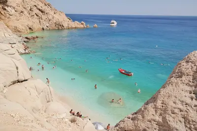
    Ikaria is one of the world's five so-called Blue Zones, where a striking number of people live past 90. The island between Samos and the Cyclades has few large hotel complexes; instead, it offers mountain villages, hot springs, and summer festivals that last until morning.You come for hiking on old mule tracks, for swimming on the north coast around Armenistis, and for the Panigyria. Schedules and opening hours are handled more casually here than elsewhere.

    Sources & method

    • Photos: Wikimedia Commons, Unsplash, Pexels. Each photo carries its credit.
    • The content is based on web research from public, traceable sources. How the content is made · The role of AI