Fernweh: Home
    ExploreTravel GuidesPlan a tripMy tripLast visited
    de|en
    All Places & RegionsAll highlightsAbout FernwehFAQPrivacy PolicyImprint
    ExploreTravel GuidesPlan a tripMy tripLast visited
    • Neighborhoods & highlights
    • Walking tours
    • Eat & drink
    • Food culture
    • Culture
    • Getting around
    • Accommodation
    • Plan trip
    • Nearby
    Monemvasia

    Greece

    Monemvasia

    CityCulture

    Monemvasia is perched on a steep limestone rock off the Laconian east coast, linked to the mainland solely by a causeway.

    by Felix Gillen

    1. Home
    2. Destinations
    3. Greece
    4. Peloponnese
    5. Monemvasia
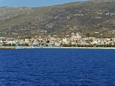
    Monemvasia is perched on a steep limestone rock off the Laconian east coast, linked to the mainland solely by a causeway. Its name, meaning 'single entrance', accurately describes this location, which made the settlement difficult to attack since its 6th-century founding.Behind the walls, Byzantine churches and stone houses stand closely together; above on the plateau lies the deserted Upper Town with the Church of Agia Sofia. The town is car-free and ideal for one or two peaceful days.

    Sights in Monemvasia

    Discover the most important sights and attractions

    Petrified Forest near Agia Marina

    1Petrified Forest near Agia Marina

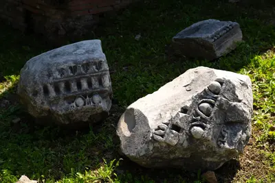
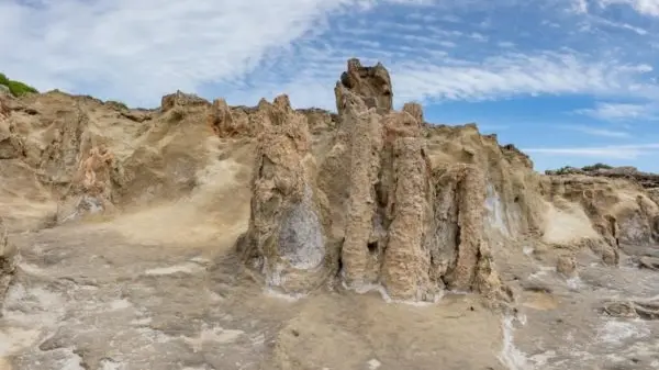
    On the coast near the chapel of Agia Marina, in the south of the Vatika Peninsula and about 35 kilometers from Monemvasia, lie the remains of a petrified palm forest. The trees grew here approximately two to three million years ago, their wood later replaced by silica and lime solutions. Preserved are trunks 50 centimeters to one meter in diameter and up to two meters high, as well as rootstocks; individual conifers and deciduous trees are also found. Part of the site lies underwater and can be seen while snorkeling. From the village of Agios Nikolaos, a road about three kilometers long leads to the chapel.
    Open in Google Maps
    Geopark of Agios Nikolaos

    2Geopark of Agios Nikolaos

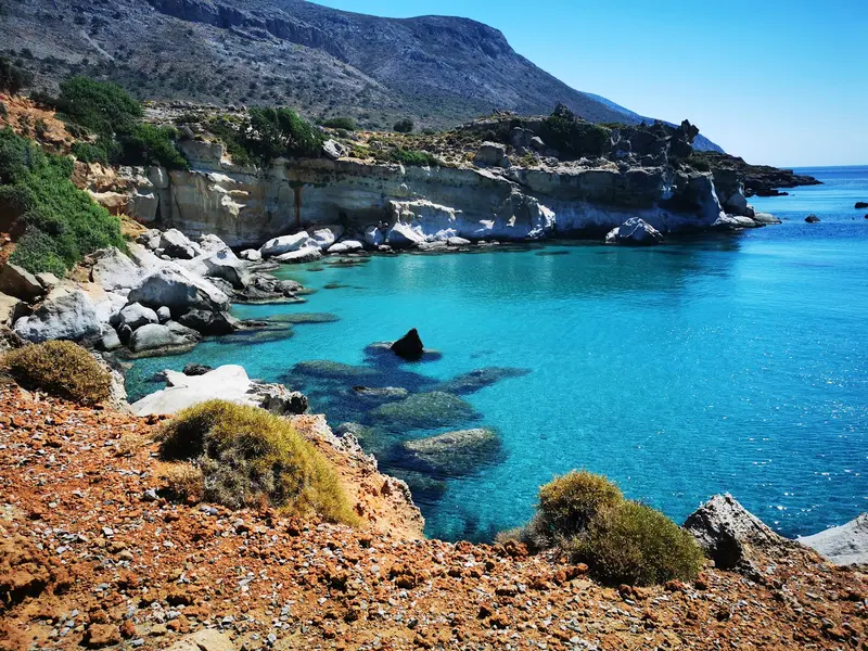
    The Geopark encompasses the coastal sections of Agia Marina, Korakas, and Spitha, south of the village of Agios Nikolaos at the southern tip of Laconia. Alongside the fossilised palms, palm fruits, and roots, shells, snails, sea urchins, and other animals from a shallow sea dating back around 2.5 million years are preserved in the rock here. The discovery sites are listed in the Atlas of Geological Monuments of the Aegean. Off the coast, at a depth of twelve metres, lies the wreck of the Turkish freighter Kaptan Ismail Hakki, which sank in 1978 and is visited by divers.
    Open in Google Maps
    Christos Elkomenos and the main square

    3Christos Elkomenos and the main square

    The only larger square in the lower town opens to the sea and is dominated by the church of Christos Elkomenos, the main church of the locality. Its name refers to an icon of Christ led to crucifixion, which Emperor Isaak II Angelos had brought to Constantinople in the 12th century. Above the entrance is a relief with two peacocks, a Byzantine motif for immortality. Opposite stands a mosque from the first Ottoman rule in the 16th century, which today houses the Archaeological Collection and displays architectural elements, ceramics, and tombstones from all epochs of the rock.
    Open in Google Maps
    Agia Sofia in the Upper Town

    4Agia Sofia in the Upper Town

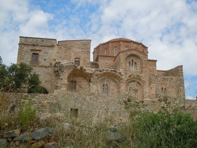
    The church Agia Sofia stands on the northern edge of the plateau, immediately above the steep cliff. It was built in the 12th century, originally dedicated to Panagia Hodegetria, and is a cross-in-square church with an octagonal dome chamber. Under Ottoman rule, it served as a mosque, and remnants of 12th-century wall paintings are preserved. From the forecourt, on clear days, the view extends far over the Myrtoan Sea. The ascent from the gate of the lower town takes about 25 minutes on a paved serpentine path.
    Open in Google Maps
    Kastro: the Lower Town of Monemvasia

    5Kastro: the Lower Town of Monemvasia

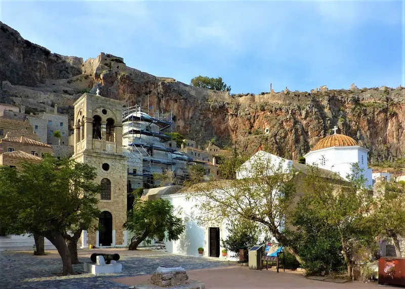
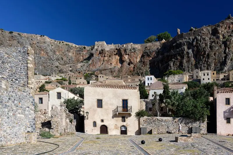
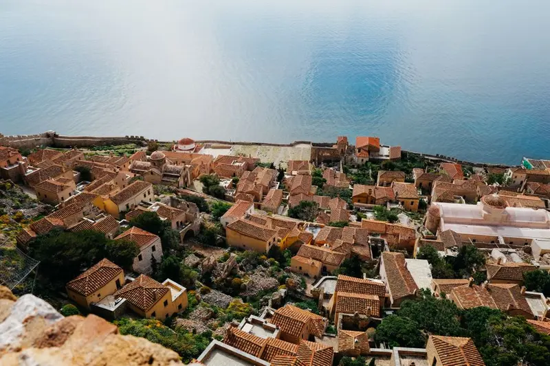
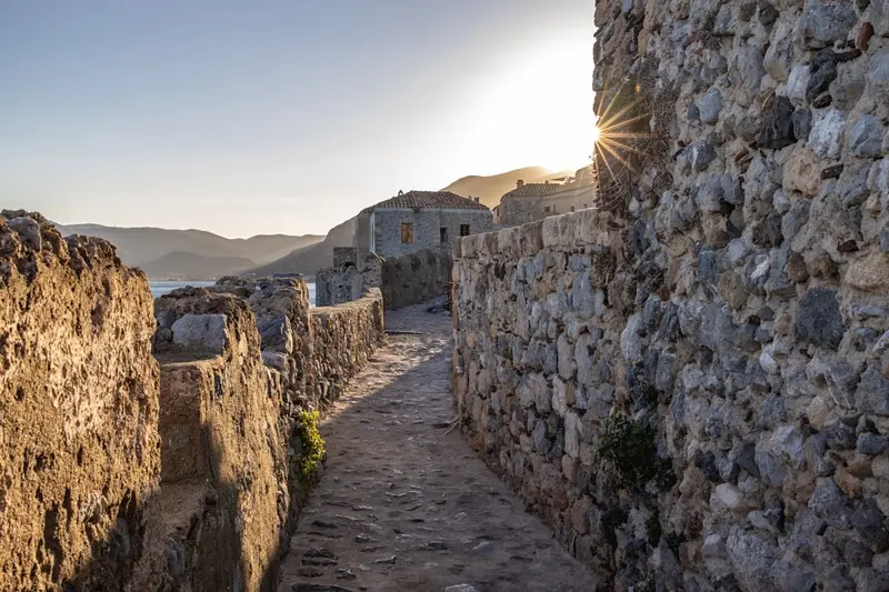
    The Lower Town lies on a narrow, sheltered strip on the rock's south side, entered through an angled defensive gate, forcing attackers through singly. A continuous main lane runs through the town, with stairs and passages branching off. Houses predominantly from Venetian and Ottoman eras. Few dozen residents lived here in 1971; many houses since restored, most now hotels, shops, holiday rentals. No vehicles allowed; luggage pushed or carried.
    Open in Google Maps
    Ano Poli, the abandoned Upper City

    6Ano Poli, the abandoned Upper City

    The plateau was home to the main fortress, featuring a governor's palace, cisterns, barracks, and residences that housed thousands of people at times. Since the 19th century, Ano Poli has been uninhabited; only foundations, vaults, and the rock-hewn water reservoirs that supplied the site during sieges remain. The area is freely accessible and unfenced; cliffs drop off in several spots without railings. The plateau gets unpleasant in windy conditions, and there's no shade in summer. Bring water, as there are no provisions available at the top.
    Open in Google Maps

    City walks in Monemvasia

    Curated walking tours through the city's highlights, handpicked by experienced travel journalists.

    Monemvasia's Journey Through Time: Through Lanes and Fortress Walls

    Immerse yourself in the fascinating world of the rock town of Monemvasia. This roughly two-hour walk takes you through the winding lanes of the lower town, past historic churches, and offers breathtaking views of the Aegean. Experience a unique mix of Byzantine history, architecture and Mediterranean flair.

    ~2 Std.
    Open in Google Maps
    Stops (7)

    Food and Drink

    1

    Édem

    Édem is situated within Monemvasia's Lower Town walls, on the main alley between city gate and main square. Greek cuisine is served.
    Show on Google Maps
    2

    Matoula

    Classic Greek tavern in the lower town within the walls, with a garden terrace and sea views. The menu features grilled meats, souvlaki, fish, saganaki, and Bouyourdi, oven-baked feta with tomatoes and peppers.
    Show on Google Maps
    3

    To Kanoni

    The establishment on the lower town's main square, founded in 1986, features a rooftop garden with views over the square and the sea. The cuisine is Greek with refined preparations, such as Makarounes with chicken, stuffed calamari, or caramelized Pancetta.
    Show on Google Maps
    4

    Chrisovoulo

    Restaurant in a 16th-century building in the lower town, with a balcony overlooking the sea. Modern Greek cuisine reinterprets traditional recipes, with the menu featuring octopus, sea bass fillet, and langoustines in kataifi pastry.
    Show on Google Maps

    Food & Drink in Monemvasia

    The eateries in Kastro are mostly on the main street or on terraces overlooking the sea and are accordingly more expensive than on the mainland. In Gefyra, you eat simpler and cheaper.
    Malvasian wine

    Malvasian wine

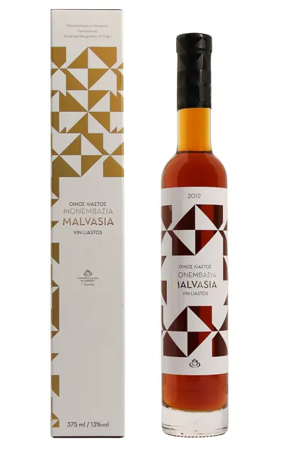
    The sweet wine, traded as Malvasia throughout Europe in the Middle Ages, is named after Monemvasia because the town was the export port. Cultivation ceased under Ottoman rule and was only resumed in the 1990s. Since 2010, it has held the Protected Designation of Origin Monemvasia-Malvasia, produced from sun-dried grapes in Laconia. Several tavernas and shops in the Kastro stock it.

    Laconian Olive Oil

    Around Molaoi and Skala's plains, Athinolia and Koroneiki varieties grow, pressed from November to January. The oil is robust and peppery. Village cooperatives sell direct from the mill; Kastro shops offer bottles to go. In tavernas, the oil is served openly.

    Citrus fruits from the plain of Molaoi

    The alluvial plain north of Monemvasia is one of Lakonia's larger orange growing regions. From December to March, freshly squeezed juice is available, with sales stalls lining the country roads. The fruits are also used to make spoon sweets and candied peels. These are traditionally served with a glass of water alongside coffee.

    Fish from the Myrtoic Sea

    Die Küste vor Monemvasia fällt schnell tief ab, gefangen werden Meerbarbe, Drachenkopf, Tintenfisch und Sardinen. Auf den Karten unterscheiden die Tavernen zwischen Wildfang und Zuchtfisch, der Preis wird nach Kilo berechnet. Frag vor der Bestellung nach Gewicht und Kilopreis. In Gefyra am Hafen ist die Auswahl größer als oben im Kastro.

    Culture and History of Monemvasia

    Byzantine FortressThe first settlement emerged in the late 6th century, when inhabitants of the Peloponnese sought refuge on the rock from Slavic and Avar invasions. Monemvasia developed into an important Byzantine trading and naval base, later alternating between Byzantine, Frankish, Venetian, and Ottoman rule. During its heyday, an estimated several thousand to over ten thousand people lived here.Churches and TownscapeIn the lower town stand stone houses, narrow alleys, and churches like Christos Elkomenos. On the plateau is the Agia Sofia from the 12th century, which served as a mosque under Ottoman rule. By 1971, only a few dozen people lived in the Kastro; many houses were then restored and used as guesthouses and holiday apartments.MalvasierThe Italian name of the town, Malvasia, gave the sweet wine Malvasier its name. Monemvasia primarily served as an export harbor; the grapes originated from various regions of the Peloponnese and the Aegean. Today, vintners in Laconia once again cultivate wines under the name Monemvasia-Malvasia.

    Traveling in Monemvasia

    On the RockWithin the Kastro, you can only get around on foot. No vehicles fit through the angled gate; luggage is carried or pushed with handcarts, which is why accommodations ask in advance for your arrival time. The pavement is smooth, worn stone and steep in places; sturdy shoes are more important than any local knowledge. From the lower town up to Agia Sofia, you'll need about 25 minutes, with little shade along the way. The place is practically inaccessible with a wheelchair or stroller.Between Gefyra and KastroFrom the mainland town of Gefyra to the city gate, it's a good 15-minute walk across the causeway and the rock road. During the day, a small shuttle bus operates; in the evenings, it runs less frequently. Parking spaces are located by the causeway and in front of the gate, and in summer, they are occupied from late morning onwards. Taxis are available in Gefyra and drive up to the gate, but no further. KTEL buses connect Gefyra with Sparta and Athens, usually with a change in Molaoi or Sparta.

    Accommodations in Monemvasia

    Find perfect stay in Monemvasia

    Booking.com* (Affiliate link)
    Search Hotels
    Agoda* (Affiliate link)
    Search Hotels
    Airbnb
    Vacation Rentals

    * Affiliate link: if you book through it, we earn a small commission. The price stays the same for you.

    Campgrounds in Monemvasia

    Find perfect campground in Monemvasia

    Search via Google Maps
    Campgrounds nearby (15km)
    Camping.info
    Find Campgrounds
    Park4Night
    RV Parks & Camping

    Plan your trip to Monemvasia

    Save places, build a route and plan your city trip, all in one place.

    1. 1
      Sunrise over alpine peaks and a sea of clouds
      1234

      Round trip

      12 days · 4 stops

      Saved

      Pick a route

      Pick a ready-made one or save places and plan your own.

      Open bookmarks
    2. 2

      Trip to Monemvasia

      Live
      • 1Petrified Forest near Agia Marina3 days
      • 2Geopark of Agios Nikolaos4 days
      • 3Christos Elkomenos and the main square5 days
      Budget

      Plan your trip

      The planner sorts stops, days and budget. Plan together in real time.

      Start trip planning
    3. 3
      9:41 No signal
      Monemvasia
      Available offline

      Use it on the road

      Download the guide to your phone and use it on site, even offline.

    Nearby

    Neapoli (Neapoli Voion)

    Neapoli (Neapoli Voion)

    Neapoli is the port town at the southern tip of the Malea Peninsula in southeastern Laconia. The town stands on the site of ancient Boiai; its current street grid dates from the 19th century, and life revolves around the waterfront promenade.Most travellers come for the ferry to Kythira or on their way to Elafonisos. Those who stay will find a stalactite cave, the sunken Bronze Age settlement of Pavlopetri, and a stretch of coast with fossilized tree stumps in the vicinity.
    Mani

    Mani

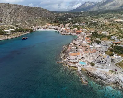
    The Mani is the middle of the three southern fingers of the Peloponnese, a barren limestone landscape between the Taygetos and the sea. Residential towers of grey rubble stone characterize the villages from Kardamyli down to Cape Tenaro, the southernmost point of the Greek mainland. Between them lie bays with clear water, Byzantine chapels, and the caves of Diros.
    Hydra

    Hydra

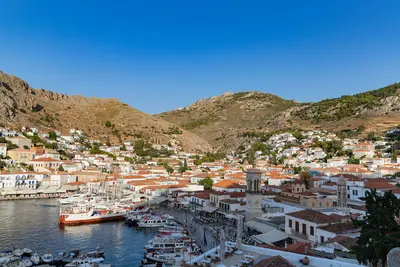
    Hydra is a narrow, rocky island in the Saronic Gulf off the coast of the Peloponnese. Around the semicircular harbour rise the stone houses and mansions of the shipping families who supplied a large part of the Greek fleet during the War of Independence in 1821. There are no cars or other vehicles on the island; loads are carried by mules and donkeys.
    Nafplio

    Nafplio

    Nafplio lies on Argolis' east coast, on the Argolian Gulf, some 140 kilometers southwest of Athens. From 1823 to 1834, it served as the first capital of independent Greece, having previously seen Venetians and Ottomans alternately rule its port. The city retains three fortresses, a compact old town of Venetian and neoclassical houses, and a scenic rock path encircling the peninsula.
    Ancient Epidauros

    Ancient Epidauros

    Ancient Epidaurus refers to two sites, twelve kilometers apart: the coastal village of Palea Epidavros on the Saronic Gulf and the Asklepieion inland, a UNESCO World Heritage site since 1988. For centuries, this sanctuary was the most important healing center in the Greek world. Predominantly preserved is the theater from the 4th century BC, whose acoustics still work without technical amplification today.

    Sources & method

    • Photos: Wikimedia Commons, Unsplash, Pexels, Google Maps. Each photo carries its credit.
    • Place data such as addresses and ratings comes from Google Maps.
    • The content is based on web research from public, traceable sources. How the content is made · The role of AI