ExploreTravel GuidesMy Trips
    de|en
    All Places & RegionsAbout FernwehFAQPrivacy PolicyImprint
    ExploreTravel GuidesMy Trips
    • Neighborhoods & highlights
    • Eat & drink
    • Food culture
    • Culture
    • Getting around
    • Excursions
    • Accommodation
    • Plan trip
    • Nearby
    Mani
    CityCulture

    Mani

    The Mani is the middle of the three southern fingers of the Peloponnese, a barren limestone landscape between the Taygetos and the sea.

    More
    1. Home
    2. Destinations
    3. Greece
    4. Peloponnese
    5. Mani
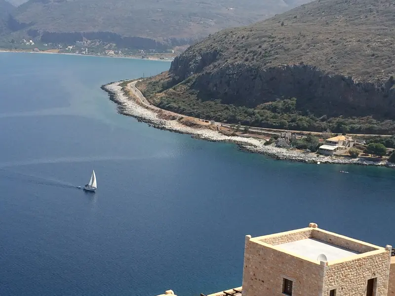
    The Mani is the middle of the three southern fingers of the Peloponnese, a barren limestone landscape between the Taygetos and the sea. Residential towers of grey rubble stone characterize the villages from Kardamyli down to Cape Tenaro, the southernmost point of the Greek mainland. Between them lie bays with clear water, Byzantine chapels, and the caves of Diros.
    Three Parts of a PeninsulaThe Mani extends about 70 kilometers from the Taygetos south into the sea. The Outer Mani on the west side around Kardamyli and Stoupa belongs to Messenia and is greener; the Inner Mani around Areopoli, Gerolimenas, and Vathia is dry and stony. Small villages lie on the east coast towards the Laconian Gulf, off the main route. There are no large towns; Areopoli has fewer than a thousand inhabitants.Landscape and SettlementsThe villages cling to the hillsides, each with churches and residential towers, many of them abandoned or restored as guesthouses. Between the villages lie terraced dry-stone walls and olive groves; beaches are mostly narrow pebble coves.Travel TimeSpring and autumn are ideal for hiking and for drives to the towers; in mid-summer, it is hot and shadeless. The roads are winding; for the stretch from Kardamyli to Cape Tenaro, you will need several hours.
    The Mani is divided into the Outer Mani on the Messenian coast with Kardamyli, the Inner Mani with Areopoli, Limeni, Diros, Gerolimenas, and Vathia, and the quieter east coast towards the Laconian Gulf. Areopoli is the practical starting point for the south, Kardamyli for hikes on the Taygetos.

    Sights in Mani

    Discover the most important sights and attractions

    Vathia
    Angela Stefanoni / Wikimedia Commons / CC BY 3.0

    1Vathia

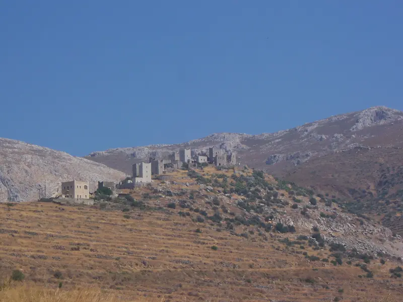
    Vathia is perched on a hill near the southern tip of Mani, just before Cape Tenaro, a densely packed village of residential towers. It was first mentioned in writing in 1571, and most of the towers were built in the 18th century, when the Mani clans waged their feuds from these fortified homes.During the 20th century, most residents abandoned the village, and many of the towers fell into disrepair. Starting in 1980, some were restored by the Greek Tourism Organisation and converted into accommodations. From the roadside car park, you walk through narrow alleys between the towers, and in the evening, the western light streams over the sea onto the stone facades.
    Open in Google Maps
    Areopoli
    Bgabel / Wikimedia Commons / CC BY-SA 3.0

    2Areopoli

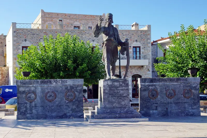
    Areopoli is situated at an altitude of around 250 meters above Limeni Bay and is the main town of Inner Mani. Until 1912, the town was called Tsimova; its current name means 'City of Ares'. On March 17, 1821, Petros Mavromichalis, the last Bey of Mani, declared the uprising against the Ottomans here, a week before the official start of the War of Independence.The Church of Taxiarches stands on 17 March Square; its 1836 bell tower is adorned with stone reliefs and zodiac signs. The old town comprises residential towers and grey rubble stone alleys; the Pikoulakis Tower houses a museum on Mani's church history. A market is held on Saturdays in the main square, featuring Mavromichalis' bronze statue.
    Open in Google Maps
    Gerolimenas
    Leonidas Kourentis / Wikimedia Commons / CC BY-SA 4.0

    3Gerolimenas

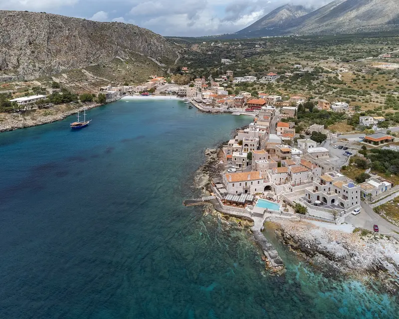
    Gerolimenas is situated in a sheltered bay on the west coast in the south of Mani. The village originated around 1870 as a trading port, through which merchants exported regional products to Western Europe, including quails. Until the 1970s, it was almost exclusively accessible by sea.Stone houses and former warehouses surround the small harbour, while tavernas line the waterfront. To the west, the steep rocky coast of Kavo Grosso rises. Gerolimenas is a practical base for excursions to Vathia and Cape Tenaro.
    Open in Google Maps
    Caves of Diros
    Koppi2 at German Wikipedia / Wikimedia Commons / CC BY-SA 3.0

    4Caves of Diros

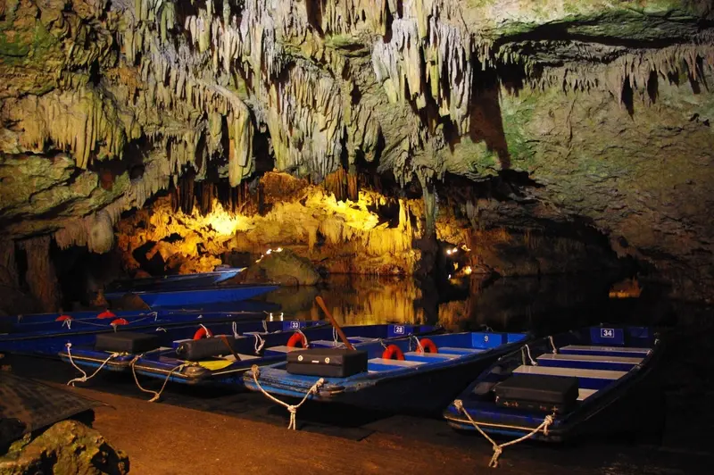
    The Diros Caves are located on the west coast near Pyrgos Dirou, a few kilometers south of Areopoli. Inside the Vlychada cave, you'll travel approximately 1,200 meters by flat-bottomed boat through flooded passages with dripstone formations, as a boatman poles the boat through the narrow sections. Afterwards, a short walk of about 300 meters leads to the exit.The cave was systematically explored starting in the 1950s, and today, around 15 kilometers of passages have been mapped. In the neighboring Alepotrypa cave, archaeologists discovered traces of a Neolithic settlement, and a museum displays artifacts from the excavations. Even in summer, the cave is cool, so a light jacket is advisable.
    Open in Google Maps
    Cape Tenaro
    Attraction

    5Cape Tenaro

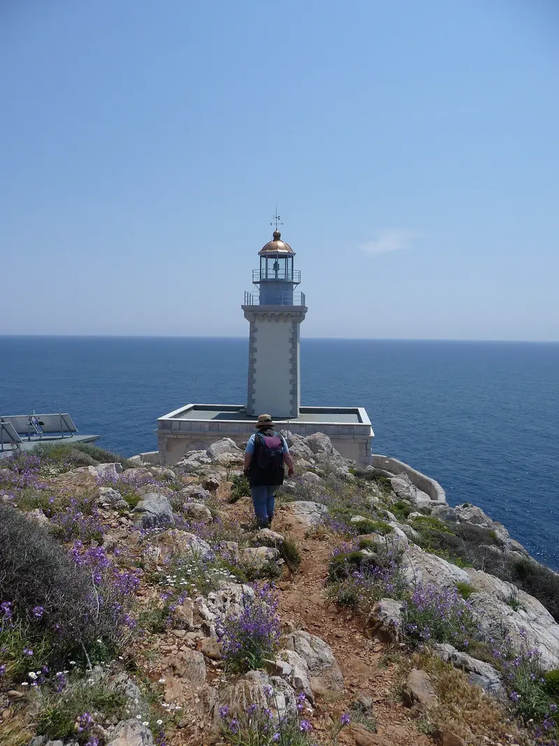
    The Cape Tenaro, also Cape Matapan, is the southernmost point of mainland Greece. In antiquity, a coastal cave was considered an entrance to the Underworld, through which Heracles is said to have brought up Cerberus. Remains of the Sanctuary of Poseidon are preserved, above which stands the Chapel of Agioi Asomatoi.From the chapel near Kokkinogeia, a marked path of just over two kilometers leads to the late 19th-century lighthouse; allow 40 to 50 minutes per direction. Along the way, at Aria Bay, lies a Roman floor mosaic, part of a former bath complex. The path is rocky and unsheltered; bring water and sturdy shoes.
    Open in Google Maps
    Limeni
    Zigomitros Athanasios / Wikimedia Commons / CC BY-SA 4.0

    6Limeni

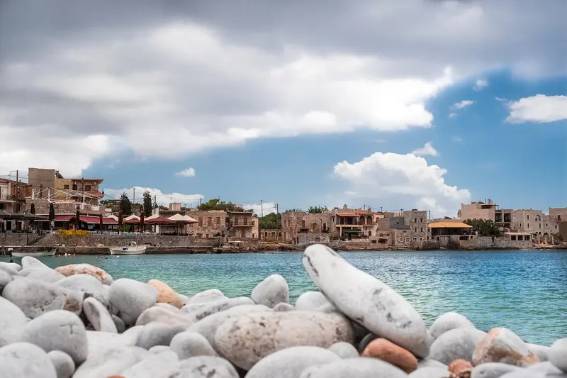
    Limeni is a small village at the inner end of Oitylo Bay, below Areopoli, whose port it once was. Stone houses in the Mani style stand on the shore above very clear, turquoise water.By the water stands the restored tower of the Mavromichalis family, a four-story building with arched gateways, which the family used as its ancestral seat. There is no sandy beach; swimming is done from the rocks and jetties. The tavernas on the shore serve fish and Meze, and the village is reachable from Areopoli in a few minutes by car.
    Open in Google Maps

    Restaurants in Mani

    1

    Barba Petros (Areopoli)

    Located on the main street of Areopoli's old town, this tavern is considered the oldest in the area. It serves Mani country cuisine with market vegetables and local meat, such as grilled lamb ribs. You can dine in the lofty dining room or on the terrace.
    Show on Google Maps
    2

    O Takis (Limeni)

    The fish taverna is located directly on the water in Limeni Bay, below Areopoli. The menu features fish and seafood, and it's known for its lobster pasta for two. From the tables, you look out over the bay and the fishing boats.
    Show on Google Maps
    3

    Kyrimai (Gerolimenas)

    The restaurant is part of the hotel, set in the restored 1870 Kyrimis trade buildings by Gerolimenas harbour. The cuisine uses regional, seasonal ingredients to reinterpret Greek recipes. The terrace overlooks the water.
    Show on Google Maps
    4

    Lela's Taverna (Kardamyli)

    Lela Giannakea, Patrick Leigh Fermor's chef, opened the tavern in 1983 in a family house by the sea next to the old oil mill of Kardamyli. Today, her son and grandson run the restaurant, cooking contemporary Greek cuisine with local ingredients. From the terrace, you look out onto the port and Meropi island.
    Show on Google Maps

    Food and Drink in the Mani

    The cuisine of Mani is a simple country cuisine of olive oil, pork, wild herbs, and legumes.

    Siglino

    Siglino is pork smoked with sage, thyme, and cypress wood, then preserved in olive oil or fat. Every family traditionally prepared it themselves in winter. In taverns, it's served fried or with eggs.

    Lalagia

    Lalagia are thin strips of dough, fried until crispy in fresh olive oil. Traditionally, they are served at Christmas and Epiphany. They are eaten with honey or sugar.
    Olive oil and olives
    Michael Fielitz / Wikimedia Commons / CC BY-SA 2.0

    Olive oil and olives

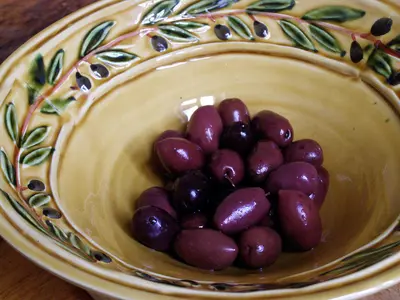
    Old olive trees stand on Mani's terraces; their oil is the basis of almost every dish and was once used for preserving. In the Outer Mani, the large, dark Kalamata olives grow. Many farms sell oil directly.
    Honey and Pasteli
    Mushushu / Wikimedia Commons / CC BY-SA 3.0

    Honey and Pasteli

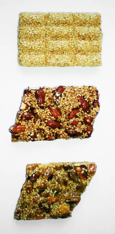
    The honey from Mani comes from thyme and wild blossoms of the dry slopes. With sesame, it becomes Pasteli, a firm bar known since antiquity. You can find both in shops and at roadside stalls.

    The History and Culture of the Mani

    Clans and TowersThe Mani was never permanently controlled by either the Venetians or the Ottomans. Its family clans managed their own affairs, often through blood feuds that lasted for generations. For this purpose, they built the narrow, multi-storey residential towers from which they fought; most date back to the 18th and 19th centuries.1821On March 17, 1821, Petros Mavromichalis, the last Bey of Mani, proclaimed the uprising against the Ottomans in Areopoli, a week before the official start of the War of Independence. The Mavromichalis family was based in the Tower of Limeni. His statue now stands in the main square of Areopoli.Churches and LiteratureNumerous small Byzantine churches stand in the Mani, many with frescoes, often secluded from the villages. The British writer Patrick Leigh Fermor lived for decades near Kardamyli; his book about travelling through the Mani shaped the region's image abroad.

    Getting there and exploring the Mani

    Getting ThereThe nearest airport is Kalamata, which also has direct flights from Germany during summer. From there, it's about 35 kilometers to Kardamyli and roughly an hour and a half to Areopoli. From Athens, you can drive via Sparta and Gythio, reaching the Inner Mani in about four hours.Rental CarThe Mani is difficult to explore without a rental car. The main road follows the west coast from Kalamata via Kardamyli, Areopoli, and Gerolimenas south, and back along the east coast to Gythio. The roads are well-maintained but winding, and petrol stations are scarce in the south.BusesKTEL intercity buses connect Kalamata with Kardamyli and Stoupa, as well as Gythio with Areopoli. However, they only run a few times a day and rarely reach the villages further south. There is no regular bus service to Cape Tenaro and Vathia.

    Day Trips from Mani

    Gythio

    The port town of Gythio is situated at the entrance to Mani on the Laconian Gulf. On Marathonisi island, accessible via a causeway, stands the Tzanetakis Tower, home to the Historical and Ethnological Museum of Mani. South of the town lies the wreck of the Dimitrios on Valtaki Beach.

    Mystras

    The Byzantine ruined city of Mystras, on Taygetos' slopes above Sparta, is a UNESCO World Heritage site. From Areopoli, it's about a 90-minute drive via Gythio. Allow half a day for the steep site with its palace, monastery churches, and castle.

    Viros Gorge and Taygetos

    From Kardamyli, marked trails lead into the Viros Gorge and up to villages on Taygetos like Exochori. The gorge is dry in summer and temporarily flooded in winter. For longer tours, you should set off early and take enough water with you.

    Accommodations in Mani

    Find perfect stay in Mani

    Booking.com* (Affiliate link)
    Search Hotels
    Agoda* (Affiliate link)
    Search Hotels
    Airbnb
    Vacation Rentals

    * Affiliate link: if you book through it, we earn a small commission. The price stays the same for you.

    Campgrounds in Mani

    Find perfect campground in Mani

    Search via Google Maps
    Campgrounds nearby (15km)
    Camping.info
    Find Campgrounds
    Park4Night
    RV Parks & Camping

    Plan your trip to Mani

    Save places, build a route and plan your city trip, all in one place.

    1. 1
      1234

      Round trip

      12 days · 4 stops

      Saved

      Pick a route

      Take a ready-made round trip or build your own from saved places.

      Open bookmarks
    2. 2

      Trip to Mani

      Live
      • 1Vathia3 days
      • 2Areopoli4 days
      • 3Gerolimenas5 days
      Budget

      Plan your trip

      The planner sorts stops, days and budget. Plan together in real time.

      Start trip planning
    3. 3
      9:41 No signal
      Available offline

      Use it on the road

      Download the guide to your phone and use it offline on location.

    Nearby

    Monemvasia

    Monemvasia

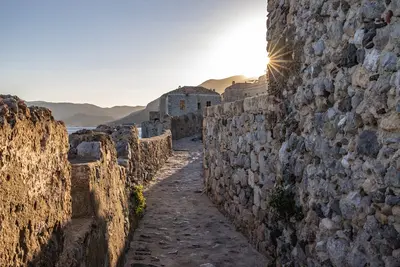
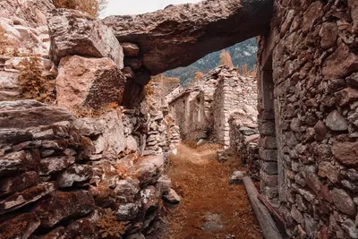
    Monemvasia lies on a rock off the Laconian east coast, rising some 300 meters from the sea and connected to the mainland only by a causeway. The name means 'single entrance' and precisely describes its position, which made the site hard to attack since the 6th century. Behind the wall, Byzantine churches and stone houses stand close together; on the plateau above lies the abandoned Upper Town.
    Neapoli (Neapoli Voion)
    C messier / Wikimedia Commons / CC BY 3.0

    Neapoli (Neapoli Voion)

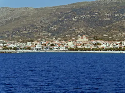
    Neapoli is a port town at the southern tip of the Malea Peninsula in southeastern Laconia, approximately 115 kilometers south of Sparta. From here, ferries depart for Kythira, Antikythira, and Elafonisos. The town stands on the site of ancient Boiai and is a starting point for the Kastania Cave and the submerged settlement of Pavlopetri.
    Peloponnese

    Peloponnese

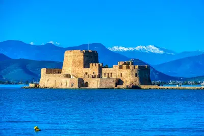
    The Peloponnese clings to the southern end of the Greek mainland and, strictly speaking, has been an island since the construction of the Corinth Canal. Within an area the size of Hesse, Mycenaean castles, the Sanctuary of Olympia, Byzantine ruined cities, and Venetian sea fortresses lie close together. Between them, mountain ranges rise to over 2,400 meters, and coastal roads remain narrow and winding.
    Nafplio

    Nafplio

    Nafplio lies on Argolis' east coast, on the Argolian Gulf, some 140 kilometers southwest of Athens. From 1823 to 1834, it served as the first capital of independent Greece, having previously seen Venetians and Ottomans alternately rule its port. The city retains three fortresses, a compact old town of Venetian and neoclassical houses, and a scenic rock path encircling the peninsula.
    Hydra
    dronepicr / Wikimedia Commons / CC BY 2.0

    Hydra

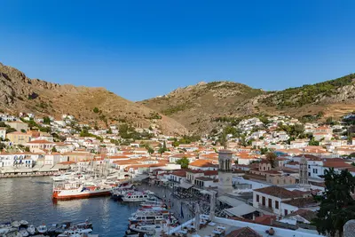
    Hydra is a narrow, rocky island in the Saronic Gulf off the coast of the Peloponnese. Around the semicircular harbour rise the stone houses and mansions of the shipping families who supplied a large part of the Greek fleet during the War of Independence in 1821. There are no cars or other vehicles on the island; loads are carried by mules and donkeys.