Fernweh: Home
    ExploreTravel GuidesPlan a tripMy tripLast visited
    de|en
    All Places & RegionsAll highlightsAbout FernwehFAQPrivacy PolicyImprint
    ExploreTravel GuidesPlan a tripMy tripLast visited
    • Neighborhoods & highlights
    • Eat & drink
    • Food culture
    • Culture
    • Getting around
    • Accommodation
    • Plan trip
    • Nearby
    Pilion (Pelion)

    Greece

    Pilion (Pelion)

    City

    East of Volos, the Pilion Peninsula separates the Pagasetic Gulf from the Aegean Sea.

    by Felix Gillen

    1. Home
    2. Destinations
    3. Greece
    4. Thessaly
    5. Pilion (Pelion)
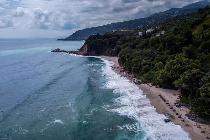
    East of Volos, the Pilion Peninsula separates the Pagasetic Gulf from the Aegean Sea. Its forested mountain ridge rises to over 1,600 metres, with stone villages featuring slate roofs, plane tree squares, and old mansions clinging to its slopes. In Greek mythology, Pilion is considered the home of the Centaurs.You come here for hiking on old paved mule tracks, for the beaches on the Aegean coast and for the mountain villages like Makrinitsa, Milies or Tsagarada. Spring and autumn are the most pleasant travel times; in winter, you can ski on the mountain.

    Sights in Pilion (Pelion)

    Discover the most important sights and attractions

    Damouchari Viewing Point

    1Damouchari Viewing Point

    The viewpoint is located on the road above Damouchari, the small port town on the Aegean coast below Mouresi. From here, you overlook the natural harbour with its stone houses, and next to it, the pebble beach of Palia Damouchari. At the harbour stand the ruins of a castle, which the Byzantines built at least in the 11th century and which the Venetians later used, along with the Church of Agios Nikolaos from 1744. In September 2007, scenes for the film Mamma Mia were shot in Damouchari. It is approximately 46 kilometres from Volos.
    Open in Google Maps
    Mylopotamos Beach

    2Mylopotamos Beach

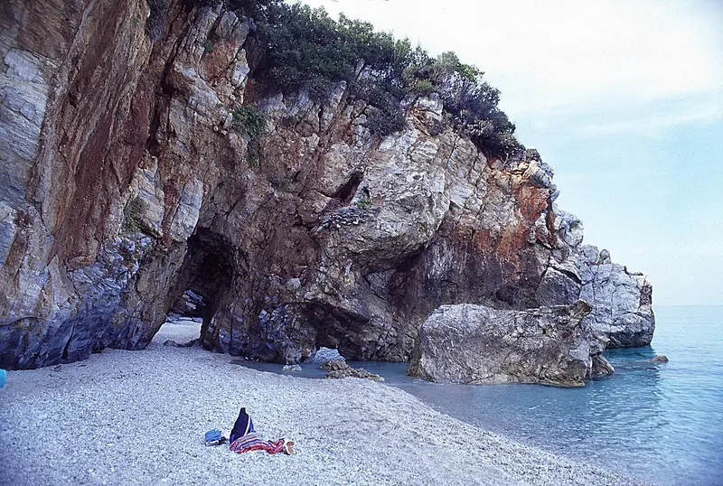
    Mylopotamos Beach lies on Pilion's Aegean coast, about six kilometers from Tsagarada. A rock with a natural arch divides it into two gravel and sand coves, accessible via the rock passage. One cove has a beach bar for drinks and snacks; the other is quieter, featuring a shady cave. A short path with steps leads from the parking lot to the water.
    Open in Google Maps

    3Goritsa Hill above Volos

    Goritsa Hill rises on the eastern edge of Volos, bearing the remains of a fortified city from the late 4th century BC. Sections of walls, towers, and the grid-patterned street system, typical for a new foundation of that era, are preserved.The founders of the settlement remain unknown; it is debated whether it was a complex from the time of Philip II or Demetrius I, serving to control the Pagasetic Gulf. It was apparently inhabited for only a few decades.From the ridge, you can overlook the Gulf, the port of Volos, and the road to Pelion. The ascent is short but without shade, and is best undertaken in the early morning or towards evening.
    Open in Google Maps
    Makrinitsa and its main square

    4Makrinitsa and its main square

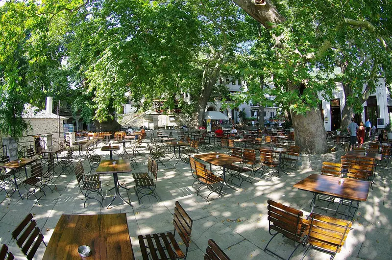
    Makrinitsa clings at around 600 meters on the slope above Volos and is called the Balcony of Pelion, because the view from almost every terrace reaches over the Pagasetic Gulf. Cars stay at the village entrance; everything else is via stairs and paved paths.The village square lies under old plane trees, in its center stands a marble fountain with reliefs. Adjacent to the square is the Agios Ioannis Prodromos church, whose arcade and freestanding bell tower are typical of Pelion architecture.In the old kafeneio on the square, the folk painter Theophilos Hatzimichail left a mural in the early 20th century, depicting the fighter Katsantonis. Theophilos lived in Pelion for a long time and painted for board and lodging.
    Open in Google Maps

    5Historical Museum Portaria

    Portaria is located a few kilometres below Makrinitsa and was a prosperous place in the 18th and 19th centuries, where silk was processed and traded with Volos. The historical museum collects what remained from this period: household items, tools, documents, and photographs.The collection is small, but it illustrates how the Pilion villages functioned economically before roads and railways shifted trade to Volos. It is supplemented by material on the village's history in the 20th century.A good half hour is sufficient for the tour. It makes sense to combine it with a stroll through Portaria itself, whose square, with its plane tree and springs, is just next door, at the edge of the village.
    Open in Google Maps
    Pelion Railway Moutzouris

    6Pelion Railway Moutzouris

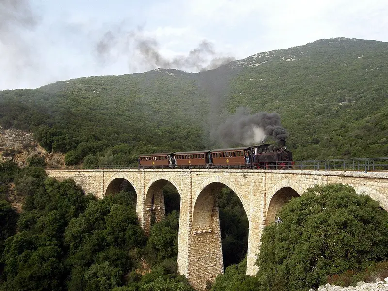
    The Pilion Railway, locally called Moutzouris, is a narrow-gauge line with a 600-millimeter gauge, built between 1895 and 1903 from Volos to the mountain villages. The engineer Evaristo de Chirico, father of the painter Giorgio de Chirico, was responsible for its routing.The upper section from Ano Lechonia to Milies, approximately 15 kilometers, remains, with the train taking about an hour and a half to cover it. The route winds along slopes, crosses ravines on stone viaducts, and near Milies, it traverses a curved iron bridge, considered a technical marvel.The service runs seasonally, typically from spring to autumn and on weekends, partly with steam locomotives, partly with diesel. Seating is limited, so advance booking is recommended. Milies itself is worth a visit for its school library from 1814.
    Open in Google Maps

    Food & Drinks

    1

    Agora 1955 (Portaria)

    A Portaria spot combining a taverna, cafe, and small shop under one roof. Daytime mainly sees coffee served; evenings feature warm meals with the peninsula's typical dishes. It's located directly on the main road in the village center.
    Show on Google Maps
    2

    To Katofli tis Ketis

    A small tavern in the village area of Portaria, away from the main road. The kitchen works with what Pelion taverns typically serve: slow-cooked dishes, pites, and seasonal salads. The establishment is family-run and accordingly small.
    Show on Google Maps
    3

    Kritsa (Portaria)

    Restaurant in Portaria, part of a guesthouse, also welcoming non-residents. The focus is on the peninsula's cuisine, meaning oven-baked and slow-cooked dishes. The tables offer views over the Pagasetic Gulf.
    Show on Google Maps
    4

    Taverna Ortansies (Portaria)

    Taverna in Portaria with outdoor seating, featuring a classic taverna menu: Mezedes, stews, grilled dishes, and salads. It's in the village's southern part, just below the square.
    Show on Google Maps
    5

    Archontiko (Portaria)

    Traditional restaurant in Portaria, set within one of the village's old stone houses. The menu offers regional cuisine from the peninsula, including Spetzofai and oven dishes.
    Show on Google Maps

    Eating and Drinking in Pilion

    Pilion thrives on its own slopes. From its terraces come apples, chestnuts, walnuts, and olives; from the forest, mushrooms and wild herbs; and from the sea, fish and octopus. However, the region's most famous food culture is found down in Volos, where the tsipouradika set the tone.

    Spetzofai

    The Peninsula’s Dish: hearty country sausage, bell pepper and tomato, braised and served in the pan. It’s on the menu in almost every village, with the spiciness varying from kitchen to kitchen.

    Tsipouradiko in Volos

    At Pilion's foot, don't order food – order a Tsipouro carafe; Mezedes are served automatically, changing each round. The ritual spans hours; don't schedule anything afterward.

    Firiki apples, from Zagora

    The small, elongated apple variety from the northeast slopes has a PDO. The cooperative is in Zagora, and in autumn, it’s also sold directly by the roadside.

    Chestnuts and Walnuts

    The northern slopes are covered with chestnut forest. In October, several villages host chestnut festivals. From walnuts, spoon sweets and liqueur are made, both sold in the villages.

    Fish on the East Coast

    In Agios Ioannis, Chorefto and Damouchari, the day's catch is grilled and charged by weight. On the west side, by the Pagasetic Gulf, the selection is smaller, but the tavernas there are open year-round.

    Pelion's Cultural Heritage and History

    The Pelion Peninsula is deeply rooted in Greek mythology, known as the home of the Centaurs and the starting point for the Argonauts on their quest for the Golden Fleece. Its history spans from ancient settlements through the Byzantine era, reflected in numerous monasteries and churches, to the Ottoman period. During Ottoman rule, Pelion enjoyed relative autonomy, which allowed for a cultural and economic boom, the traces of which are still visible today.Characteristic of the region are the traditional villages with their unique architecture. The so-called Pelion houses, often three-storied with robust stone walls, slate roofs, and carved wooden balconies, are typical and bear witness to the region's prosperity in the 18th and 19th centuries. Numerous Byzantine and post-Byzantine churches, often adorned with impressive frescoes, define the landscape and serve as important testimonies of religious art and craftsmanship.Pelion continues to preserve its customs to this day, manifesting in regional festivals, traditional music and dance, as well as local crafts. The gastronomy, based on local products such as olive oil, fruits, and wild herbs, is another central component of the cultural identity and connects visitors with the authentic way of life of the locals.

    Exploring Locally

    By CarA rental car is the most practical solution for Pelion. The roads are asphalted but winding and narrow; trips between the west and east side take longer than a map suggests. You can get rental cars in Volos or at Nea Anchialos Airport.Bus and TrainThe KTEL buses of the Magnesia region run from Volos to the larger villages, but only a few times a day outside the season. The narrow-gauge railway between Ano Lechonia and Milies is a seasonal excursion train, not for daily commuting. Check timetables in advance.On FootThe village centers are best explored on foot. A network of old paved paths, the Kalderimia, connects many villages with each other and the coast. Taxis are available in Volos and some larger towns.

    Accommodations in Pilion (Pelion)

    Find perfect stay in Pilion (Pelion)

    Booking.com* (Affiliate link)
    Search Hotels
    Agoda* (Affiliate link)
    Search Hotels
    Airbnb
    Vacation Rentals

    * Affiliate link: if you book through it, we earn a small commission. The price stays the same for you.

    Campgrounds in Pilion (Pelion)

    Find perfect campground in Pilion (Pelion)

    Search via Google Maps
    Campgrounds nearby (15km)
    Camping.info
    Find Campgrounds
    Park4Night
    RV Parks & Camping

    Plan your trip to Pilion (Pelion)

    Save places, build a route and plan your city trip, all in one place.

    1. 1
      Sunrise over alpine peaks and a sea of clouds
      1234

      Round trip

      12 days · 4 stops

      Saved

      Pick a route

      Pick a ready-made one or save places and plan your own.

      Open bookmarks
    2. 2

      Trip to Pilion (Pelion)

      Live
      • 1Damouchari Viewing Point3 days
      • 2Mylopotamos Beach4 days
      • 3Goritsa Hill above Volos5 days
      Budget

      Plan your trip

      The planner sorts stops, days and budget. Plan together in real time.

      Start trip planning
    3. 3
      9:41 No signal
      Pilion (Pelion)
      Available offline

      Use it on the road

      Download the guide to your phone and use it on site, even offline.

    Nearby

    Larissa

    Larissa

    Larissa is the capital of the Thessaly region and lies in the middle of the wide Thessalian plain on the Pinios. The city is predominantly modern, yet its historical layers lie close together on and around Frourio Hill: the Hellenistic First Ancient Theatre, an early Christian basilica, and the Ottoman market hall Bezesteni.You come for the Diachronic Museum, the lively pedestrian zone, and Alkazar Park by the river. In midsummer, it gets very hot in the plain; spring and autumn are more pleasant.
    Thessaly

    Thessaly

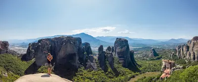
    Thessaly lies between the Pindus Mountains and the Aegean Sea and consists largely of a vast plain that supplies Greece with grain and cotton. On its fringes stand the monastery rocks of Meteora, the Pelion Peninsula rises above the coast, and Mount Olympus marks its northern border. Anyone driving from Athens to Thessaloniki crosses the region in two hours; those who turn off will find mountain villages, bathing coves, and towns largely untouched by tourism.
    Central Greece area

    Central Greece area

    Central Greece, in Greek Sterea Ellada, stretches from the Gulf of Corinth, over Mount Parnassus, to the Malian Gulf. Between Delphi's Oracle Sanctuary, Thermopylae Pass, and the mountain villages of Evrytania, lies a landscape many travellers merely pass through en route north. Those who stop find ancient sites without crowds and a mountain range snowy in winter.
    Thermopylae

    Thermopylae

    At **Thermopylae**, in 480 BC, a Greek force under the Spartan King Leonidas held back Xerxes' Persian army for three days. Back then, a narrow coastal pass ran here between the Kallidromo Mountains and the sea; today, due to the Spercheios River's deposits, the coast is several kilometers away.Little remains of the pass itself on the terrain. Visitors who stop here will see the Leonidas Monument, the Kolonos Hill (site of the last stand), and the information center explaining the vanished landscape. The stop is easily integrated into a trip between Athens and Northern Greece.
    Chalkidiki

    Chalkidiki

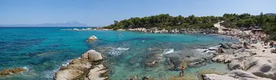
    The Chalkidiki peninsula, southeast of Thessaloniki, extends into three narrow fingers: Kassandra, Sithonia, and Athos. Pine forests here stretch to sandy beaches and clear bays. Additionally, there are the Monastic Republic on the Holy Mountain, the Petralona stalactite cave, and Stagira, the birthplace of Aristotle.

    Sources & method

    • Photos: Wikimedia Commons, Unsplash, Pexels. Each photo carries its credit.
    • The content is based on web research from public, traceable sources. How the content is made · The role of AI