Fernweh: Home
ExploreGuideDestinationsMy tripsMy trip
de|en
All Places & RegionsRound tripsNight trains in EuropeAll highlightsAbout FernwehFAQPrivacy PolicyImprint
Download on the App StoreGet it on Google Play
ExploreGuideDestinationsMy tripsMy trip
    • Places & highlights
    • Recommendations
    • Eat & drink
    • Food culture
    • Culture
    • Getting around
    • Accommodation
    • Nearby
    Dovedale

    Photo by Sela Hatting on Pexels

    Great Britain

    Dovedale

    Point of Interest

    Dovedale is an approximately five-kilometre-long limestone valley in the south of the Peak District, through which the River Dove forms the border between Derbyshire and Staffordshire.

    by Felix Gillen

    1. Home
    2. Destinations
    3. Great Britain
    4. Peak District National Park
    5. Dovedale
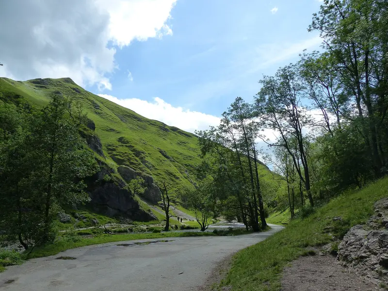
    Dovedale is an approximately five-kilometre-long limestone valley in the south of the Peak District, through which the River Dove forms the border between Derbyshire and Staffordshire. Steep, wooded slopes, rock pinnacles like the Twelve Apostles and Ilam Rock, and the stepping stones at the foot of Thorpe Cloud make the valley one of the National Park's most visited destinations.Large parts belong to the National Trust. The path along the river is flat and easily walkable, but busy on summer weekends. Those who come early in the morning or during the week will largely have the valley to themselves.
    Great Britain travel guideRound trips in Great BritainPlan a trip with Dovedale

    Contents

    • Places & highlights
    • Recommendations
    • Eat & drink
    • Food culture
    • Culture
    • Getting around
    • Accommodation
    • Nearby

    Sehenswürdigkeiten

    Discover the most important sights and attractions

    1Well Dressing in Tissington

    Well Dressing is a custom found almost exclusively in the Peak District: wells and springs are adorned with large-scale pictures made entirely of natural materials. Flower petals, seeds, bark, and moss are pressed piece by piece into a wooden board coated with moist clay, creating a mosaic. It lasts for about a week.Tissington, four kilometers east of Dovedale, is considered the origin of the tradition and decorates six wells, including Hall Well, Town Well, and Children's Well. The ceremony takes place every year on Ascension Day. Its origin is disputed: one explanation points to gratitude for springs that did not dry up during the Plague of 1348. The village is located on the Tissington Trail, a disused railway line that is now a cycle and footpath.
    Open in Google Maps
    Thorpe Cloud

    Chris Gunns / Wikimedia Commons / CC BY-SA 2.0, mod.

    2Thorpe Cloud

    Thorpe Cloud is the conical hill that guards the entrance to Dovedale. At 287 metres, it is modest, yet appears more striking than many taller mountains because it rises freely from the valley. It consists of a fossilised coral reef that formed approximately 350 million years ago in a tropical shallow sea.The ascent from the Stepping Stones takes about 25 minutes and is short but steep, and rocky in its upper section. At the summit, views open up into the Dove Gorge and over the hills of Staffordshire and Derbyshire. The name Cloud does not derive from atmospheric clouds, but from the Old English clud for rock.
    Open in Google Maps
    Ilam Park

    bouldie / Wikimedia Commons / CC BY 2.0, mod.

    3Ilam Park

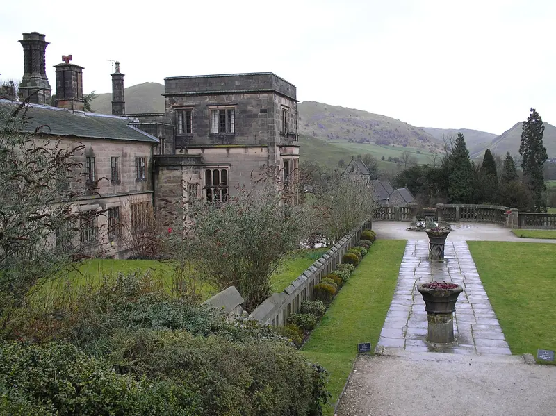
    Ilam Park is located in the Manifold Valley directly west of Dovedale and is owned by the National Trust. The landscaped park surrounds Ilam Hall, a 19th-century manor house, of which only one wing remains after partial demolition in the 1930s; it now serves as a youth hostel.The park offers the most convenient access to Dovedale: from the car park, a path across country tracks leads to the Stepping Stones in a good 20 minutes, avoiding the crowds at the main car park. In Ilam village, there are Swiss-style houses built by the industrialist Jesse Watts-Russell. The Manifold disappears upstream into the limestone during dry spells and reappears in the park.
    Open in Google Maps
    Dovedale Stepping Stones

    Chris Morgan / Wikimedia Commons / CC BY-SA 2.0, mod.

    4Dovedale Stepping Stones

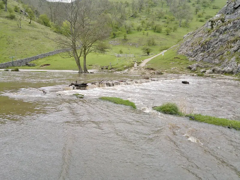
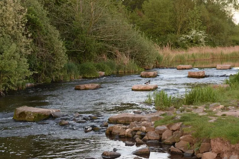
    The Stepping Stones are the most famous landmark of the Peak District: a series of flat limestone slabs across which the River Dove can be crossed dry-shod. They were installed in the 1890s, when Victorian excursion traffic to Dovedale began.From the car park at the valley end, it's about a ten-minute walk upstream. The stones are slippery when wet; after heavy rain, some are submerged. Beyond them, the path ascends via the Lover's Leap steps and passes the limestone pinnacles of the Twelve Apostles and the natural archway of Reynard's Cave. It's just over four kilometres to Milldale, and the return journey follows the same path back.
    Open in Google Maps
    Milldale and Viator's Bridge

    John Sparshatt / Wikimedia Commons / CC BY-SA 2.0, mod.

    5Milldale and Viator's Bridge

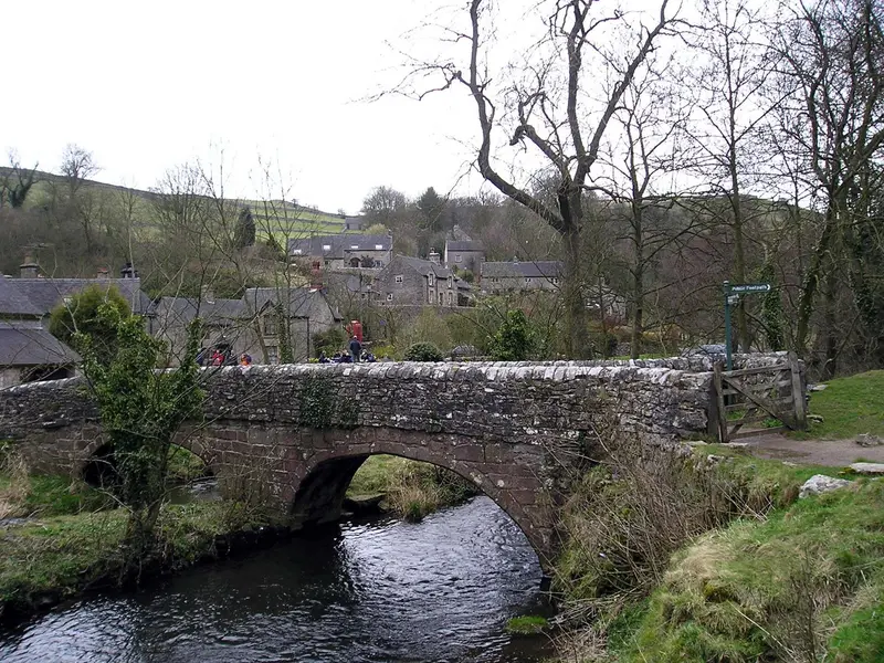
    Milldale marks the upper end of Dovedale Gorge, a good four kilometers upstream from the Stepping Stones. The hamlet consists of a few stone houses and a kiosk, and cars can barely reach it.Across the Dove is Viator's Bridge, a narrow packhorse bridge without railings. It owes its name to The Compleat Angler: In the second part, authored by Charles Cotton and published in the fifth edition of Izaak Walton's book in 1676, a character named Viator complains about the bridge's narrowness. Walton and Cotton fished in the Dove, and the valley has since been considered a cradle of fly-fishing. At Polly's Cottage kiosk, you can get drinks and snacks, and the National Trust's small information barn tells the story of the valley and its mill.
    Open in Google Maps

    Restaurants in Dovedale

    1

    Sycamore Inn

    A village pub in Parwich, about six kilometres northeast of Dovedale near the Tissington Trail. The pub is owned by the village community, which operates it together with a small shop. Pub dishes and ales are served, highly rated and popular with cyclists and hikers.
    Show on Google Maps
    2

    The Bowling Green Steakhouse

    A steakhouse with a bar in Ashbourne, the market town on the southern edge of the Peak District, about seven kilometres southeast of Dovedale. Besides steaks, there's pub fare; with over a thousand reviews, it's one of the town's most popular spots. Reserve in the evenings.
    Show on Google Maps
    3

    Market Place Fish & Chip Restaurant

    A Fish-and-Chips restaurant with takeaway in Ashbourne's Market Place, around seven kilometres from Dovedale. Classic battered fish with chips, available to eat in or take away; highly rated and a straightforward choice after a hike.
    Show on Google Maps

    Foods and Drinks

    In the valley itself, there is only one kiosk in Milldale. You'll find pubs, tea rooms and restaurants in Ilam, Thorpe, Hartington, and especially in Ashbourne.

    Staffordshire Oatcakes

    Soft oat flour pancakes, filled for breakfast on the Staffordshire side of the Dove with cheese, bacon or mushrooms.

    Ashbourne Gingerbread

    A firm ginger biscuit which, according to legend, dates back to a recipe of French prisoners of war from the time of the Napoleonic Wars. Bakeries in Ashbourne still sell it today.

    Cream Tea

    Scones with Clotted Cream and jam are just the thing after a hike in the valley, for example, in the tearoom of Ilam Park or in Tissington.

    Culture and History

    The Anglers' ValleyDovedale is closely associated with Izaak Walton, whose 1653 book The Compleat Angler is one of the most famous works on fly-fishing. His friend Charles Cotton, who lived in Beresford Dale, wrote a chapter on fishing the Dove for a later edition. Cotton's small fishing temple from 1674 still stands on the riverbank today, though on private land.Well Dressing in TissingtonIn the village of Tissington, every year around Ascension Day, the wells are adorned with large panels made of flower petals, moss, and seeds. The custom is considered one of the oldest of its kind in Derbyshire and attracts many visitors during this week.An Early Excursion DestinationAlready in the 19th century, travelers came to Ashbourne by train to see the valley. The former railway line is now the Tissington Trail, a cycling and walking path that leads north along the edge of the valley.

    Getting Here and Around

    By CarThe main National Trust car park is at the south end of the valley between Thorpe and Ilam and is chargeable. On fine weekends, it is full by morning; alternatives are available in Milldale and Ilam.By Public TransportThe nearest major train station is Derby. From there, buses run to Ashbourne, about seven kilometres southeast. Few direct buses run into the valley, so from Ashbourne, you can walk, cycle, or take a taxi.On Foot and By BikeThe path from the Stepping Stones to Milldale is about five kilometres long and largely flat. The Tissington Trail connects Ashbourne with Parsley Hay; bikes can be rented at the trail end in Ashbourne. Cycling is not permitted within the valley itself.

    Accommodations in Dovedale

    Find perfect stay in Dovedale

    Booking.com* (Affiliate link)
    Search Hotels
    Agoda* (Affiliate link)
    Search Hotels
    Airbnb
    Vacation Rentals

    * Affiliate link: if you book through it, we earn a small commission. The price stays the same for you.

    Campgrounds in Dovedale

    Find perfect campground in Dovedale

    Search via Google Maps
    Campgrounds nearby (15km)
    Camping.info
    Find Campgrounds
    Park4Night
    RV Parks & Camping

    Nearby

    White Peak

    White Peak

    The White Peak is the limestone plateau in the south and central part of the Peak District. Dry stone walls divide the pastures into narrow fields, and between them, narrow valleys like Lathkill Dale, Monsal Dale, and Dovedale cut into the pale rock. The paths are gentler than in the moorland Dark Peak to the north and are easily accessible all year round.

    Unsplash

    Bakewell

    Bakewell

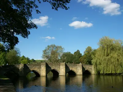
    Bakewell is the only town within the Peak District National Park, a small market town of grey limestone on the River Wye. A medieval five-arched bridge leads into the centre, and above the rooftops stands All Saints Church with its octagonal tower.The town is known for Bakewell Pudding and its Monday market. It serves as a good base for Chatsworth, Haddon Hall, and the Monsal Trail. On summer weekends, the centre is busy; during the week, outside of market days, it is much quieter.

    Tony Grist·public domain

    Buxton

    Buxton

    Buxton is the spa town of the Peak District, located at an altitude of around 300 meters on the western edge of the National Park. Even the Romans used the warm spring, which emerges from the ground here at a constant temperature of about 28 degrees. The town received its current appearance in the 18th and 19th centuries, when the Dukes of Devonshire developed it into a spa resort.In the center are the curved Crescent, today a hotel with a thermal spa, the Opera House by Frank Matcham, and the Pavilion Gardens. At St Ann's Well, you can fill up on the spring water for free. With its train station, the town is a good base for hikes in the Goyt Valley and the White Peak.

    pierre matile·Pexels

    Peak District National Park

    Peak District National Park

    The Peak District in central England was established in 1951 as Britain's first national park and lies between the major cities of Manchester and Sheffield. It consists of two contrasting halves: the Dark Peak in the north with moorlands and dark gritstone edges, and the White Peak in the south with limestone valleys, dry stone walls, and sheep pastures.In between lie market towns like Bakewell and Buxton, the cave village of Castleton, and country estates like Chatsworth. The area is easily accessible by train and bus and is suitable for day hikes as well as multi-day trips.

    Unsplash

    Castleton

    Castleton

    Castleton is a village at the western end of the Hope Valley, right where the pale limestone of the White Peak meets the dark shale and sandstone hills of the Dark Peak. Above the stone houses, on a rock spur, stands the ruin of Peveril Castle, one of England's earliest Norman castles.Around the village are four show caves, in two of which the rare Blue John is still mined. Also, there's Winnats Pass and Mam Tor with the ridge to Lose Hill, one of the most popular hikes in the National Park. On weekends, the village gets very busy.

    Angel S·Pexels

    Your next steps

    Dovedale is in Great Britain. Ways to carry on from here.

    • More in Great Britain

      Highlights, areas, routes and the best time to travel for all of Great Britain.

      Great Britain travel guide
    • Round trips in Great Britain

      Ready-made routes through Great Britain, with stops, nights and a map.

      See the routes
    • Plan a trip with Dovedale

      The Guide asks about season, length and who is coming, and suggests a trip with Dovedale.

      Plan the trip

    Sources & method

    • Photos: Wikimedia Commons, Pexels. Each photo carries its credit.
    • Place data such as addresses and ratings comes from Google Maps.
    • The content is based on web research from public, traceable sources. How the content is made · The role of AI