Fernweh: Home
    ExploreTravel GuidesPlan a tripMy tripLast visited
    de|en
    All Places & RegionsAll highlightsAbout FernwehFAQPrivacy PolicyImprint
    ExploreTravel GuidesPlan a tripMy tripLast visited
    • Overview
    • Places in the region
    • Eat & drink
    • Culture
    • Getting around
    • Round trips
    • Nearby
    Fiordland National Park

    New Zealand

    Fiordland National Park

    Region

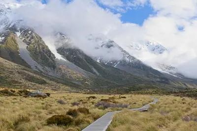
    Fiordland, at around 12,500 square kilometers, is New Zealand's largest national park and part of the UNESCO World Heritage Site Te Wāhipounamu.

    by Felix Gillen

    1. Home
    2. Destinations
    3. New Zealand
    4. Fiordland National Park
    Fiordland, at around 12,500 square kilometers, is New Zealand's largest national park and part of the UNESCO World Heritage Site Te Wāhipounamu. Fourteen fjords, including Milford and Doubtful Sound, cut deep into mountains covered in rainforest. Te Anau is the gateway for almost all tours.
    The park occupies the entire southwest corner of the South Island and is largely undeveloped. Only one road, the Milford Road, leads in. Most travellers stay in Te Anau or Manapouri and from there visit Milford Sound by car or bus, and Doubtful Sound with a combined boat and bus tour. Three Great Walks start in the region: Milford, Kepler, and Routeburn Track. It rains a lot; the main hiking season runs from late October to April. Sandflies are ubiquitous; bring insect repellent.
    Doubtful Sound

    Place 1 of 4

    Doubtful Sound

    The Doubtful Sound, in Māori Patea, is three times longer than Milford Sound and considerably more secluded. It is only accessible via a boat trip across Lake Manapouri and a bus journey over the Wilmot Pass, so fewer visitors share the fjord.

    Discover
    Manapouri

    Place 2 of 4

    Manapouri

    Manapouri is a small town on the eastern shore of Lake Manapouri, approximately 20 kilometers south of Te Anau. Boats for Doubtful Sound tours depart from Pearl Harbour, and it's also a quieter overnight stay option than Te Anau.

    Discover
    Milford Sound

    Place 3 of 4

    Milford Sound

    Milford Sound, called Piopiotahi in Māori, is New Zealand's best-known fjord and the only one in Fiordland that can be reached by road.

    Discover
    Te Anau

    Place 4 of 4

    Te Anau

    Situated on the eastern shore of Lake Te Anau, the South Island's largest lake, Te Anau is the main base for Fiordland National Park. From here, tours depart for Milford and Doubtful Sound, and the Kepler Track starts at the town's edge.

    Discover

    Sights in Fiordland National Park

    Discover the most important sights and attractions

    Homer Tunnel
    Attraction

    Homer Tunnel

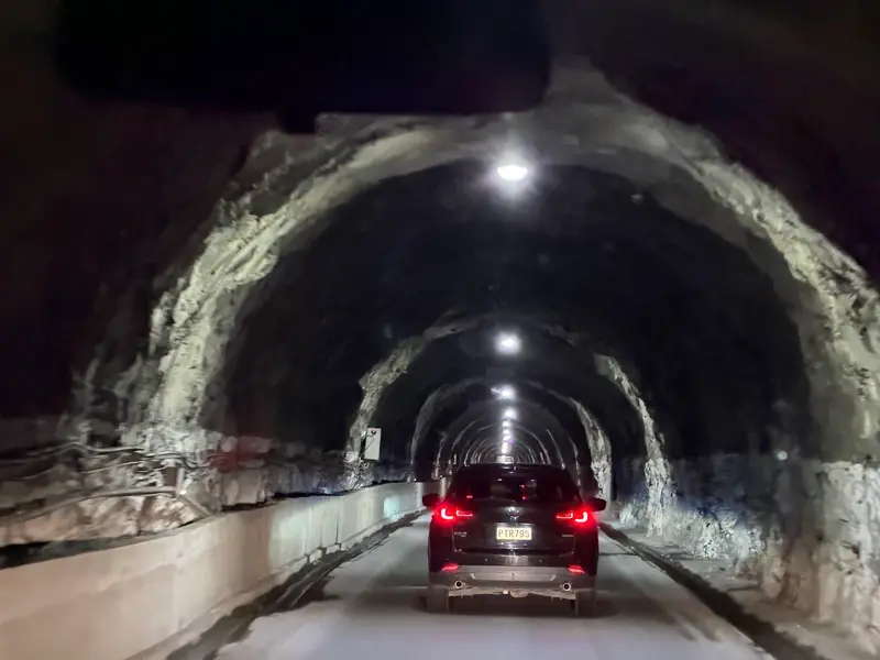
    The approximately 1.2-kilometer long, single-lane tunnel through the rock of the Darran Mountains is the bottleneck of the Milford Road. Keas often wait at the eastern portal, don't feed them. The traffic light phases can mean longer waiting times.
    Open in Google Maps
    Mirror Lakes

    Mirror Lakes

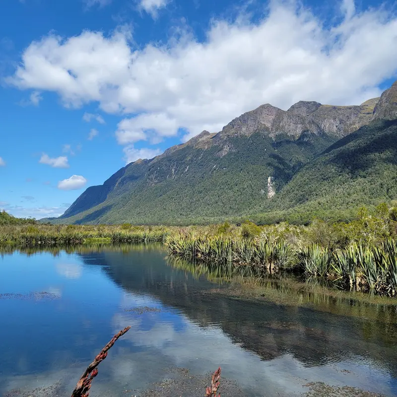
    A short wooden boardwalk on the Milford Road leads to small ponds in the Eglinton Valley, in which the Earl Mountains are reflected when there is no wind. The stop takes about ten minutes.
    Open in Google Maps

    Essen & Trinken

    1

    Pio Pio Restaurant

    Cafe and restaurant on the Milford Sound Highway in Milford Sound, near the boat dock.
    Show on Google Maps
    2

    Milford Sound Information Center & Cafe

    Café in the Freshwater Basin Information Centre, at State Highway 94's end, by the car park and boat terminal. Handy for a coffee or snack before or after your boat ride.
    Show on Google Maps

    Nature and History

    Glaciers shaped the fjords during the Ice Ages, then the sea flooded the valleys. For the Kāi Tahu, the region was primarily a hunting and gathering ground, hardly permanently settled. Europeans arrived as sealers and whalers, later as explorers and gold miners.Fiordland was declared a National Park in 1952. In the Murchison Mountains, the 'extinct' Takahē was rediscovered in 1948; Department of Conservation programmes now protect endangered birds on predator-free islands off the coast.

    Exploring Fiordland

    On the Road in FiordlandWithout your own car, you depend on tours. Te Anau is reachable in about two hours from Queenstown, where you'll find a supermarket, petrol stations, and the DOC visitor centre.The Milford Road (SH94) is around 120 km long and has no petrol stationYou can only reach Doubtful Sound by boat via Lake Manapouri and bus via Wilmot PassGreat Walks huts must be booked in advance with DOC during peak season

    Round trips through this region

    New Zealand South Island Road Trip In-depth

    New Zealand South Island Road Trip In-depth

    The route leads from Lake Tekapo to Aoraki/Mount Cook, on to Queenstown and Te Anau, then via Wanaka and Haast Pass to the West Coast glaciers. From Te Anau, it’s just over two hours’ drive to Milford Sound; Wanaka to Franz Josef is about four hours.

    15 Days
    6 stops

    Nearby

    Doubtful Sound

    Doubtful Sound

    The Doubtful Sound, in Māori Patea, is three times longer than Milford Sound and considerably more secluded. It is only accessible via a boat trip across Lake Manapouri and a bus journey over the Wilmot Pass, so fewer visitors share the fjord.
    Te Anau

    Te Anau

    Situated on the eastern shore of Lake Te Anau, the South Island's largest lake, Te Anau is the main base for Fiordland National Park. From here, tours depart for Milford and Doubtful Sound, and the Kepler Track starts at the town's edge.
    Manapouri

    Manapouri

    Manapouri is a small town on the eastern shore of Lake Manapouri, approximately 20 kilometers south of Te Anau. Boats for Doubtful Sound tours depart from Pearl Harbour, and it's also a quieter overnight stay option than Te Anau.
    Milford Sound

    Milford Sound

    Milford Sound, called Piopiotahi in Māori, is New Zealand's best-known fjord and the only one in Fiordland that can be reached by road. Steep rock walls, the 1,692-meter-high Mitre Peak and waterfalls such as Stirling Falls shape the roughly 15-kilometer-long inlet.
    Glenorchy

    Glenorchy

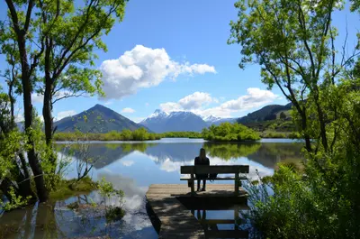
    Glenorchy is located at the northern end of Lake Wakatipu, a 45-minute drive from Queenstown, at the entrance to the Dart and Rees Valleys. The town is a starting point for the Routeburn Track and the backdrop for numerous film scenes, including from The Lord of the Rings trilogy.

    Sources & method

    • Photos: Unsplash, Google Maps. Each photo carries its credit.
    • Place data such as addresses and ratings comes from Google Maps.
    • The content is based on web research from public, traceable sources. How the content is made · The role of AI