Fernweh: Home
    ExploreTravel GuidesPlan a tripMy tripLast visited
    de|en
    All Places & RegionsAll highlightsAbout FernwehFAQPrivacy PolicyImprint
    ExploreTravel GuidesPlan a tripMy tripLast visited
    Tongariro Nationalpark Gebiet

    New Zealand

    Tongariro Nationalpark Gebiet

    DistrictCulture

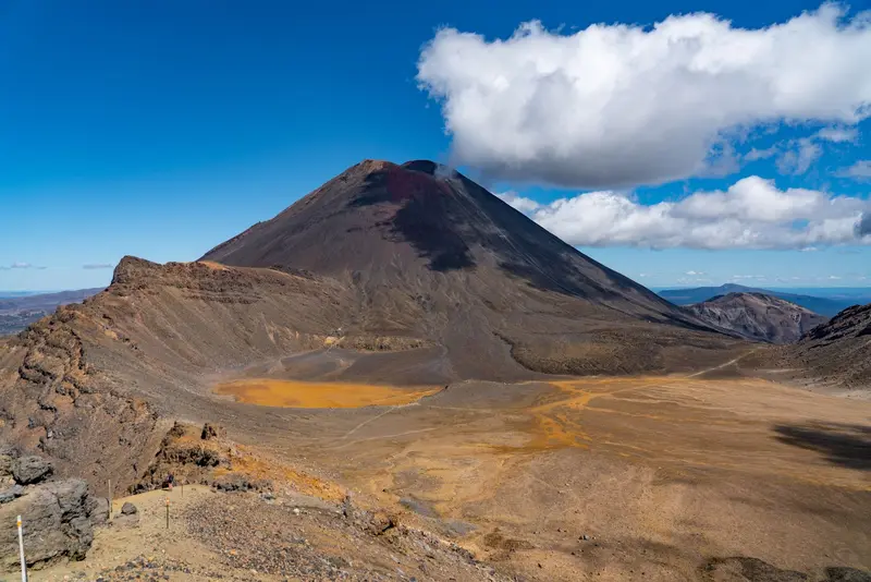
    Three active volcanoes dominate the Tongariro National Park: Tongariro, Ngāuruhoe, and Ruapehu.

    by Felix Gillen

    1. Home
    2. Destinations
    3. New Zealand
    4. Central North Island
    5. Tongariro Nationalpark Gebiet
    Three active volcanoes dominate the Tongariro National Park: Tongariro, Ngāuruhoe, and Ruapehu. The park was established in 1894 as New Zealand's first national park, and in 1993 it became the first site listed under the new criteria for cultural landscapes on the World Heritage List, making it both a natural and cultural heritage site. The most famous trail is the Tongariro Alpine Crossing, which climbs from 1120 meters at the Mangatepopo car park to 1886 meters at Red Crater and descends to 760 meters at Ketetahi Road. Additionally, shorter trails from Whakapapa Village to Taranaki Falls, to the Tama Lakes, and through the beech forest along Whakapapanui Stream are also rewarding.The volcanoes are active. Before every tour, check the current status with DOC and GeoNet and read the travel and safety advice from the Auswärtiges Amt, which is linked on our country page.

    Sehenswürdigkeiten

    Discover the most important sights and attractions

    Tongariro Alpine Crossing

    1Tongariro Alpine Crossing

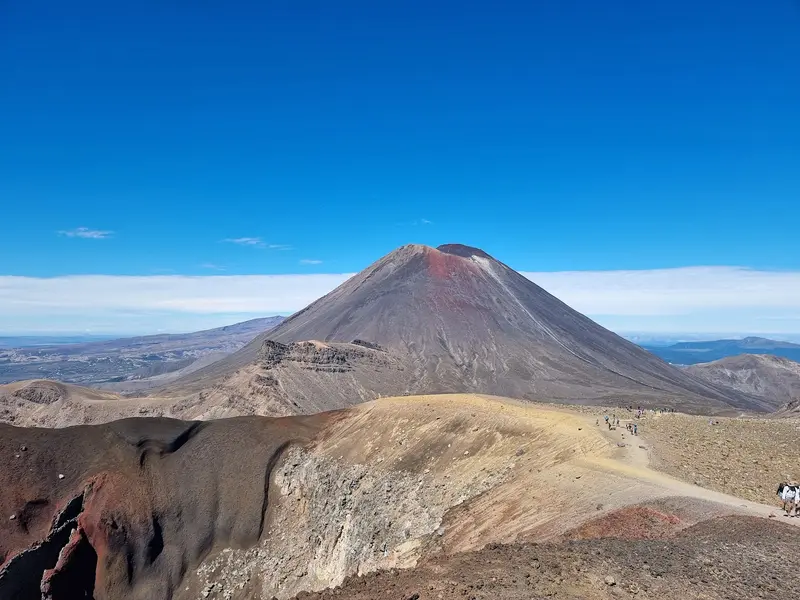
    Day hike through active volcanic terrain from Mangatepopo car park to Ketetahi Road, passing Red Crater (1886 m) and the Emerald Lakes. According to DOC, you'll need 7 to 8 hours in summer. At the start, there's no parking for Crossing hikers in season, so take a pre-booked shuttle.
    Open in Google Maps
    Tawhai Falls (Gollum's Pool)

    2Tawhai Falls (Gollum's Pool)

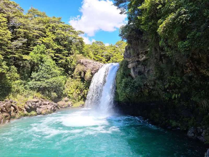
    Waterfall in the forest on State Highway 48 below Whakapapa Village, a filming location for 'The Lord of the Rings', also known as Gollum's Pool. A short path leads down from the road.
    Open in Google Maps
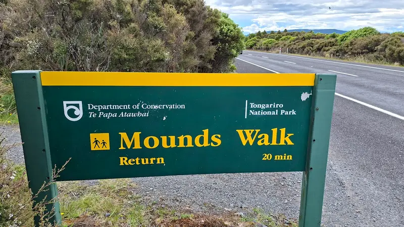
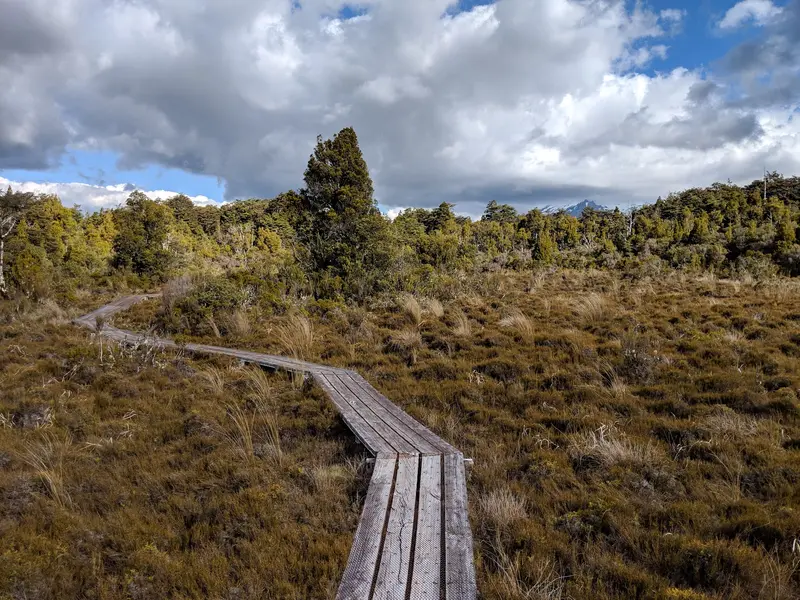
    Mounds walk at Tongariro National Park

    3Mounds walk at Tongariro National Park

    Short walking path along State Highway 48 to grass-covered hills of volcanic scree, with views of Ruapehu.
    Open in Google Maps
    Whakapapanui walk at Tongariro National Park

    4Whakapapanui walk at Tongariro National Park

    Short walk near Whakapapa Village through beech forest and open tussockland by the Whakapapanui Stream.
    Open in Google Maps
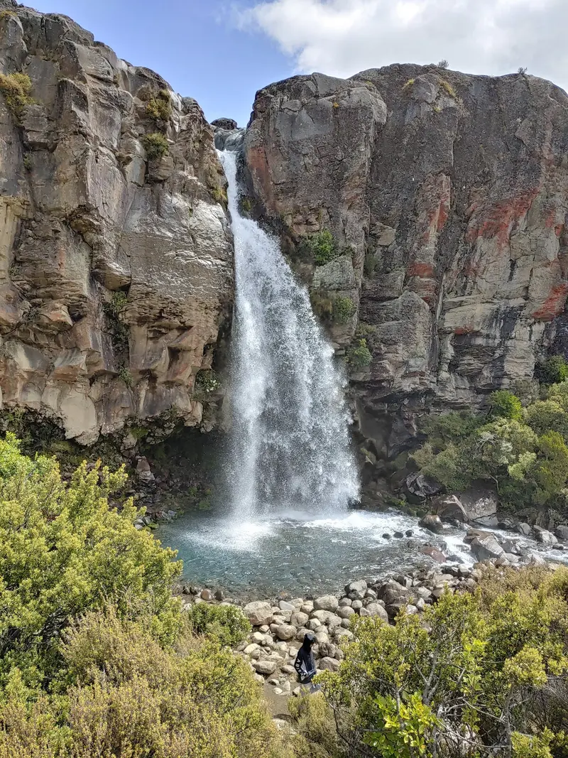
    Taranaki Falls
    Attraction

    5Taranaki Falls

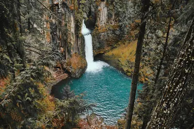
    Waterfall plunging over an edge of volcanic rock into a basin. A loop track leads there from Whakapapa Village through tussockland and beech forest.
    Open in Google Maps
    Tama Lakes
    Attraction

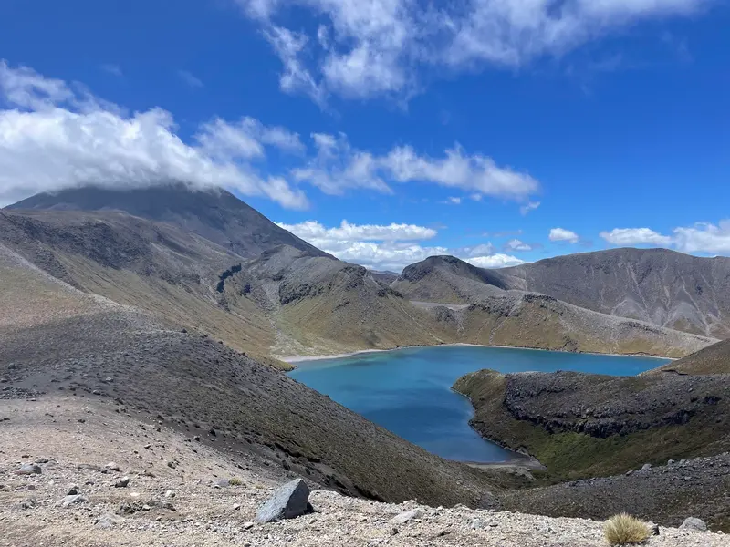
    6Tama Lakes

    Two crater lakes in the saddle between Ruapehu and Ngāuruhoe. The path from Whakapapa Village leads past the Taranaki Falls; for the upper lake, you need more time and good weather.
    Open in Google Maps

    Essen & Trinken

    1

    The Station

    Café in the National Park Village station building on Station Road.
    Show on Google Maps
    2

    Freddies

    Restaurant in Ohakune, southern edge of National Park.
    Show on Google Maps
    3

    Schnapps Bar

    Bar with pub food on State Highway 4 in National Park Village.
    Show on Google Maps
    4

    Spiral Restaurant @ The Park

    Restaurant on Millar Street in National Park Village.
    Show on Google Maps

    Ngāti Tūwharetoa's Holy Mountains

    The peaks are sacred mountains (maunga tapu) for the Ngāti Tūwharetoa and the local Hapū Ngāti Hikairo ki Tongariro. In 1887, Ariki Horonuku Te Heuheu Tūkino IV placed the core of the mountainous region with its three volcanic peaks under protection through a tuku, to preserve them for his people and all New Zealanders. This led to the creation of the National Park in 1894, according to DOC the fourth in the world.The Iwi ask visitors not to climb the mountain peaks in the park and not to touch or enter the lakes and waterways, including the Emerald Lakes at the Crossing. Respect this, even if the trails are open.

    Getting there and around the park

    Starting points are Whakapapa Village to the west of Ruapehu, National Park Village on State Highway 4, and Ohakune to the south. The Northern Explorer train between Auckland and Wellington stops in National Park and Ohakune.According to DOC, the Tongariro Alpine Crossing takes 7 to 8 hours in summer. As the start and end points are far apart and no parking is available for Crossing hikers at Mangatepopo car park during the season, book a shuttle in advance. Mountain weather changes quickly, so take warm and waterproof clothing and check the weather and volcanic alert level before you start.

    Accommodations in Tongariro Nationalpark Gebiet

    Find perfect stay in Tongariro Nationalpark Gebiet

    Booking.com* (Affiliate link)
    Search Hotels
    Agoda* (Affiliate link)
    Search Hotels
    Airbnb
    Vacation Rentals

    * Affiliate link: if you book through it, we earn a small commission. The price stays the same for you.

    Nearby

    Taupō

    Taupō

    Taupō is located on the northeastern shore of Lake Taupō, New Zealand's largest lake. The lake fills a caldera formed by massive volcanic eruptions; the last major eruption occurred around 232 AD.The town is a base for water sports, trout fishing, skydiving, and excursions to Huka Falls, Craters of the Moon, and Tongariro National Park, whose volcanoes you can see from the shore on clear days.
    Waitomo

    Waitomo

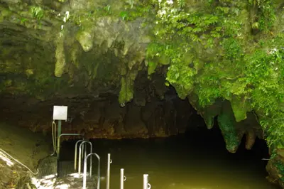
    Waitomo is a small village in the hilly karst country of the King Country, and beneath the pastures lies a network of limestone caves. The name combines wai (water) and tomo (hole, shaft) and describes a stream that disappears into the ground. In the Waitomo Glowworm Cave you glide by boat beneath thousands of glowworm lights, you reach the Ruakuri Cave through a spiral entrance, and the dry Aranui Cave shows stalactites and stalagmites. During the day, the Ruakuri Walk is worthwhile, as is a detour along Te Anga Road to the Mangapohue Natural Bridge and the 35-metre-high Marokopa Falls.
    Hawke's Bay

    Hawke's Bay

    Hawke's Bay on the East Coast of the North Island is both orchard and wine country. Around Napier, Hastings and Havelock North, apple orchards, vineyards, and gravel soils alternate; the coast features long beaches and the gannet colony at Cape Kidnappers. The 1931 earthquake still shapes the cityscape: Napier and Hastings were rebuilt in Art Deco and Spanish Mission styles afterwards.
    Napier

    Napier

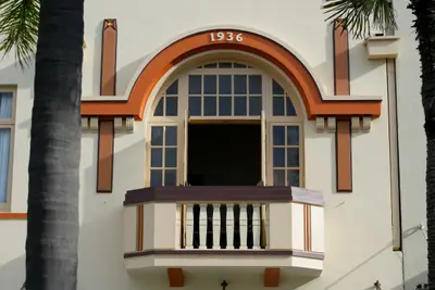
    Napier is located on Hawke Bay on the east coast of the North Island and is primarily known for its Art Deco centre. The earthquake of February 3, 1931, destroyed large parts of the city, after which the centre was rebuilt in the style of the era. Today, you can stroll among pastel-coloured facades, walk along the Marine Parade by the sea, and view the harbour from Bluff Hill. The Hawke's Bay wineries are just a short drive away.

    Hastings

    Hastings is the heart of the Heretaunga fruit and wine plains in Hawke's Bay. After the 1931 earthquake, which claimed 93 lives here, the city centre was rebuilt in Art Deco and Spanish Mission styles. Today, you can stroll from the Clock Tower through Heretaunga Street, visit the Farmers' Market on Sundays, and head from here to the Gimblett Gravels wineries or up Te Mata Peak near Havelock North.

    Sources & method

    • Photos: Pexels, Google Maps. Each photo carries its credit.
    • Place data such as addresses and ratings comes from Google Maps.
    • The content is based on web research from public, traceable sources. How the content is made · The role of AI