Colombia
Sierra de La Macarena
Region
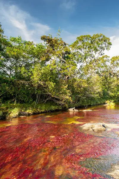
The Sierra de La Macarena is a mountain range in the Meta Department, south of Villavicencio, where the Andes, Orinoco savannas, and Amazon meet. It is known for Caño Cristales, a river that a water plant colors red during the rainy season.
by Felix Gillen
The Sierra de La Macarena is a mountain range in the Meta Department, south of Villavicencio, where the Andes, Orinoco savannas, and Amazon meet. It is known for Caño Cristales, a river that a water plant colors red during the rainy season. The starting point is the small town of La Macarena, which you reach by flight.
The Sierra de La Macarena National Park was designated in 1989 and covers approximately 619,546 hectares across six municipalities of Meta. It connects Andean forest, savanna, and Amazon rainforest. The rock formations belong to the Guiana Shield and are among Colombia's oldest.Season and RulesCaño Cristales only opens seasonally. According to Parques Nacionales, the 2026 season runs from May 29th to December. Visits are only possible with authorized operators and guides from La Macarena.Besides Caño Cristales, there are other authorized destinations around La Macarena, such as the Cristalitos viewpoint, Laguna del Silencio, and Raudal de Angosturas I with petroglyphs.
More places in Sierra de La Macarena
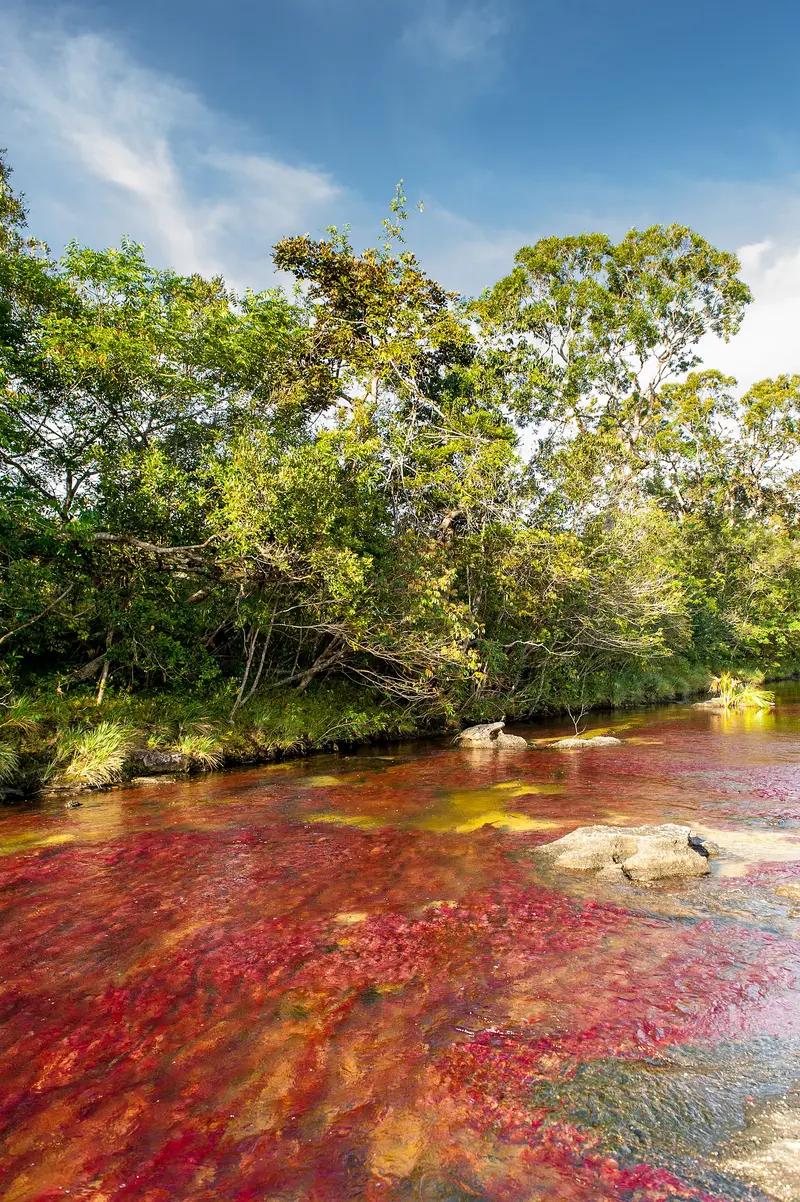
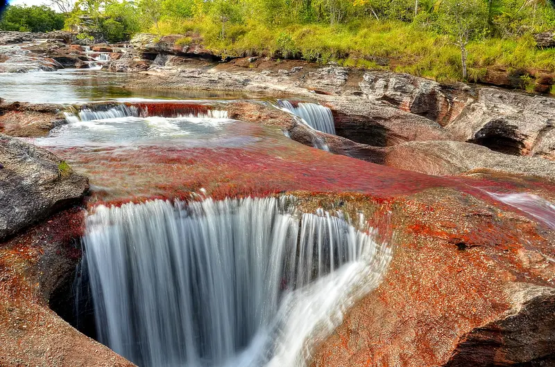
Caño Cristales is a river in the Sierra de La Macarena National Park in the Meta Department, accessible by flight to La Macarena. Between June and November, the aquatic plant Macarenia clavigera dyes its bed red, complemented by green, yellow, and black hues. The river is a succession of rapids, cascades, and pools that flow into the Río Guayabero.
Food & Drink in La Macarena
La Macarena isst wie die Llanos: Rindfleisch vom offenen Feuer, Flussfisch und Reisgebäck. Dazu trinkt man meist Limonade.
Mamona
Young beef, skewered vertically on wooden stakes around a fire and slowly cooked, seasoned only with salt. This specialty, also known as Ternera a la llanera, is the most famous dish of the Llanos and comes with yuca or plantain.
Plato macarenense
Das Gericht des Ortes wurde von der traditionellen Köchin Numa Eneida Roa Alfonso nach den Farben von Caño Cristales entworfen. Es verbindet Bananenblatt, Reis, Savannen-Koriander, Bauernkäse, Kochbanane und Avocado.
Pan de arroz
A pastry made from rice and cheese, found everywhere in the bakeries of the Llanos. In La Macarena, it complements main meals along with plantain.
Cachama frita
Fried Cachama, a river fish, is among the typical dishes in Meta, alongside meat. In La Macarena, fish is served alongside Mamona and boiled country chicken.
Best Time to Visit
When is the best time for your trip?
24–26°C·400–499 mm(heavy rain)
In Meta, December to February is the dry season; Villavicencio sees over 390 mm of monthly rain from April to October. Yet, for Caño Cristales, the rainy season is the travel season: Only with sufficient water do the aquatic plants color the river red. Lonely Planet calls July to October the blooming season.
The visiting season for Caño Cristales begins late May or June, depending on the year, and ends in December; dates depend on the plant cycle. Access is by flight to La Macarena with a local guide. Before travelling, check the current travel and safety advisories from the Foreign Office.
Seasons
Jan
Feb
Mar
Apr
May
Jun
Jul
Aug
Sep
Oct
Nov
Dec
Dry season
Interim time
Wet season
Best Time to Visit
▶Show detailed monthly data
| Month | Temp (°C) | Rain (mm) | Sun (h) |
|---|---|---|---|
| January | 26.7 | 63 | 5.5 |
| February | 27.2 | 132 | 4.7 |
| March | 26.8 | 230 | 3.6 |
| April | 25.7 | 520 | 3.7 |
| May | 25.2 | 674 | 3.9 |
| June | 24.5 | 542 | 3.7 |
| July | 24.2 | 461 | 3.7 |
| August | 24.9 | 400 | 4.4 |
| September | 25.5 | 407 | 5.1 |
| October | 25.6 | 499 | 5.2 |
| November | 25.6 | 425 | 4.9 |
| December | 25.9 | 186 | 5.3 |
Videos & Travel Reports
13 of the best places to visit in Colombia
Lonely Planet article by Steph Dyson, last updated in March 2026, covering Cartagena, the Amazon, the coffee region, Tayrona, the Sierra Nevada, La Guajira, San Gil, Providencia, Caño Cristales and…
Life in La Macarena
Tourism around Caño Cristales is central to the community. According to Parques Nacionales, approximately 650 families depend on it directly or indirectly.Festival: In November, La Macarena celebrates a festival around the Vellozia tubiflora, a fire-resistant plant with white blossoms.Rock Art: At Raudal de Angosturas I and Mirador Cristalitos, there are petroglyphs and rock paintings.
Arrival and on the go
Flight: Satena flies year-round on Mondays and Fridays from Villavicencio to La Macarena, in the 2026 season until November 15, additionally on Wednesdays, Fridays, and Sundays directly from Bogotá. Packages often include flights.Check the current UK FCDO travel advice before your trip.On Location: Boat on the Río Guayabero from Puerto Inderena, followed by off-road vehicle and hiking trails.