Colombia
La Guajira
Region
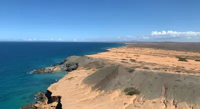
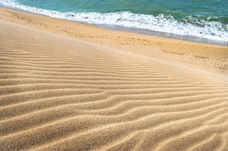
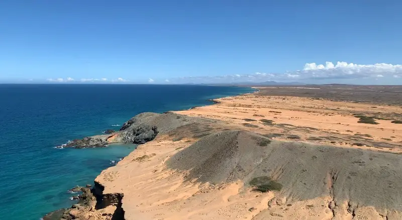
La Guajira is the desert peninsula in the far northeast of Colombia on the border with Venezuela. You travel here for Cabo de la Vela, the dunes of Punta Gallinas at South America's northernmost point, and the Wayuu culture.
by Felix Gillen
La Guajira is the desert peninsula in the far northeast of Colombia on the border with Venezuela. You travel here for Cabo de la Vela, the dunes of Punta Gallinas at South America's northernmost point, and the Wayuu culture. The starting point is Riohacha, the capital of the department.
The north of the peninsula is dry and sparsely populated. Here, semi-desert, dunes, and the Caribbean Sea meet, and constant trade winds make the coast a destination for kitesurfers.Land of the WayuuA large part of Alta Guajira belongs to the municipality of Uribia, which is considered Colombia's largest indigenous municipality. Most accommodations are simple Wayuu posadas and rancherías, and you often sleep in a hammock (Chinchorro).PlanningBeyond Riohacha and Uribia, supplies are scarce, and reliable ATMs are nonexistent. Punta Gallinas is practically only reachable by a 4x4 tour.
Food & Drink in La Guajira
The peninsula's cuisine is influenced by the Wayuu and revolves around goat. On the coast, fish, shrimp, and lobster are added.
fallow
The Wayuu's most famous dish: goat meat, offal, and fat. Once made with animal blood, it's now rarely so.
Chivo guisado
Braised goat, one of many preparations of the animal central to Wayuu culture. In La Guajira, goat is also available grilled, fried, dried, and with rice.
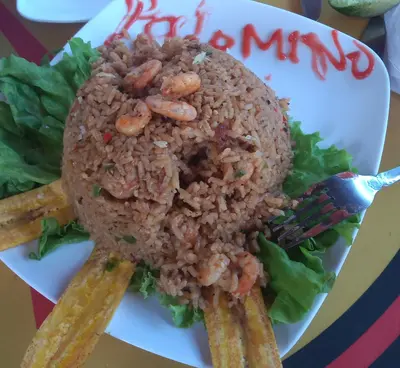
Arroz con camarones
Rice with fresh prawns, a coastal staple. For breakfast, the leftovers from the day before are often fried with egg.
Chirrinchi
Homemade sugarcane spirit, produced in small quantities. It is closely linked to the traditions of the Wayuu.
Best Time to Visit
When is the best time for your trip?
27–30°C·2–51 mm(little rain)
La Guajira is the country's driest region. Riohacha sees under 6mm rain monthly from January to March; June and July are also dry. Short rainy seasons occur from September to November.
Further north, it gets even drier: The Puerto Bolívar station near Uribia records less than 30 mm of rain in most months. With monthly averages of 27 to 30 degrees and plenty of sun, you'll need sun protection. Before your trip, check the current travel and safety advisories from the Federal Foreign Office.
Seasons
Jan
Feb
Mar
Apr
May
Jun
Jul
Aug
Sep
Oct
Nov
Dec
Dry season
Interim period
Wet season
Best Time to Visit
▶Show detailed monthly data
| Month | Temp (°C) | Rain (mm) | Sun (h) |
|---|---|---|---|
| January | 27.1 | 4 | 8.5 |
| February | 27.2 | 2 | 8.1 |
| March | 27.4 | 6 | 7.5 |
| April | 28.0 | 31 | 6.7 |
| May | 28.8 | 76 | 6.3 |
| June | 29.7 | 51 | 7.8 |
| July | 29.9 | 37 | 8.4 |
| August | 29.5 | 80 | 8.1 |
| September | 28.5 | 143 | 6.9 |
| October | 28.0 | 149 | 6.7 |
| November | 27.7 | 76 | 7.2 |
| December | 27.3 | 31 | 7.8 |
Videos & Travel Reports
13 of the best places to visit in Colombia
Lonely Planet article by Steph Dyson, last updated in March 2026, covering Cartagena, the Amazon, the coffee region, Tayrona, the Sierra Nevada, La Guajira, San Gil, Providencia, Caño Cristales and…
The Wayuu Culture
The Wayuu are a matrilineal society. They are known for their woven bags (Mochilas), the purchase of which directly supports the local economy.The area around Cabo de la Vela is called Jepirra by the Wayuu. According to their beliefs, the souls of the deceased cross into the afterlife there, making the place sacred to them.
Getting There & Around
Plane: Typically, fly to Riohacha, then continue overland from there.Cabo de la Vela: about three hours overland from Riohacha, with a stop in Uribia for water and provisions.Punta Gallinas: via an agency from Riohacha or by 4x4 from Cabo de la Vela; from there, the journey takes several hours depending on the track.Cash: Beyond Riohacha, there are no reliable ATMs. Bring small denominations.