Fernweh: Home
    ExploreTravel GuidesPlan a tripMy tripLast visited
    de|en
    All Places & RegionsAll highlightsAbout FernwehFAQPrivacy PolicyImprint
    ExploreTravel GuidesPlan a tripMy tripLast visited
    Bieszczady

    Poland

    Bieszczady

    Point of Interest

    The Bieszczady Mountains, in the far southeast of Poland, bordering Slovakia and Ukraine, are part of the Eastern Carpathians.

    by Felix Gillen

    1. Home
    2. Destinations
    3. Poland
    4. Bieszczady
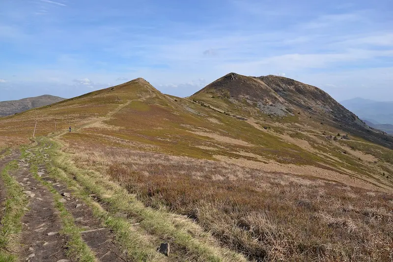
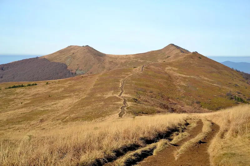
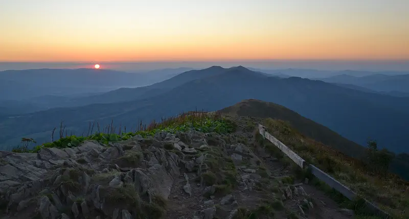
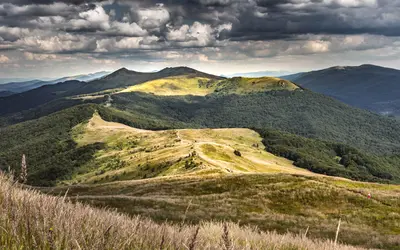
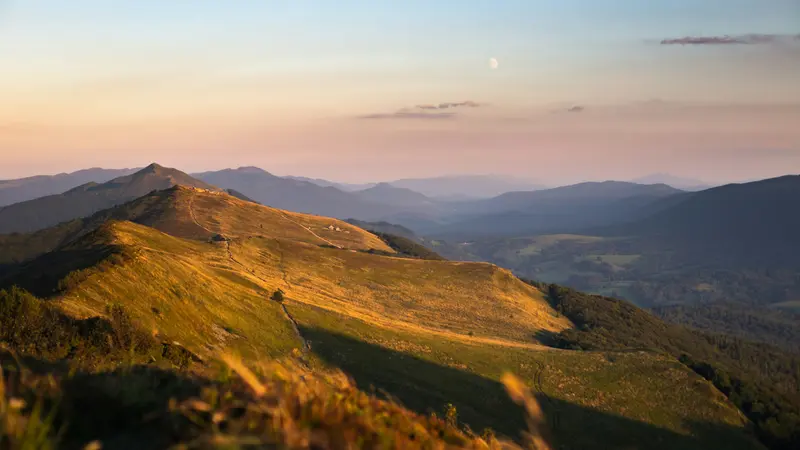
    The Bieszczady Mountains, in the far southeast of Poland, bordering Slovakia and Ukraine, are part of the Eastern Carpathians. Its heart is the Bieszczady National Park (Bieszczadzki Park Narodowy), founded in 1973, and at over 292 square kilometers, it's the largest national park in the Polish mountains. Since 1992, it has been part of the transnational East Carpathian Biosphere Reserve, and since 2021, parts of its beech forests have been on the UNESCO World Heritage List.Characteristic features are the Połoniny, treeless mountain meadows above the tree line, such as Połonina Caryńska and Połonina Wetlińska, as well as the peaks Tarnica (1346 meters), Krzemień, and Halicz. Bears, wolves, lynx, and a free-ranging herd of European bison live in the forests. To the north lies the Solina Reservoir, Poland's largest capacity reservoir; in the region's villages stand wooden Cerkwie, including the UNESCO World Heritage churches of Smolnik and Turzańsk.

    Sights in Bieszczady

    Discover the most important sights and attractions

    Tarnica
    Natural Feature

    1Tarnica

    At 1346 meters, the highest peak of the Polish Bieszczady. From Wołosate, a 4.4-kilometer trail leads up in about two hours, first marked blue, then yellow from the pass below Tarnica. After rain, the muddy paths are slippery.
    Open in Google Maps
    Połonina Wetlińska
    Attraction

    2Połonina Wetlińska

    Elongated mountain meadow above the village of Wetlina, one of the National Park's most famous Połoniny.
    Open in Google Maps
    Połonina Caryńska
    Natural Feature

    3Połonina Caryńska

    Treeless ridge with high pastures, up to 1297 meters high, near Ustrzyki Górne. The Połoniny, the Bieszczady's hallmark, offer wide views.
    Open in Google Maps

    Restaurants in Bieszczady

    1

    Inn Under Caryńska

    Inn with restaurant and bar in Ustrzyki Górne, operating since 1997. The kitchen serves regional and traditional Old Polish dishes; its decor reflects Boyko culture.
    Show on Google Maps

    Nature and History

    Wilderness in the SoutheastThe Bieszczady National Park is home to over 230 vertebrate species. European bison were reintroduced in the 1960s; today, around 280 of these animals live throughout the Bieszczady, considered the largest free-ranging mountain herd of its kind. In Wołosate and Tarnawa Niżna, the park breeds Hucul ponies, which are used for grazing the meadows.Wooden Churches and DamSince 2013, the wooden Tserkvas of the Carpathian region in Poland and Ukraine have been UNESCO World Heritage sites. In the Bieszczady, these include the St. Michael's Churches in Smolnik and Turzańsk. The Solina Dam, built between 1960 and 1968, is Poland's highest dam, at nearly 82 meters high and approximately 664 meters long; the lake behind it covers approximately 22 square kilometers.

    Arrival and Visit

    Admission and TrailsTo use the trails in the National Park, you need a ticket, which you can purchase as an e-ticket via the park's website (bdpn.gov.pl) or at ticket points during the season; a day ticket costs 11 Złoty, reduced 5.50 Złoty (as of October 2026). Popular entry points include Wołosate, from where a 4.4-kilometer trail leads to Tarnica, and Ustrzyki Górne, the seat of the park administration. Dogs are only permitted on designated trails when on a leash and muzzled. The park publishes current advisories regarding closures, severe weather, and bears; read them before your tour.Getting ThereThe Bieszczady mountains are located away from major railway lines; most visitors arrive by car. Those traveling by bus should check regional timetables in advance.

    Accommodations in Bieszczady

    Find perfect stay in Bieszczady

    Booking.com* (Affiliate link)
    Search Hotels
    Agoda* (Affiliate link)
    Search Hotels
    Airbnb
    Vacation Rentals

    * Affiliate link: if you book through it, we earn a small commission. The price stays the same for you.

    Campgrounds in Bieszczady

    Find perfect campground in Bieszczady

    Search via Google Maps
    Campgrounds nearby (15km)
    Camping.info
    Find Campgrounds
    Park4Night
    RV Parks & Camping

    Nearby

    The Carpathian Foothills (Podkarpackie) in southeastern Poland border Slovakia to the south and Ukraine to the east. Rzeszów is the capital of the voivodeship, formed in 1999; its largest rivers are the San, Wisłoka, and Wisłok.To the south, the landscape rises to the Bieszczady, where Tarnica, at 1,346 meters, forms the highest point of the voivodeship. Noble residences like Łańcut and Krasiczyn, the fortress city of Przemyśl, and wooden Cerkwie tell of the eventful history of this borderland.
    Łańcut Castle

    Łańcut Castle

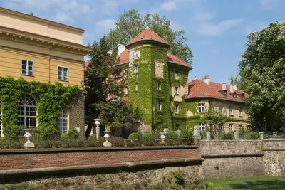
    Łańcut Castle (Zamek w Łańcucie), located in the Carpathian Foothills near Rzeszów, is a former magnate residence of the Lubomirski and Potocki families. Stanisław Lubomirski, Voivode of Kraków, had the complex expanded between 1629 and 1641 following plans by Maciej Trapola; after 1783, Izabela Lubomirska converted parts of the fortifications into gardens. From 1816, it belonged to the Potocki family, residing there until 1944. Since September 1944, the castle has served as a museum, and since 2005, the complex and its park have held the status of a Polish historical monument.In addition to the castle rooms, the museum houses the Coach House with a collection of carriages and accessories; the Orchid House in the park; a department for icons and sacred art; and a Judaica collection connected with the Synagogue of Łańcut founded by the Lubomirskis. The approx. 36-hectare landscape park, with an Italian Garden, Rose Garden, and moat, surrounds the castle.
    Pieniny and the Dunajec Gorge

    Pieniny and the Dunajec Gorge

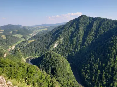
    The Pieniny Mountains are a small limestone range on the border with Slovakia, east of the Tatra Mountains. The Polish Pieniny National Park was established in 1932 as Poland's first national park and covers just over 23 square kilometres. The highest peak of the central massif is Trzy Korony (Three Crowns) at 982 metres, from whose viewing platform on Okrąglica you look deep into the valley.The Pieniny Mountains are primarily known for the Dunajec Gorge: The river has carved its way in loops between steep limestone cliffs. On wooden rafts, the region's rafters take visitors from Sromowce through the gorge to Szczawnica or Krościenko. West of this, the castles of Niedzica and Czorsztyn face each other across the Czorsztyn Reservoir.
    Małopolska

    Małopolska

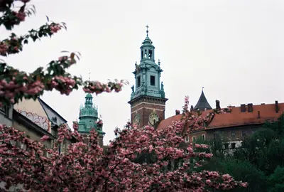
    Lesser Poland (Małopolska) stretches from the Vistula around Krakow (Kraków) to the peaks of the High Tatras on the Slovakian border. Krakow, capital of the Kingdom of Poland until 1596, serves as the administrative and cultural heart of the Voivodeship; its Old Town, the Wieliczka Salt Mine, and the Auschwitz-Birkenau Memorial together form several UNESCO World Heritage Sites located close by.To the south, the land rises through hills to the Carpathians. Around Zakopane and in the Pieniny, the Goral people define the landscape with their wooden architecture, sheep's cheese, and folk music, and in the villages of Southern Lesser Poland stand Gothic wooden churches that have been World Heritage Sites since 2003.
    Zamość

    Zamość

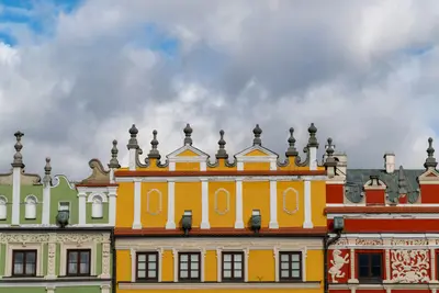
    Zamość is located in southeastern Poland, approximately 240 km from Warsaw and 110 km from Lemberg (Lwiw), and has about 58,000 inhabitants. From 1578, Jan Zamoyski had the city designed by the Venetian architect Bernardo Morando as an ideal Renaissance town, which earned it the nickname "Padua of the North." Since 1992, the Old Town has been a UNESCO World Heritage site.The Old Town has a hexagonal layout: in the west were the Zamoyski family residence and the Academy, and in the east, the burgher town with three squares: the Great Market (Rynek Wielki), the Salt Market, and the Water Market. On the Great Market, with its arcaded houses, stands the Town Hall with its 52-meter-high clock tower. Remains of the fortress are preserved around the Old Town.You can see the main sights in one day. Zamość also serves as an excellent base for excursions into the Roztocze National Park.

    Sources & method

    • Photos: Wikimedia Commons, Unsplash, Google Maps. Each photo carries its credit.
    • Place data such as addresses and ratings comes from Google Maps.
    • The content is based on web research from public, traceable sources. How the content is made · The role of AI