ExploreTravel GuidesPlan a trip
    de|en
    All Places & RegionsAbout FernwehFAQPrivacy PolicyImprint
    ExploreTravel GuidesPlan a trip
    Teotihuacán
    MIKHEIL / Wikimedia Commons / CC BY-SA 4.0

    Mexico

    Teotihuacán

    Point of InterestCulture

    Teotihuacán, around 50 kilometers northeast of Mexico City, was one of the largest cities in Mesoamerica between the 1st and 7th centuries and has been a UNESCO World Heritage site since 1987.

    1. Home
    2. Destinations
    3. Mexico
    4. Central Mexican Highlands
    5. Teotihuacán
    Teotihuacán, around 50 kilometers northeast of Mexico City, was one of the largest cities in Mesoamerica between the 1st and 7th centuries and has been a UNESCO World Heritage site since 1987. You travel here to walk along the Avenue of the Dead between the over 60-meter-high Pyramid of the Sun and the Pyramid of the Moon, a day trip easily undertaken from the capital. The Aztecs gave the long-abandoned city its name, often translated as 'Place where men become gods'. In 2023, INAH recorded around 1.8 million visitors.
    The Site at a GlanceThe archaeological zone stretches along the Avenue of the Dead, extending from the Ciudadela in the south to the Pyramid of the Moon in the north. In between are the Pyramid of the Sun, the Museo de la Cultura Teotihuacana, and remains of residential palaces; at the northern edge, the Museo de Murales showcases the city's murals. Plan at least three to four hours for a walking tour.What is Currently AccessibleFollowing a brief closure in April 2026, the zone is again open daily from 8 AM to 5 PM. The Avenue of the Dead and both museums are accessible, but the pyramids cannot currently be climbed. Check the current status with INAH before your visit.Best Time to VisitAim to arrive at opening time, 8 AM: it's cooler and less crowded then. During the spring equinox in March, visitor numbers are particularly high, and INAH implements special access rules.

    Sights in Teotihuacán

    Discover the most important sights and attractions

    Sun Pyramid (Pirámide del Sol)
    Historic Landmark

    Sun Pyramid (Pirámide del Sol)

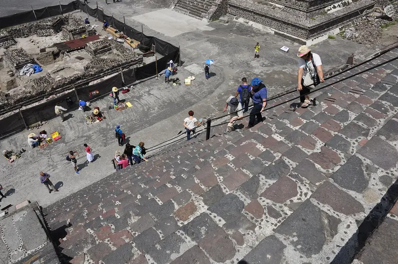
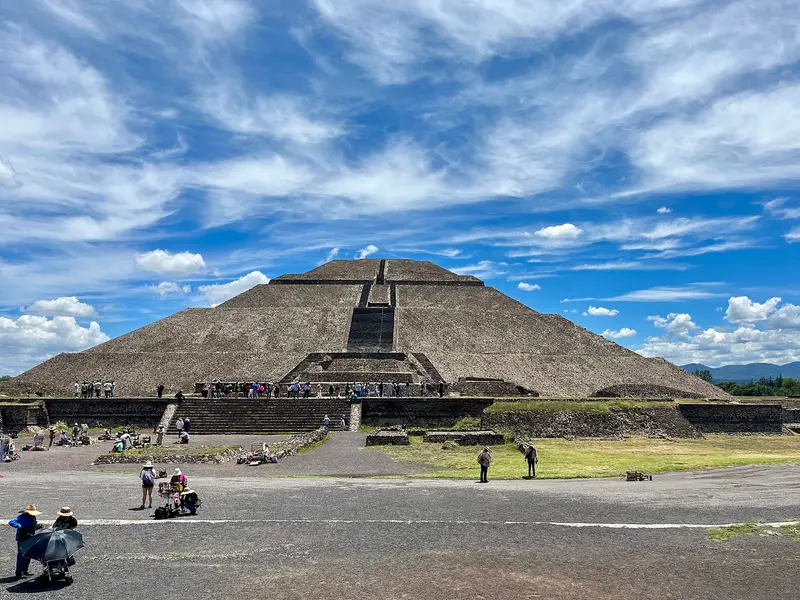
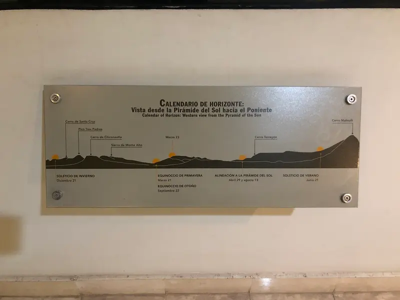
    Standing at a good 60 meters, the Pyramid of the Sun on the east side of the Avenue of the Dead is the tallest structure in Teotihuacán. You are currently not allowed to climb it, but the plaza in front and the view from the Avenue of the Dead clearly show its true scale.
    Open in Google Maps
    Museum of Teotihuacan Murals Beatriz de la Fuente
    Museum

    Museum of Teotihuacan Murals Beatriz de la Fuente

    The museum on the northern edge of the Zone, near the Moon Pyramid, displays murals from the city’s residential palaces in nine halls. Open 9:00 to 16:30, included with Zone admission.
    Open in Google Maps
    Citadel and Temple of the Feathered Serpent
    Attraction

    Citadel and Temple of the Feathered Serpent

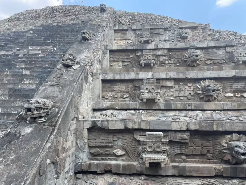
    The Spanish considered the large walled plaza at the south end of the Avenue of the Dead a fortress, calling it Ciudadela. At its center stands the Temple of the Feathered Serpent (Quetzalcóatl); upon its dedication, over a hundred people were sacrificed and buried.
    Open in Google Maps
    Museum of Teotihuacan Culture
    Museum

    Museum of Teotihuacan Culture

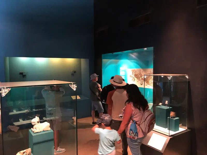
    The museum near the Pyramid of the Sun showcases over 600 finds from the city across eight halls, explaining Teotihuacán's structure and daily life. Open 9 AM to 4:30 PM, included with zone admission.
    Open in Google Maps
    Moon Pyramid (Pirámide de la Luna)

    Moon Pyramid (Pirámide de la Luna)

    The roughly 40-meter-high Pyramid of the Moon closes off the Avenue of the Dead to the north; in front of it lies the Plaza de la Luna. The ascent has been closed since April 2026 until further notice, check the current status with INAH. Immediately west of the plaza stands the Palace of Quetzalpapálotl with pillars carved with butterflies and quetzal feathers.
    Open in Google Maps
    Street of the Dead (Calzada de los Muertos)

    Street of the Dead (Calzada de los Muertos)

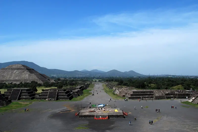
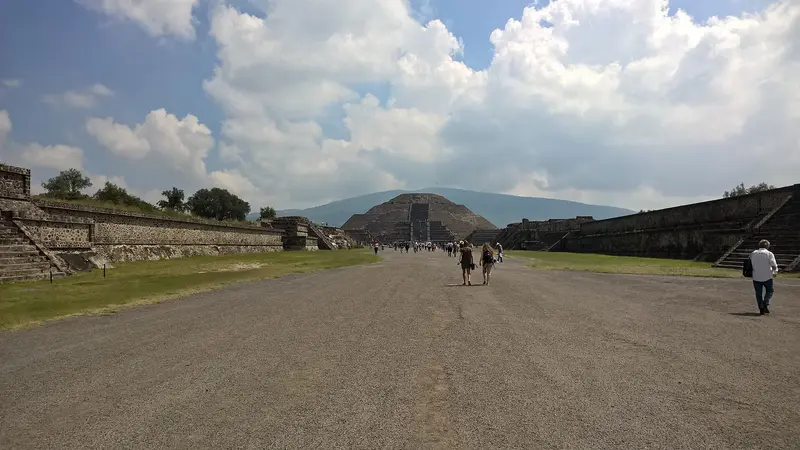
    The approximately four-kilometer-long main axis stretches from the Ciudadela in the south to the Moon Pyramid in the north, and is lined with platforms and temple structures. On its east side stands the Sun Pyramid.
    Open in Google Maps

    Sights in Teotihuacán

    Discover the most important sights and attractions

    Sun Pyramid (Pirámide del Sol)
    Historic Landmark

    1Sun Pyramid (Pirámide del Sol)

    Standing at a good 60 meters, the Pyramid of the Sun on the east side of the Avenue of the Dead is the tallest structure in Teotihuacán. You are currently not allowed to climb it, but the plaza in front and the view from the Avenue of the Dead clearly show its true scale.
    Open in Google Maps
    Museum of Teotihuacan Murals Beatriz de la Fuente
    Museum

    2Museum of Teotihuacan Murals Beatriz de la Fuente

    The museum on the northern edge of the Zone, near the Moon Pyramid, displays murals from the city’s residential palaces in nine halls. Open 9:00 to 16:30, included with Zone admission.
    Open in Google Maps
    Citadel and Temple of the Feathered Serpent
    Attraction

    3Citadel and Temple of the Feathered Serpent

    The Spanish considered the large walled plaza at the south end of the Avenue of the Dead a fortress, calling it Ciudadela. At its center stands the Temple of the Feathered Serpent (Quetzalcóatl); upon its dedication, over a hundred people were sacrificed and buried.
    Open in Google Maps
    Museum of Teotihuacan Culture
    Museum

    4Museum of Teotihuacan Culture

    The museum near the Pyramid of the Sun showcases over 600 finds from the city across eight halls, explaining Teotihuacán's structure and daily life. Open 9 AM to 4:30 PM, included with zone admission.
    Open in Google Maps
    Moon Pyramid (Pirámide de la Luna)

    5Moon Pyramid (Pirámide de la Luna)

    The roughly 40-meter-high Pyramid of the Moon closes off the Avenue of the Dead to the north; in front of it lies the Plaza de la Luna. The ascent has been closed since April 2026 until further notice, check the current status with INAH. Immediately west of the plaza stands the Palace of Quetzalpapálotl with pillars carved with butterflies and quetzal feathers.
    Open in Google Maps
    Street of the Dead (Calzada de los Muertos)

    6Street of the Dead (Calzada de los Muertos)

    The approximately four-kilometer-long main axis stretches from the Ciudadela in the south to the Moon Pyramid in the north, and is lined with platforms and temple structures. On its east side stands the Sun Pyramid.
    Open in Google Maps

    Restaurants in Teotihuacán

    1

    La Gruta

    Restaurant in a large cave of volcanic origin, about 200 meters from Gate 5 of the archaeological site behind the Pyramid of the Sun. Serving traditional Mexican cuisine, such as the house-made Mole with turkey, Barbacoa, and Mixiotes.
    Show on Google Maps
    2

    Rabbit in the Moon Teotihuacán

    Mezcalería and restaurant on the Archaeological Circuit right by the archaeological site. In the mornings, breakfast is served with Chilaquiles and egg dishes, later Mexican dishes like Escamoles and Cecina tacos, and on weekends Lamb Barbacoa. Enjoy Mezcal neat or in cocktails.
    Show on Google Maps
    3

    La Cueva Teotihuacán

    Mexican restaurant on Avenida Hombres Ilustres, a few hundred meters east of La Gruta, on the site's east side. On Google, it's among the highest-rated spots around the pyramids.
    Show on Google Maps

    History & Meaning

    A Metropolis Before the AztecsTeotihuacán arose in the first centuries CE and flourished during the Classic Period, approximately between 350 and 650. Estimates for the population at its peak range from around 100,000 to 250,000, with more recent studies of residential buildings suggesting closer to 100,000. In the 7th century, the center was burned down and abandoned. When the Mexica found the ruins centuries later, they gave the city the name by which it is known today. In 1987, Teotihuacán became Mexico's first UNESCO World Heritage site.The SiteThe Avenue of the Dead forms the city's north-south axis. At its northern end stands the Moon Pyramid, over 40 meters high, and on its eastern side, the Sun Pyramid, over 60 meters high. To the south lies the Ciudadela, a large walled plaza containing the Temple of the Feathered Serpent, where over a hundred people were sacrificed during its consecration. The Palace of Quetzalpapálotl, with its carved pillars, was likely a residence of the priestly elite.MuralsThe city's residential palaces preserve colorful wall paintings. The Museo de Murales Teotihuacanos Beatriz de la Fuente exhibits them in nine halls, while the Museo de la Cultura Teotihuacana presents over 600 finds from the city in eight halls.

    Arrival & Visit

    Getting ThereBuses to San Juan Teotihuacán and the Pyramids depart from Terminal Central del Norte bus station (Metro Autobuses del Norte, Line 5); the ticket counter is at Sala 8; look for the sign reading 'Pirámides'. The journey takes just under an hour, longer on weekends. Alternatively, take Metro Line 3 to Potrero and change there to a bus heading towards Apan. By car, the Autopista Ecatepec-Pirámides leads to the zone, about 45 minutes from the city center.Opening Hours and AdmissionDaily 8 AM to 5 PM, last entry 4:30 PM; museums open 9 AM to 4:30 PM.Admission 210 Pesos (as of 2026). Mexicans and foreign residents of Mexico pay 105 Pesos and nothing on Sundays; for international tourists, the full price applies even on Sundays.Tickets are available at on-site ticket offices and via the official INAH website.The site offers little shade. Bring water, a hat, and sun protection.Climbing the PyramidsThe Pyramid of the Sun may not be climbed at present. Ascent to the Pyramid of the Moon was again possible up to the first platform from May 2025, but has been closed indefinitely since April 2026.Hot Air Balloon RidesHot air balloons launch early in the morning over the valley. Since March 2026, the aviation authority AFAC, with a standing commission, monitors launches in San Juan Teotihuacán and San Martín de las Pirámides. Only book with providers who can demonstrate their AFAC permit.

    Accommodations in Teotihuacán

    Find perfect stay in Teotihuacán

    Booking.com* (Affiliate link)
    Search Hotels
    Agoda* (Affiliate link)
    Search Hotels
    Airbnb
    Vacation Rentals

    * Affiliate link: if you book through it, we earn a small commission. The price stays the same for you.

    Nearby

    Centro Histórico

    Centro Histórico

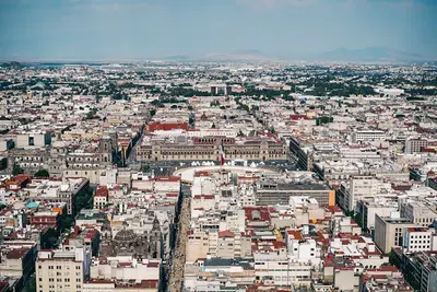
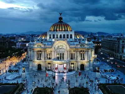
    The Historic Centre of Mexico City has been a UNESCO World Heritage site since 1987. Around the Zócalo you'll find the Templo Mayor, Cathedral, and National Palace, while to the west, Madero pedestrian street leads to Bellas Artes and the Alameda. In the side streets, you'll discover colonial palaces, churches, markets, and traditional cafes; the major sights are detailed on the Mexico City page.
    Mexico City

    Mexico City

    Mexico City, the country's capital, is located at approximately 2,240 meters in a high valley surrounded by volcanoes, and its metropolitan area has nearly 22 million inhabitants. You travel here for the ruins of the Aztec capital Tenochtitlán beneath the colonial center, a UNESCO World Heritage site since 1987; for museums like the National Museum of Anthropology; and for a cuisine ranging from taco stands to tasting menus. Green residential neighborhoods like Roma and Condesa, the canals of Xochimilco, and day trips to Teotihuacán round out the stay.
    Roma Norte

    Roma Norte

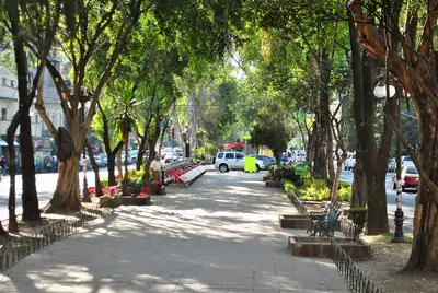
    Roma Norte emerged circa 1900 as a wealthy residential area. French-style villas, Art Nouveau, and Art Deco buildings line tree-lined streets like Avenida Álvaro Obregón and Calle Colima. Today, the district features cafés, galleries, bars, and top city restaurants, plus popular lodging.
    Condesa

    Condesa

    West of Roma, Condesa developed from the early 20th century on the land of the Hacienda of the Condesa de Miravalle. In the 1920s, the grounds of the former horse racetrack around today's Parque México were added. It is characterized by Art Deco residential buildings, wide green median strips, and the México and España parks. The district is quiet and green, but comes alive in the evenings with restaurants and bars on Avenidas Tamaulipas and Michoacán.
    Polanco

    Polanco

    Polanco, north of Chapultepec Park, is one of the city's most affluent neighborhoods. Avenida Presidente Masaryk is lined with luxury shops, while side streets feature embassies, hotels, and some of Mexico's most renowned restaurants. In the northwest, in Nuevo Polanco, are the Soumaya and Jumex museums.