Fernweh: Home
    ExploreTravel GuidesPlan a tripMy tripLast visited
    de|en
    All Places & RegionsAll highlightsAbout FernwehFAQPrivacy PolicyImprint
    ExploreTravel GuidesPlan a tripMy tripLast visited
    • Neighborhoods & highlights
    • Walking tours
    • Eat & drink
    • Food culture
    • Culture
    • Nightlife
    • Getting around
    • Accommodation
    • Plan trip
    • Nearby
    Cholula

    Mexico

    Cholula

    CityCulture

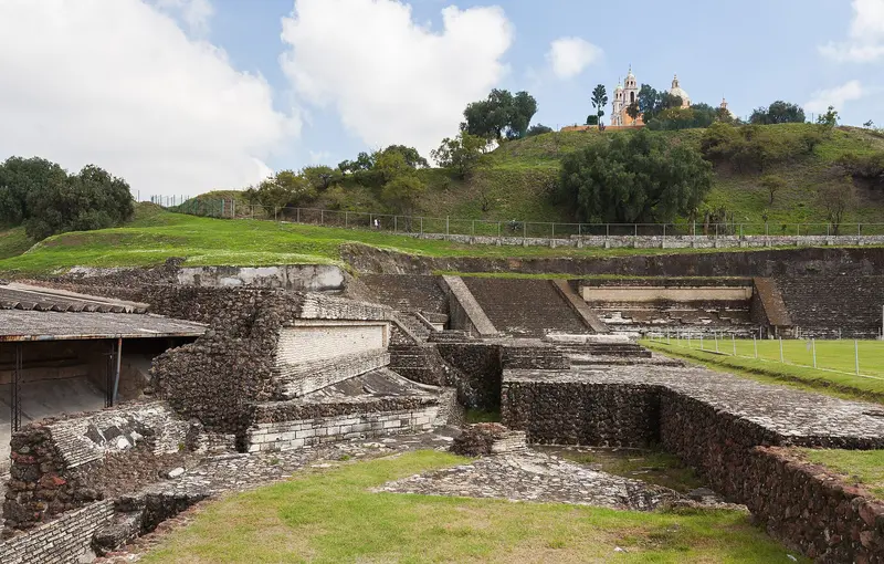
    Cholula lies about 10 km west of Puebla and comprises the municipalities of San Pedro and San Andrés Cholula. Its landmark is the Great Pyramid, atop which the church Nuestra Señora de los Remedios has stood since 1594.

    by Felix Gillen

    1. Home
    2. Destinations
    3. Mexico
    4. Central Mexican Highlands
    5. Cholula
    Cholula lies about 10 km west of Puebla and comprises the municipalities of San Pedro and San Andrés Cholula. Its landmark is the Great Pyramid, atop which the church Nuestra Señora de los Remedios has stood since 1594.On a clear day, you can see the volcanoes Popocatépetl and Iztaccíhuatl from there.

    Sights in Cholula

    Discover the most important sights and attractions

    1Cerro Zapotecas

    The 2,380 m-high volcanic hill is located about 3 km west of Cholula's center. On its main terrace, archaeologists found temple foundations and a ball court; today, locals use the paths for hiking and mountain biking.
    Open in Google Maps
    Church

    2Sanctuary of Our Lady of the Remedies

    The Spanish built the pilgrimage church in 1594 atop the pyramid. A paved path leads to the top, where you'll see Cholula and, on clear days, Popocatépetl and Iztaccíhuatl.
    Open in Google Maps
    Church

    3Convento de San Gabriel Arcángel

    The Franciscan Monastery on the east side of the main square was founded before 1528 on the site of a Quetzalcóatl temple; the current stone building was constructed between 1549 and 1552. The Royal Chapel belongs to the monastery complex.
    Open in Google Maps
    Church

    4The Royal Chapel of Natives

    The chapel in San Gabriel's monastic complex was for the indigenous people. Its wide interior has seven naves and 49 domes.
    Open in Google Maps
    Great Pyramid of Cholula (Tlachihualtépetl)
    Attraction

    5Great Pyramid of Cholula (Tlachihualtépetl)

    The pyramid was built over in several phases from the 3rd century BC to the 9th century AD and is considered, by volume, the largest known pyramid in the world. Archaeologists excavated around 8 km of tunnels; since March 2026, after six years of closure, a good 800 m of these are again accessible in controlled groups at fixed times, narrow and unsuitable for people with claustrophobia. The Museo de Sitio opposite shows a model of the construction phases.
    Open in Google Maps
    Temple of Santa María Tonantzintla
    Church

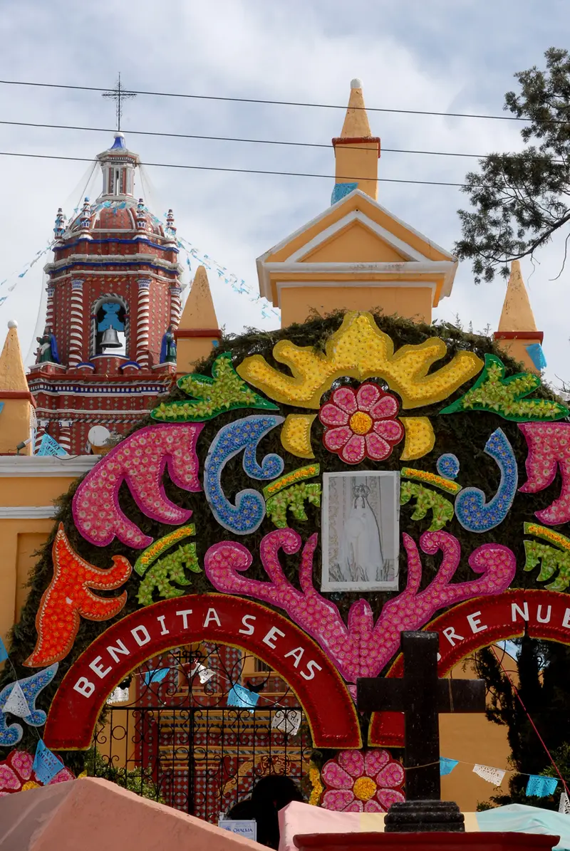
    6Temple of Santa María Tonantzintla

    The village church a few kilometers south of Cholula is completely covered inside with painted stucco: angels with indigenous features, saints, and tropical fruits like mango and chili. It is considered an example of folk Baroque.
    Open in Google Maps

    City walks in Cholula

    Curated walking tours through the city's highlights, handpicked by experienced travel journalists.

    Cholula's Heartbeat: From Zócalo Splendour to the Pyramid Church

    On this roughly two-hour walk, discover the best of Cholula. From lively squares and historic monasteries to the majestic pyramid with its iconic church on the summit, experience the unique mix of pre-Columbian history and colonial charm.

    ~2 Std.
    Open in Google Maps
    Stops (6)

    Essen & Trinken

    1

    Mesón Las Macetitas

    Restaurant with Mexican cuisine a few blocks west of San Pedro Cholula's main square.
    Show on Google Maps
    2

    Ciudad Sagrada

    Upscale restaurant with Mexican cuisine at Avenida 2 Oriente 615, a few minutes' walk north of the Pyramid.
    Show on Google Maps
    3

    Mel's Bistro Cholula

    Bistro with international cuisine, breakfast and coffee between Main Square and Pyramid.
    Show on Google Maps
    4

    Churrería Las Duyas Zócalo San Pedro Cholula

    Churrería on San Pedro Cholula's main square, offering freshly fried churros and hot chocolate.
    Show on Google Maps

    Food and Drink in Cholula

    Cholula shares the cuisine of the Puebla region and has some of its own specialties.

    Cold Chocolate

    Cold, frothed cocoa, traditionally served in painted wooden bowls.

    Cemitas

    Large sesame buns with breaded meat, avocado, cheese and Pápaloquelite.

    Mole poblano

    Dark chili chocolate sauce, which many restaurants offer.

    Churros

    Fried piped pastries with hot chocolate, for example in San Pedro's main square.

    History and Culture

    Pyramid and ChurchesThe Great Pyramid, known as Tlachihualtépetl in Nahuatl, was built in several phases from approximately the 3rd century BCE. After the conquest, the Spanish erected churches on pre-Hispanic sacred sites: the San Gabriel convent on the site of a Quetzalcóatl temple and, in 1594, the church on the pyramid. According to legend, Cholula has 365 churches, one for each day of the year; in reality, over a hundred churches and chapels were built in the valley during the colonial era.ExcursionsTonantzintla and Acatepec: two village churches a few kilometers south, one with painted stucco, the other with a Talavera facade.Puebla: UNESCO Old Town about 10 km east.Cacaxtla: pre-Hispanic murals in the state of Tlaxcala.

    Nightlife

    In Cholula, you'll find a diverse nightlife scene, ranging from relaxed Mezcal bars to lively meeting spots. You'll discover venues specializing in agave spirits like the **Espina Barra de Agaves**, as well as places for craft beer and the **Jazzatlán Club de Jazz Cholula** for live music.
    1

    Espina Barra de Agaves

    Bar specializing in agave spirits like Mezcal, on the west edge of the pyramid near Calle Ferrocarril.
    Show on Google Maps
    2

    Roulotte Tortería Gourmet y Cerveza (San Andrés Cholula)

    Pub with Tortas, stuffed Mexican sandwiches, and beer on Avenida 5 de Mayo in San Andrés Cholula.
    Show on Google Maps
    3

    Casa Relampago

    Bar on Calle Ferrocarril 707 on the western edge of the Pyramid, one of Cholula's nightlife streets.
    Show on Google Maps
    4

    Jazzatlán Club de Jazz Cholula

    Jazz club on Avenida 2 Oriente between Main Square and Pyramid, with live music in the evening.
    Show on Google Maps
    5

    Bilderberg Taproom

    Beer bar with craft beer on tap on Prolongación 4 Oriente in San Andrés Cholula.
    Show on Google Maps

    Exploring Cholula

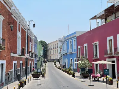
    The center of San Pedro Cholula, with its main square, convent, and pyramid, is compact and easily explored; it's a ten-minute walk from the main square to the pyramid. City buses and *colectivos* run to Puebla; have small change ready. Taxi or ride-sharing services like Uber and DiDi are more convenient.Tonantzintla and Acatepec are a few minutes away by taxi or *colectivo*.

    Accommodations in Cholula

    Find perfect stay in Cholula

    Booking.com* (Affiliate link)
    Search Hotels
    Agoda* (Affiliate link)
    Search Hotels
    Airbnb
    Vacation Rentals

    * Affiliate link: if you book through it, we earn a small commission. The price stays the same for you.

    Plan your trip to Cholula

    Save places, build a route and plan your city trip, all in one place.

    1. 1
      Sunrise over alpine peaks and a sea of clouds
      1234

      Round trip

      12 days · 4 stops

      Saved

      Pick a route

      Pick a ready-made one or save places and plan your own.

      Open bookmarks
    2. 2

      Trip to Cholula

      Live
      • 1Cerro Zapotecas3 days
      • 2Sanctuary of Our Lady of the Remedies4 days
      • 3Convento de San Gabriel Arcángel5 days
      Budget

      Plan your trip

      The planner sorts stops, days and budget. Plan together in real time.

      Start trip planning
    3. 3
      9:41 No signal
      Cholula
      Available offline

      Use it on the road

      Download the guide to your phone and use it on site, even offline.

    Nearby

    Puebla

    Puebla

    Puebla was founded by the Spanish in 1531 and is located at an altitude of approximately 2,135 m between Mexico City and Veracruz. Its Old Town, with its Cathedral, the Rosary Chapel, and numerous facades adorned with Talavera tiles, has been a UNESCO World Heritage site since 1987.The city is considered the birthplace of Mole poblano and Chiles en nogada and is a good starting point for Cholula and the volcanoes Popocatépetl and Iztaccíhuatl.

    Los Sapos

    Los Sapos is a neighborhood in the southeast of Puebla's Old Town, a few blocks from the Zócalo. Around Calle 6 Sur between 5 and 7 Oriente, you'll find antique shops, cafés, and bars; on weekends, an antique market is held here.
    Barrio del Artista

    Barrio del Artista

    The Barrio del Artista is a small artists' district on the eastern edge of Puebla's Old Town, approximately ten minutes' walk from the Zócalo. Around a square on Calle 8 Norte, painters work in open studios and sell their paintings directly.
    Teotihuacán

    Teotihuacán

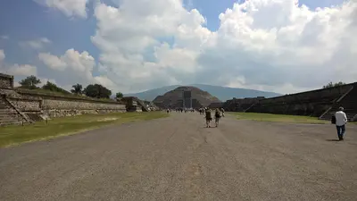
    Teotihuacán, around 50 kilometers northeast of Mexico City, was one of the largest cities in Mesoamerica between the 1st and 7th centuries and has been a UNESCO World Heritage site since 1987. You travel here to walk along the Avenue of the Dead between the over 60-meter-high Pyramid of the Sun and the Pyramid of the Moon, a day trip easily undertaken from the capital. The Aztecs gave the long-abandoned city its name, often translated as 'Place where men become gods'. In 2023, INAH recorded around 1.8 million visitors.
    Coyoacán

    Coyoacán

    Coyoacán in southern Mexico City was an independent town even before its incorporation; Hernán Cortés established his first headquarters here after the conquest. Cobblestone streets, colonial houses, and tree-lined squares give the district a peaceful character. The most famous address is the Casa Azul, Frida Kahlo's home.

    Sources & method

    • Photos: Wikimedia Commons. Each photo carries its credit.
    • Place data such as addresses and ratings comes from Google Maps.
    • The content is based on web research from public, traceable sources. How the content is made · The role of AI