Fernweh: Home
    ExploreTravel GuidesPlan a tripMy tripLast visited
    de|en
    All Places & RegionsAll highlightsAbout FernwehFAQPrivacy PolicyImprint
    ExploreTravel GuidesPlan a tripMy tripLast visited
    • Overview
    • Places in the region
    • Food culture
    • Best travel time
    • Culture
    • Getting around
    • Nearby
    Michoacán

    Mexico

    Michoacán

    Region

    Michoacán lies in the west of the central Mexican highlands and is the heartland of the Purépecha.

    by Felix Gillen

    1. Home
    2. Destinations
    3. Mexico
    4. Michoacán
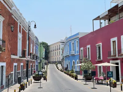
    Michoacán lies in the west of the central Mexican highlands and is the heartland of the Purépecha. Its capital, Morelia, possesses one of the most intact colonial centers in the country, which has been a UNESCO World Heritage site since 1991.Around Lake Pátzcuaro, coppersmiths, lacquer art, and wood carving characterize the villages. To the east, from November to March, millions of Monarch butterflies overwinter in the mountain forests of the Mariposa Monarca Biosphere Reserve.
    Michoacán extends from the central highlands to the Pacific coast and is the heartland of the Purépecha, whose empire was ruled from Tzintzuntzan upon the arrival of the Spanish in 1522. The capital Morelia has a colonial center of pink stone, protected since 1991. Around Lake Pátzcuaro are the colonial town of Pátzcuaro, Janitzio Island, and the Yácatas of Tzintzuntzan. To the west, the church ruins of San Juan Parangaricutiro and the Paricutín volcano bear witness to the 1943 eruption. To the east, from November to March, monarch butterflies overwinter in the mountain forests.

    More places in Michoacán

    Morelia

    Morelia

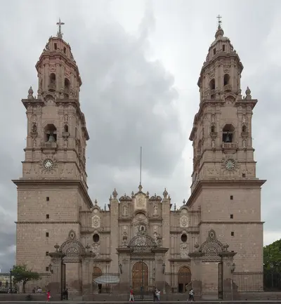
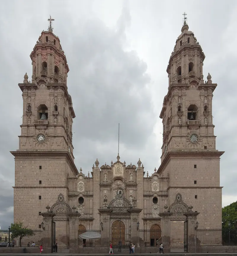
    Morelia, the capital of Michoacán, is located at approximately 1,920 meters in the western highlands, a three to four-hour drive west of Mexico City. Its historic city center, featuring over 200 buildings of pink cantera stone, has been a UNESCO World Heritage site since 1991, characterized by its cathedral, the arcades surrounding the Plaza de Armas, and the aqueduct with 253 arches.The city is an excellent base for exploring Lake Pátzcuaro, the surrounding Purépecha villages, and from November to March, the monarch butterfly overwintering grounds.

    Sights in Michoacán

    Discover the most important sights and attractions

    Isla de Janitzio
    Attraction

    Isla de Janitzio

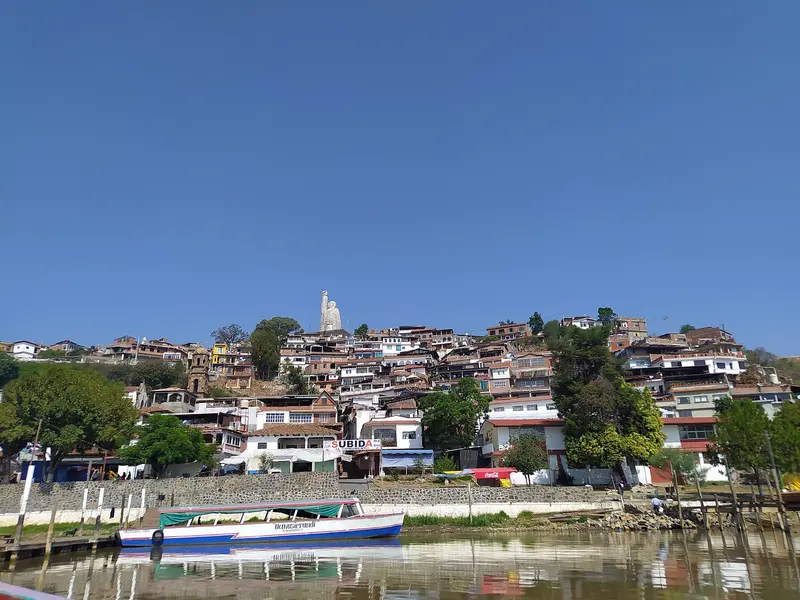
    The largest island in Lake Pátzcuaro can be reached in about 25 minutes by boat from the Pátzcuaro pier. At the summit stands a 40-meter-tall Morelos statue, housing a spiral staircase that leads past murals up to the raised fist. Janitzio is known for the nightly vigil for Día de Muertos.
    Open in Google Maps
    Archaeological Zone of Tzintzuntzan
    Attraction

    Archaeological Zone of Tzintzuntzan

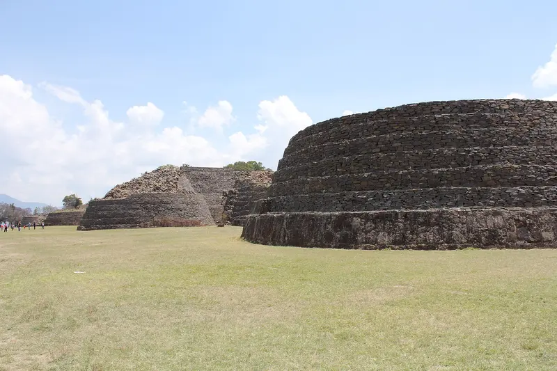
    Tzintzuntzan, on the northeast shore of Lake Pátzcuaro, was the capital of the Purépecha Empire upon the arrival of the Spanish in 1522. On a large platform on the hillside stand five Yácatas, the characteristically rounded Purépecha pyramids, overlooking the lake.
    Open in Google Maps
    Attraction

    Monarch Butterfly Sanctuary El Rosario

    El Rosario in the municipality of Ocampo is one of two visitor-accessible protected areas of the Mariposa Monarca Biosphere Reserve, since 2008 a UNESCO World Heritage site. From November to March, monarch butterflies hang in dense clusters on the fir trees; the path to the colonies leads uphill through the forest.
    Open in Google Maps
    Attraction

    Plaza Vasco de Quiroga (Pátzcuaro)

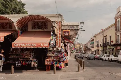
    Pátzcuaro's vast main square is lined with old ash trees and colonial houses; in its center, since 1964, stands a fountain featuring the bronze statue of Bishop Vasco de Quiroga by Francisco Zúñiga. A few minutes' walk away are the Basílica de Nuestra Señora de la Salud and the Casa de los Once Patios, which houses artisan shops.
    Open in Google Maps
    Church Ruin of San Juan Parangaricutiro (Paricutín)
    Attraction

    Church Ruin of San Juan Parangaricutiro (Paricutín)

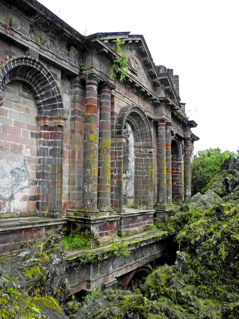
    The Paricutín volcano emerged in 1943 in a cornfield and by 1952 had buried two villages under lava and ash. From the solidified lava field, only parts of the church of San Juan Parangaricutiro still protrude. The starting point is Angahuan village, about 30 kilometers west of Uruapan, where guides and horses are ready.
    Open in Google Maps

    Food & Beverages

    The traditional Mexican cuisine was added to the UNESCO list of intangible cultural heritage in 2010, with Michoacán as an exemplary region. Typical dishes include corn, beans, and pork, as well as fish from Lake Pátzcuaro.

    Carnitas

    Slow-cooked pork in lard, sold as tacos or by weight; a weekend tradition in many places across the region.

    Corundas and Uchepos

    Corundas are triangular tamales in corn husks; Uchepos are made from young corn and often eaten sweet.

    Sopa tarasca

    Bean soup with tomato and Pasilla chili, served with tortilla strips, cheese, and cream.

    Gaspacho moreliano

    Cup with diced fruit and jicama, citrus juice, cheese, and chili powder, a specialty from Morelia.

    Best Time to Visit

    When is the best time for your trip?

    November
    December
    January
    February
    March
    15–18°C·6–19 mm(little rain)
    From November to March, it's dry and sunny, and Monarch butterflies overwinter in the eastern reserves. Early November also marks the Día de Muertos at Lake Pátzcuaro. Winter nights in the highlands are cool.
    These values are for Morelia, around 1,920 meters. The Pátzcuaro highlands are similarly mild, but the Pacific coast and hot Tierra Caliente lowlands are noticeably warmer. The rainy season from June to September usually brings afternoon showers.

    Seasons

    Jan
    Feb
    Mar
    Apr
    May
    Jun
    Jul
    Aug
    Sep
    Oct
    Nov
    Dec
    Dry season
    Wet period
    Passage
    Best Time to Visit
    ▶Show detailed monthly data
    MonthTemp (°C)Rain (mm)Sun (h)
    January14.5197.6
    February15.898.7
    March18.1109.1
    April20.3148.8
    May21.5468.4
    June20.91426.9
    July19.41836.3
    August19.41676.5
    September19.11416.1
    October18.0557.1
    November16.5127.8
    December15.067.5

    Culture and Traditions

    Purépecha and CraftsThe Purépecha people continue to shape Michoacán to this day; their language is spoken in many villages around Lake Pátzcuaro and on the Meseta. After the conquest, Bishop Vasco de Quiroga organized the villages by craft in the 16th century; to this day, many places are known for a specific trade, for example Santa Clara del Cobre for copper work.Día de MuertosIn late October and early November, families around Lake Pátzcuaro hold nocturnal vigils in the cemeteries, with the celebration on Janitzio Island being particularly renowned.ExcursionsPátzcuaro and Janitzio: Colonial town and boat trip to the island with the Morelos statue.Tzintzuntzan: five Yácatas of the ancient Purépecha capital on the lakeshore.Monarch Butterflies: El Rosario and Sierra Chincua sanctuaries in the east, open from November to March.Paricutín: Horseback ride or hike from Angahuan to the church ruin in the lava field.

    On the Road in Michoacán

    Morelia is the hub, with General Francisco J. Mujica Airport about 27 kilometers northeast of the city, and a bus terminal connecting to the entire region. Frequent buses run to Pátzcuaro, taking a good hour. From there, reach Tzintzuntzan and the Janitzio boat dock by combi or taxi. For the Monarch Butterfly Reserves and Angahuan, guided tours or a rental car are most practical.Plan overland journeys during daylight hours and check the current UK FCDO Travel Advice for Mexico before you go; it also covers individual states.

    Nearby

    Morelia

    Morelia

    Morelia, the capital of Michoacán, is located at approximately 1,920 meters in the western highlands, a three to four-hour drive west of Mexico City. Its historic city center, featuring over 200 buildings of pink cantera stone, has been a UNESCO World Heritage site since 1991, characterized by its cathedral, the arcades surrounding the Plaza de Armas, and the aqueduct with 253 arches.The city is an excellent base for exploring Lake Pátzcuaro, the surrounding Purépecha villages, and from November to March, the monarch butterfly overwintering grounds.
    Santiago de Querétaro

    Santiago de Querétaro

    Santiago de Querétaro was founded in 1531 and lies approximately 220 km northwest of Mexico City at about 1,820 m elevation. Its Old Town, with its squares, Baroque churches, and a 74-arch aqueduct, has been a UNESCO World Heritage site since 1996.In 1810, the conspiracy that triggered the War of Independence began here, and in 1917, Mexico's current constitution was proclaimed in the Teatro de la República.
    San Miguel de Allende

    San Miguel de Allende

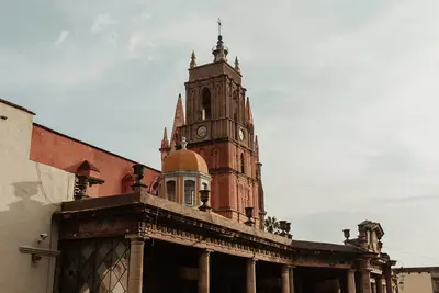
    San Miguel de Allende sits at roughly 1,900 meters in Guanajuato state, about four bus hours north of Mexico City. Its old town, with steep cobblestone streets, ochre houses and the pink Parroquia, has been a UNESCO World Heritage site since 2008, along with the Sanctuary of Atotonilco. For decades, many foreigners have lived here, especially from the USA and Canada.
    Barrio de la Presa

    Barrio de la Presa

    La Presa lies southeast of the Old Town, along the Paseo de la Presa, leading up to the Presa de la Olla reservoir. In the 19th and early 20th centuries, country houses of wealthy families were built here in the style of Italian villas or Swiss chalets; many now serve as schools, offices, or hotels. The district is greener and quieter than the center; at its upper end lie the reservoir and Parque Florencio Antillón.
    Barrio de Pastita

    Barrio de Pastita

    Pastita is a residential district on the eastern edge of Guanajuato, traversed by an old aqueduct. Tourists rarely venture here, but you'll witness everyday life amidst colorful houses, small tiendas, and stepped alleys. The main point of interest is the museum, located in the former home of Olga Costa and José Chávez Morado. You can reach it by any city bus marked 'Pastita' at the eastern end of the city center.

    Sources & method

    • Photos: Wikimedia Commons, Pexels. Each photo carries its credit.
    • Place data such as addresses and ratings comes from Google Maps.
    • The content is based on web research from public, traceable sources. How the content is made · The role of AI