Fernweh: Home
    ExploreTravel GuidesPlan a tripMy tripLast visited
    de|en
    All Places & RegionsAll highlightsAbout FernwehFAQPrivacy PolicyImprint
    ExploreTravel GuidesPlan a tripMy tripLast visited
    • Neighborhoods & highlights
    • Recommendations
    • Walking tours
    • Eat & drink
    • Food culture
    • Culture
    • Nightlife
    • Getting around
    • Accommodation
    • Plan trip
    • Nearby
    San Miguel de Allende

    Mexico

    San Miguel de Allende

    CityCulture

    San Miguel de Allende sits at roughly 1,900 meters in Guanajuato state, about four bus hours north of Mexico City.

    by Felix Gillen

    1. Home
    2. Destinations
    3. Mexico
    4. Central Mexican Highlands
    5. San Miguel de Allende
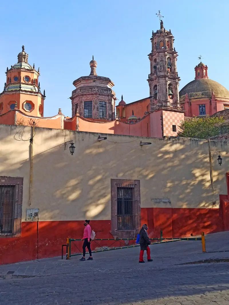
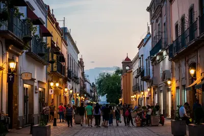
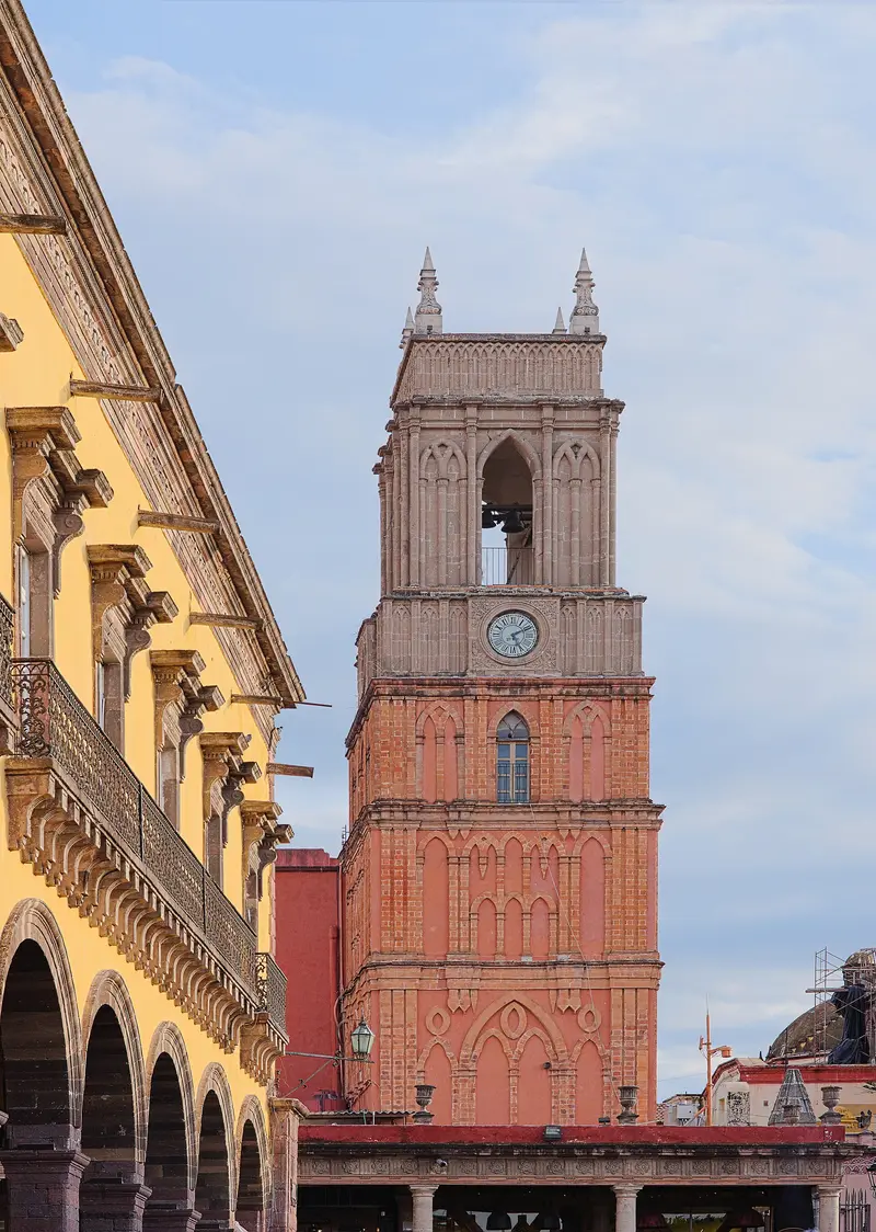
    San Miguel de Allende sits at roughly 1,900 meters in Guanajuato state, about four bus hours north of Mexico City. Its old town, with steep cobblestone streets, ochre houses and the pink Parroquia, has been a UNESCO World Heritage site since 2008, along with the Sanctuary of Atotonilco. For decades, many foreigners have lived here, especially from the USA and Canada.

    Sights in San Miguel de Allende

    Discover the most important sights and attractions

    Parroquia de San Miguel Arcángel

    1Parroquia de San Miguel Arcángel

    Parish Church on the Jardín Principal and a city landmark. The church building dates from the 17th century, with its pink Neo-Gothic facade added by local architect Zeferino Gutiérrez in the late 19th century. Illuminated at night.
    Open in Google Maps

    2Templo de la Inmaculada Concepción (Las Monjas)

    Monastery Church on Calle Canal, built between 1755 and 1842. Its large dome, which Zeferino Gutiérrez set atop in 1891, modeled after Paris's Dôme des Invalides, defines the cityscape next to the Parroquia. The former monastery next door now houses the Bellas Artes Cultural Center.
    Open in Google Maps
    Oratory of San Felipe Neri

    3Oratory of San Felipe Neri

    18th-century Baroque church with a pink stone facade. Inside, numerous oil paintings hang, and nearby is the richly decorated Santa Casa de Loreto chapel.
    Open in Google Maps

    4Church of San Rafael

    Small church, also known as Santa Escuela, right next to the Parroquia by the Jardín. It was founded in 1742. According to legend, the first Christian ceremony of the place took place here.
    Open in Google Maps

    5Mercado de Artesanías

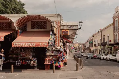
    Market in a long, narrow alley north of the center. Selling tin lanterns, glass, ceramics, and textiles. Haggling is common.
    Open in Google Maps
    Charco del Ingenio

    6Charco del Ingenio

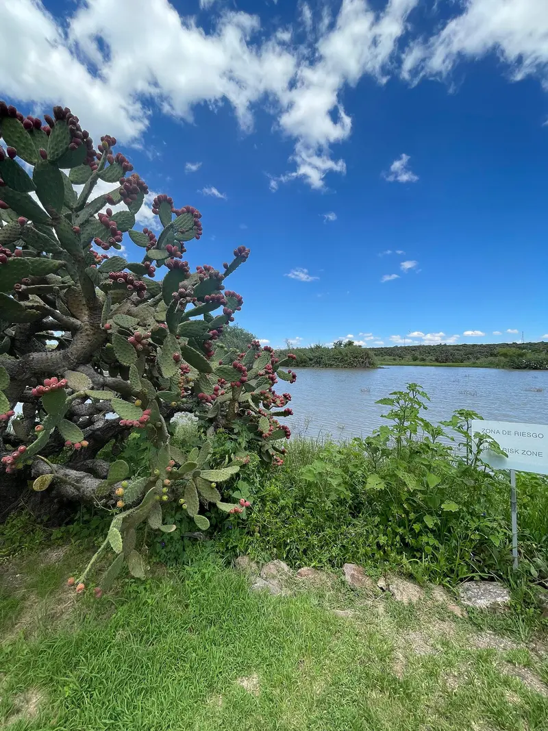
    Botanical garden and nature reserve on the city edge with a huge cactus collection. Trails lead to a gorge, reservoir, viewpoints. A 20-minute walk upwards from the center.
    Open in Google Maps

    City walks in San Miguel de Allende

    Curated walking tours through the city's highlights, handpicked by experienced travel journalists.

    Colonial Splendour & Artists' Flair: A Walk Through San Miguel de Allende

    On this two-hour walk, discover the heart of San Miguel de Allende, a UNESCO World Heritage city. Immerse yourself in the colourful lanes, admire the impressive architecture and let the artistic spirit of this charming town enchant you. A perfect mix of culture, history and breathtaking views awaits you.

    ~2 Std.
    Open in Google Maps
    Stops (5)

    Essen & Trinken

    Rosewood San Miguel de Allende

    Elegante Zimmer und Suiten in einem stilvollen Hotel mit Restaurants, Rooftop-Bar, 3 Außenpools und Tennisplätzen.
    Show on Google Maps
    1

    1826 Restaurant

    Restaurant at Hotel Rosewood south of the city center. Mexican cuisine with regional ingredients, upscale prices.
    Show on Google Maps
    2

    El Pato Barbacoa y Mixiotes

    Simple eatery in the Obraje district with Barbacoa and Mixiotes, meat cooked in agave skin. Especially on weekend mornings.
    Show on Google Maps
    3

    Gorditas estilo Queretaro

    Small stand with Querétaro-style Gorditas, stuffed corn patties with various Guisados. Affordable and quick.
    Show on Google Maps
    4

    Rincón de Don Tomás

    Restaurant under the arcades by the Jardín with Mexican cuisine. The location with a view of the Parroquia is the main reason for a visit.
    Show on Google Maps
    5

    La Parada

    Peruvian restaurant on Calle Recreo. Ceviche, Tiraditos and Pisco Sour in a small courtyard. Reserve for evenings.
    Show on Google Maps
    6

    Lavanda Café

    A cafe with its own roast near the Mercado de Artesanías. Breakfast and brunch, often a wait on weekends.
    Show on Google Maps
    7

    Áperi

    Upscale restaurant in Hotel Dôce 18 on Calle Quebrada. Seasonal cuisine with local ingredients, also as a menu at the chef's counter. Reservations required.
    Show on Google Maps

    Food and Drink

    Besides upscale restaurants for international guests, there are simple fondas and street food, especially around the Mercado Ignacio Ramírez.

    Gorditas

    Thick corn flatbreads, filled with hearty stews, found at stalls citywide.

    Enchiladas mineras

    Tortillas in Guajillo sauce with potatoes and carrots, typical for the state of Guanajuato.

    Wine from Guanajuato

    Nearby, wineries such as Dos Buhos and Cuna de Tierra produce wine, many offer tastings.

    History and City Living

    From San Miguel el Grande to AllendeThe Franciscan Juan de San Miguel founded the town in 1542 as San Miguel el Grande. It grew rich as a stop on the Silver Route between Zacatecas and Mexico City. Ignacio Allende, one of the leaders of the 1810 independence movement, was born here. In his honor, the city has borne its current name since 1826.City of ArtistsIn 1938, Felipe Cossío del Pomar and Stirling Dickinson founded an art school in the former monastery, later joined by the Instituto Allende. After World War II, many US veterans came to study with GI Bill scholarships. To this day, galleries, courses, and cultural centers like Bellas Artes shape the cityscape. Around September 29, the city celebrates its patron, San Miguel Arcángel, for a week with processions and fireworks.ExcursionsAbout 14 kilometers outside the city lies the 18th-century Sanctuary of Atotonilco, whose interiors Antonio Martínez de Pocasangre painted over approximately three decades. In the surrounding area, there are several hot springs and wineries.

    Nightlife

    1

    Tunki Rooftop by Handshake

    Rooftop bar on Calle Hospicio with cocktails and views over the Old Town.
    Show on Google Maps
    2

    Los Milagros

    Bar on Calle Relox north of the Jardín with Mezcal and cocktails.
    Show on Google Maps
    3

    Luna Rooftop

    The Rosewood Hotel's rooftop terrace with views over the city and the Parroquia. Enjoy sunset cocktails, at upscale prices.
    Show on Google Maps
    4

    El Grito

    Club on Calle Umarán, near the Jardín, open late on weekends.
    Show on Google Maps

    Getting There and Around

    Getting ThereSan Miguel does not have its own airport; the closest are in Querétaro and near León/Silao (El Bajío). From Mexico City (Terminal Norte), ETN and Primera Plus take about 3.5 to 4 hours to the Central de Autobuses, located roughly two kilometers from the Jardín. Flecha Amarilla makes more stops and takes longer.LocallyThe center is walkable. Taxis will get you to the bus station or Charco del Ingenio in a few minutes. Driving in the Old Town is difficult due to narrow one-way streets and limited parking.

    Accommodations in San Miguel de Allende

    Find perfect stay in San Miguel de Allende

    Booking.com* (Affiliate link)
    Search Hotels
    Agoda* (Affiliate link)
    Search Hotels
    Airbnb
    Vacation Rentals

    * Affiliate link: if you book through it, we earn a small commission. The price stays the same for you.

    Plan your trip to San Miguel de Allende

    Save places, build a route and plan your city trip, all in one place.

    1. 1
      Sunrise over alpine peaks and a sea of clouds
      1234

      Round trip

      12 days · 4 stops

      Saved

      Pick a route

      Pick a ready-made one or save places and plan your own.

      Open bookmarks
    2. 2

      Trip to San Miguel de Allende

      Live
      • 1Parroquia de San Miguel Arcángel3 days
      • 2Templo de la Inmaculada Concepción (Las Monjas)4 days
      • 3Oratory of San Felipe Neri5 days
      Budget

      Plan your trip

      The planner sorts stops, days and budget. Plan together in real time.

      Start trip planning
    3. 3
      9:41 No signal
      San Miguel de Allende
      Available offline

      Use it on the road

      Download the guide to your phone and use it on site, even offline.

    Nearby

    Santiago de Querétaro

    Santiago de Querétaro

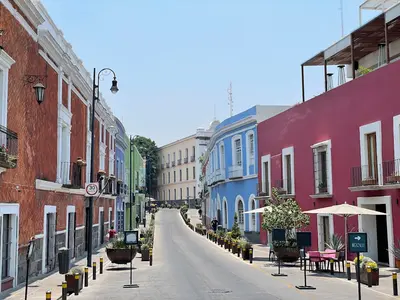
    Santiago de Querétaro was founded in 1531 and lies approximately 220 km northwest of Mexico City at about 1,820 m elevation. Its Old Town, with its squares, Baroque churches, and a 74-arch aqueduct, has been a UNESCO World Heritage site since 1996.In 1810, the conspiracy that triggered the War of Independence began here, and in 1917, Mexico's current constitution was proclaimed in the Teatro de la República.
    Barrio de Pastita

    Barrio de Pastita

    Pastita is a residential district on the eastern edge of Guanajuato, traversed by an old aqueduct. Tourists rarely venture here, but you'll witness everyday life amidst colorful houses, small tiendas, and stepped alleys. The main point of interest is the museum, located in the former home of Olga Costa and José Chávez Morado. You can reach it by any city bus marked 'Pastita' at the eastern end of the city center.
    Barrio de la Presa

    Barrio de la Presa

    La Presa lies southeast of the Old Town, along the Paseo de la Presa, leading up to the Presa de la Olla reservoir. In the 19th and early 20th centuries, country houses of wealthy families were built here in the style of Italian villas or Swiss chalets; many now serve as schools, offices, or hotels. The district is greener and quieter than the center; at its upper end lie the reservoir and Parque Florencio Antillón.
    Guanajuato

    Guanajuato

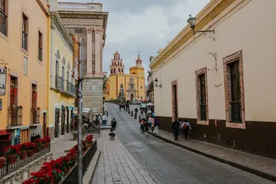
    Guanajuato stretches at over 2,000 m altitude through a narrow gorge in the central highlands, approximately 340 road kilometers northwest of Mexico City. You come for the colorful Old Town from the silver mining era, a UNESCO World Heritage site since 1988, with steep stair-alleys, Baroque churches, and squares bustling with students. In the 18th century, the La Valenciana mine at times supplied around two-thirds of the world's silver production, making the city rich. Colorful houses cling to the slopes, and most traffic runs through tunnels beneath the Old Town.
    Morelia

    Morelia

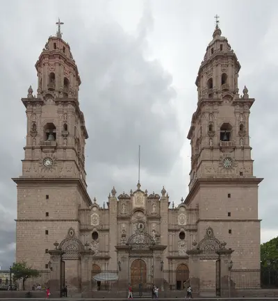
    Morelia, the capital of Michoacán, is located at approximately 1,920 meters in the western highlands, a three to four-hour drive west of Mexico City. Its historic city center, featuring over 200 buildings of pink cantera stone, has been a UNESCO World Heritage site since 1991, characterized by its cathedral, the arcades surrounding the Plaza de Armas, and the aqueduct with 253 arches.The city is an excellent base for exploring Lake Pátzcuaro, the surrounding Purépecha villages, and from November to March, the monarch butterfly overwintering grounds.

    Sources & method

    • Photos: Wikimedia Commons, Pexels. Each photo carries its credit.
    • Place data such as addresses and ratings comes from Google Maps.
    • The content is based on web research from public, traceable sources. How the content is made · The role of AI