Fernweh: Home
    ExploreTravel GuidesPlan a tripMy tripLast visited
    de|en
    All Places & RegionsAll highlightsAbout FernwehFAQPrivacy PolicyImprint
    ExploreTravel GuidesPlan a tripMy tripLast visited
    Sai Yok National Park

    Thailand

    Sai Yok National Park

    National Park

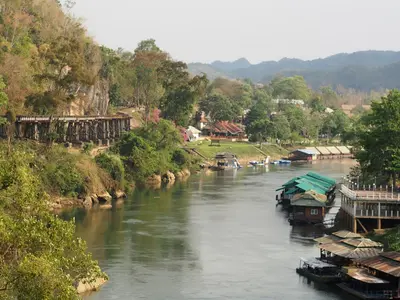
    The Sai Yok National Park is situated about 100 kilometers northwest of Kanchanaburi along the Khwae Noi river, extending to the Myanmar border.

    by Felix Gillen

    1. Home
    2. Destinations
    3. Thailand
    4. West Thailand (Kanchanaburi and area)
    5. Sai Yok National Park
    The Sai Yok National Park is situated about 100 kilometers northwest of Kanchanaburi along the Khwae Noi river, extending to the Myanmar border. Established in 1980, it covers some 500 square kilometers of limestone mountains, forest, and the river.The most visited is the approximately 15-meter-high Sai Yok Noi waterfall, right by the main road. About 40 kilometers further, by the park administration, is the Sai Yok Yai waterfall, plunging directly into the river over a rock edge. You can cross to the other bank via a suspension bridge.Some of the park's limestone caves are home to the Kitti's hog-nosed bat, the world's smallest mammal at about 2 grams. The largest cave is Tham Lawa, approximately 500 meters long. Along the river, remains of a Thailand-Burma Railway bridge and a Japanese camp have also been preserved.

    Sehenswürdigkeiten

    Discover the most important sights and attractions

    Wat Phutthawimut Wanaram (Wat Tham Phumut)

    Cave temple in Sai Yok district, with a prayer room in a rock chamber and Buddha figures in dim light. Access is via stairs on the hillside. Operated by monks, no entrance fee, but donations are customary. Keep shoulders and knees covered, remove shoes before entering.
    Open in Google Maps

    Wat Phutakhian

    Temple complex on Road 323 near the park, rarely visited by tourists and mainly a gathering point for the surrounding villages. Quiet courtyard with a sala and monks' residences. A brief stop on the drive between Kanchanaburi and Thong Pha Phum.
    Open in Google Maps

    Suspension bridge over Khwae Noi

    The pedestrian bridge at the administrative area connects the two banks and gives access to the waterfall and the rafters' lodges. It sways noticeably when several people are on it. From the center, the river's course is visible in both directions.
    Open in Google Maps

    Sai Yok Yai Waterfall

    A roughly 10-meter high waterfall plunges over a rock edge directly into the Khwae Noi, right next to the park administration. A short path from the administration area leads over a suspension bridge to a viewpoint. It's fullest at the end of the rainy season.
    Open in Google Maps

    Tham Lawa

    The park's largest cave, approximately 500 meters long with five large chambers full of stalactites and stalagmites. A lamp is essential; inquire at the park administration about access and tours. Access may be restricted during the rainy season.
    Open in Google Maps

    Essen & Trinken

    Khrua Pa Pui

    Small eatery in the Phu Toei district, featuring an everyday Thai menu. No English menu available; ordering is by pointing. Opening hours are flexible, depending on street activity.
    Show on Google Maps

    Pa Nok (Tom Yam and Noodle Soups)

    Made-to-order kitchen in Tha Sao offering noodle soups and Tom Yam with river fish Pla Khang, as indicated by the sign. Dishes are cooked to order, the menu is a list of basic meals. Simple tables, local clientele.
    Show on Google Maps

    Roadside street kitchen

    Restaurant in 8XCP+5MX.
    Show on Google Maps

    Baan Aaya Coffee and Restaurant

    Restaurant and coffee shop in Tha Sao, at the park entrance. Indoor and outdoor seating, Thai menu with some Western dishes. One of the few places in the area that is also open in the afternoon.
    Show on Google Maps

    Food and Drink at the Sai Yok National Park

    Im Park selbst gibt es nur einfache Verpflegung bei der Verwaltung und an den Flößerunterkünften, die für ihre Gäste kochen. Die Auswahl liegt an der Straße 323 und in den Dörfern Tha Sao und Phu Toei: Lokale mit Bestellküche, Nudelsuppen und Grillgerichten, ausgelegt auf Fernfahrer und Ausflügler. Wer im Park unterwegs ist, sollte Wasser und einen Snack dabei haben; unterwegs gibt es nichts.

    Ahan Tam Sang

    Cooked to order: fried rice, stir-fries with basil, omelet over rice. The standard along Highway 323.

    River fish

    Riverside eateries serve freshwater fish from the Khwae Noi, grilled or as a hot and sour soup.

    Street-side Noodle Soups

    Kuay Teow in its usual varieties, freshest in the mornings and at noon.

    Stands at Sai Yok Noi Waterfall

    At the waterfall's parking lot, there are stalls with snacks, drinks, and simple dishes.

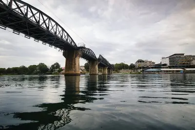
    Tracks of the Thailand-Burma Railway

    The Thailand-Burma Railway ran through the park area, built in 1942 and 1943 under Japanese occupation by Allied prisoners of war and a much larger number of Asian forced laborers. Tens of thousands died from exhaustion, dysentery, cholera, and malnutrition. Remains of a railway bridge and a Japanese army camp are preserved in the park.To understand the history in context, it's best to combine the visit with the Hellfire Pass Interpretive Centre and the Thailand-Burma Railway Centre in Kanchanaburi. The remains in the park are places of remembrance; please act respectfully.

    Local adventures

    The park is located on Highway 323 between Kanchanaburi and Sangkhlaburi. Sai Yok Noi waterfall is right by the road with parking; the park headquarters, along with Sai Yok Yai waterfall, is about 40 kilometers further.Getting there: Buses and minivans from Kanchanaburi towards Thong Pha Phum and Sangkhlaburi stop by the road. Having your own vehicle offers much more flexibility, as sites are spread out.On foot: From the headquarters, a short path leads to the Khwae Noi suspension bridge and Sai Yok Yai waterfall.Caves: For the caves, a lamp is needed. Ask at the park headquarters about access and guided tours. Access can be restricted during rainy season.Equipment: Long trousers for forest trails, sturdy shoes, insect repellent. Mobile reception is patchy within the park.

    Accommodations in Sai Yok National Park

    Find perfect stay in Sai Yok National Park

    Booking.com* (Affiliate link)
    Search Hotels
    Agoda* (Affiliate link)
    Search Hotels
    Airbnb
    Vacation Rentals

    * Affiliate link: if you book through it, we earn a small commission. The price stays the same for you.

    Nearby

    Hellfire Pass

    Hellfire Pass

    The Hellfire Pass Interpretive Centre commemorates the construction of the Thailand-Burma Railway, built during World War II under Japanese occupation by Allied prisoners of war and Asian forced laborers. The name refers to the Konyu Cutting: during night work, illuminated by oil lamps and bamboo fires, the scene with the emaciated prisoners looked like a depiction of hell.Opened in 1998 and operated by Australia, the museum documents working conditions, diseases, and mortality with photos, artifacts, and eyewitness accounts.From the museum, a path leads down into the cutting, where drilling marks in the rock are still visible. Visitors can follow the former railway track several kilometers further through the forest. An audio guide provides context for the stations. The memorial is located about 80 kilometers northwest of Kanchanaburi on Highway 323.
    Erawan National Park

    Erawan National Park

    Erawan National Park is located approximately 65 to 70 kilometers northwest of Kanchanaburi. Established in 1975 as Thailand's twelfth national park, it covers around 550 square kilometers and is primarily known for the seven-tiered Erawan Waterfall with its turquoise-green pools. The name Erawan refers to the three-headed white elephant of Hindu mythology.A path follows the stream from tier to tier; the lower levels are easily accessible, while further up, the trail becomes steeper and rockier. Bathing is permitted in several pools, where small fish will nibble at your feet. Shoes with good grip are recommended as the edges can be slippery.Beyond the waterfall, there are forested limestone mountains and the stalactite cave Tham Phra That. Early mornings on weekdays are the quietest, while weekends and public holidays see many day-trippers.
    Kanchanaburi City

    Kanchanaburi City

    Kanchanaburi is located at the confluence of the Khwae Yai and Khwae Noi rivers, which merge here to form the Mae Klong. The city is known for the Bridge on the River Kwai, part of the Thailand-Burma Railway, which Allied prisoners of war and Asian forced laborers were compelled to build under Japanese occupation during World War II. You can cross the bridge on foot and ride a segment of the historic railway by train. Museums and war cemeteries tell the story of the prisoners. Excursions lead to Erawan National Park and Hellfire Pass. It's most pleasant from November to February.
    West Thailand (Kanchanaburi and area)

    West Thailand (Kanchanaburi and area)

    Western Thailand, around the province of Kanchanaburi, combines war history and nature. This is where the Thailand-Burma Railway ran, built during World War II under Japanese occupation by prisoners of war and forced labourers, and known as the Death Railway.Attractions include the Bridge on the Khwae Yai, the war cemeteries and museums in Kanchanaburi, Hellfire Pass, the tiered waterfalls in Erawan National Park, and further north, Sangkhlaburi with its long wooden bridge.
    Sangkhlaburi

    Sangkhlaburi

    Sangkhlaburi is the northernmost district of Kanchanaburi Province, situated on the shore of the Khao Laem Reservoir near the Myanmar border. Besides Thais, Mon and Karen people live here, which is reflected in their language, cuisine, and temple architecture.Its landmark is the Mon Bridge (Uttamanusorn Bridge), Thailand's longest wooden bridge at around 445 meters. It connects the Mon village of Wang Kha with the town. Early in the morning, the monks' alms collection can be observed here. On the Mon side stands Wat Wang Wiwekaram with a gilded chedi modelled after Indian prototypes.During the dry season, usually in March and April, the walls and ordination hall of the old temple emerge from the lake, remnants of the settlement that was flooded with the construction of the Vajiralongkorn Dam in 1984. The cooler months from November to February are the most pleasant time to travel.

    Sources & method

    • Photos: Unsplash. Each photo carries its credit.
    • The content is based on web research from public, traceable sources. How the content is made · The role of AI