Fernweh: Home
    ExploreTravel GuidesPlan a tripMy tripLast visited
    de|en
    All Places & RegionsAll highlightsAbout FernwehFAQPrivacy PolicyImprint
    ExploreTravel GuidesPlan a tripMy tripLast visited
    • Neighborhoods & highlights
    • Eat & drink
    • Food culture
    • Culture
    • Getting around
    • Accommodation
    • Plan trip
    • Nearby
    Sangkhlaburi

    Thailand

    Sangkhlaburi

    CityCulture

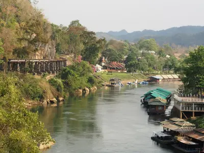
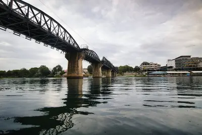
    Sangkhlaburi is the northernmost district of Kanchanaburi Province, situated on the shore of the Khao Laem Reservoir near the Myanmar border.

    by Felix Gillen

    1. Home
    2. Destinations
    3. Thailand
    4. West Thailand (Kanchanaburi and area)
    5. Sangkhlaburi
    Sangkhlaburi is the northernmost district of Kanchanaburi Province, situated on the shore of the Khao Laem Reservoir near the Myanmar border. Besides Thais, Mon and Karen people live here, which is reflected in their language, cuisine, and temple architecture.Its landmark is the Mon Bridge (Uttamanusorn Bridge), Thailand's longest wooden bridge at around 445 meters. It connects the Mon village of Wang Kha with the town. Early in the morning, the monks' alms collection can be observed here. On the Mon side stands Wat Wang Wiwekaram with a gilded chedi modelled after Indian prototypes.During the dry season, usually in March and April, the walls and ordination hall of the old temple emerge from the lake, remnants of the settlement that was flooded with the construction of the Vajiralongkorn Dam in 1984. The cooler months from November to February are the most pleasant time to travel.

    Sights in Sangkhlaburi

    Discover the most important sights and attractions

    1Tree in the Reservoir (Ko Klang Nam)

    A solitary tree in the shallow waters of the Khao Laem Reservoir, a remnant of the forest that was flooded with the settlement in 1984. Visible from shore paths and by boat. Depending on the water level, it stands in the water or on an exposed sandbank; more emerges at the end of the dry season.
    Open in Google Maps

    2Mon Bridge (Saphan Mon)

    The Uttamanusorn Bridge, at around 445 meters, is Thailand's longest wooden bridge. Mon workers built it in 1986 and 1987 on the initiative of Luang Pho Uttama, after the reservoir separated the town and the Mon village of Wang Kha. In 2013, a section collapsed during a flood, and it was reopened in 2014. In the mornings, residents cross over to offer food to monks.
    Open in Google Maps

    3Wat Wang Wiwekaram

    The main temple of the Mon community at Wang Kha, closely associated with the monk Luang Pho Uttama. The predecessor building has been in the reservoir since 1984 and can be seen during the dry season. Keep shoulders and knees covered, remove shoes before the buildings.
    Open in Google Maps

    4Chedi Buddhakhaya

    The golden stupa belongs to Wat Wang Wiwekaram and is modeled after the Mahabodhi Temple in Bodhgaya, the site of Buddha's enlightenment in India. It stands freely on a hill, from which you can see the surrounding area. At its foot lies a market area with goods from Myanmar.
    Open in Google Maps

    5Mon Quarter Ban Waeng Ka

    The residential area beyond the wooden bridge, where Mon is the everyday language. Wooden houses on hilly lanes, small shops, a market with goods from Myanmar, women with thanaka paste on their faces. Not an open-air museum, but an inhabited quarter: ask before photographing and stay quiet in the lanes.
    Open in Google Maps

    Essen & Trinken

    1

    Kalo Kalo Saep Ver

    Isaan-style cuisine with spicy salads and grilled dishes, as the "saep" in the name suggests. Simple decor; order in Thai or by pointing. Located in a soi near the market.
    Show on Google Maps
    2

    Long Yian Long

    Restaurant in เลขที่ 53 Tambon Nong Lu.
    Show on Google Maps
    3

    Ran Che Nu (Soi 3)

    Restaurant in 99 Sam Prasob.
    Show on Google Maps
    4

    Khao Kaeng Song Phi Nong

    Khao Kaeng Cuisine: A display of curries and stews; point to two or three and you get rice. Largest selection at midday. Find it on Soi Si Suwan Khiri, on the Mon side.
    Show on Google Maps
    5

    Kuaitiao Kai Tun Mara Hia Khom

    Noodle kitchen specializing in Kuay Teow with braised chicken and bitter melon, a soup with a Chinese touch. Small eatery with few tables, open all day until the pots are empty.
    Show on Google Maps

    Food and Drink in Sangkhlaburi

    The cuisine in Sangkhlaburi blends Thai standards with Mon and Burmese influences: more curries with an oil layer, more fermented ingredients, more leaf and herb salads than further south. Meals are cooked for locals, not for tour groups; English menus are the exception. Food service ends early, often by 8 PM.

    Khao Kaeng

    Countertop curry-rice: Pick two or three pots, served with rice. The fastest, cheapest meal in town, best selection at lunch, choices shrink later.

    Mon and Burmese Style Dishes

    In the district beyond the bridge, you'll discover Mon-Art style curries and noodle soups, plus Burmese-influenced salads and tea leaf dishes. Small, often only afternoon-open stalls with no signage.

    Early Market

    The market on the Thai side opens early in the morning. In addition to vegetables and fish, expect ready snacks, sweetened rice in banana leaf, and coffee. Anyone wanting to see the monks' alms round is out at this time anyway.

    Noodle Soups

    Kuay Teow in several variations, including chicken soup with bitter melon, a dish with Chinese influence. Served all day, often in small eateries.

    Coffee and Views

    On the slopes above the reservoir are some cafés with views of the water and the bridge. Mornings often bring fog over the lake, which is the best time for it.

    Mon Community and the Sunken Settlement

    Sangkhlaburi showcases Thailand's ethnic diversity in everyday life. Alongside Thais, Mon, Karen, and people with Burmese roots live here; in the village of Wang Kha, beyond the bridge, Mon is the everyday language.The monk Luang Pho Uttama is the community's most important focal point. On his initiative, Mon workers built the wooden bridge in 1986 and 1987 after the reservoir had separated the settlements. In 2013, a part of the bridge collapsed during floods, and it was reopened in 2014.The second focal point is loss: When the Vajiralongkorn Dam impounded the river in 1984, the old settlement and the old Wat Wang Wiwekaram vanished underwater. In the dry season, the ordination hall, walls, and foundations are visible; in the rainy season, only the hall's roof still protrudes.When photographing in the Mon village and temple, remember: ask first, and keep shoulders and knees covered.In the mornings, monks cross the bridge for alms rounds. Maintain your distance and do not block their path.Whether the Three Pagodas Pass border crossing is open, and for whom, changes. For current information on the border region, consult the Foreign Office.

    Exploring on-site

    The town is easy to explore on foot if you stay on one side of the lake. The long wooden bridge connects the town and Mon Village; crossing it takes a few minutes.Scooter: Rentals are available in town, making them the most practical solution for trips to the temple and surrounding areas. Some roads are steep; if you lack riding experience, it's best to avoid them.Songthaew and Motorcycle Taxi: Serve common destinations; clarify price beforehand.Boat: Longtail boats travel, among other places, to the sunken temple, depending on the water level. Prices are usually negotiated per boat.Getting There: Buses and minivans depart from Kanchanaburi via Thong Pha Phum; the journey on the winding route takes several hours.

    Accommodations in Sangkhlaburi

    Find perfect stay in Sangkhlaburi

    Booking.com* (Affiliate link)
    Search Hotels
    Agoda* (Affiliate link)
    Search Hotels
    Airbnb
    Vacation Rentals

    * Affiliate link: if you book through it, we earn a small commission. The price stays the same for you.

    Plan your trip to Sangkhlaburi

    Save places, build a route and plan your city trip, all in one place.

    1. 1
      Sunrise over alpine peaks and a sea of clouds
      1234

      Round trip

      12 days · 4 stops

      Saved

      Pick a route

      Pick a ready-made one or save places and plan your own.

      Open bookmarks
    2. 2

      Trip to Sangkhlaburi

      Live
      • 1Tree in the Reservoir (Ko Klang Nam)3 days
      • 2Mon Bridge (Saphan Mon)4 days
      • 3Wat Wang Wiwekaram5 days
      Budget

      Plan your trip

      The planner sorts stops, days and budget. Plan together in real time.

      Start trip planning
    3. 3
      9:41 No signal
      Sangkhlaburi
      Available offline

      Use it on the road

      Download the guide to your phone and use it on site, even offline.

    Nearby

    Hellfire Pass

    Hellfire Pass

    The Hellfire Pass Interpretive Centre commemorates the construction of the Thailand-Burma Railway, built during World War II under Japanese occupation by Allied prisoners of war and Asian forced laborers. The name refers to the Konyu Cutting: during night work, illuminated by oil lamps and bamboo fires, the scene with the emaciated prisoners looked like a depiction of hell.Opened in 1998 and operated by Australia, the museum documents working conditions, diseases, and mortality with photos, artifacts, and eyewitness accounts.From the museum, a path leads down into the cutting, where drilling marks in the rock are still visible. Visitors can follow the former railway track several kilometers further through the forest. An audio guide provides context for the stations. The memorial is located about 80 kilometers northwest of Kanchanaburi on Highway 323.
    Sai Yok National Park

    Sai Yok National Park

    The Sai Yok National Park is situated about 100 kilometers northwest of Kanchanaburi along the Khwae Noi river, extending to the Myanmar border. Established in 1980, it covers some 500 square kilometers of limestone mountains, forest, and the river.The most visited is the approximately 15-meter-high Sai Yok Noi waterfall, right by the main road. About 40 kilometers further, by the park administration, is the Sai Yok Yai waterfall, plunging directly into the river over a rock edge. You can cross to the other bank via a suspension bridge.Some of the park's limestone caves are home to the Kitti's hog-nosed bat, the world's smallest mammal at about 2 grams. The largest cave is Tham Lawa, approximately 500 meters long. Along the river, remains of a Thailand-Burma Railway bridge and a Japanese camp have also been preserved.
    Erawan National Park

    Erawan National Park

    Erawan National Park is located approximately 65 to 70 kilometers northwest of Kanchanaburi. Established in 1975 as Thailand's twelfth national park, it covers around 550 square kilometers and is primarily known for the seven-tiered Erawan Waterfall with its turquoise-green pools. The name Erawan refers to the three-headed white elephant of Hindu mythology.A path follows the stream from tier to tier; the lower levels are easily accessible, while further up, the trail becomes steeper and rockier. Bathing is permitted in several pools, where small fish will nibble at your feet. Shoes with good grip are recommended as the edges can be slippery.Beyond the waterfall, there are forested limestone mountains and the stalactite cave Tham Phra That. Early mornings on weekdays are the quietest, while weekends and public holidays see many day-trippers.
    Kanchanaburi City

    Kanchanaburi City

    Kanchanaburi is located at the confluence of the Khwae Yai and Khwae Noi rivers, which merge here to form the Mae Klong. The city is known for the Bridge on the River Kwai, part of the Thailand-Burma Railway, which Allied prisoners of war and Asian forced laborers were compelled to build under Japanese occupation during World War II. You can cross the bridge on foot and ride a segment of the historic railway by train. Museums and war cemeteries tell the story of the prisoners. Excursions lead to Erawan National Park and Hellfire Pass. It's most pleasant from November to February.
    West Thailand (Kanchanaburi and area)

    West Thailand (Kanchanaburi and area)

    Western Thailand, around the province of Kanchanaburi, combines war history and nature. This is where the Thailand-Burma Railway ran, built during World War II under Japanese occupation by prisoners of war and forced labourers, and known as the Death Railway.Attractions include the Bridge on the Khwae Yai, the war cemeteries and museums in Kanchanaburi, Hellfire Pass, the tiered waterfalls in Erawan National Park, and further north, Sangkhlaburi with its long wooden bridge.

    Sources & method

    • Photos: Unsplash. Each photo carries its credit.
    • The content is based on web research from public, traceable sources. How the content is made · The role of AI