Fernweh: Home
ExploreGuideDestinationsMy tripsMy trip
de|en
All Places & RegionsRound tripsNight trains in EuropeAll highlightsAbout FernwehFAQPrivacy PolicyImprint
Download on the App StoreGet it on Google Play
ExploreGuideDestinationsMy tripsMy trip
    • Neighborhoods & highlights
    • Eat & drink
    • Getting around
    • Accommodation
    • Plan trip
    • Round trips
    • Nearby
    Pensacola

    Photo by Viktoria B. on Pexels

    United States

    Pensacola

    City

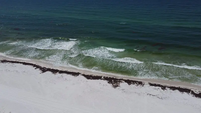
    Pensacola is located in the far west of the Florida Panhandle on the Gulf Coast. A bridge leads to Pensacola Beach on Santa Rosa Island, with its bright sand and free parking.

    by Felix Gillen

    1. Home
    2. Destinations
    3. United States
    4. Florida
    5. Pensacola
    Pensacola is located in the far west of the Florida Panhandle on the Gulf Coast. A bridge leads to Pensacola Beach on Santa Rosa Island, with its bright sand and free parking. Further west, the Gulf Islands National Seashore is home to the Civil War-era Fort Pickens.The naval air station is home to the Blue Angels. The National Naval Aviation Museum showcases over 150 aircraft, but is only accessible to foreign visitors if accompanied by a US citizen.
    United States travel guideSee the round tripPlan a trip with Pensacola

    Contents

    • Neighborhoods & highlights
    • Eat & drink
    • Getting around
    • Accommodation
    • Round trips
    • Nearby

    Sights in Pensacola

    Discover the most important sights and attractions

    Attraction

    1Pensacola Beach

    The beach on Santa Rosa Island is known for its bright sand, and parking is free. In Pensacola, the Blue Angels aerobatic team is stationed, with their Homecoming Show taking place in November at the naval base.
    Open in Google Maps
    Historic Landmark

    2Fort Pickens

    The Civil War-era fort is located in the western part of the Gulf Islands National Seashore on Santa Rosa Island. The gate opens from 8 AM until sunset; admission is 25 US dollars per vehicle for up to seven days. The visitor center is closed for renovations (as of October 2026); a ferry operates Friday through Sunday from March to October.
    Open in Google Maps
    Museum

    3National Naval Aviation Museum

    The museum at NAS Pensacola naval air station exhibits over 150 aircraft with free admission. Access is strictly regulated: foreign nationals may only enter when accompanied by a US citizen, who must also drive the car; Uber and Lyft are not permitted. Information regarding visiting days is contradictory (daily or only on weekends), so please be sure to check the museum's website in advance.
    Open in Google Maps

    Restaurants in Pensacola

    Traveling

    Gulf Islands National SeashoreAdmission $25 per vehicle, valid for one to seven days.The Fort Pickens Area gate opens daily from 8 AM until sunset; the Battery 234 Loop is currently closed indefinitely (as of October 2026).From March to October, a ferry runs to the Fort Fridays through Sundays.Naval Aviation MuseumAccess via West Gate with passport, only when accompanied by a US citizen who is also driving; no ride services, only clear bags allowed. Please check current visiting days in advance.

    Accommodations in Pensacola

    Find perfect stay in Pensacola

    Booking.com* (Affiliate link)
    Search Hotels
    Agoda* (Affiliate link)
    Search Hotels
    Airbnb
    Vacation Rentals

    * Affiliate link: if you book through it, we earn a small commission. The price stays the same for you.

    Campgrounds in Pensacola

    Find perfect campground in Pensacola

    Search via Google Maps
    Campgrounds nearby (15km)
    Camping.info
    Find Campgrounds
    Park4Night
    RV Parks & Camping

    Plan your trip to Pensacola

    Save places, build a route and plan your city trip, all in one place.

    1. 1
      Sunrise over alpine peaks and a sea of clouds
      1234

      Round trip

      12 days · 4 stops

      Saved

      Pick a route

      Pick a ready-made one or save places and plan your own.

      Open bookmarks
    2. 2

      Trip to Pensacola

      Live
      • 1Pensacola Beach3 days
      • 2Fort Pickens4 days
      • 3National Naval Aviation Museum5 days
      Budget

      Plan your trip

      The planner sorts stops, days and budget. Plan together in real time.

      Start trip planning
    3. 3
      9:41 No signal
      Pensacola
      Available offline

      Photo by Viktoria B. on Pexels

      Use it on the road

      Download the guide to your phone and use it on site, even offline.

    Round trips with Pensacola

    The South: Charleston, Savannah and New Orleans

    The South: Charleston, Savannah and New Orleans

    The route begins in Charleston, proceeds along the coast to Savannah, then cuts across the South to the Gulf of Mexico and New Orleans. The stretch from Savannah to New Orleans is long; split it with an overnight stay on the Gulf Coast, or take a domestic flight and avoid the one-way rental fee. Fort Sumter off Charleston, where the Civil War began, is accessible only by boat. The Atlantic hurricane season runs from June 1st to November 30th, and summer is also hot and humid; spring and autumn are the most pleasant travel times.

    11 Days
    4 stops
    Open jaw

    Evan Walker·Pexels

    Nearby

    Marigny and Bywater

    Marigny and Bywater

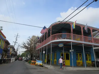
    Faubourg Marigny and Bywater are the two neighborhoods just downriver from the French Quarter, across Esplanade Avenue. Come for the live music on Frenchmen Street, the candy-colored Creole cottages, and an evening under string lights in the wine garden at Bacchanal.The Marigny runs from Esplanade to the railroad tracks along Homer Plessy Way (formerly Press Street); Bywater picks up on the other side. Bernard de Marigny began selling lots on his family's plantation in 1806, so the streets are a little younger and more modest than the Quarter's. Frenchmen Street sits right at the near edge, about a 15-minute walk from Jackson Square.Bywater is quieter and more artsy: murals, small galleries, cash-only dive bars and Crescent Park on the river. The Spotted Cat Music Club on Frenchmen is covered on the main New Orleans page.

    Infrogmation of New Orleans·CC BY-SA 4.0

    French Quarter

    French Quarter

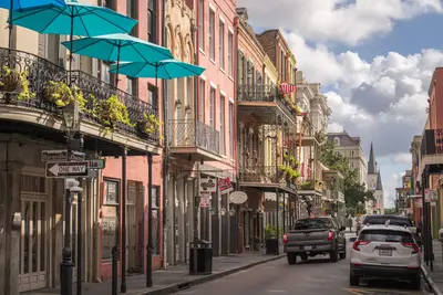
    The French Quarter, or Vieux Carré, is the original 1718 city of New Orleans, set on a bend of the Mississippi. People come for the wrought-iron balconies and hidden courtyards, the old bars, and Creole dining rooms that have served the same dishes for generations.The Quarter is a tight grid between Canal Street, Esplanade Avenue, North Rampart Street and the river, and you can walk across it in about 15 minutes. Despite the name, most of what you see is Spanish colonial: fires in 1788 and 1794 wiped out much of the French town. Jackson Square and St. Louis Cathedral are covered on the main New Orleans page.Bourbon Street gets loud and crowded from late afternoon on. For a nicer stroll, take Royal Street, lined with galleries and antique shops, or Chartres Street. Before 9 a.m. you'll have the streets nearly to yourself and can grab a table at Café du Monde without a line.

    Mark Stebnicki·Pexels

    New Orleans

    New Orleans

    New Orleans sits on the Mississippi in south Louisiana. You come for live music every night of the week, for Creole cooking, and for streets that still show their French and Spanish colonial past.The city was founded in 1718 under Jean-Baptiste Le Moyne de Bienville. Its historic core is the French Quarter, anchored by Jackson Square with St. Louis Cathedral, the Cabildo and the Presbytère. For live music, head to Frenchmen Street in neighboring Faubourg Marigny, where more locals go out than on Bourbon Street.The St. Charles streetcar has been running since 1835 and is considered the oldest continuously operating streetcar line in the world. It rolls from Canal Street through the Garden District to Carrollton, and at $1.25 it's the cheapest city tour you'll find. You don't need a car for the French Quarter, Marigny or Tremé; parking there is scarce and expensive.The neighborhoodsFrench Quarter: the old city, with museums, old-line Creole restaurants and the oldest bars in town, best explored on foot by day.Marigny and Bywater: just downriver, with the Frenchmen Street music strip, colorful cottages, street art and Crescent Park on the river.Garden District and Uptown: mansions along St. Charles Avenue, shopping on Magazine Street, Audubon Park and clubs like Tipitina's.Tremé and Mid-City: Black history around Congo Square, brass bands in neighborhood bars, Bayou St. John and City Park.PlanningWhen to go: February through May and October through November are the most comfortable. June through September is hot and humid, and Atlantic hurricane season runs June 1 to November 30.Big dates: During Carnival season (January through Fat Tuesday) and Jazz Fest (late April into early May), hotels sell out or spike months ahead. Book as early as you can.Where to stay: The French Quarter and Marigny put you closest to music and food; the Garden District and Uptown along the St. Charles line are quieter.

    Mary Hammel·Unsplash

    Tremé and Mid-City

    Tremé and Mid-City

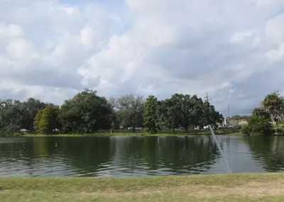
    Tremé and Mid-City lie inland from the French Quarter, between Rampart Street and City Park. Come for the city's Black history, brass bands in neighborhood bars, and Creole soul food that locals happily line up for.Tremé starts right across Rampart and is often called the oldest Black neighborhood in the country: free people of color were buying property here as early as the 1700s. It's home to Louis Armstrong Park and Congo Square, and to St. Augustine Church, founded in 1841. Beyond it, Mid-City is a residential area stretching along Canal Street and Bayou St. John out to City Park.City Park and NOMA, Parkway Bakery and The Broadside are covered on the main New Orleans page. Conditions can change from one block to the next; for current safety guidance, see the UK FCDO Travel Advice.

    Infrogmation of New Orleans·CC BY-SA 4.0

    Garden District and Uptown

    Garden District and Uptown

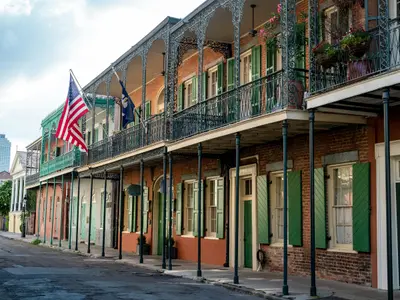
    The Garden District and Uptown are the residential neighborhoods upriver from downtown, strung along the St. Charles streetcar line. Come for the mansions under live oaks, the shops and restaurants of Magazine Street, and music clubs where the crowd is mostly local.The Garden District, between St. Charles Avenue and Magazine Street, was built up from the 1830s on former Livaudais Plantation land. It belonged to the City of Lafayette until New Orleans annexed it in 1852 and has been a National Historic Landmark since 1974. Take the streetcar to Washington Avenue for Commander's Palace and Lafayette Cemetery No. 1 (1833), which reopened in October 2026 after seven years, though only for guided tours of up to 16 people (book at prcno.org). For a route through the streets, see the New Orleans city walks.Uptown has no hard borders. Most people mean the stretch between the river and Claiborne Avenue, from the Garden District out to Audubon Park and the Tulane and Loyola campuses. In the 1800s St. Charles Avenue was the city's millionaires' row, and many of those houses still stand. Closer to the river, Magazine Street runs parallel, lined with independent boutiques, galleries and places to eat.

    Infrogmation·CC BY-SA 4.0

    Your next steps

    Pensacola is in United States. Ways to carry on from here.

    • More in United States

      Highlights, areas, routes and the best time to travel for all of United States.

      United States travel guide
    • Round trips with Pensacola

      One route passes through Pensacola, with stops, nights and a map.

      See the round trip

    Sources & method

    • Photos: Pexels. Each photo carries its credit.
    • Place data such as addresses and ratings comes from Google Maps.
    • The content is based on web research from public, traceable sources. How the content is made · The role of AI