Fernweh: Home
ExploreGuideDestinationsMy tripsMy trip
de|en
All Places & RegionsRound tripsNight trains in EuropeAll highlightsAbout FernwehFAQPrivacy PolicyImprint
Download on the App StoreGet it on Google Play
ExploreGuideDestinationsMy tripsMy trip
    • Places & highlights
    • Eat & drink
    • Culture
    • Getting around
    • Accommodation
    • Nearby
    Lake Pukaki and Twizel

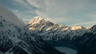
    Photo by Kaiser Concha on Pexels

    New Zealand

    Lake Pukaki and Twizel

    Point of Interest

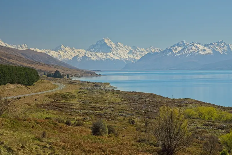
    Lake Pukaki in the Mackenzie Country covers 178.7 square kilometers and is up to 70 meters deep. Its turquoise hue comes from the glacial flour of the Tasman River, which is fed by the Tasman and Hooker Glaciers.

    by Felix Gillen

    1. Home
    2. Destinations
    3. New Zealand
    4. Canterbury
    5. Lake Pukaki and Twizel
    Lake Pukaki in the Mackenzie Country covers 178.7 square kilometers and is up to 70 meters deep. Its turquoise hue comes from the glacial flour of the Tasman River, which is fed by the Tasman and Hooker Glaciers. From its southern shore, on a clear day, you can see Aoraki/Mount Cook, some 70 kilometers away.Seven kilometers south lies Twizel, founded in 1968 as a settlement for the workers of the Upper Waitaki Hydropower Project. The town serves as a convenient base for Aoraki/Mount Cook, Lake Tekapo, and the Alps 2 Ocean Cycle Trail.
    New Zealand travel guideRound trips in New ZealandPlan a trip with Lake Pukaki and Twizel

    Contents

    • Places & highlights
    • Eat & drink
    • Culture
    • Getting around
    • Accommodation
    • Nearby

    Sights in Lake Pukaki and Twizel

    Discover the most important sights and attractions

    Point of Interest

    1Lake Pukaki Viewpoint

    Viewpoint on the southern shore of the lake on the road between Tekapo and Twizel. In clear weather, you can see Aoraki/Mount Cook across the turquoise water.
    Open in Google Maps
    Attraction

    2Lake Ruataniwha

    The reservoir near Twizel, opened in 1982, has one of New Zealand's most important ten-lane rowing courses.
    Open in Google Maps

    Restaurants in Lake Pukaki and Twizel

    Lake, River and Stars

    HydropowerLake Pukaki, along with Lake Tekapo, accounts for over half of New Zealand's hydropower storage capacity. Twizel was established in 1968 as a workers' town for the Upper-Waitaki Project and today has around 1,790 residents, almost three times as many in summer.Nature and SkyTwizel runs a breeding program for the Kakī stilt; 150 young birds were released in 2021. The region is part of the Aoraki Mackenzie International Dark Sky Reserve, a night sky sanctuary.

    Getting There & Around

    Driving times to Lake PukakiFrom Christchurch, about 3 hours 35 minutes (289 kilometers).From Queenstown, about 2 hours 40 minutes (221 kilometers).From Lake Tekapo, about 40 minutes.From TwizelTo Tekapo and Aoraki/Mount Cook Village, allow about 45 minutes each. The Alps 2 Ocean Cycle Trail runs from Lake Tekapo for 54 kilometers to Twizel and continues to Lake Ōhau Lodge.

    Accommodations in Lake Pukaki and Twizel

    Find perfect stay in Lake Pukaki and Twizel

    Booking.com* (Affiliate link)
    Search Hotels
    Agoda* (Affiliate link)
    Search Hotels
    Airbnb
    Vacation Rentals

    * Affiliate link: if you book through it, we earn a small commission. The price stays the same for you.

    Nearby

    Lake Tekapo

    Lake Tekapo

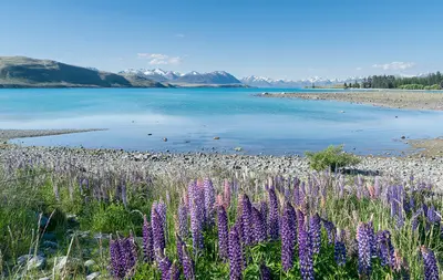
    Lake Tekapo, in Māori Takapō, is a small town on the southern shore of the eponymous lake in the Mackenzie Basin. Fine rock flour from the glaciers colors the water milky turquoise, with the Southern Alps standing in the background.By day, the view from Mount John and the stone church on the shore beckon; by night, the starry sky: The region belongs to the Aoraki Mackenzie International Dark Sky Reserve. In early summer, lupins bloom along the shores, an introduced plant that attracts many photographers.

    Krzysztof Golik·CC BY-SA 4.0

    Aoraki/Mount Cook National Park

    Aoraki/Mount Cook National Park

    The Aoraki/Mount Cook National Park encompasses the highest peaks of the Southern Alps, notably Aoraki/Mount Cook at 3,724 meters. Approximately 40 percent of its area is covered by glaciers, including the Tasman Glacier, the country's longest. The park has existed since 1953 and is part of the UNESCO World Heritage Site Te Wāhipounamu.The starting point is the small Mount Cook Village at the end of State Highway 80. From here, short hikes like the Hooker Valley Track, mountaineering tours, and scenic flights depart. At night, the park is part of the Aoraki Mackenzie International Dark Sky Reserve.

    Janiere Fernandez·Pexels

    Glacier Region (Franz Josef & Fox Glacier)

    Glacier Region (Franz Josef & Fox Glacier)

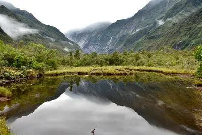
    In Westland Tai Poutini National Park, two glaciers extend from the Southern Alps deep into the rainforest: Franz Josef and Fox Glacier. The two namesake villages are located about 25 kilometers apart on State Highway 6 and serve as the base for glacier hikes, helicopter flights, and valley walks.Both glaciers have retreated significantly in recent decades. Today, you can only access the ice with guided Heli-Hikes; the valley paths end at viewpoints at a distance from the glacier terminus.

    Pexels

    Wanaka

    Wanaka is located on the southern shore of Lake Wānaka, about an hour's drive north of Queenstown. It is quieter than its neighbour and a gateway to Mount Aspiring National Park, the Roys Peak track, and the ski fields of Cardrona and Treble Cone.
    Central Otago

    Central Otago

    Central Otago is the dry highland in the South Island's interior, between Cromwell, Alexandra, and Clyde. Rugged schist hills, orchards, and vineyards shape the landscape, with gold rush traces dotting almost every valley.

    Unsplash

    Your next steps

    Lake Pukaki and Twizel is in New Zealand. Ways to carry on from here.

    • More in New Zealand

      Highlights, areas, routes and the best time to travel for all of New Zealand.

      New Zealand travel guide
    • Round trips in New Zealand

      Ready-made routes through New Zealand, with stops, nights and a map.

      See the routes
    • Plan a trip with Lake Pukaki and Twizel

      The Guide asks about season, length and who is coming, and suggests a trip with Lake Pukaki and Twizel.

      Plan the trip
    Sources & method

    • Photos: Pexels. Each photo carries its credit.
    • Place data such as addresses and ratings comes from Google Maps.
    • The content is based on web research from public, traceable sources. How the content is made · The role of AI