Fernweh: Home
    ExploreTravel GuidesPlan a tripMy tripLast visited
    de|en
    All Places & RegionsAll highlightsAbout FernwehFAQPrivacy PolicyImprint
    ExploreTravel GuidesPlan a tripMy tripLast visited
    • Overview
    • Places in the region
    • Nearby
    Podlachia
    Wojsyl / Wikimedia Commons / CC BY-SA 3.0

    Poland

    Podlachia

    Region

    Podlachia (Podlasie) is located in the far north-east of Poland, bordering Belarus. The regional capital is Białystok.

    by Felix Gillen

    1. Home
    2. Destinations
    3. Poland
    4. Podlachia
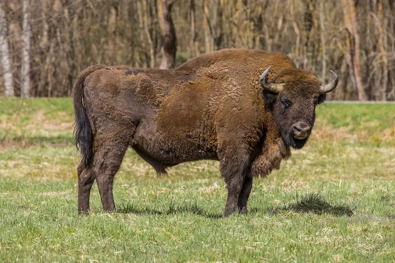
    Podlachia (Podlasie) is located in the far north-east of Poland, bordering Belarus. The regional capital is Białystok. For centuries, the region has been shaped by multiple cultures: Alongside the Polish majority, the Belarusian minority lives here, Orthodox churches stand beside Catholic ones, and until World War II, Jews constituted a large part of the population in many towns. For travellers, Podlachia is primarily a destination for nature experiences. In the south-east lies the Białowieża Forest with its European bison, north-west of Białystok is the vast marsh and river valley of the Biebrza, home to Poland's largest national park. In between are small towns like Tykocin on the Narew, whose history is closely tied to the region's Jewish heritage.
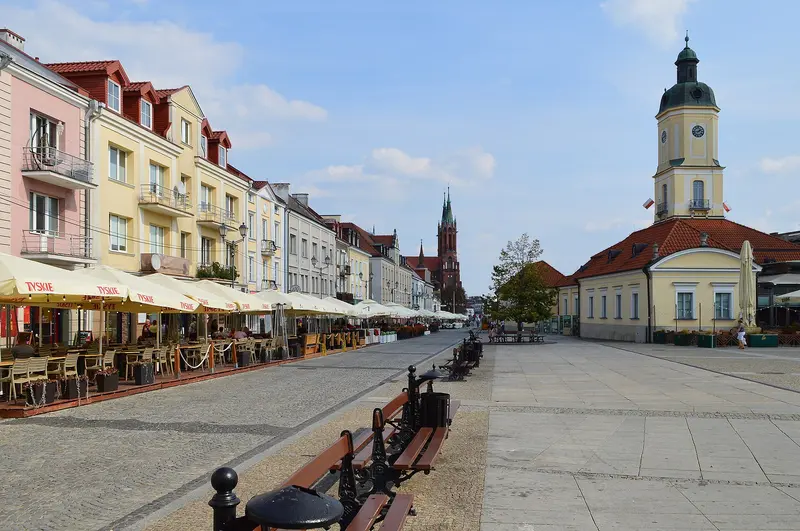
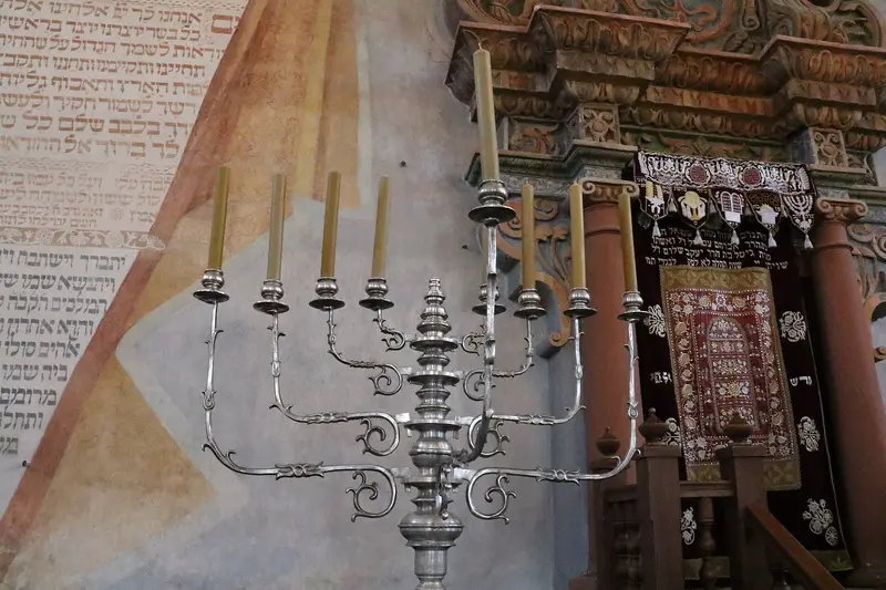
    The starting point for most journeys is Białystok, Podlachia's only major city. With the baroque Branicki Palace, Kościuszko Market, and the Orthodox St. Nicholas Cathedral, the city reveals its tumultuous history. Ludwik Zamenhof, the founder of Esperanto, was born here in 1859. The city is connected to Warsaw by the S8 expressway and rail. Southeast of Białystok, on the border with Belarus, lies the Białowieża National Park, founded in 1932 and a UNESCO World Heritage site since 1979. The forest is considered Europe's last primeval lowland forest. The European bison show enclosure and the Palace Park in Białowieża village are accessible free of charge or for an entrance fee, while the former strict protection zone is only accessible with a guide. Northwest of Białystok stretches the Biebrza Valley, home to the Biebrza National Park, founded in 1993 and, at around 592 square kilometers, Poland's largest national park. It is a Ramsar site and a habitat for elk and rare breeding birds such as the aquatic warbler. On the Narew River lies the small town of Tykocin, with its Great Synagogue dating from 1642 and a baroque market square. The regional cuisine includes Babka ziemniaczana and Kartacze, and an annual Babka cooking championship takes place in nearby Supraśl.
    Białowieża National Park
    Charles J. Sharp / Wikimedia Commons / CC BY-SA 4.0

    Place 1 of 2

    Białowieża National Park

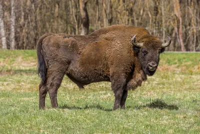
    Białowieża National Park (Białowieski Park Narodowy) protects the Polish core of the Białowieża Forest on the border with Belarus.

    Discover
    Białystok
    Scotch Mist / Wikimedia Commons / CC BY-SA 4.0

    Place 2 of 2

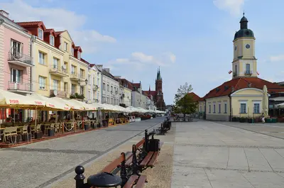
    Białystok

    Białystok is the capital of Podlaskie Voivodeship and, with approximately 290,000 inhabitants, its only large city. It lies northeast of Warsaw (Warszawa), not far from the border with Belarus.

    Discover

    Sights in Podlachia

    Discover the most important sights and attractions

    Tykocin
    Attraction

    Tykocin

    The small town on the Narew west of Białystok was about half Jewish until World War II. The Great Synagogue, dating from 1642, today houses the Museum of Jewish Culture. In the summer of 1941, around 1,400 Jewish inhabitants were murdered in the forests near Łopuchowo. The market square was redesigned in Baroque style after a 1656 fire; on it stands the monument of Hetman Stefan Czarniecki, commissioned in 1763 by Jan Klemens Branicki. Branicki also had the Holy Trinity Church built from 1742 to 1749; ruins of Sigismund Augustus's Castle are preserved.
    Open in Google Maps
    Biebrza National Park
    National Park

    Biebrza National Park

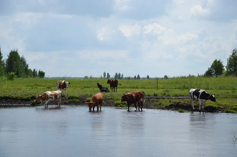
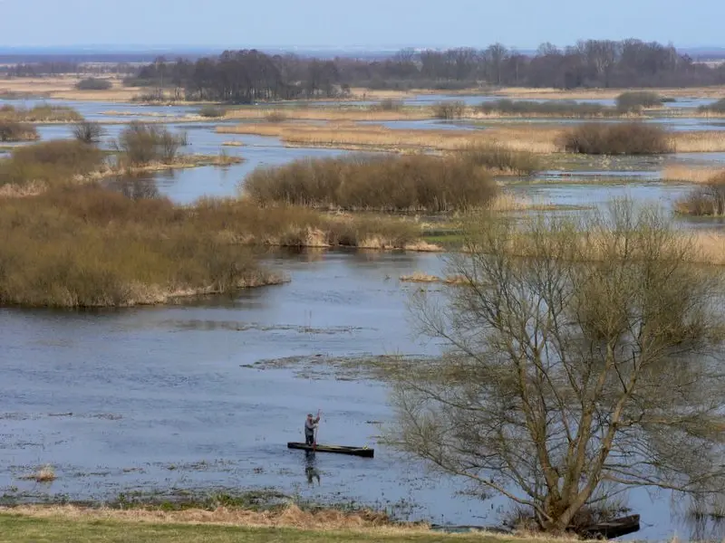
    Founded 1993, Poland's largest national park spans 592 sq km, protecting extensive Biebrza Valley fens. It's a Ramsar site since 1995. Home to around 400 elk and rare breeding birds like the Aquatic Warbler, Ruff, and Great Snipe. Explore by canoe on the Biebrza, on approx. 100 km of cycle paths, and nature trails like Czerwone Bagno. Administration is in Osowiec-Twierdza.
    Open in Google Maps

    Nearby

    Białystok

    Białystok

    Białystok is the capital of Podlaskie Voivodeship and, with approximately 290,000 inhabitants, its only large city. It lies northeast of Warsaw (Warszawa), not far from the border with Belarus. Białystok received city rights around 1691, and owes its appearance primarily to the Branicki magnate family, whose baroque palace is known as the 'Versailles of Podlachia'. In the 19th century, the city grew into an industrial center. The heart of the city center (Centrum) is Kościuszko Market (Rynek Kościuszki) with its baroque town hall. To its west, on ul. Lipowa, stand the Orthodox St. Nicholas Cathedral and, a little further on, the modernist St. Roch's Church. To the east, the Branicki Palace with its gardens and the Bojary district connect, known for its old wooden architecture and home to the Zamenhof Center. For centuries, Białystok was a city of many cultures. In 1931, around 40,000 of the approximately 100,000 inhabitants were Jewish, and there were more than 60 synagogues. Today, a Belarusian minority lives in the city, visible among other things in its Orthodox churches. Białystok is a good starting point for excursions to the Białowieża National Park in the southeast of the region.
    Białowieża National Park

    Białowieża National Park

    Białowieża National Park (Białowieski Park Narodowy) protects the Polish core of the Białowieża Forest on the border with Belarus. Established in 1932, it is Poland's second-oldest national park after Pieniny National Park, and today covers approximately 105 square kilometers. The forest is considered Europe's last primeval lowland forest, dominated by pedunculate oak, small-leaved lime, and hornbeam. It has been on the UNESCO World Heritage List since 1979, with the Belarusian part added in 1992. The symbol of the park is the European bison (Wisent). The species was extinct in the wild, but in 1952, the first animals bred in captivity were reintroduced here. The village of Białowieża serves as a starting point for visits, featuring the Palace Park, the Museum of Natural History and Forestry, and the park administration. The most valuable part, the former strict protection zone, may only be entered with a licensed guide; other sections are accessible via marked hiking and cycling trails. According to the National Park administration, all hiking trails in the park are open (as of October 2026). Along the border with Belarus, a ban on staying in a border strip has been in effect since June 2024, extended by the Ministry of Interior every 90 days. According to reports on the Polish Ministry of Interior's regulation, this strip generally exempts villages and hiking trails and is approximately two kilometers wide in protected areas. For current travel and security information, including regarding the border area, see the UK Foreign, Commonwealth & Development Office (FCDO).
    Nikolaiken (Mikołajki)

    Nikolaiken (Mikołajki)

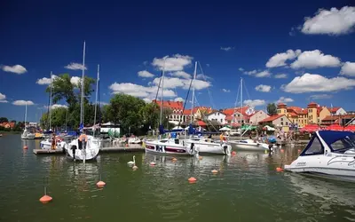
    Nikolaiken (Mikołajki) is a small town with over 3,300 inhabitants in the heart of the Masurian Lake District. The town lies at the narrow passage between Lake Tałty and Lake Mikołajki, which merge here, and only a few kilometres from Lake Śniardwy, Poland's largest lake. Nikolaiken was first mentioned in 1444; it received town privileges in 1726. Today, Mikołajki is one of Masuria's most important sailing centres. Along the shore are a marina, excursion boat piers, and houseboat rentals. The centre is small: restaurants and guesthouses line the market square and church square, and a pedestrian bridge, completed in 2016, connects the waterfront promenades across the narrow lake passage. About five kilometres to the east lies Lake Łuknajno, a nature reserve and UNESCO Biosphere Reserve with one of Europe's largest mute swan colonies. In the vicinity is also the Krutynia, a popular river for canoe trips.
    Lötzen (Giżycko)

    Lötzen (Giżycko)

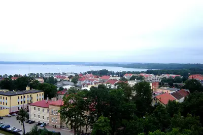
    Lötzen (Giżycko), with roughly 27,000 residents, is one of the larger towns in the Masurian Lake District. It's situated on an isthmus between Lake Löwentin (Niegocin) and the Lake Mamry system, including Lake Kisajno. First mentioned in 1340, Lötzen gained town rights in 1612 and has been connected to the rail network since 1868. On Lake Löwentin's shore are harbours, including the municipal Ekomarina, plus the town beach and adjacent park. The Lötzener Canal (Kanał Łuczański) is spanned by an 1898 swing bridge, still hand-operated today. West of town lies the extensive Boyen Fortress grounds, plus a water tower with a viewing café and Bruno's Hill with the 1909 Bruno Cross. Lötzen thrives primarily on water sports. From here, sailing trips and excursion boats depart across the large Masurian lakes, and in summer, the town hosts events like the Sea Shanty Festival.
    Warmian-Masurian

    Warmian-Masurian

    The Warmian-Masurian Voivodeship (Warmińsko-Mazurskie) in northeastern Poland unites two historic landscapes. Ermland (Warmia) in the west was shaped for centuries by the Warmian Cathedral Chapter, whose castles and cathedrals in Allenstein (Olsztyn) and Frauenburg (Frombork) still stand today. Masuren (Mazury) in the east is known for the Masurian Lake District, featuring Lake Spirdingsee (Śniardwy), the largest lake in Poland. Until 1945, the region predominantly belonged to East Prussia. For travelers, Ermland-Masuren is primarily a destination for water sports and nature: sailing on the large lakes, excursion boats between lakeside towns, and canoe tours on rivers like the Krutynia. Additionally, there are testimonies to a turbulent history, from Copernicus and baroque pilgrimage churches to the ruins of the Wolf's Lair.

    Sources & method

    • Photos: Wikimedia Commons. Each photo carries its credit.
    • Place data such as addresses and ratings comes from Google Maps.
    • The content is based on web research from public, traceable sources. How the content is made · The role of AI