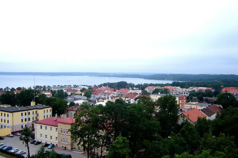
This route follows the Polish Baltic coast from Szczecin via the seaside resorts of Świnoujście and Kołobrzeg to the moving dunes near Łeba and on to Gdańsk. From there, it continues via Malbork Castle into Warmia to Olsztyn and into the Masurian Lake District to Mikołajki and Giżycko. This is a car route: The stages are mostly 60 to 140 kilometres long, as the train only serves some of the places in Masuria. Beaches, dunes, Hanseatic towns, and lakes alternate.
11 Days / 10 Nights
June to September; in peak summer, coastal beaches and parking are full.
RV Friendly
9 stops
Why This Route?
This route connects northern Poland's two major water landscapes: the long Baltic coast with its seaside resorts and national park, and the Masurian Lake District. In between lie Gdańsk and Malbork Castle as cultural stops. By car, you can also reach places off the main rail routes.
Hidden Gems
Fort Gerhard in Świnoujście: Prussian coastal fortress on Wolin Island, adjacent to the Polish Baltic's highest lighthouse
Swing bridge over the Lötzener Canal: built in 1898, still hand-operated today
Lake Łuknajno near Mikołajki: a nature reserve where mute swans breed and up to 2,000 swans gather for molting in summer.
Getting there and back
Open jaw: start and end are in different places
Arrival
Car · Stettin (Szczecin), über die A6You can reach Szczecin from Germany by car via the A6 motorway. If you prefer to rent a car upon arrival: Szczecin Główny station has trains to Berlin, and Szczecin-Goleniów Airport is outside the city.
Departure
Car · Lötzen (Giżycko)From Giżycko to Warsaw, according to the route planner, it's around 290 kilometers by road. With your own car, the journey back to Germany is long; plan a separate travel day or a stopover for it.
Itinerary
Stop 1 • 1 Night
Stettin (Szczecin)
City
Stettin (Szczecin) is situated on the Oder River, just before it flows into the Szczecin Lagoon, and with almost 390,000 inhabitants, it is Poland's seventh-largest city and the capital of the West Pomeranian Voivodeship. Since 1278, the city has been part of the Hanseatic League, and its port remains one of the largest on the Baltic Sea. North of the center, the Oder widens into Lake Dąbie (Jezioro Dąbie).
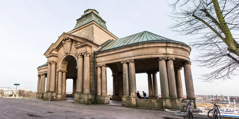
The Old Town, with the Ducal Castle and St. James' Cathedral, is located on the west bank, above which is the Hakenterrasse with views of the river. Opposite, between the arms of the Oder, are the islands of Lastadie (Łasztownia) and Silberwiese. Adjacent is the New Town, whose wide avenues, modeled on Parisian designs, converge on star-shaped squares like Plac Grunwaldzki.
From Berlin, Stettin is easily accessible by train and is perfect for a long weekend. If you have more time, combine your visit with the coast around Swinemünde or Kolberg.
Start on the Oder: Pomeranian Dukes' Castle, St. James Cathedral, and Hakenterrasse with river views.
4 Sights
4 Restaurants
History and Architecture
Hanseatic City and Residence
Stettin joined the Hanseatic League in 1278. In the Old Town stands the Castle of the Pomeranian Dukes, rebuilt after the war. St. James' Cathedral, founded in 1187 and modeled after Lübeck's St. Mary's Church, is today Poland's second-tallest church. After the August 1944 air raids, its tower only regained its spire in the 21st century.
The New Town was laid out with wide, straight avenues and star-shaped squares, its plan recalling Paris, while the houses look more like Berlin's. Between 1902 and 1921, the Hakenterrasse was added as an imposing riverfront promenade.
Modern Architecture
The Philharmonic Hall by Barcelona-based firm Barozzi Veiga opened in September 2014. Its ice-like form and translucent glass facade, which glows white at night, earned it the European Union Prize for Contemporary Architecture in 2015. The Central Cemetery, one of Europe's largest, is also worth a stroll.
Swinemünde (Świnoujście) is situated on the eastern part of Usedom Island, the western tip of Wollin, and the small island of Kaseburg (Karsibór). The Swine River separates Usedom and Wollin. Approximately 39,000 people live here. Swinemünde has been a seaside resort since its first bathing season in July 1824.
On the Usedom side are the city center and the spa district with the Lenné spa park, the beach, and the promenade, which stretches about twelve kilometers across the border to Ahlbeck, Heringsdorf, and Bansin. On the Wollin side, you'll find the tallest lighthouse on the Baltic coast, Fort Gerhard, and the port facilities with the LNG terminal.
Its location directly on the German border makes Swinemünde an easy day trip from Usedom, and several days are also worthwhile for a beach holiday.
Approx. 110 kilometers from Stettin. The town center and spa quarter are on Usedom; since late June 2023, a road tunnel under the Swine connects Usedom and Wollin, the free ferries at Warszów mainly carry pedestrians and cyclists.
3 Sights
3 Restaurants
History and Culture
Seaside Resort since 1824
In July 1824, the first official bathing season opened with the founding of the sea and brine spa. From 1826, Peter Joseph Lenné designed the spa park, connecting the spa district and the city center. Today, the promenade connects Swinemünde with Ahlbeck, Heringsdorf, and Bansin on the German side of Usedom.
Fortress and Port City
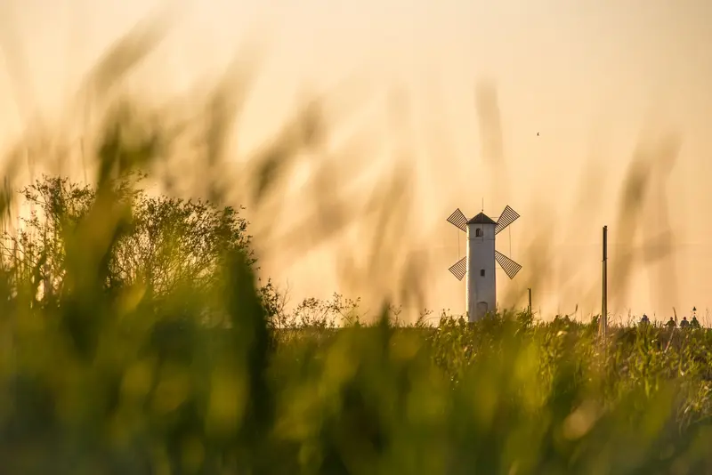
The Swine estuary was secured by several forts, including the Westfort, the Engelsburg, and Fort Gerhard next to the 1857 lighthouse. Its landmark is the Mühlenbake from 1874 on the Westmole. In 2023, the tunnel under the Swine opened, and since 2010, an LNG terminal has been developed on Wollin.
Kolberg (Kołobrzeg), situated at the mouth of the Persante (Parsęta) into the Baltic Sea, is a brine and spa resort with over 43,000 inhabitants and a long tradition: first guests arrived around 1800, and by 1904, the town already welcomed over 13,000 spa visitors. Weak brine springs once laid the foundation for the settlement and the town's wealth; it belonged to the Hanseatic League from before 1361 to 1610. In the year 1000, it briefly hosted a bishopric with Bishop Reinbern.
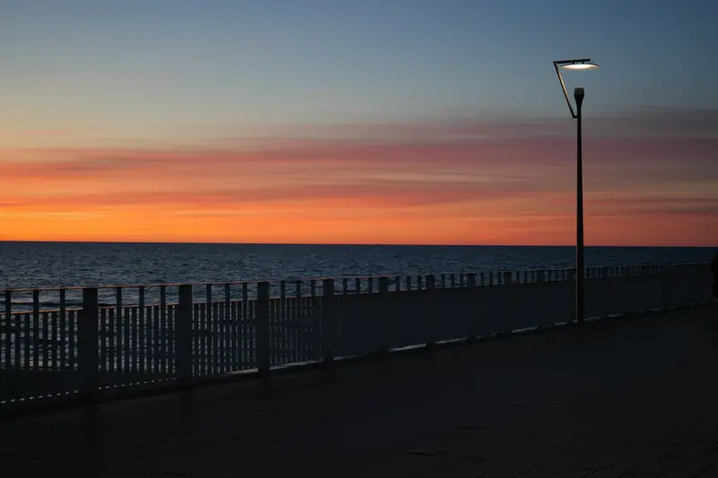
In the Old Town are the five-aisled 14th-century cathedral and the city hall designed by Schinkel. In March 1945, the city was about 90 percent destroyed. Towards the sea lie the Spa Quarter and the promenade; at the harbour stand the lighthouse and the 220-meter-long pier.
Kolberg is ideal for beach holidays and spa stays. At the harbour, the fishing cooperative sells the fresh and smoked catch from its cutters directly to customers.
Approximately 130 kilometers along the coast. A 14th-century cathedral, spa district, lighthouse, and pier are all close together.
3 Sights
3 Restaurants
History and Culture
Salt, Hanseatic League, and Cathedral
Salt extraction made Kolberg prosperous in the Middle Ages; the city was a member of the Hanseatic League until 1610. The Cathedral, a five-aisled hall church where the first mass was celebrated in 1321, bears witness to this. Inside hangs the wooden Schlieffen Crown from 1523, and the choir stalls date from around 1340. Since 1986, the Cathedral has been a Basilica minor, and today it serves as a Co-cathedral.
Sieges and Marriage to the Sea
In 1807, Gneisenau, Schill, and Nettelbeck defended the city against Napoleon's siege. From March 4 to 18, 1945, the city was fought over, after which it lay approximately 90 percent in ruins. Since 1963, a monument on the promenade has commemorated the symbolic marriage of Poland to the sea after its capture. The Museum of Polish Arms tells the military history of the country.
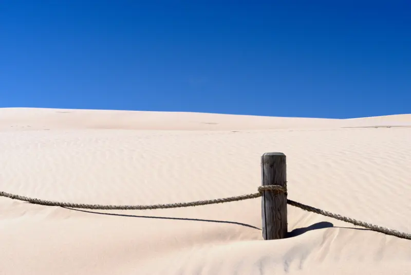
Łeba is a small seaside resort with around 3,000 inhabitants at the mouth of the river of the same name into the Baltic Sea, about 50 kilometers northeast of Stolp (Słupsk). The town has been a spa since 1862. Its location between the Baltic Sea, Lake Łebsko (Jezioro Łebsko), and Sarbsko Lake makes it a starting point for the Słowiński National Park, which begins directly to its west.
The national park, founded in 1967, is known for its shifting dunes: The Łącka Dune reaches 42 meters and moves up to ten meters annually. Additionally, there's Lake Łebsko, with a good 71 square kilometers the largest coastal lake west of Gdańsk, and Lake Gardno. Since the 1970s, the area has been a UNESCO Biosphere Reserve, and a Ramsar wetland since 1995.
In the town itself, days revolve around the beach, the harbor canal, and fried fish eateries. For the dune, you should plan half a day, ideally early in the morning or late in the afternoon.
At approx. 175 km, this is the longest coastal stage. Plan half a day for the moving dune, ideally early or late afternoon; paths to Łącka Dune require a fee from May to September.
3 Sights
3 Restaurants
Geschichte und Kultur
A City Fleeing the Sand
A Pomeranian fishing settlement stood here as early as the 11th century; Lebamünde was first mentioned in 1282, gaining city rights in 1357 under the Teutonic Order. Storm surges in 1497 and 1558 shifted the river mouth, and wandering dunes threatened houses, leading to the town's relocation inland in 1570. Of the old St. Nicholas Church, only a wall remnant remains; the new church was completed in 1592.
Rockets in the Dunes
Near Rąbka, en route to the Łącka Dune, lay a German rocket test site where Rheintochter and Rheinbote projects were tested. A museum now commemorates it. In contrast, Kluki's open-air museum displays the Slowinzen's way of life, from whom the National Park takes its name.
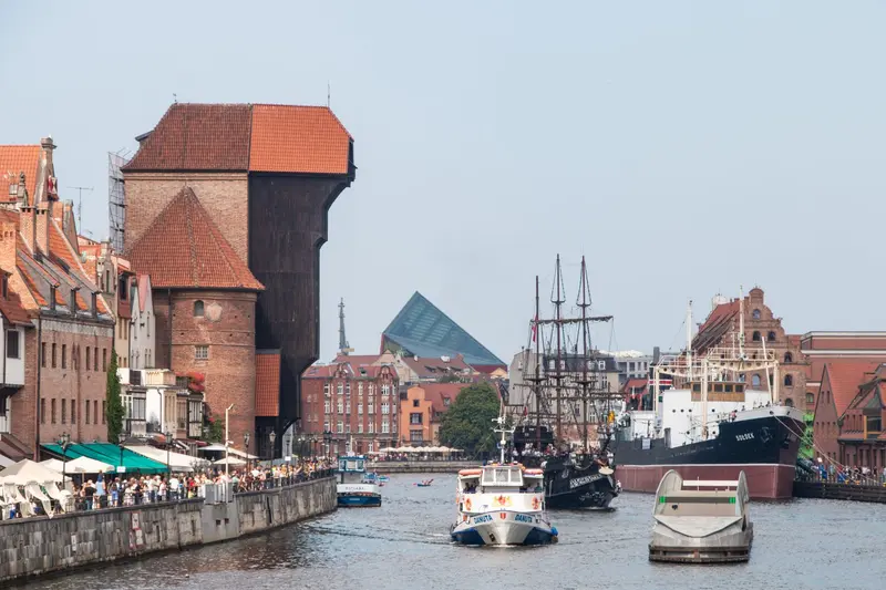
Danzig (Gdańsk) is located on Gdańsk Bay, where the Motława River flows into the Baltic Sea, west of the Vistula estuary. With nearly 490,000 inhabitants, the capital of the Pomeranian Voivodeship is Poland's sixth-largest city and forms the Tri-City (Trójmiasto) with Sopot and Gdingen (Gdynia). For centuries, Danzig was a Hanseatic city, prospering through grain trade and amber. In 1945, its center lay almost entirely in ruins, but it was rebuilt under Polish leadership.
The heart is the Main Town (Główne Miasto) with Long Lane, Long Market, and Mariacka Street. To the north lies the Old Town, and east of the Motława are Granary Island and Langgarten. Further north, the shipyards dominate the landscape, where Solidarność originated in 1980. Outside the center are Langfuhr (Wrzeszcz) and Oliva (Oliwa). In Oliwa, you'll find the monastery founded around 1185 and the cathedral.
A weekend is sufficient for the Old Town and the main museums. With two or three more days, you can visit Westerplatte and take the S-Bahn to Sopot or continue to the Hel Peninsula.
About 110 km from Łeba. You won't need a car downtown; leave it at your accommodation. The SKM goes to Sopot.
6 Sights
4 Restaurants
Culture and History
Hanseatic City and Reconstruction
Gdańsk was a member of the Hanseatic League from 1361 until the last Hansetag in 1669. This story is told by the gabled houses of Langgasse, Artushof as a meeting place for merchants, and St. Mary's Church, one of the three largest brick churches north of the Alps. Much of what you see today is the result of reconstruction after 1945. On Long Market, the 44th Modern Hansetag was opened in June 2024.
Where the 20th Century Began and Ended
On September 1, 1939, the battleship Schleswig-Holstein shelled the Polish garrison on Westerplatte; the attack is considered the start of World War II in Europe. In August 1980, workers at the Lenin Shipyard went on strike, and from their strike committee under Lech Wałęsa, the Solidarność trade union emerged. The Museum of the Second World War and the European Solidarność Centre tell both chapters in detail.
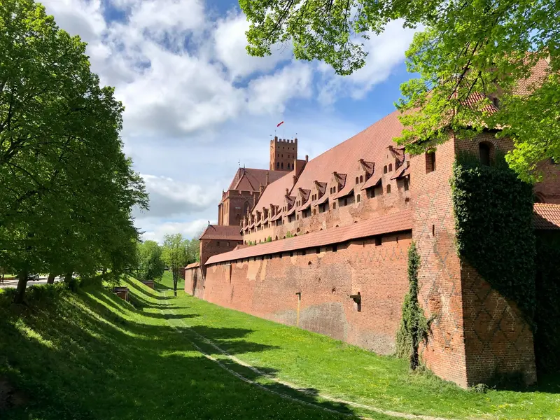
Marienburg (Malbork), located on the Nogat, a distributary of the Vistula, is considered Europe's largest brick building: over 30 million bricks were used across approximately 21 hectares. The Teutonic Order constructed the complex between about 1270 and 1300; from 1309, it was the Grand Master's seat. A UNESCO World Heritage site since 1997, it attracts around 500,000 visitors each year.
The castle has three sections: the Upper Castle (with St. Mary's Church), the Middle Castle (Grand Master's Palace, Great Refectory), and the Outer Bailey (housing service buildings). Plan half a day for the interiors; an excursion from Danzig is easily manageable by train or car.
A stop on the way to Olsztyn, approximately one hour by car from Gdańsk. Parking is available near the castle.
3 Sights
2 Restaurants
History of the Order Castle
From the Seat of the Order to a Polish Royal Castle
In 1309, the Grand Master of the Teutonic Order moved his seat to the Nogat. Mercenaries sold the castle to the Polish king in 1456, who then took up residence in it in 1457. In 1772, it passed to Prussia and was restored in the late 19th century under Emperor Wilhelm II by Conrad Steinbrecht.
Destruction and Reconstruction
The fighting in 1945 destroyed around 60 percent of the complex. Poland rebuilt it after the war, and the Castle Museum was founded in 1961. A symbol of this reconstruction is the eight-meter-high Madonna figure of St. Mary's Church, which was reconsecrated in 2016 after its restoration.
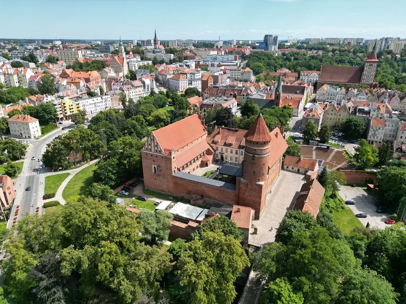
Allenstein (Olsztyn) is the capital of the Warmian-Masurian Voivodeship and, with over 165,000 inhabitants, the largest city in the region. It is situated on the Łyna River (Alle) in historical Warmia and was founded in 1353. Above the Old Town stands the Castle of the Warmian Cathedral Chapter, where Nicolaus Copernicus lived from 1516 as the administrator of the chapter's estates. Since 1999, Allenstein has also been home to the University of Warmia and Masuria.
Its core is the Old Town (Stare Miasto) with the High Gate, remnants of the medieval city wall, the late-Gothic Old Town Hall, and the Co-Cathedral of St. James. Surrounding it are the City Centre (Śródmieście) and districts such as Kortowo, Zatorze, and Jaroty; in total, the city is divided into 23 districts.
Unusual for a large city is its proportion of water and forest: within the city limits lie more than ten lakes, the largest being Lake Ukiel with its city beach, plus a large municipal forest. Allenstein is therefore an excellent starting point for excursions into Warmia and the Masurian Lake District.
About 140 kilometers from Malbork. Old Town with the High Gate and the Castle, which Copernicus administered from 1516 to 1521; additionally Lake Ukiel (Krzywe), at 412 hectares one of the lakes within the city.
5 Sights
3 Restaurants
Culture and History
Copernicus and the Cathedral Chapter
The city's history is closely linked to the Warmian Cathedral Chapter, which had the castle built from the mid-14th century. Nicolaus Copernicus managed the Chapter's estates from here and led the defense of the castle in 1521. An astronomical table, which he created himself in 1517, is preserved in the cloister. The Planetarium, opened in 1973 for the astronomer's 500th birthday, builds on this connection.
Museums, Stages, and University
Within the castle, the Museum of Warmia and Masuria displays collections on the region's history and art. The Stefan Jaracz Theatre opened in 1925; today, it is the city's largest stage. The University of Warmia and Masuria, founded in 1999, brings many students to Olsztyn, which is noticeable in the cafés and pubs around the Old Town.
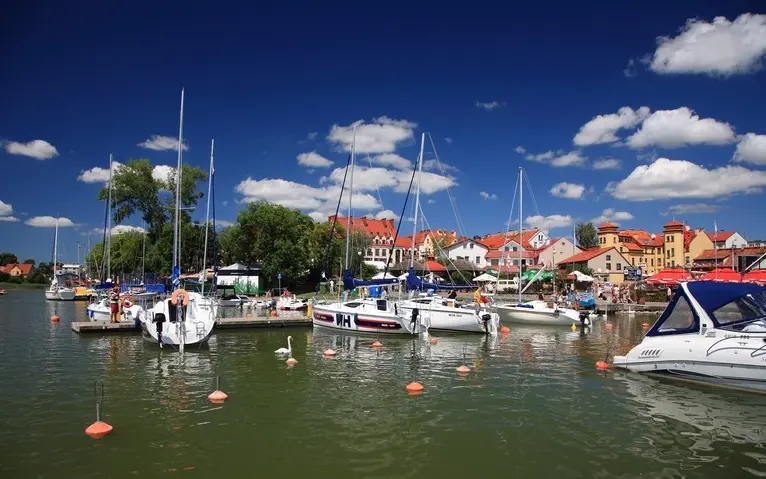
Nikolaiken (Mikołajki) is a small town with over 3,300 inhabitants in the heart of the Masurian Lake District. The town lies at the narrow passage between Lake Tałty and Lake Mikołajki, which merge here, and only a few kilometres from Lake Śniardwy, Poland's largest lake. Nikolaiken was first mentioned in 1444; it received town privileges in 1726.
Today, Mikołajki is one of Masuria's most important sailing centres. Along the shore are a marina, excursion boat piers, and houseboat rentals. The centre is small: restaurants and guesthouses line the market square and church square, and a pedestrian bridge, completed in 2016, connects the waterfront promenades across the narrow lake passage.
About five kilometres to the east lies Lake Łuknajno, a nature reserve and UNESCO Biosphere Reserve with one of Europe's largest mute swan colonies. In the vicinity is also the Krutynia, a popular river for canoe trips.
Around 80 kilometers from Allenstein. Sailing center on Lake Nikolaiker, in season excursion boats of Żegluga Mazurska dock here. Lake Łuknajno is about five kilometers away.
3 Sights
3 Restaurants
Culture and History
Protestant Masuria
Until 1945, Nikolaiken belonged to East Prussia, primarily Protestant. Designed by Karl Friedrich Schinkel, the Holy Trinity Church was consecrated in 1842 and remains the parish church of the Lutheran congregation. The 1973-founded Museum of the Polish Reformation, in the Protestant community building, displays old prints, Bibles, and hymnals from Masuria.
The King of the Vendace
The town's coat of arms depicts a crowned fish, bound with a chain. It's based on a legend: fishermen caught the fish king, who protected lake fish from their nets, allowing them to resume their catches. As the fountain figure Król Sielaw, King of the Vendace, he is now Nikolaiken's emblem. The legend recalls the long-standing importance of fishing here, especially for vendace.
Lötzen (Giżycko), with roughly 27,000 residents, is one of the larger towns in the Masurian Lake District. It's situated on an isthmus between Lake Löwentin (Niegocin) and the Lake Mamry system, including Lake Kisajno. First mentioned in 1340, Lötzen gained town rights in 1612 and has been connected to the rail network since 1868.
On Lake Löwentin's shore are harbours, including the municipal Ekomarina, plus the town beach and adjacent park. The Lötzener Canal (Kanał Łuczański) is spanned by an 1898 swing bridge, still hand-operated today. West of town lies the extensive Boyen Fortress grounds, plus a water tower with a viewing café and Bruno's Hill with the 1909 Bruno Cross.
Lötzen thrives primarily on water sports. From here, sailing trips and excursion boats depart across the large Masurian lakes, and in summer, the town hosts events like the Sea Shanty Festival.
Just 40 km from Nikolaiken. Fortress Boyen, swing bridge, and Lake Löwentin harbor – excursion boats depart from here across the large lakes.
4 Sights
2 Restaurants
Culture and History
Fortress City
Boyen Fortress was constructed between 1844 and 1856 by order of King Friedrich Wilhelm IV and named after Prussian General Hermann von Boyen. The star-shaped complex spans some 100 hectares and was designed for around 3,000 soldiers. Three of the six bastions bear the General's first names, the other three his motto's terms: Recht, Schwert, Licht. Today, an association maintains the fortress, which houses a museum and a youth hostel in the barracks at Lötzener Tor.
From Teutonic Castle to Watersports Hub
The 14th-century castle, the city's nucleus, now functions as a hotel. Until 1945, Lötzen was part of East Prussia; in 1946, it received its Polish name, honouring Pastor Gustav Gisevius. Cultural life is organized by the Giżyckie Centrum Kultury, which also runs the Nowa Fala cinema and hosts the Sea Shanty Festival (Szanty w Giżycku).