Back to Singapore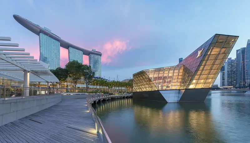
Singapore in 5 Days with Islands and Nature
by Felix Gillen
Five days that combine city and nature: Marina Bay and Chinatown, the Botanic Gardens, the wildlife parks at Mandai, a day by bike on Pulau Ubin and a beach day on Sentosa. Your base is a hotel at Marina Bay, and you reach the day trips by MRT, bus and boat.
8 stops
Why This Route?
Singapore is greener than many expect. This route links the well-known districts with rainforest, wildlife parks, a rural island and a beach day, without changing hotels. Five days leave room for rain showers and breaks from the heat.
Hidden Gems
- Jejawi Tower at Chek Jawa on Pulau Ubin
- Henderson Waves, at 36 metres Singapore's highest pedestrian bridge, in the Southern Ridges
- TreeTop Walk in the MacRitchie area, closed on Mondays
Getting there and back
Round trip, returning to where you started
- Arrival
- Flight · Singapur Changi (SIN)From Changi Airport you reach Marina Bay by MRT (change at Tanah Merah) or by taxi. Changi Point Ferry Terminal, the departure point for Pulau Ubin, lies in the east of the island like the airport.
- Departure
- Flight · Singapur Changi (SIN)
Itinerary
Stop 1 • 5 Nights
Marina Bay
routes.tagDescriptions.stadtteil. Stunning architecture and historic buildings and routes.tagDescriptions.skyline.
Marina Bay is Singapore's iconic skyline district: The Marina Bay Sands hotel, the ArtScience Museum, the Supertrees of Gardens by the Bay, and the towers of the financial district frame the bay here. You'll come for the gardens, the view from the SkyPark, and in the evening for the light shows on the water. The approximately 360-hectare area was reclaimed from the sea starting in 1971; the last 38 hectares at Bayfront were added in 1994. Since the construction of the Marina Barrage in 2008, the bay has been a freshwater reservoir.The best way to explore here is to walk along the waterfront promenade around the bay, from the Merlion across the Helix Bridge to the gardens. Five MRT lines serve the district; the most important stations are Bayfront, Marina Bay, Gardens by the Bay, and Esplanade.
Hotel base. Gardens by the Bay with the evening Garden Rhapsody show at the Supertrees.
5 Sights
3 Restaurants
A District Built on Reclaimed Land
From Sea to SkylineAccording to the URA, Singapore began land reclamation along the downtown shoreline in 1971, with the final 38 hectares at the Bayfront reclaimed in 1994. The new land became home to the financial district around Marina Bay Financial Centre and Asia Square, the Esplanade, the Singapore Flyer, and eventually Gardens by the Bay. Significant portions of the Formula 1 Marina Bay Street Circuit also stand on reclaimed land.The Bay as a Water ReservoirIn 2008, the Marina Channel was dammed with the Marina Barrage. Since then, Marina Bay and the Kallang Basin have formed a freshwater reservoir that supplies additional drinking water, maintains stable water levels for water sports, and protects areas like Chinatown from flooding.
Stop 2 • 0 Nights
Chinatown
routes.tagDescriptions.stadtteil. routes.tagDescriptions.tempel and routes.tagDescriptions.shophouses.
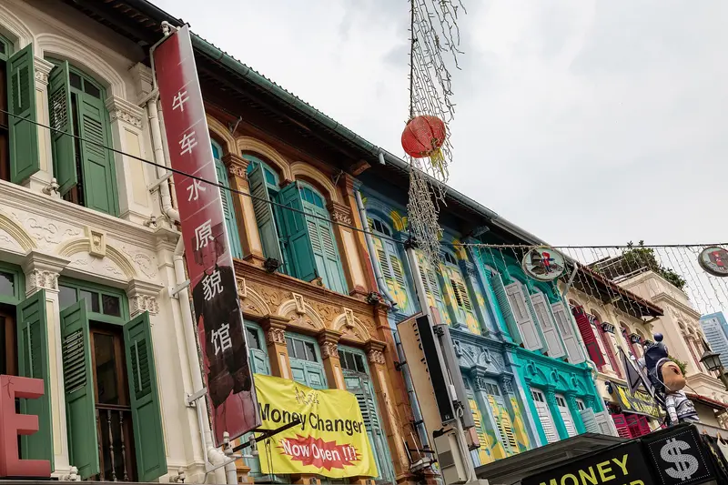
Chinatown is Singapore's historic Chinese quarter southwest of the Singapore River. You come for its temples of three religions, the restored shophouses, and the Maxwell and Chinatown Complex Hawker Centres. Raffles' 1822 town plan allocated the area to Chinese immigrants; the Chinese name Niu Che Shui, 'Bullock-Cart Water', recalls the water carts that supplied the district in the 19th century. Since 1989, it has been a conservation area; the urban planning authority URA divides it into four districts: Kreta Ayer, Telok Ayer, Tanjong Pagar, and Bukit Pasoh.Standing close together are the Buddha Tooth Relic Temple, the Hindu Sri Mariamman Temple, and the Masjid Jamae Mosque. The district is accessible via Chinatown and Maxwell MRT stations.
Temples on South Bridge Road and lunch at a hawker centre.
5 Sights
3 Restaurants
History and Faith
An Immigrant DistrictTelok Ayer, by the former shore, is the oldest part of Chinatown and developed from the 1820s, with Kreta Ayer following in the 1830s. Clan associations, organised by dialect groups, supported the newcomers. Shophouses were often overcrowded: at the Chinatown Heritage Centre, you can see reconstructed living cabins, such as those of a clog maker and a Samsui woman.Temples Side by SideThe district was never purely Chinese. Indian traders settled on South Bridge Road, where in 1826 the mosque of the Tamil Chulia Muslims and in 1827 the Sri Mariamman Temple were established. The Thian Hock Keng Temple on Telok Ayer Street is dedicated to Mazu, the Goddess of the Sea, whom sailors honoured after a safe voyage.
Stop 3 • 0 Nights
Singapore Botanic Gardens
routes.tagDescriptions.unesco-welterbe. routes.tagDescriptions.park and routes.tagDescriptions.orchideen.
The Botanic Gardens in the Tanglin district is an approximately 82-hectare park featuring lakes, themed gardens, and the National Orchid Garden. Since July 4, 2015, it has been listed as the first and, to date, only tropical botanical garden on the UNESCO World Heritage list. It was established in 1859 by an Agricultural and Horticultural Society at its current location. Under Director Henry Nicholas Ridley, who took office in 1888, research into rubber cultivation was conducted here; his methods helped Malaya become the world's largest natural rubber producer.The Gardens are freely accessible daily from 5 AM to midnight. You can stroll from Swan Lake at Tanglin Gate across lawns and themed gardens to the National Orchid Garden, which is the only paid-admission area. Two MRT stations are located directly at the entrances: Botanic Gardens in the north and Napier in the south.
UNESCO World Heritage Site since 2015; visit in the morning, then continue to Orchard Road.
4 Sights
3 Restaurants
Rubber, Orchids and World Heritage
Research Garden of the Colonial EraFrom the start, the garden was more than a park: economic crops were trialled here, above all rubber. Henry Nicholas Ridley developed tapping methods and promoted cultivation among planters. Also from this period is Burkill Hall, an 1886 plantation bungalow that once served as the directors' residence and is named after directors Isaac and Humphrey Burkill.Orchids as a National SymbolOrchid cultivation is closely linked to the garden. According to NParks, the National Orchid Garden has displayed over 1,500 species and 3,000 hybrids since 1995. In 2021, the Tropical Montane Orchidetum was added, featuring cool and mist houses where plants from tropical mountain regions thrive.
Stop 4 • 0 Nights
Mandai
routes.tagDescriptions.zoo. routes.tagDescriptions.wildtiere and routes.tagDescriptions.night safari.
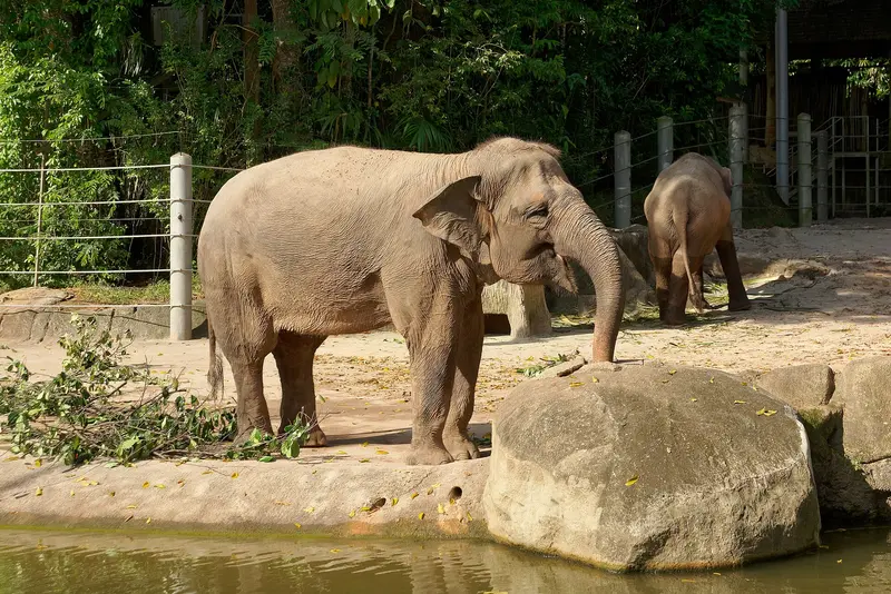
Mandai in northern Singapore is the city-state's hub for zoological parks. On the edge of the Upper Seletar Reservoir, in the Central Catchment area, there are now five parks: the Singapore Zoo (opened 1973), Night Safari (1994), River Wonders, Bird Paradise (moved from Jurong in 2023), and the newest park, Rainforest Wild Adventure. They are operated by the Mandai Wildlife Group, known as Wildlife Reserves Singapore until 2021.With the opening of Rainforest Wild Adventure's eastern section in May 2026, the roughly ten-year transformation into Mandai Wildlife Reserve is complete. You can spend a full day here and switch to the Night Safari in the evening. The Mandai Wildlife West and East entrance areas, with restaurants, are accessible without a ticket. You can reach Mandai by MRT and shuttle buses.
A full day in the Mandai Wildlife Reserve: Singapore Zoo, Bird Paradise (since 2023) or Rainforest Wild Adventure (since 2025), and optionally the Night Safari in the evening.
5 Sights
3 Restaurants
Open Enclosures and a Night Zoo
The Open Zoo ConceptUpon its opening on June 27, 1973, the Singapore Zoo adopted a concept that was unusual at the time: instead of cages, hidden moats, glass, and low barriers separate animals and visitors. Its most famous animal was the Sumatran orangutan female Ah Meng, who appeared in tourism advertising and died in 2008.Expansion to a Wildlife ReserveThe Night Safari followed in 1994, according to Guinness World Records the world's first nocturnal zoo. The historic Jurong Bird Park relocated to Mandai in 2023 as Bird Paradise, while the West and East parts of Rainforest Wild Adventure opened in 2025 and 2026. With the okapi, the park shows this forest giraffe for the first time in Southeast Asia.
Stop 5 • 0 Nights
Katong und Joo Chiat
routes.tagDescriptions.peranakan. routes.tagDescriptions.shophouses and routes.tagDescriptions.katong laksa.
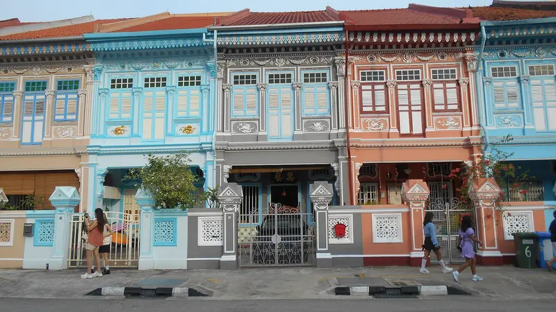
Katong and Joo Chiat form Singapore's eastern Peranakan district, a residential area of vibrantly decorated shophouses, old coffee houses, and small family businesses. You come here to see the shophouses along Koon Seng Road and eat Peranakan cuisine like Katong Laksa and Nyonya rice dumplings right where it originated.Until the 19th century, this area housed coconut and cotton plantations. Entrepreneur Chew Joo Chiat, dubbed the 'King of Katong,' acquired vast tracts of land, gifted the city the street now bearing his name in 1917, and sold plots to developers. In the early 20th century, wealthy Peranakan families settled, constructing the district's characteristic houses. In 2011, Joo Chiat was designated Singapore's first 'Heritage Town'. Since 2024, you can easily reach the district via the Thomson-East Coast Line.
Peranakan shophouses on Koon Seng Road and laksa on East Coast Road.
4 Sights
4 Restaurants
Peranakan Heritage Amidst Laksa and Temples
Straits Chinese HousesThe Peranakan, descendants of Chinese immigrants who absorbed Malay influences in language, dress, and cuisine, shaped Katong from the early 20th century. Their terraced houses blend Chinese, Malay, and European elements; the URA calls the houses on Koon Seng Road some of the finest examples of the Straits Eclectic style in the district. Peranakan families lived there until the 1970s. Parts of the area have been under conservation since July 1993.Laksa, Kueh, and KopitiamKatong Laksa, a spicy coconut milk noodle soup with dried prawns, cockles, and fishcake, is served with short-cut noodles and eaten only with a spoon. In the 1940s, brothers Ng Juat Swee and Ng Chwee Seng sold it on the streets, making it famous; today, several laksa eateries are located side by side along East Coast Road. Traditional establishments like Kim Choo Kueh Chang (since 1945) and Chin Mee Chin (around 100 years old) showcase their history in small exhibitions that are part of the heritage authority's Street Corner Heritage Galleries program.Diverse CommunitiesThe district isn't solely Peranakan: the Sri Senpaga Vinayagar Temple traces its origins to Ceylonese Tamils, and at the northern end of Joo Chiat lies Geylang Serai, the heart of the Malay community in the east of the city.
Stop 6 • 0 Nights
Pulau Ubin
routes.tagDescriptions.insel. routes.tagDescriptions.kampong and routes.tagDescriptions.radfahren.
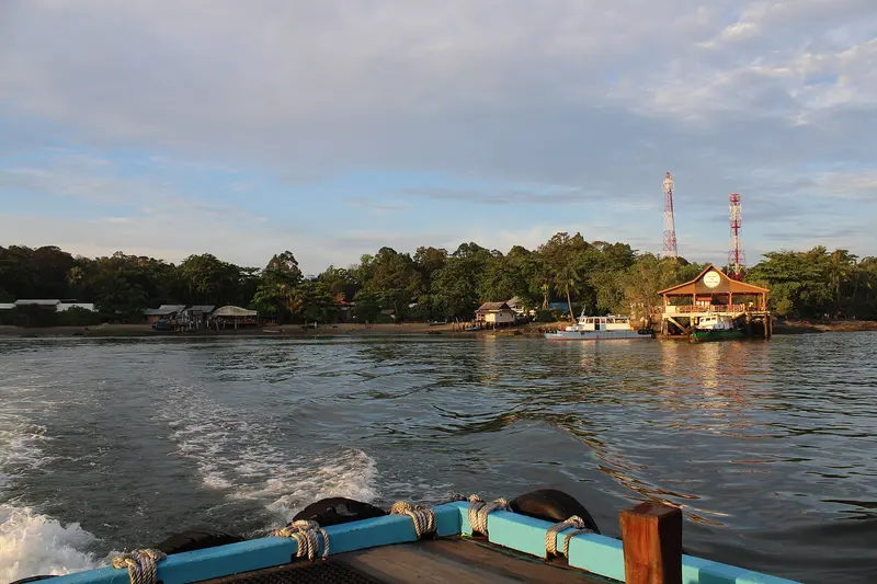
Pulau Ubin is an island of just over ten square kilometers off Singapore's northeast coast, and one of the country's last kampongs, or traditional villages. You come to cycle a rented bike through forests and past flooded quarries to the mangroves and mudflats of Chek Jawa. Its Malay name means 'Granite Island': From the 19th century onwards, its quarries supplied granite for projects including the Johor Causeway and Horsburgh Lighthouse. In the 1970s, several thousand people still lived here; most moved away after the quarries closed.You can rent bikes in the village at the jetty. From there, paths lead to Chek Jawa in the east and to the mountain bike park at Ketam Quarry. The crossing by bumboat from Changi Point Ferry Terminal takes about ten minutes.
Bumboat from Changi Point Ferry Terminal (4 Singapore dollars), hire a bike and ride to the Chek Jawa wetlands with their boardwalk and the 21-metre Jejawi Tower. A section of the Coastal Loop is closed until the end of April 2027 (expected). Bring water.
4 Sights
3 Restaurants
Granite, Kampong and Mudflats
Quarrymen and FishermenChinese settlers operated private quarries from about 1847 onwards; later, the colonial administration extensively mined granite for structures like the Pedra Branca lighthouse, Fort Canning, and the harbor. The workers were predominantly Hakka, later also Hokkien and Teochew; from the 1880s, Malay fishermen joined them. Today, only a few dozen people live permanently on the island. In the Ketam area stands the German Girl Shrine, a small shrine that, according to tradition, commemorates a young German woman who died in 1914.The Rescue of Chek JawaThe approximately 100-hectare wetland at the eastern tip was slated for reclamation from 1992. After its biodiversity became known in late 2000, the government halted the land reclamation in 2001. Since 2007, a visitor center, a boardwalk, and an observation tower have made the area accessible. Six habitats converge here, from sandy beaches and seagrass meadows to mangroves.
Stop 7 • 0 Nights
Sentosa
routes.tagDescriptions.insel. routes.tagDescriptions.strände and routes.tagDescriptions.freizeitparks.
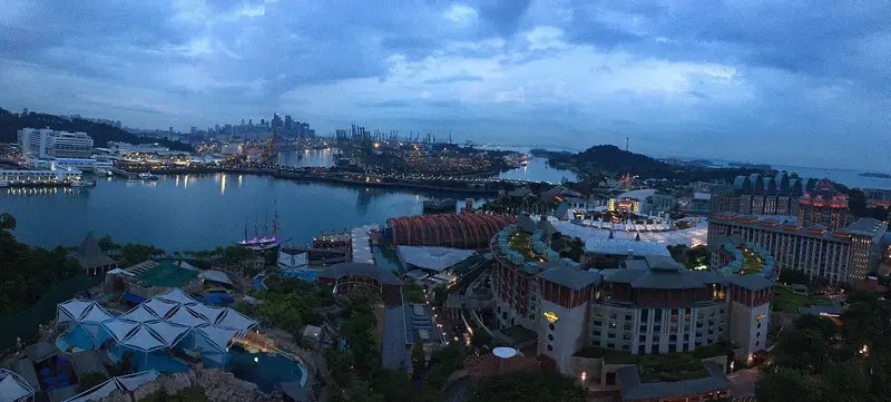
Sentosa is Singapore's leisure island, nearly five square kilometers in size and located about half a kilometer off the south coast. You come for the beaches in the south, the attractions of Resorts World Sentosa, or the military history of Fort Siloso. Until the early 1970s, it was called Pulau Blakang Mati and served the British as a fortress protecting the harbor entrance; during World War II, the Japanese used Fort Siloso as a prisoner-of-war camp. The new name comes from the Sanskrit word Santosha and means peace and tranquility.In the north lies Resorts World Sentosa with Universal Studios and the Singapore Oceanarium, which opened in 2025; in the south are Siloso, Palawan, and Tanjong beaches. In between, the Sensoryscape walkway connects both sides. You can reach the island on foot via the Sentosa Boardwalk, by monorail on the Sentosa Express from VivoCity, or by cable car from Mount Faber.
Walk onto the island via the Sentosa Boardwalk, Siloso and Palawan beaches, and with children the Singapore Oceanarium, which opened in 2025.
5 Sights
3 Restaurants
Fortress Island and Leisure Hub
Military HistoryIn the 19th century, the British built several coastal forts on the island to secure the entrance to New Harbour, today's Keppel Harbour. Fort Siloso was built in the 1870s and, at the beginning of World War II, was one of the twelve batteries of "Fortress Singapore". After the Japanese occupation in 1942, it served as a camp for Australian and British prisoners of war. In 1967, the British handed over the island to the armed forces of independent Singapore, after which its development into a tourist destination began.Resorts World and New AttractionsResorts World Sentosa opened in 2010, and in March of the same year, Universal Studios Singapore, the first Universal park in Southeast Asia, also opened. In 2025, Minion Land and the Singapore Oceanarium, successor to the S.E.A. Aquarium, were added. The Sentosa Sensoryscape walking trail is the first component of the Sentosa-Brani Master Plan.
Stop 8 • 0 Nights
Kampong Glam
routes.tagDescriptions.malaiisches viertel. routes.tagDescriptions.moschee and routes.tagDescriptions.street art.
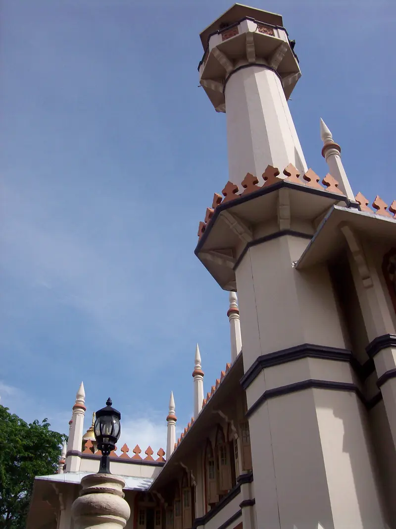
Kampong Glam is Singapore's historic Malay-Muslim quarter, located north of the Singapore River. You come here for the Sultan Mosque, the fabric shops on Arab Street, the murals in Haji Lane, and the murtabak eateries along North Bridge Road. Following the 1819 treaty between the East India Company, Sultan Hussein Shah of Johor, and Temenggong Abdul Rahman, the Sultan settled here with his entourage. The 1822 town plan allocated the area to the Sultan's court and to Malay, Arab, and Bugis traders; street names like Arab Street, Bussorah Street, and Muscat Street serve as a reminder of this.The golden domes of the Sultan Mosque are the focal point, surrounded by restored shophouses housing cafés and boutiques. The Malay Heritage Centre in the former Sultan's palace reopened in April 2026. Kampong Glam is a few minutes' walk from Bugis MRT station.
Last evening at the Sultan Mosque and in the lanes around Haji Lane.
5 Sights
3 Restaurants
Sultan's Court, Traders & Pilgrims
From Sultan's Palace to MuseumSultan Ali Iskandar Shah, son of Sultan Hussein, commissioned the construction of the Istana Kampong Gelam palace; its building history is currently being re-examined, as evidence emerged in 2026 suggesting completion around 1890. After an inheritance dispute in 1896, the estate became state property. Since 2005, it has housed the Malay Heritage Centre, which, following a redesign from October 2022 to April 2026, now presents six new permanent exhibitions under the title "Dari Rantau Ke Rumah". In the adjacent Gedung Kuning, the "Yellow House", Malay cuisine is served today.Fabrics, Pilgrims, and MurtabakIn the 1970s and 1980s, Arab Street was the hub of textile trade; shops like Osman Silk House (established 1935) still sell silk and batik today. Haji Lane is named after the Mecca pilgrims who once found accommodation here. Indian-Muslim family businesses like Zam Zam (1908) and Victory (1910) have shaped the culinary scene on North Bridge Road for over a hundred years. For mosque visits: shoulders and knees must be covered, and women must also cover their hair; cloaks are available at the entrance.
8 stops
Route Summary
Duration6 Days
Stops8 Places
TypeMixed
Best Time to GoFebruary to April and June to August; Pulau Ubin and Mandai are best early in the day