Ten days through southern and southeastern Poland: from Krakow to Zakopane in the Tatra Mountains, to the Dunajec Gorge in the Pieniny Mountains, and on to the Bieszczady Mountains, a part of the Eastern Carpathians in the far southeast, bordering Slovakia and Ukraine. On the way back north, the route includes Łańcut Castle, the Renaissance town of Zamość, the artists' town of Kazimierz Dolny, and Lublin. This is a car route, as the Pieniny and Bieszczady Mountains are off the main railway lines. The drive from the Pieniny to the Bieszczady Mountains is the longest leg, at approximately 250 kilometers.
10 Days / 9 Nights
June to September; rafting on the Dunajec from April 1 to October 31; reserve parking for Morskie Oko in advance with the Tatra National Park
9 stops
Why This Route?
The south showcases Poland's mountainous side: high mountains in the Tatra, limestone cliffs in the Pieniny, and vast mountain meadows in the Bieszczady. The return journey through the Carpathian Foothills and the Lublin region adds noble residences, ideal towns, and the Vistula Valley, thus uniting nature and culture in one trip.
Hidden Gems
Sokolica in the Pieniny: Rocky peak above the Dunajec Gorge, accessible from Szczawnica via the blue hiking trail with a ferry crossing over the Dunajec in just over an hour
Wooden churches of Smolnik and Turzańsk in the Bieszczady: wooden Tserkvas, which are part of the UNESCO World Heritage
Loess gorge Korzeniowy Dół near Kazimierz Dolny: one of the many sunken roads in the landscape protection park around the town
Getting there and back
Open jaw: start and end are in different places
Arrival
Flight · Krakau-Balice (KRK)From Krakow-Balice Airport, the SKA1 regional train goes to Kraków Główny Main Station. Only pick up your rental car when leaving Krakow; explore the Old Town and Kazimierz on foot and by tram.
Departure
Train · Lublin GłównyReturn the rental car in Lublin and clarify the one-way fee with the rental company beforehand. From Lublin Główny main station, trains travel to Warsaw in less than two hours; Lublin Airport in Świdnik is accessible by train in about 15 minutes from Lublin Główny.
Itinerary
Stop 1 • 1 Night
Krakow (Kraków)
City
Route highlight
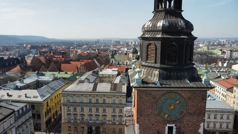
Krakow (Kraków) lies on the Vistula in southern Poland and, with around 800,000 inhabitants, is the country's second-largest city. Until 1596, it was the capital of the Kingdom of Poland; on Wawel Hill, kings were crowned until 1734 and most of them were interred. Since 1978, its historic center—the Old Town, Wawel, Stradom, and Kazimierz—has been a UNESCO World Heritage site.The Old Town (Stare Miasto) surrounds the Rynek Główny, whose layout dates back to 1257. A green belt, the Planty, occupies the site of the former city fortifications; the historic Royal Route begins at St. Florian's Gate and led coronation processions up to Wawel. South of it lies Kazimierz, founded as a separate city in 1335 and for centuries a center of Jewish life. Today, synagogues, cafés, and bars mingle there.Beyond the Vistula lies Podgórze, where German occupiers established the ghetto in 1941; in the Zabłocie district stands Oskar Schindler's former enamel factory. To the east, Nowa Huta is an industrial city of the socialist era, incorporated in 1951.
A day for Old Town, Wawel and Kazimierz. New to Krakow? Better add a second night.
6 Sights
4 Restaurants
Culture and History
Royal City and UniversityKrakow was residence of Polish kings until 1596, when Sigismund III moved the court to Warsaw. Wawel Cathedral remained the coronation and burial church. In 1364, Casimir the Great founded the Krakow Academy (today's Jagiellonian University), Central Europe's second oldest university after Prague. From St. Mary's Church's taller tower, the Hejnał, a trumpet melody stopping mid-note, is played hourly, recalling a legendary 1241 Mongol attack.Jewish KrakowKazimierz hosts central Jewish historical buildings: the Old Synagogue, Remuh Synagogue (with cemetery), Tempel Synagogue, and Isaac Synagogue. The Old Synagogue is now a museum. Since 1988, the Jewish Culture Festival is held annually, from late June to early July. In Podgórze, the ghetto sites and Schindler's Factory recall the persecution and murder of Krakow's Jews under German occupation.
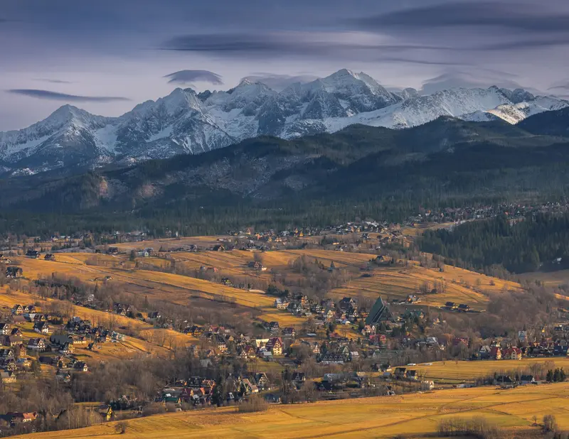
Zakopane is located at the foot of the High Tatras, at an altitude of around 840 meters, and has a population of over 25,000. The town is considered Poland's winter capital; the railway line from Chabówka, via which you arrive today from Krakow (Kraków), was built starting in 1899; in summer, it is a starting point for hikes in the Tatra National Park, and in winter for skiers and the World Cup ski jumping at Wielka Krokiew.The pedestrian zone Krupówki, with its shops and eateries, forms the town center. From ul. Na Gubałówkę, a funicular railway leads up to the scenic ridge Gubałówka. To the south lies Kuźnice, the valley station for the cable car to Kasprowy Wierch and the starting point for many hiking trails.
About 100 kilometers from Krakow. Its center is the Krupówki pedestrian zone, a cable car to Kasprowy Wierch departs from Kuźnice; tickets for it should preferably be bought online in advance.
5 Sights
4 Restaurants
Culture of the Gorals
The Zakopane StyleAround 1890, the painter and architect Stanisław Witkiewicz developed his own architectural style, combining the traditional building methods of the Goral people from Podhale with elements of Art Nouveau. The first building in this style was Villa Koliba (1892 to 1893), which today serves as the Museum of the Zakopane Style, part of the Tatra Museum. The Tatra Museum itself was founded in 1889.MusicThe composer Karol Szymanowski lived in Zakopane from 1930 to 1936; his Villa Atma now houses a museum dedicated to him. In some Karczmas, bands play Goral folk music in the evenings.
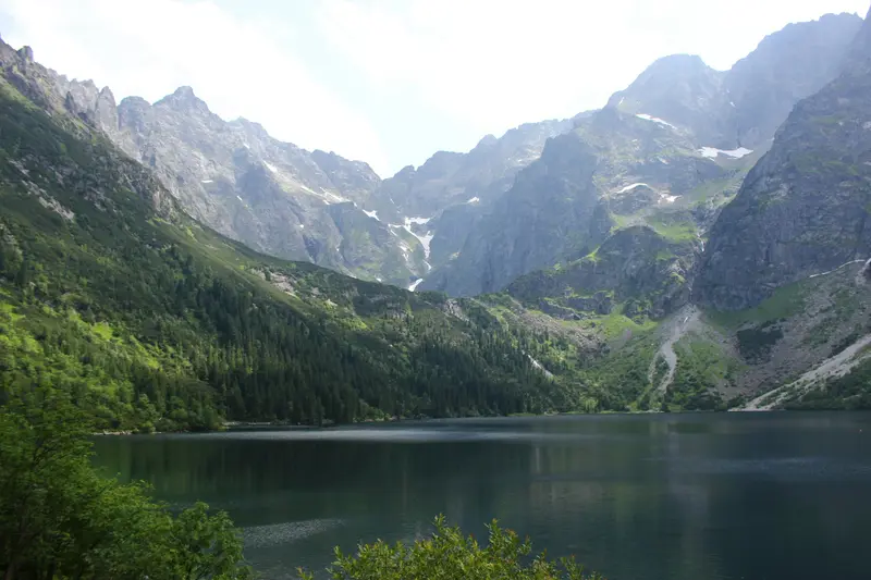
The Tatra National Park (Tatrzański Park Narodowy, TPN) has protected the Polish part of the Tatra Mountains since 1955, covering over 211 square kilometers. Together with the Slovak National Park, it has formed a cross-border UNESCO Biosphere Reserve since 1993. Here, Rysy (2,499 meters on the Polish side) is Poland's highest peak; chamois, marmots, brown bears, and lynxes live in the forests and cirques.The most famous destination is Morskie Oko, a glacial lake at an altitude of 1,395 meters in the Rybi Potok Valley at the foot of the Mięguszowieckie Szczyty. Covering almost 35 hectares, it is the second-largest lake in the Tatra after Wielki Staw and up to approximately 51 meters deep. From the Palenica Białczańska car park, an approximately 8.5-kilometer-long asphalt road leads up, which is closed to private cars.
Day trip from Zakopane. Reserve parking at Palenica Białczańska online with the National Park at least one day in advance; without a car, buses depart from Zakopane. The approximately 8 to 9-kilometer road to the lake is closed to private vehicles.
3 Sights
Nature and History
Protected for Over a CenturyChamois and marmots have been protected in the Tatra since 1868, when the Galician Parliament passed a law against their capture. In 1939, a nature park was created within the state forests, eventually becoming the national park on January 1, 1955. Morskie Oko has been owned by the Polish state since 1933.Around Morskie OkoOn the shore, at 1410 meters, stands the PTTK mountain hut, built in 1908 and one of the oldest huts in the Tatra. It serves as a starting point for tours to Rysy and the surrounding passes. Morskie Oko is one of the few Tatra lakes with a natural trout population; since 2021, beavers have also been observed here.
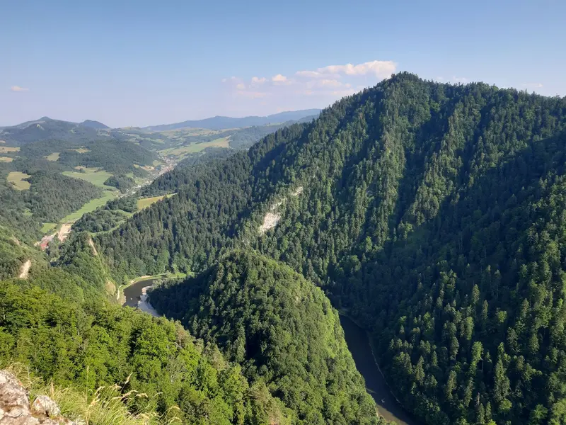
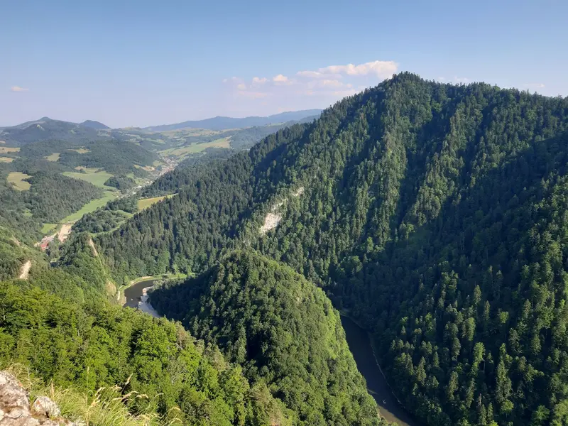
The Pieniny Mountains are a small limestone range on the border with Slovakia, east of the Tatra Mountains. The Polish Pieniny National Park was established in 1932 as Poland's first national park and covers just over 23 square kilometres. The highest peak of the central massif is Trzy Korony (Three Crowns) at 982 metres, from whose viewing platform on Okrąglica you look deep into the valley.The Pieniny Mountains are primarily known for the Dunajec Gorge: The river has carved its way in loops between steep limestone cliffs. On wooden rafts, the region's rafters take visitors from Sromowce through the gorge to Szczawnica or Krościenko. West of this, the castles of Niedzica and Czorsztyn face each other across the Czorsztyn Reservoir.
Around 60 kilometers from Zakopane. The raft trip from Sromowce to Szczawnica is about 18 km long and takes around 2:15 hours; it's best to clarify how to get back to the starting point beforehand.
3 Sights
2 Restaurants
Nature and History
Castles on the DunajecThe Niedzica and Czorsztyn castles emerged on both sides of the ancient routes along the Dunajec. Gothic Niedzica Castle, built in the 14th century, now stands about 35 meters above the water level of the Czorsztyn Reservoir, created by a dam on the Dunajec. A legend of Inca treasure surrounds the castle.Rafters and Mountain TrailsRafting on the Dunajec has a tradition in the Pieniny; today, rafters operate their boats from their own landing stages. Hiking trails lead from Krościenko, Szczawnica, and Sromowce Niżne to Trzy Korony; the blue trail from Szczawnica leads over Sokolica.
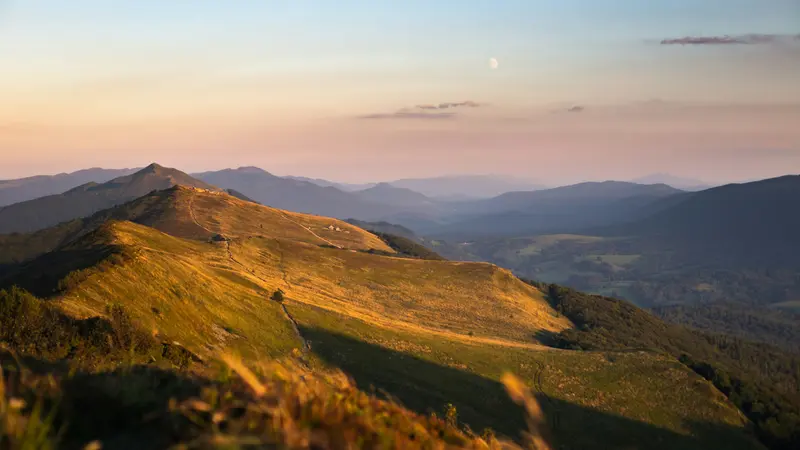
The Bieszczady Mountains, in the far southeast of Poland, bordering Slovakia and Ukraine, are part of the Eastern Carpathians. Its heart is the Bieszczady National Park (Bieszczadzki Park Narodowy), founded in 1973, and at over 292 square kilometers, it's the largest national park in the Polish mountains. Since 1992, it has been part of the transnational East Carpathian Biosphere Reserve, and since 2021, parts of its beech forests have been on the UNESCO World Heritage List.Characteristic features are the Połoniny, treeless mountain meadows above the tree line, such as Połonina Caryńska and Połonina Wetlińska, as well as the peaks Tarnica (1346 meters), Krzemień, and Halicz. Bears, wolves, lynx, and a free-ranging herd of European bison live in the forests. To the north lies the Solina Reservoir, Poland's largest capacity reservoir; in the region's villages stand wooden Cerkwie, including the UNESCO World Heritage churches of Smolnik and Turzańsk.
Long driving leg, allow half a day. Trails in the National Park require a ticket; popular entry points are Wołosate for Tarnica and Ustrzyki Górne for Połonina Caryńska.
3 Sights
1 Restaurant
Nature and History
Wilderness in the SoutheastThe Bieszczady National Park is home to over 230 vertebrate species. European bison were reintroduced in the 1960s; today, around 280 of these animals live throughout the Bieszczady, considered the largest free-ranging mountain herd of its kind. In Wołosate and Tarnawa Niżna, the park breeds Hucul ponies, which are used for grazing the meadows.Wooden Churches and DamSince 2013, the wooden Tserkvas of the Carpathian region in Poland and Ukraine have been UNESCO World Heritage sites. In the Bieszczady, these include the St. Michael's Churches in Smolnik and Turzańsk. The Solina Dam, built between 1960 and 1968, is Poland's highest dam, at nearly 82 meters high and approximately 664 meters long; the lake behind it covers approximately 22 square kilometers.
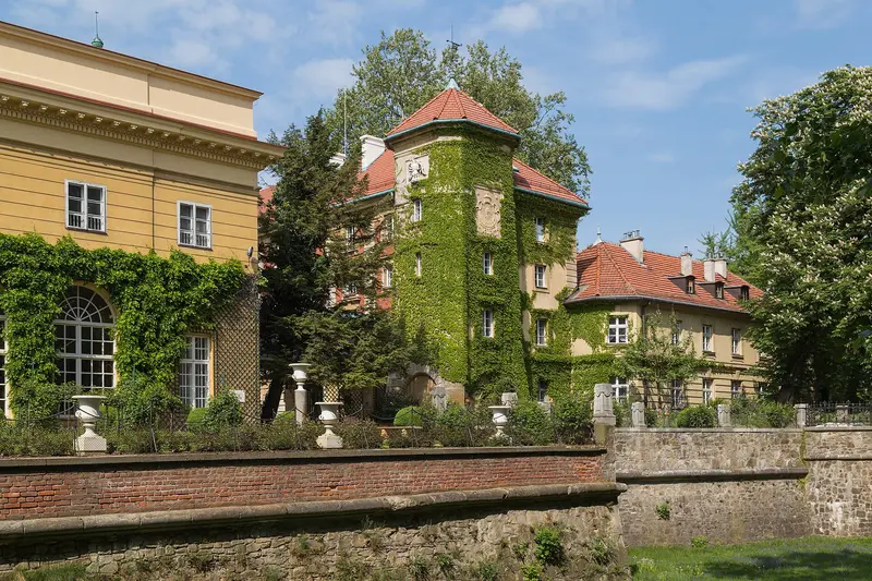
Łańcut Castle (Zamek w Łańcucie), located in the Carpathian Foothills near Rzeszów, is a former magnate residence of the Lubomirski and Potocki families. Stanisław Lubomirski, Voivode of Kraków, had the complex expanded between 1629 and 1641 following plans by Maciej Trapola; after 1783, Izabela Lubomirska converted parts of the fortifications into gardens. From 1816, it belonged to the Potocki family, residing there until 1944. Since September 1944, the castle has served as a museum, and since 2005, the complex and its park have held the status of a Polish historical monument.In addition to the castle rooms, the museum houses the Coach House with a collection of carriages and accessories; the Orchid House in the park; a department for icons and sacred art; and a Judaica collection connected with the Synagogue of Łańcut founded by the Lubomirskis. The approx. 36-hectare landscape park, with an Italian Garden, Rose Garden, and moat, surrounds the castle.
About 180 kilometers from the mountains to the Carpathian Foothills. Castle, Coach House, and Park; tickets for individual areas online or at the ticket office, check opening hours in advance on zamek-lancut.pl.
3 Sights
1 Restaurant
History and Culture
From a Tower to a Magnate's ResidenceIt started as a tower, presumably built by the Pilecki family in the second half of the 16th century and expanded around 1610 by the Stadnickis. Under Stanisław Lubomirski, the residence with bastions and a moat was built between 1629 and 1641, following plans by Maciej Trapola. In 1816, the property passed to Alfred and Artur Potocki, becoming a majorate in 1830. The park received its current form primarily in the late 19th and early 20th centuries.Music at the PalaceSince 1960, a music festival has taken place every May, originally known as the Chamber Music Days, and since 1981 as the Festiwal Muzyki in Łańcut. It is considered one of Poland's major classical music festivals.
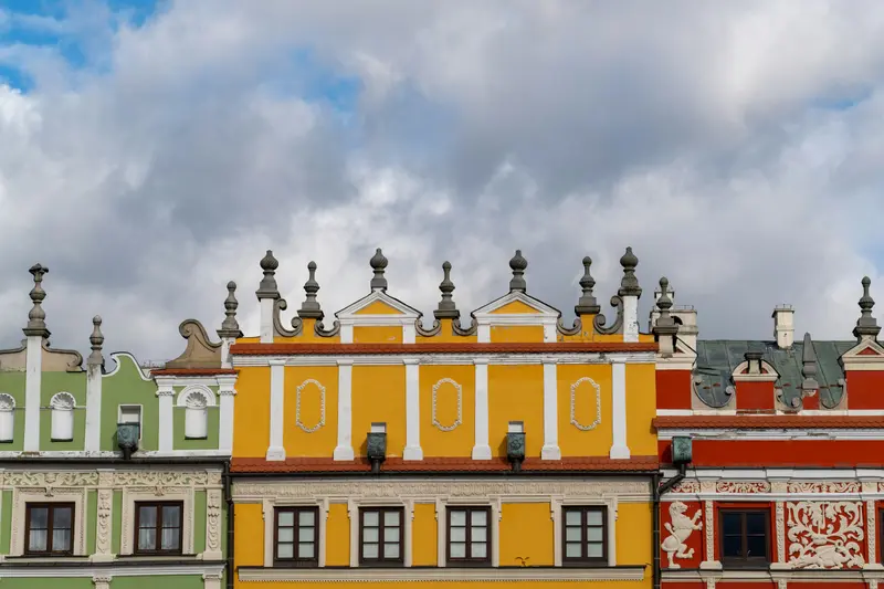
Zamość is located in southeastern Poland, approximately 240 km from Warsaw and 110 km from Lemberg (Lwiw), and has about 58,000 inhabitants. From 1578, Jan Zamoyski had the city designed by the Venetian architect Bernardo Morando as an ideal Renaissance town, which earned it the nickname "Padua of the North." Since 1992, the Old Town has been a UNESCO World Heritage site.The Old Town has a hexagonal layout: in the west were the Zamoyski family residence and the Academy, and in the east, the burgher town with three squares: the Great Market (Rynek Wielki), the Salt Market, and the Water Market. On the Great Market, with its arcaded houses, stands the Town Hall with its 52-meter-high clock tower. Remains of the fortress are preserved around the Old Town.You can see the main sights in one day. Zamość also serves as an excellent base for excursions into the Roztocze National Park.
Approx. 130 km from Łańcut. The Renaissance ideal city, with its Great Market Square and Town Hall, is a UNESCO World Heritage site; park outside the Old Town walls.
3 Sights
3 Restaurants
The Story and Culture
An Ideal Renaissance CityJan Zamoyski planned Zamość according to Italian theories of the ideal city, with Bernardo Morando implementing the plan from 1578. UNESCO calls the Old Town an outstanding example of a planned late 16th-century Renaissance city. In the Main Market Square stand the Armenian Houses with arcades and ornate attics. One of them now houses the Zamość Museum, displaying its collection. From the Town Hall tower, the Hejnał sounds daily at 12 PM during the season.Jewish Heritage and WarThe Old Town features a Renaissance synagogue from 1610-1620 and a Mikveh. From 1772 to 1809, Zamość was under Austrian rule; it then belonged to the Duchy of Warsaw and, for about a century, to Russia. During World War II, the city was part of the German General Government, and most of its Jewish population was murdered. The Rotunda served as a transit camp and execution site at that time and is now a memorial.
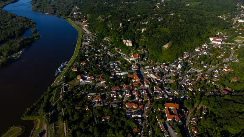
Kazimierz Dolny is located on the east bank of the Vistula River, approximately 50 km west of Lublin, and has around 2,500 inhabitants. First mentioned in 1249, the town was a port for grain trade on the Vistula. After being burned by Swedish troops in 1656 and the end of the grain trade, it lost its significance. From the late 19th century onwards, painters, writers, and summer visitors brought new life to the town.The market square, with its Renaissance burgher houses of the Przybyła family, is the center. Not far away, the Celej House holds a section of the Vistula Museum. Other sights include the parish church, the castle ruins, and the Three Crosses Hill (Drei-Kreuze-Berg) offering views of the Vistula Valley. Around the town, loess gorges wind through the Kazimierz Landscape Park, accompanied by old granaries.The town and its surroundings have been protected as a Polish Historical Monument since 1994. On summer weekends it is busy; during the week and in the off-season, it is quieter.
Stop on the way to Lublin, approx. 150 km from Zamość. Market square with Renaissance houses, Three Crosses Hill and loess ravines; it gets crowded on summer weekends.
4 Sights
3 Restaurants
History and Culture
Grain Port and Artists' TownKazimierz owed its prosperity to the grain trade on the Vistula River. The houses on the market square and the parish church, built between 1586 and 1589, are constructed from local limestone. From the late 19th century, artists flocked here, including the painter Tadeusz Pruszkowski and the writer Maria Kuncewiczowa. The Yiddish film Der Dybbuk was filmed here in 1937.Jewish Heritage and FestivalsFor many years, Kazimierz was home to a large Jewish community. In 1940, the German occupiers established a ghetto, which was dissolved in 1942. Today, the town is known for its festivals: the Folk Music Bands and Folk Singers Festival since 1966, the Dwa Brzegi Film Festival, and the Pardes Jewish Culture Festival.
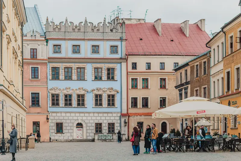
Lublin is located approximately 170 km southeast of Warsaw and, with around 327,000 inhabitants, is Poland's eighth-largest city. Five universities make it a young student city. In 1317, Lublin received Magdeburg rights and became a trading post on the Via Regia; in 1569, the Union of Lublin between Poland and Lithuania was concluded here.The Old Town lies on the edge of the Bystrzyca Valley and is surrounded by remnants of the city walls, including the Krakow Gate and Grodzka Gate. On the Market Square stands the former Town Hall, the Crown Tribunal, ringed by Renaissance burgher houses, the Cathedral, and the Dominican Basilica. The Grodzka Gate formerly marked the boundary to the Jewish Quarter; behind it rises the Castle with the Holy Trinity Chapel. West of the Old Town, the New Town and the Saxon Garden connect.On the outskirts, the Majdanek Memorial commemorates the German concentration and extermination camp. Two days should be planned for Lublin, easily combinable with Kazimierz Dolny and Zamość.
About 60 km from Kazimierz Dolny. Old Town with Krakow Gate and Crown Tribunal, castle with Trinity Chapel, and the Majdanek Memorial on the city's outskirts.
5 Sights
3 Restaurants
History and Culture
Union, Trade, and Jewish LifeLublin was first mentioned in 1198. The Union of Lublin in 1569 established the Polish-Lithuanian Commonwealth here. For centuries, Lublin was home to a large Jewish community. The Grodzka Gate, also known as the Jewish Gate, separated the Christian city within the walls from the Jewish quarter. Today, the Grodzka Gate – Teatr NN Centre, with its exhibition 'Lublin. Memory of the Place,' documents the life of the pre-war city and its inhabitants.Occupation and Post-War PeriodDuring World War II, the German occupiers established a ghetto and murdered the Jewish population; on its outskirts lay the Majdanek concentration and extermination camp. In the castle, which served as a prison from 1831 to 1954, SS members shot some 300 prisoners on July 22, 1944, before withdrawing. After the war, the Old Town was rebuilt. In 1980, strikes in the Lublin region spurred the later Solidarność movement.
Best Time to GoJune to September; rafting on the Dunajec from April 1 to October 31; reserve parking for Morskie Oko in advance with the Tatra National Park