Fernweh: Home
ExploreGuideDestinationsMy tripsMy trip
de|en
  • Why go
  • Highlights
  • Regions
  • Round trips
  • Local food
  • Good to know
  • Best time to visit
  • Travel advice
Namibia

Photo by Hub JACQU on Pexels

Travel Guide Namibia

Namibia, in southwest Africa, blends Namib dunes, Etosha National Park's wildlife, and colonial-era coastal towns.

by Felix Gillen

Why Go To Namibia?

Namibia is a land of vast spaces: In the Namib Sand Sea, a UNESCO World Heritage site since 2013, red dunes glow above white salt pans, and in Etosha National Park, elephants, rhinos, and lions gravitate towards waterholes. Between these lie the rock engravings of Twyfelfontein, the Fish River Canyon, and coastal towns like Swakopmund and Lüderitz, featuring colonial-era architecture. Well-maintained gravel roads, camps within the parks, and a stable environment make the country one of Africa's classic self-drive destinations.

Contents

  • Highlights
  • Regions
  • Round trips
  • Local food
  • Good to know
  • Best time to visit
  • Travel advice

Where in Namibia?

Pick an area. The highlights, road trips and places below follow your choice.

Highlights in Namibia

What you should have seen
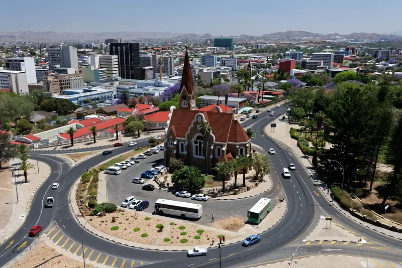
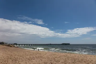
Windhoek

Photo by Gu Bra on Pexels

Highlight 1 of 4

Windhoek

Windhoek is the capital of Namibia and lies at about 1,650 m in the central highlands. Christ Church and Tintenpalast recall the German colonial era; the Independence Memorial Museum recounts Namibia's journey to independence.

Discover
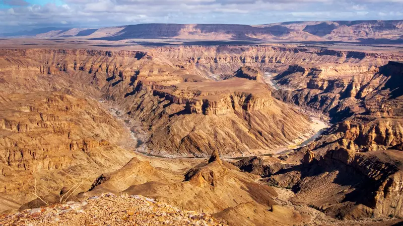
Fish River Canyon and Ai-Ais

Photo by Reto Wiezel on Pexels

Highlight 2 of 4

Fish River Canyon and Ai-Ais

The Fish River Canyon in the south is considered the second largest canyon in the world by the Ministry of Environment.

Discover
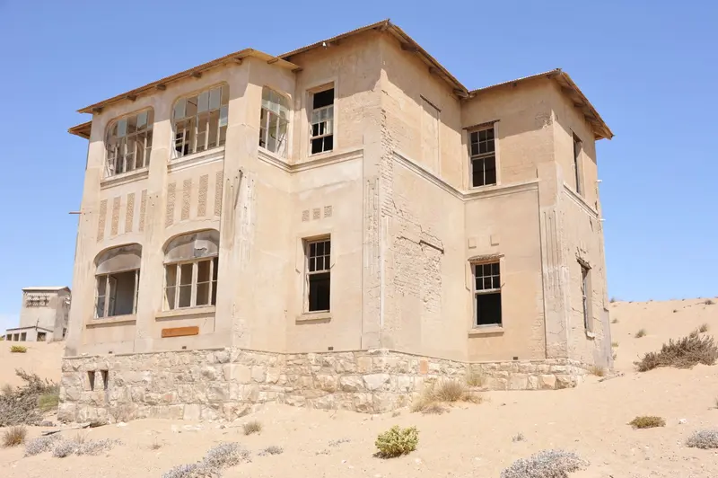
Lüderitz and Kolmanskop

Photo by Elina Emeleeva on Pexels

Highlight 3 of 4

Lüderitz and Kolmanskop

Lüderitz lies on a rocky bay of the southern Atlantic coast. Felsenkirche and Goerke-Haus recall the colonial era, while Spectacled Penguins breed on Halifax Island off the coast.

Discover
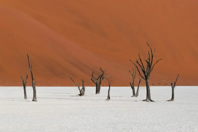
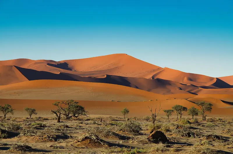
Sossusvlei and Namib-Naukluft Park

Photo by Felipe Labate on Unsplash

Highlight 4 of 4

Sossusvlei and Namib-Naukluft Park

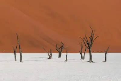
The red dunes around the salt and clay pans of Sossusvlei and Deadvlei are Namibia's most famous motif.

Discover

More highlights in Namibia

Swakopmund

Swakopmund

Founded in 1892, Swakopmund on the Atlantic coast is Namibia's most German-influenced town, featuring a lighthouse, Woermannhaus, and old railway station. It lies approximately 350 km west of Windhoek, where the Namib Desert meets the sea, and serves as the main hub for dune activities. The cold Benguela Current brings cool temperatures and frequent morning fog.

Jörg Hamel·Pexels

Skeleton Coast

Skeleton Coast

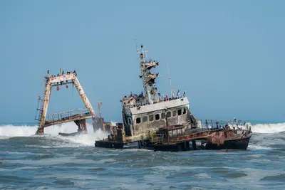
The Skeleton Coast in the northwest is a desert strip between the Atlantic and dunes, known for fog, shipwrecks, and solitude. The Skeleton Coast Park (16,390 km²) covers about 500 km from Ugab to Kunene and requires a booking or permit for entry. South of this is Cape Cross, home to the largest Cape fur seal breeding colony and replicas of the stone cross Diogo Cão erected here in 1486.

Nicola Toscan·Pexels

Damaraland and Twyfelfontein

Damaraland and Twyfelfontein

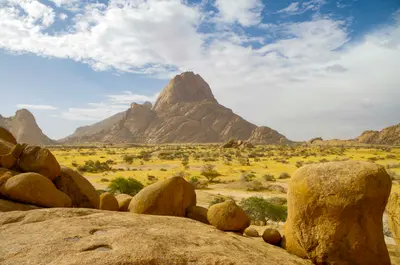
Damaraland zwischen Swakopmund und Etosha ist eine Landschaft aus Tafelbergen, Felskuppen und trockenen Flussbetten, in denen Wüstenelefanten leben. Hier liegen die Felsgravuren von Twyfelfontein, seit 2007 UNESCO-Welterbe, der Brandberg mit dem höchsten Gipfel Namibias und die markante Spitzkoppe. Viele Unterkünfte liegen in kommunalen Hegegebieten (Conservancies).

m_oros·Unsplash

Etosha National Park

Etosha National Park

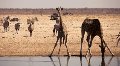
Etosha National Park in the north is Namibia's premier safari destination: Around the approximately 4,800 km² Etosha Salt Pan, the Ministry of Environment reports 114 mammal and over 400 bird species, including elephants, black rhinos, and lions. The Ministry states its area as 22,935 km², the area has been protected since 1907. The camps Okaukuejo, Halali, and Namutoni have floodlit waterholes.

Bernd Dittrich·Unsplash

Zambezi Region (Caprivi)

Zambezi Region (Caprivi)

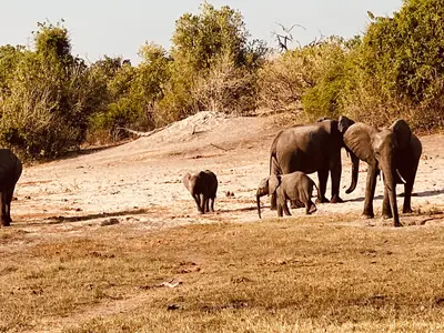
The narrow strip of land in the northeast, formerly known as the Caprivi Strip, is the opposite of the desert: Okavango, Kwando, and Zambezi shape riverine landscapes and wetlands here. The Bwabwata, Mudumu, and Nkasa Rupara National Parks, Namibia's largest protected wetland, are located on the way to the border crossings to Botswana and Zambia. The main town is Katima Mulilo, about 1,200 km from Windhoek.

Ilka Nghinamupika·CC BY-SA 4.0

Waterberg Plateau Park

Waterberg Plateau Park

The Waterberg Plateau is a sandstone massif about 50 km long, rising steeply from the plains north of Windhoek. Established in 1972, the 405 km² park offers overnight stays at Bernabé de la Bat rest camp, located at the cliff foot. The plateau is conveniently located as a stopover on the way from Windhoek to Etosha.

JMK·CC BY-SA 4.0

How to plan your trip to Namibia

From the guide to the road: here is what comes next.

  1. 1
    Sunrise over alpine peaks and a sea of clouds
    1234

    Round trip

    12 days · 4 stops

    Saved

    Pick a route

    Pick a ready-made one or save places and plan your own.

    Browse routes
  2. 2

    Trip to Namibia

    Live
    • 1Windhoek3 days
    • 2Fish River Canyon and Ai-Ais4 days
    • 3Lüderitz and Kolmanskop5 days
    Budget

    Plan your trip

    The planner sorts stops, days and budget. Plan together in real time.

    Go to My Trips
  3. 3
    9:41 No signal
    Namibia
    Available offline

    Photo by Hub JACQU on Pexels

    Use it on the road

    Download the guide to your phone and use it on site, even offline.

Regions to Discover

Explore the diverse regions of Namibia.
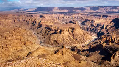
Fish River Canyon and Ai-Ais

Fish River Canyon and Ai-Ais

The Fish River Canyon in the south is considered the second largest canyon in the world by the Ministry of Environment. From the main viewpoint near Hobas, you look down on the Hell's Bend river loop deep below, and at the southern end are the hot springs of Ai-Ais. The canyon belongs to the transboundary Ai-Ais/Richtersveld Park; from May to mid-September, the multi-day canyon hike is possible with a permit.

Reto Wiezel·Pexels

Damaraland and Twyfelfontein

Damaraland and Twyfelfontein

Damaraland zwischen Swakopmund und Etosha ist eine Landschaft aus Tafelbergen, Felskuppen und trockenen Flussbetten, in denen Wüstenelefanten leben. Hier liegen die Felsgravuren von Twyfelfontein, seit 2007 UNESCO-Welterbe, der Brandberg mit dem höchsten Gipfel Namibias und die markante Spitzkoppe. Viele Unterkünfte liegen in kommunalen Hegegebieten (Conservancies).

m_oros·Unsplash

Etosha National Park

Etosha National Park

Etosha National Park in the north is Namibia's premier safari destination: Around the approximately 4,800 km² Etosha Salt Pan, the Ministry of Environment reports 114 mammal and over 400 bird species, including elephants, black rhinos, and lions. The Ministry states its area as 22,935 km², the area has been protected since 1907. The camps Okaukuejo, Halali, and Namutoni have floodlit waterholes.

Bernd Dittrich·Unsplash

Sossusvlei and Namib-Naukluft Park

Sossusvlei and Namib-Naukluft Park

The red dunes around the salt and clay pans of Sossusvlei and Deadvlei are Namibia's most famous motif. Located in the Namib-Naukluft Park, the country's largest protected area (49,768 km²), they form part of the Namib Sand Sea, a UNESCO World Heritage site since 2013. The starting point is Sesriem, about 5 hours southwest of Windhoek, from there, an asphalt road leads through the dune valley.

Felipe Labate·Unsplash

Zambezi Region (Caprivi)

Zambezi Region (Caprivi)

The narrow strip of land in the northeast, formerly known as the Caprivi Strip, is the opposite of the desert: Okavango, Kwando, and Zambezi shape riverine landscapes and wetlands here. The Bwabwata, Mudumu, and Nkasa Rupara National Parks, Namibia's largest protected wetland, are located on the way to the border crossings to Botswana and Zambia. The main town is Katima Mulilo, about 1,200 km from Windhoek.

Ilka Nghinamupika·CC BY-SA 4.0

Skeleton Coast

Skeleton Coast

The Skeleton Coast in the northwest is a desert strip between the Atlantic and dunes, known for fog, shipwrecks, and solitude. The Skeleton Coast Park (16,390 km²) covers about 500 km from Ugab to Kunene and requires a booking or permit for entry. South of this is Cape Cross, home to the largest Cape fur seal breeding colony and replicas of the stone cross Diogo Cão erected here in 1486.

Nicola Toscan·Pexels

Recommended Itineraries

Discover the best routes through Namibia.
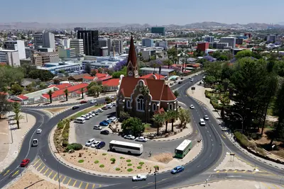
Namibia Classics Self-Drive: Dunes, Coast, and Etosha

Namibia Classics Self-Drive: Dunes, Coast, and Etosha

This classic self-drive circuit connects the dunes at Sossusvlei, the coastal town of Swakopmund, the rock landscapes of Damaraland, and wildlife viewing in Etosha National Park. Stages take 5 to 7 hours, with a large part on gravel roads. Driving times are based on Rough Guides and Viatu, without photo stops.

11 Days
Stops at a glance
  1. 1.Windhoek
  2. 2.Sossusvlei and Namib-Naukluft Park
  3. 3.Swakopmund
  4. 4.Damaraland and Twyfelfontein
  5. 5.Etosha National Park
View Route Details →

What you eat in Namibia

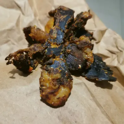
Kapana

Martin Hipangwa·CC BY-SA 4.0

Kapana

Grilled meat pieces from a street stand

Small pieces of beef, freshly prepared on the grill and seasoned with salt and chili. Most famous is the Single Quarters market in Windhoek-Katutura, where you eat right by the grill.
Oshifima

Gwasheya·CC0

Oshifima

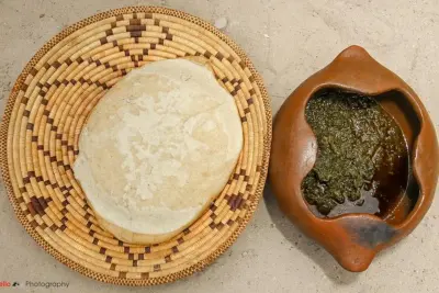
Pearl millet porridge (Mahangu)

A firm porridge of Mahangu, the Northern pearl millet, traditional among the Ovambo. It is served with meat or vegetable stews and eaten by hand.
Potjiekos

Ji-Elle·CC BY-SA 4.0

Potjiekos

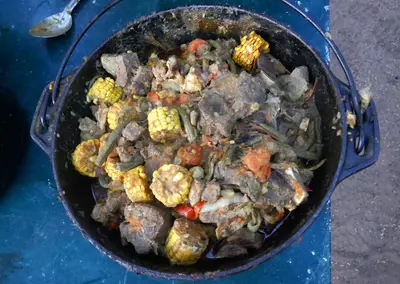
Stew from the Cast-Iron Pot

Meat and vegetables cook in layers for hours in a three-legged cast-iron pot over the fire. Potjiekos is a staple of social evenings on farms and campsites.
Biltong

Aisha.shipanga·CC BY-SA 4.0

Biltong

Air-dried cuts of meat

Spiced, air-dried beef or game meat, plus the dried sausage Droëwors. Biltong is the classic provision for long country drives.
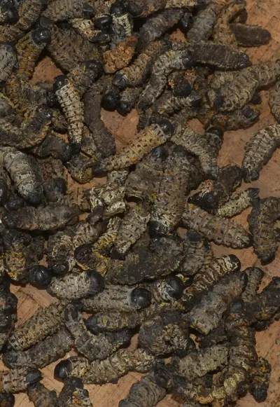
Mopane Worms

Shark2025·CC BY-SA 4.0

Mopane Worms

Omagungu

Mopane worms are collected from Mopane trees during the rainy season, pre-cooked, and then fried until crispy or dried. In the North, they are a traditional source of protein and are sold in markets.
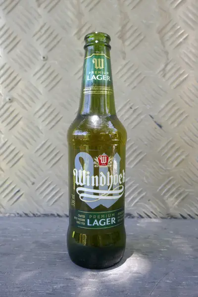
Windhoek Lager

Ji-Elle·CC BY-SA 4.0

Windhoek Lager

Beer, Reinheitsgebot style

Namibia Breweries brews its lager beer under the German Reinheitsgebot of 1516. It is the country's most famous beer and essential for an evening braai.

Good to Know

Essential info for your trip planning.

Key facts

Windhoek · 3 million (2023) · 824,292 km²

Land & People

Population and LanguagesOn approximately 824,000 km², according to the 2023 census, just over 3 million people live,…

History & Society

Colonial era and genocideIn 1883 the merchant Adolf Lüderitz acquired land from the Nama, and in 1884 the territory…

Food & Drink

Grilled MeatMeat dominates Namibian cuisine. At a Braai, alongside beef, game like oryx, springbok, and kudu make it…

Practical Info

For current and binding travel, safety and health advice, check the UK government's FCDO travel advice for Namibia (gov.

Getting Around

ArrivalHosea Kutako International Airport (WDH) is located approximately 45 km east of Windhoek.

RV Travel

Camping as a Form of TravelCamping is widespread in Namibia. In the national parks, you stay overnight in rest camps…

Traveling with Kids

Easy to plan with childrenThe parks are family friendly: children under 8 enter free of charge and a reduced fee…

Best Time to Visit

When is the best time for your trip?

May
June
July
August
September
October
14–23°C·0–11 mm(little rain)
In the dry season from May to October, it hardly rains; animals gather at Etosha's waterholes, and the tracks are easily navigable. June and July are cool at night inland, and from September onwards it gets hot. In the rainy season from November to April, the land is greener; in the north, flooding can occur.
These values are for Windhoek, located at around 1,650 m (climate normal values 1991-2020, data from the German Weather Service). On the coast around Swakopmund and Walvis Bay, the cold Benguela Current ensures cooler temperatures and frequent morning fog, while in the south and the Namib, it gets significantly hotter during the day.

Seasons

Jan
Feb
Mar
Apr
May
Jun
Jul
Aug
Sep
Oct
Nov
Dec
Dry season, best time for safaris
Rainy season with thunderstorms in the interior
Best Time to Visit
▶Show detailed monthly data
MonthTemp (°C)Rain (mm)Sun (h)
January23.8919.1
February22.8968.7
March21.6798.7
April19.4199.3
May16.5310.1
June13.919.9
July13.7010.0
August16.3010.3
September20.629.9
October22.6119.8
November23.3279.6
December24.1479.3

Travel advice

Safety, entry requirements and health: the official, up-to-date advice for Namibia is published by the UK government on GOV.UK.

Go to GOV.UK

Sources & method

  • Photos: Wikimedia Commons, Unsplash, Pexels. Each photo carries its credit.
  • The content is based on web research from public, traceable sources. How the content is made · The role of AI
Felix at Kuirau Park in Rotorua, New Zealand

Who's behind Fernweh?

Hi, I'm Felix.

I love to travel, and I love planning even more. Fernweh.guide is my attempt at building a really good online travel guide.

About Fernweh

All places in Namibia

  • Damaraland and Twyfelfontein
  • Etosha National Park
  • Fish River Canyon and Ai-Ais
  • Lüderitz and Kolmanskop
  • Skeleton Coast
  • Sossusvlei and Namib-Naukluft Park
  • Swakopmund
  • Walvis Bay
  • Waterberg Plateau Park
  • Windhoek
  • Zambezi Region (Caprivi)

More about Namibia

  • Best Time to Visit Namibia
  • Namibia with Kids
All Places & RegionsRound tripsNight trains in EuropeAll highlightsAbout FernwehFAQPrivacy PolicyImprint
Download on the App StoreGet it on Google Play
ExploreGuideDestinationsMy tripsMy trip